Today I set off at half past nine for the first part of the west coast section of the NC500. At first the scenery was similar to the day before…..

…….. but then the mountains grew higher and the coastline more rugged, and I found making short stops every few miles to take photos of the breathtaking views.

I made a longer stop at Smoo Cave, where an underground river emerged from the cave it had carved in the rock and flowed out to the sea along a deep gorge.

Inside the cave, the river formed a powerful waterfall.

I drove on, through increasingly beautiful scenery and through tiny villages with strange names – Tonuge, Achuvoldrag, Hope, Sangobeg, Badcall….. Each consisted of just a few modest houses. Given the absence of people I was amused to find this sign on the side of the road:

The road became more and more narrow and winding, the mountains became higher and higher, and the scenery more and more impressive.


At the pretty town of Lochinver, I took an optional detour along a road nicknamed by the locals as the “Wee Mad Road”, famous for its twists and turns. It was getting late, and on checking my hotel booking I saw that they requested guests to check in by eight o’clock. I tried to call the hotel, but there was no phone reception. Accommodation along the NC500 is limited and hard to book, so I was worried my room would be given to someone else if I was late. My satnav showed I would just make it if I drove without stopping, so I accelerated as best I could along the tiny road. I encountered hazards that included a motorist who had stupidly attempted the road with a caravan, and a herd of unguarded cows nonchalantly taking an evening stroll along the road.
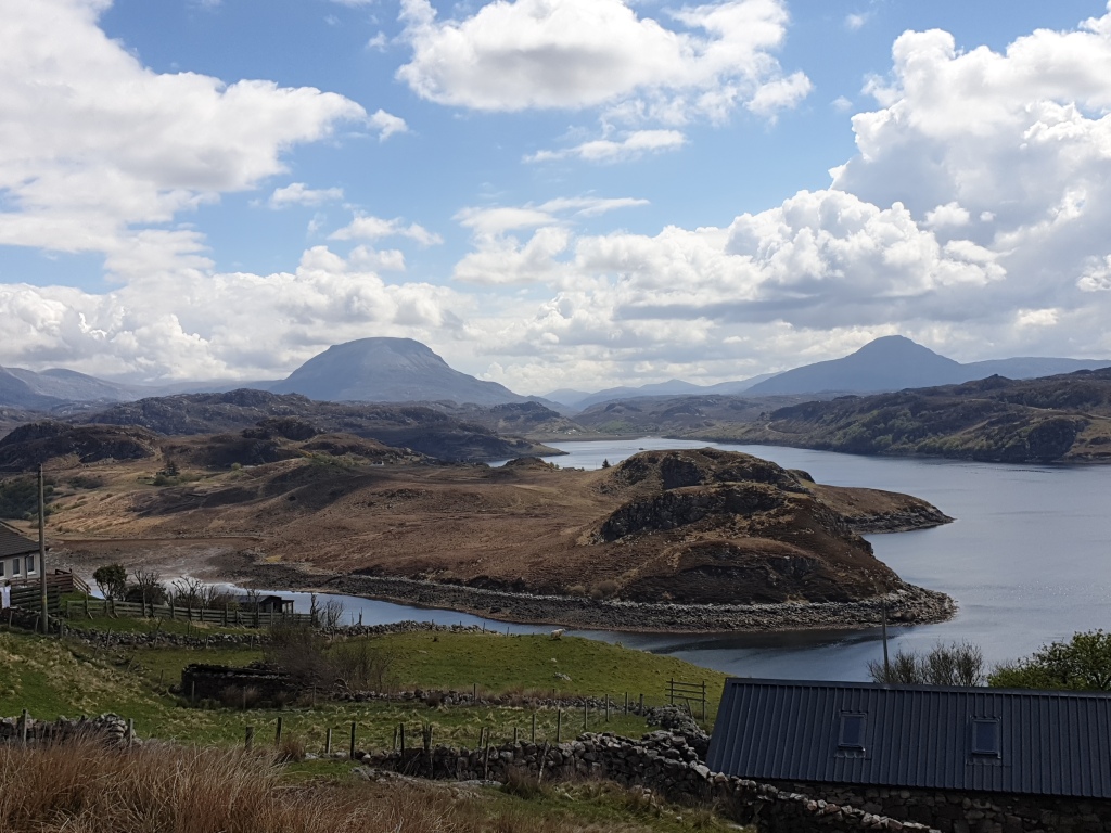
Finally the “Wee Mad Road” merged into a larger, straighter road running alongside Loch Bad a’Gaill, in a region called the Coigach. The steep mountains surrounding the loch were bathed in a soft, orange evening light, making this section of road the most beautiful of all.
I reached Ullapool, the biggest town in the region, and regained phoned reception – but found that my hotel’s phone did not work. So I pressed on inland along the wide, two-lane A835. The land opened up, with views stretching to snow-frosted mountains in the distance. I sped through this beautiful scenery in the evening sun, happy that I could finally put my foot on the accelerator, and reached my hotel just before eight.

It was a former drovers’ inn (where people herding cattle over long distances would stay to rest) and served a huge, excellent dinner of chicken with haggis, which I washed down with a pint of beer.
There had been lots of tricky driving, but it had been an excellent day. My only regret was having to rush through the best part of the road. I had only had time to stop to take one photo in the Coigach to share with my blog readers:

The rest of the Coigach scenery remains as vivid images in my memory and a feeling of space and freedom in my heart. I will be back.
