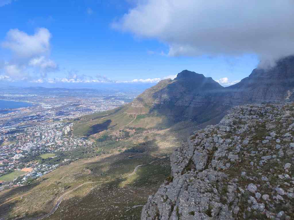
Warsaw and its turbulent past

The final leg of this trip was a short visit to Warsaw, a further 2 hours away by train. The city was founded in 1300 and became Poland’s capital in 1596. Over the next centuries, it had more than its fair share of wars, plagues and famines. From 1795 until the end of the WW I, it spent a prolonged period as a provincial city in the Russian empire, during the time when Russia and Prussia had decided to divide Poland amongst themselves. Warsaw’s biggest suffering however came during WW II, when it was occupied by the Nazis. First its Jewish population was confined to a cramped ghetto, and then completely exterminated. Later, as Soviet troops advanced towards the city in 1944, the Polish resistance rose up against the German occupiers. Stalin cynically ordered his army not to help, and after a sixty-three day battle the uprising was brutally repressed. Hitler ordered the systematic destruction of the city as revenge, and by the end of the war Warsaw had lost 85% of its buildings had a similar proportion of its population. Given its turbulent past, I had expected Warsaw to be rather grim and grey. But once again, Poland confounded my preconceptions. As I emerged from the train station, I saw a clean, well-organised and modern city.
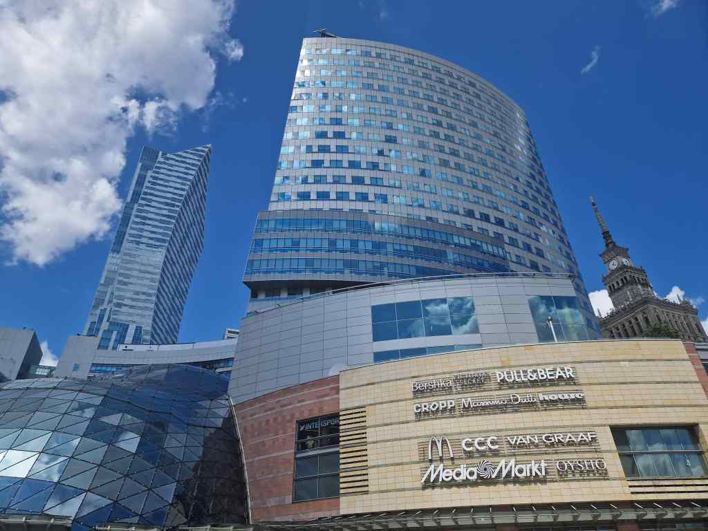
My first view of Warsaw

I found my hotel and set off to explore. First on my list was the old town, which was reconstructed to be exactly as it was before the war, in a process involving meticulous research and then a building programme that lasted until the 1960s. The result is amazingly successful, and the old town today looks like much like the centre of the many other beautiful Polish cities that were fortunate enough to avoid Warsaw’s fate.
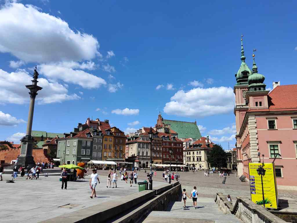
Entering the Warsaw Old Town, near the castle

The rebuilding project including recreating the Royal Castle, which I of course visited.
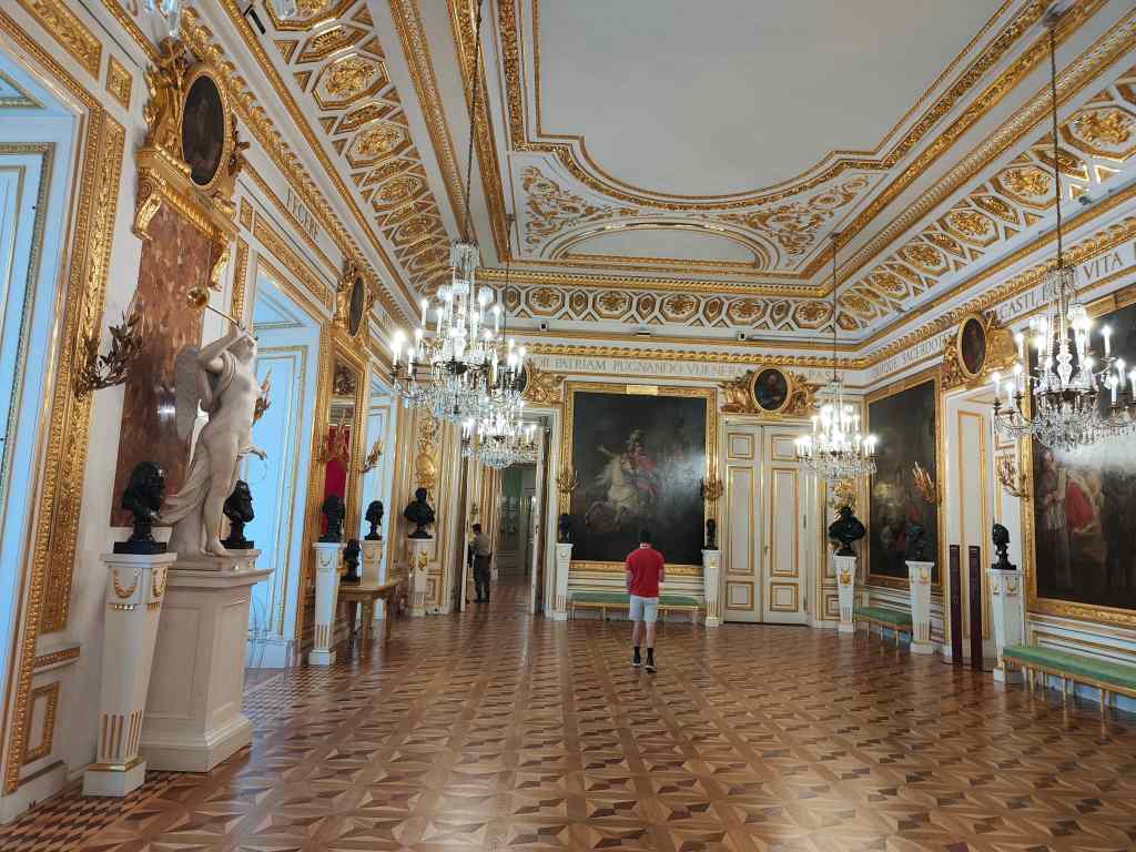
A reception room in Warsaw’s Royal Castle

Next I strolled around the old town, through narrow streets….

Warsaw Old Town streets

…to the inevitable market square. On the square is the interesting Museum of Warsaw, which chronicles the city’s remarkable and tragic history.
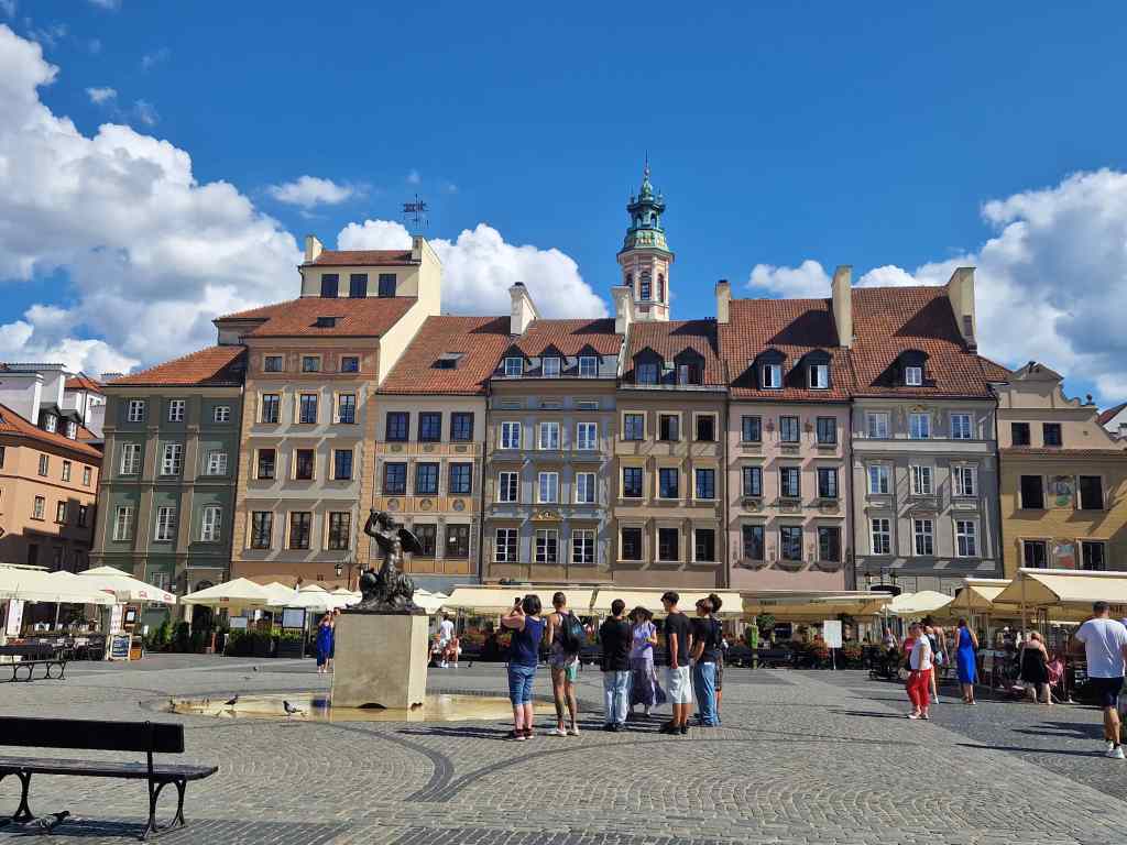
Market Square, Warsaw Old Town

Next I discovered the old town’s fortifications.
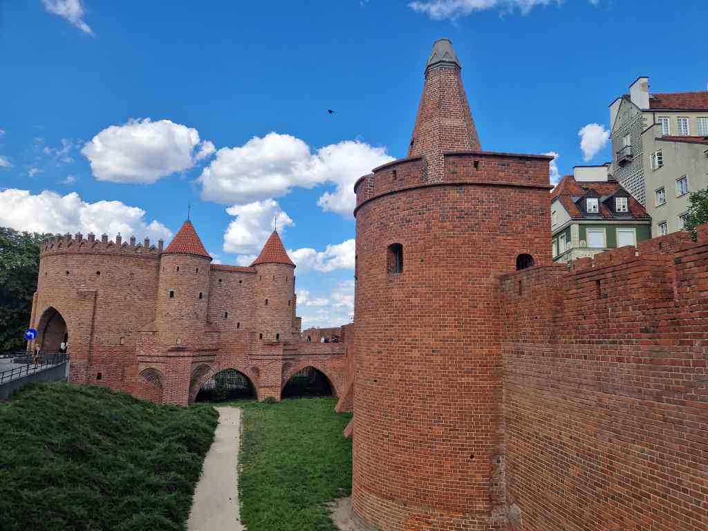
The Barbican, Warsaw

Polish cities have lots of monuments to writers, statesmen and artists who were unknown to me. I was happy to finally stumble across a statue of someone that I did recognise.
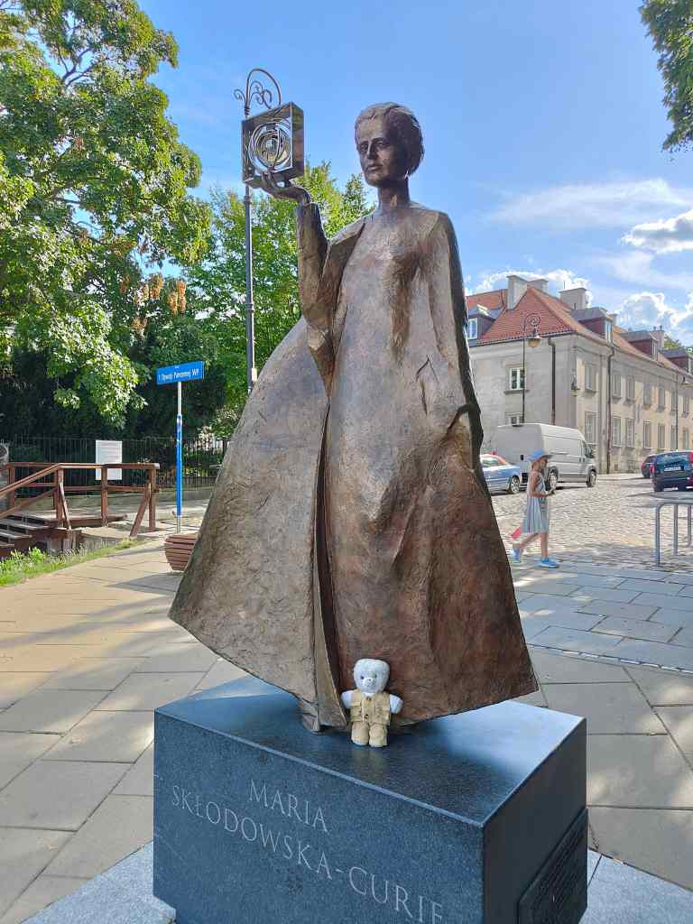
Marie Curie and me

I strolled away from the old town to explore different parts of the city. On the way I came across this marker for the former wall of the Nazi’s ghetto for the Jews.
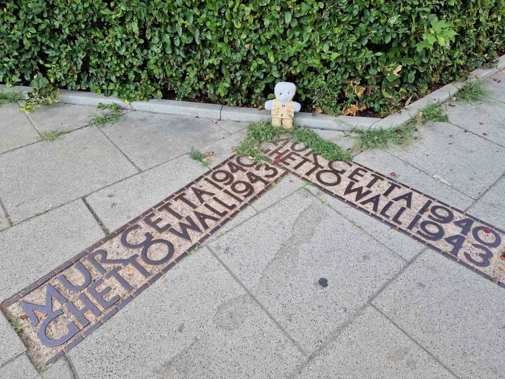
Marking the boundary of Warsaw’s WWII Ghetto

Next I found this pretty palace, one of many in Warsaw, which is now a library..

The Krasiński Palace, Warsaw

I had dinner in one of Warsaw’s many up-market restaurants. The next day I had time to make two more quick visits before my flight – the first to the beautiful Wilanow Palace, a short bus ride to the south of the city. It was built between 1677 and 1696 for King Jan III and was later a residence for various aristocratic Polish families, most notably the Potockis. Remarkably, the palace survived Warsaw’s various crises intact (although it was damaged during WW II) and it remains one of the finest examples of baroque art in the world.
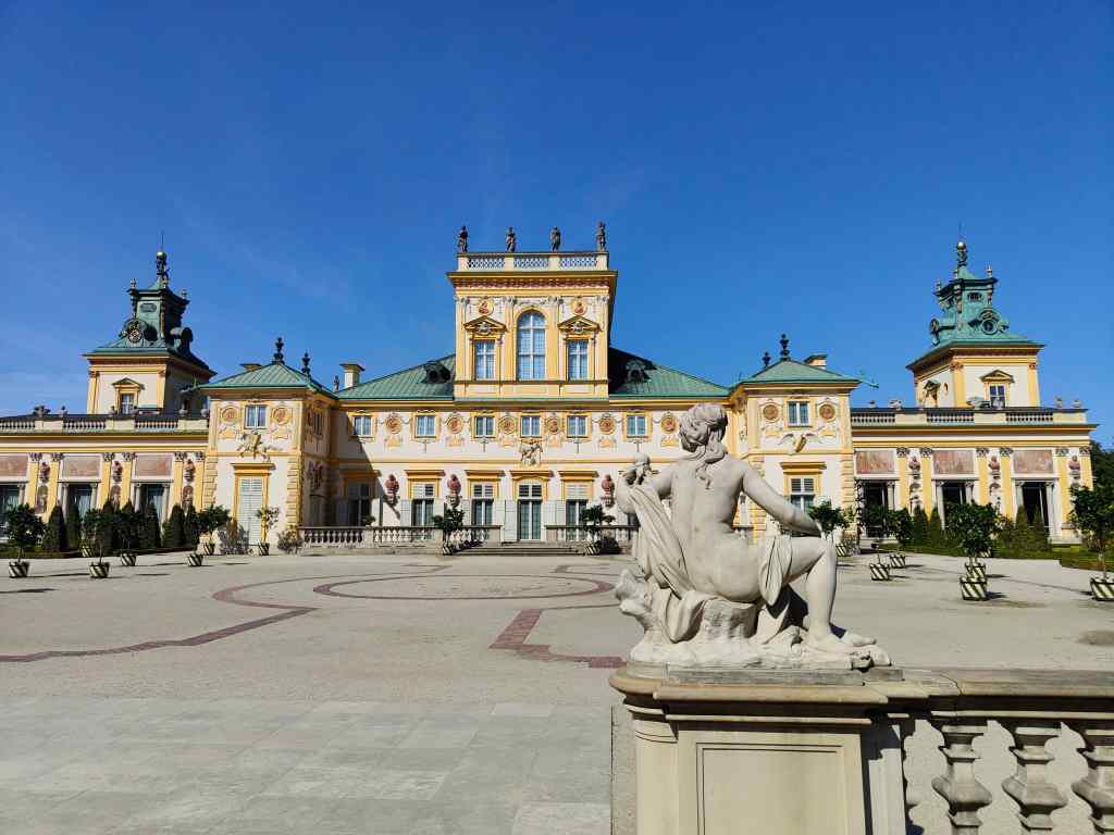
Wilanow Palace, Warsaw
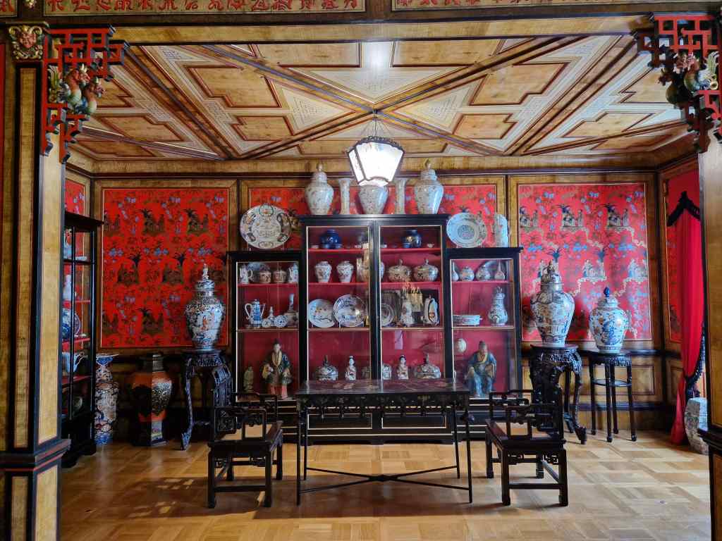
One of the oriental rooms in the Wilanow Palace

Apart from suitably impressive reception rooms, the palace also houses an art museum. I was the only person there – I think the other visitors failed to find the rather small door leading to the gallery. On the approach to the museum there was a display of empty frames, symbolising the pictures taken by the Germans or Russians during the war and so far not returned. I ended my visit with a stroll around the palace’s park.

Empty Frames, Wilanow Palace gallery
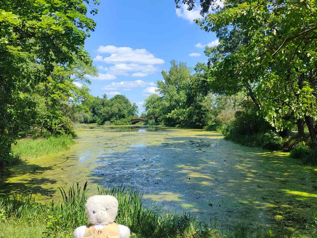
The Wilanow palace also has a pleasant park.

My final visit of this trip was to the Palace of Culture and Science, right in the centre near the main train station. This was built in the 1950s as a “gift” from the Soviet Union to Poland and when completed was the eighth tallest building in the world. It closely resembles the “seven sisters” buildings commissioned by Stalin for Moscow, and for many years dominated the Warsaw skyline in much the same way that Russia dominated Poland.

The imposing Palace of Culture and Science, Warsaw

The palace is a maze of buildings including concert halls, cinemas and a theatre but the tower is its most popular part and is Warsaw’s most-visited tourist attraction.
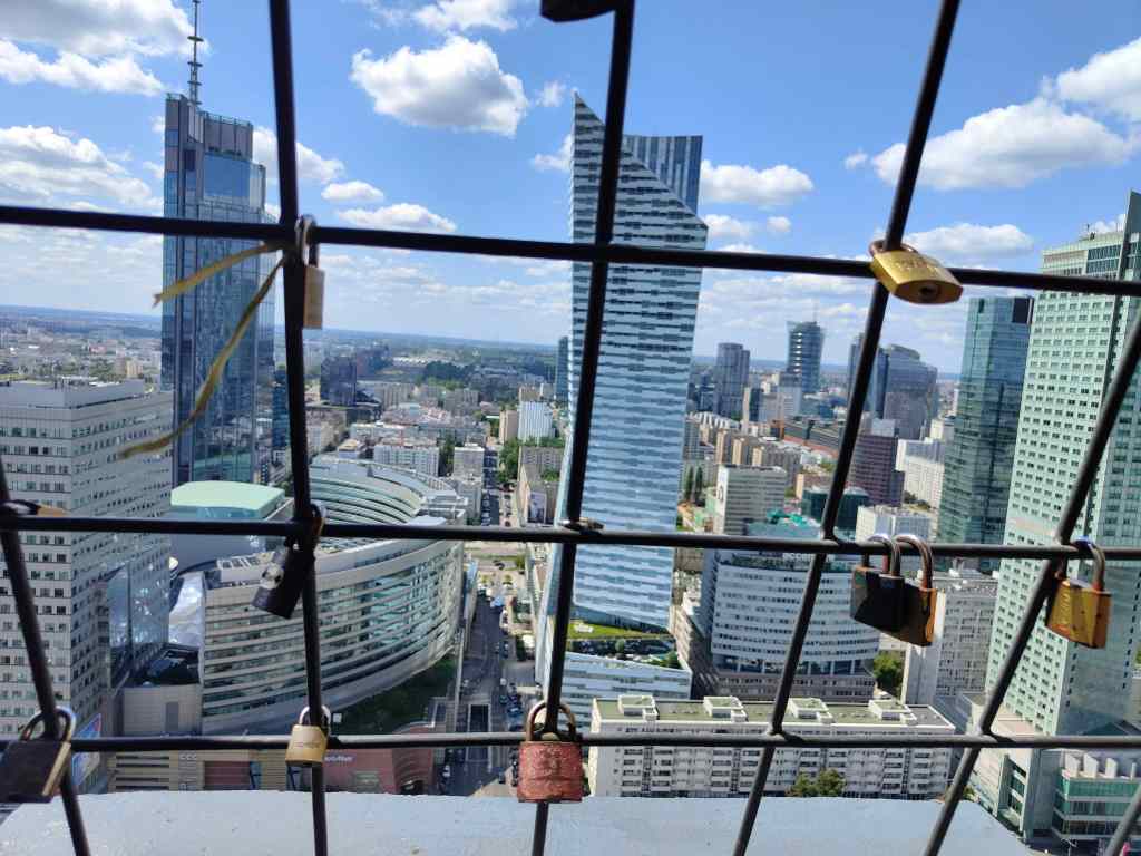
The view from the top of the Palace of Culture and Science

I took the fast lift to the top, admired the views and enjoyed the cool breeze blowing through the observation platform. It was a good way to end my second visit to Poland, a country that I am getting to like a lot. Stay tuned (i.e. subscribe!) for my next trips – Romania in September, and then Japan over October and November!
Previous Post: Torin
Torun, a little-known highlight of Poland

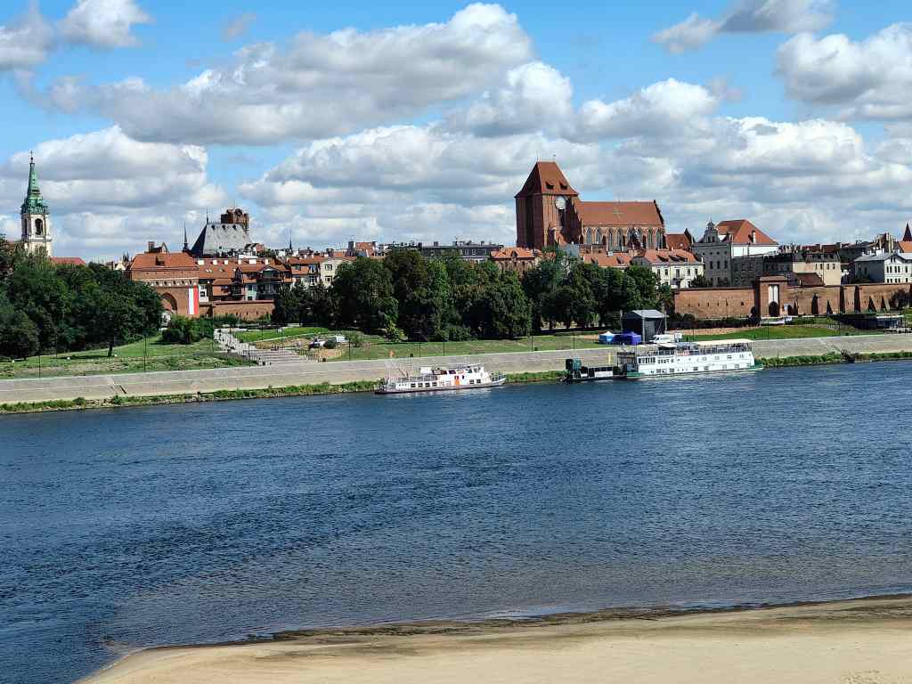
My next destination was Torun, an ancient city first settled in the 8th century, which became a base for Teutonic Knights in 1233 and a later a major trading hub and member of the Hanseatic League. Today it is a small place with a population of only 200,000. Even though it is a UNESCO listed world heritage site, few people seem to have heard of it and it attracts many fewer tourists than, say, Krakow.  So much the better for me, for I was able to visit at a relaxed pace without crowds. My first view of the city and its ancient walls was as I crossed the bridge from the train station over the Vistula river, ….
Torun on the Vistula
Torun and the Vistula river

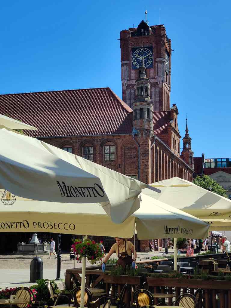
A first stroll through town revealed Torun’s charms. First, there was the inevitable market square and town hall…..

Torun’s town hall

….with a tower offering views of the city….

The view from Torun Town Hall’s Tower

….and lots of cafés. I treated myself to this rather strange coffee, topped with cream, then burnt like a crème brulée, and sprinkled with small marshmallows. Yum.

Mid-morning coffee stop in Torun’s square

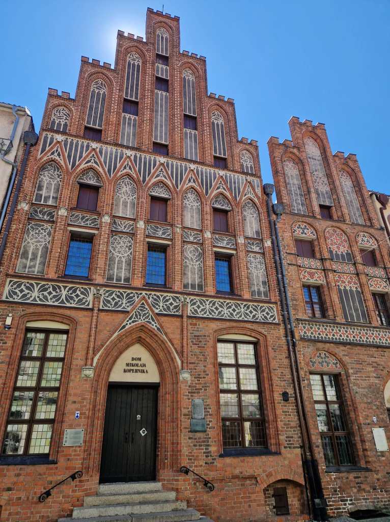
Torun has several museums. The town hall itself had an interesting art collection, whilst a very pretty building on the market square called the “House Under the Sun” had a collection of far eastern art. Probably the most famous museum though is the place where the polymath Nicolas Copernicus was born and spent the early years of his life. Copernicus changed the thinking of the world through his major work, published close to his death in 1543, devoted to the then revolutionary idea that the earth rotated around the sun. The museum covered the everyday of the Copernicus family (his father being a merchant) and Nicolas’ works and their reception (his ideas were slow to take on, and his book was banned by the church some sixty years after it was first printed).

Copernicus’ house, Torun

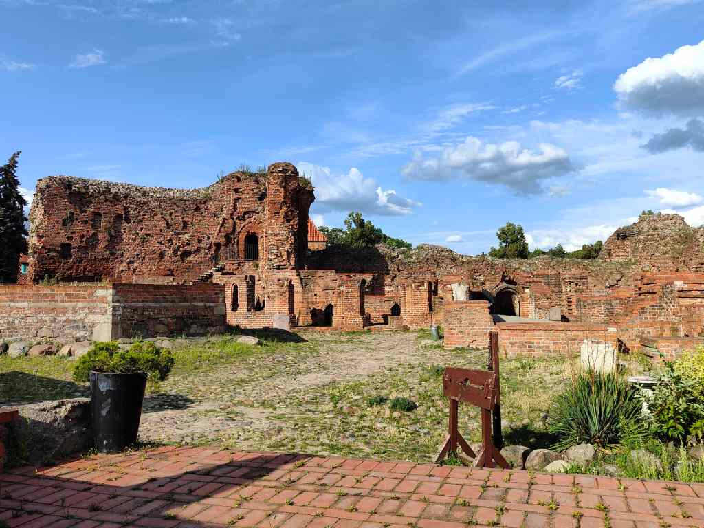
After educating myself about Copernicus I visited the final main attraction in Torun – the ruined castle of Teutonic knights, an extensive European religious and military order who were involved in protecting the Catholic Church’s interests and went on crusades to the Holy Land and Eastern Europe. The knights based in Torun also imposed restrictions and taxes on the city, which annoyed the townspeople so much that one night they stormed the castle and then set about dismantling it.

The ruins of the castle of the Teutonic Knights

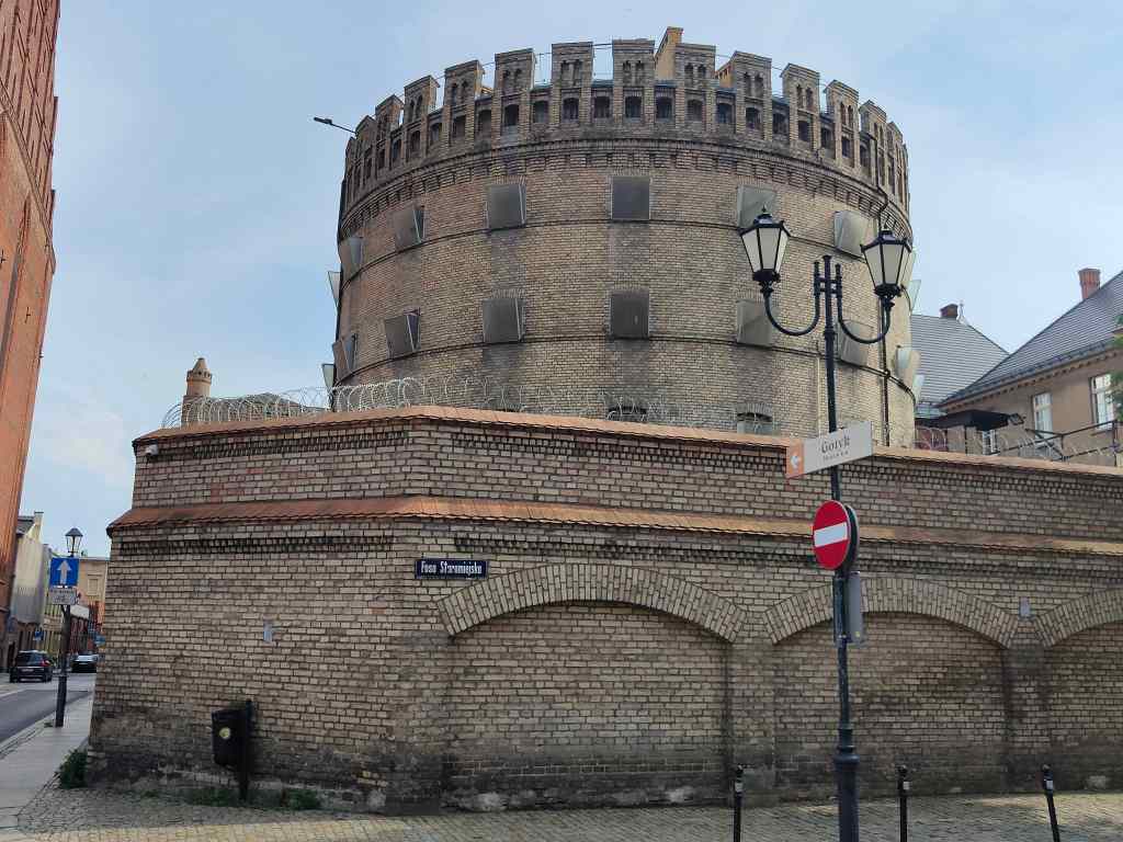
After visiting the castle, I had completed all the “must-see” sights in Torun and spent my time pleasantly wandering the streets. I found a prison, bizarrely located in the centre of town….

Not the greatest advert for the Gotyk Hotel

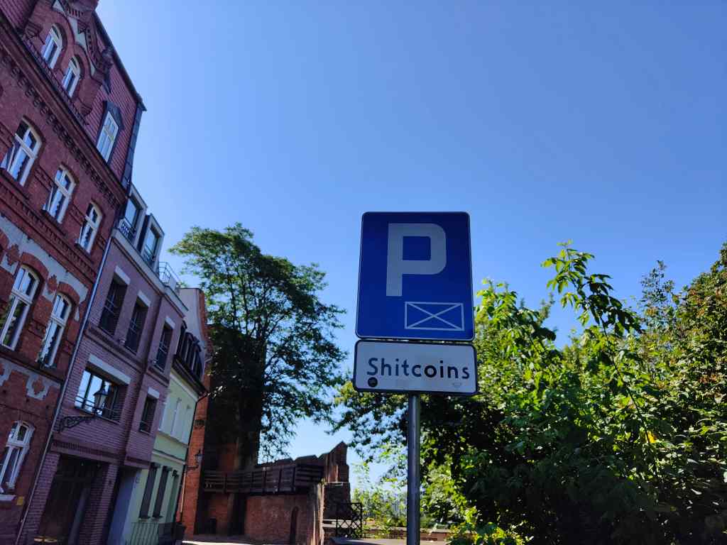
…..an unusual parking sign…..

A novel way to pay for parking?

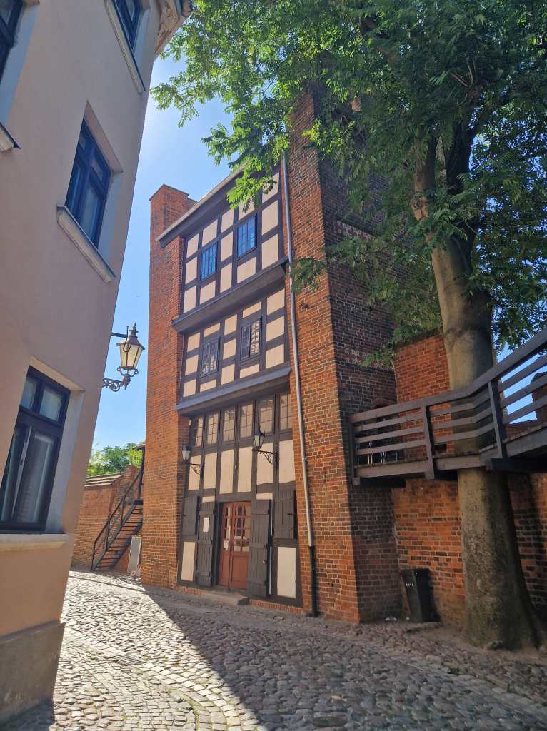
….and the leaning tower in the city walls, reputedly built by one of the Teutonic Knights.

Torun’s leaning tower

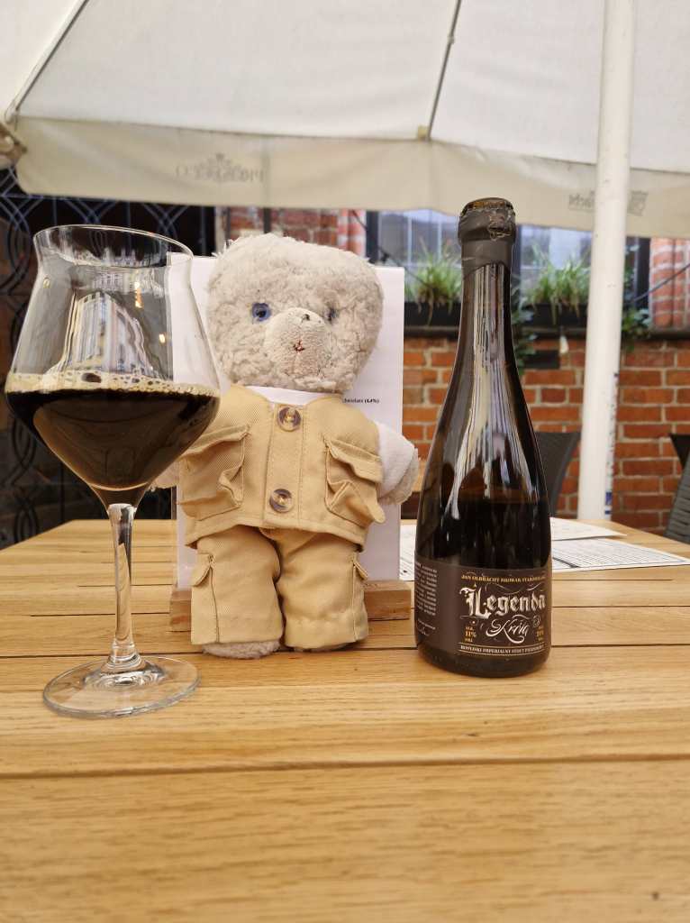
Torun is famed as a centre for production of gingerbread, and there were shops everywhere selling the stuff, and even two museums devoted to it. I ended my day – as so often in Poland – at a pleasant pavement café. This one brewed its own craft beers, including one which was flavoured with gingerbread. It turned out to contain 11% alcohol, which is why I am slightly unsteady on my paws in this picture.

And Torun’s leaning teddy. 11% by volume…almost the same as wine

Next Post- Warsaw

Previous Post – Poznan

Poznan in Poland – a pleasant surprise

Today I took the S-Bahn to the Hauptbahnhof to make the trip east to Poznan in Poland, a trip of about two and half hours. Poznan is the country’s fifth biggest city, and one of its oldest – it was once one of the four historic capitals of medieval Poland. A few dejected English football fans joined me on the train, having seen their team lose the final of the European Championship the night beforehand – they were no doubt heading for Poznan’s airport, which has direct flights to London.  On my trip to the south of Poland last year I had been surprised that the country was very clean, green and looked affluent – quite different to the post-industrial landscape of decay that I had expected. I thought that maybe this time, travelling in the north, I would see a different side to the country – but no, from the train I saw nothing but pleasant green fields and on arrival, Poznan’s station was much more modern and cleaner than Berlin’s.

I checked into my hotel, had a quick snooze to avoid the worst of the afternoon heat (it was finally hot and sunny) before walking through town to visit the impressive cathedral to the east of the city.

Poznan cathedral

Near the cathedral was a clever trompe l’oeil mural occupying the entire side of a house

Poznan street art

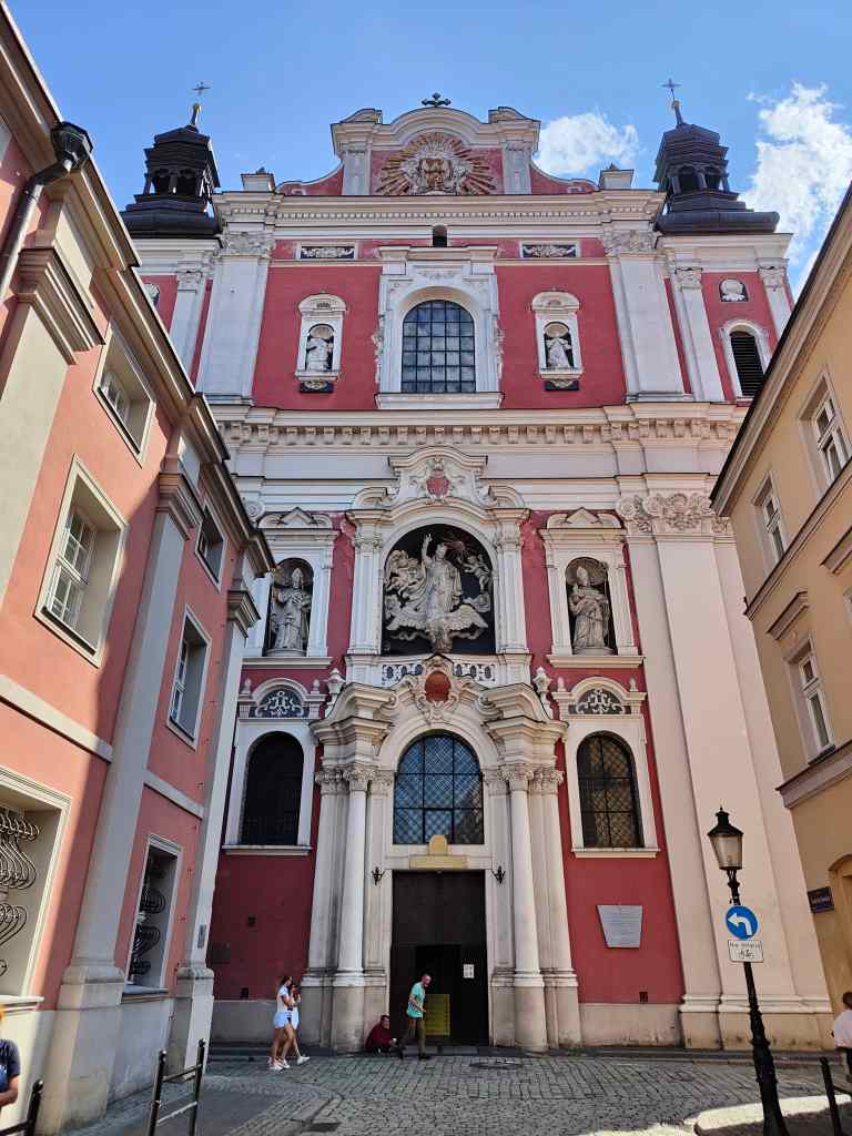
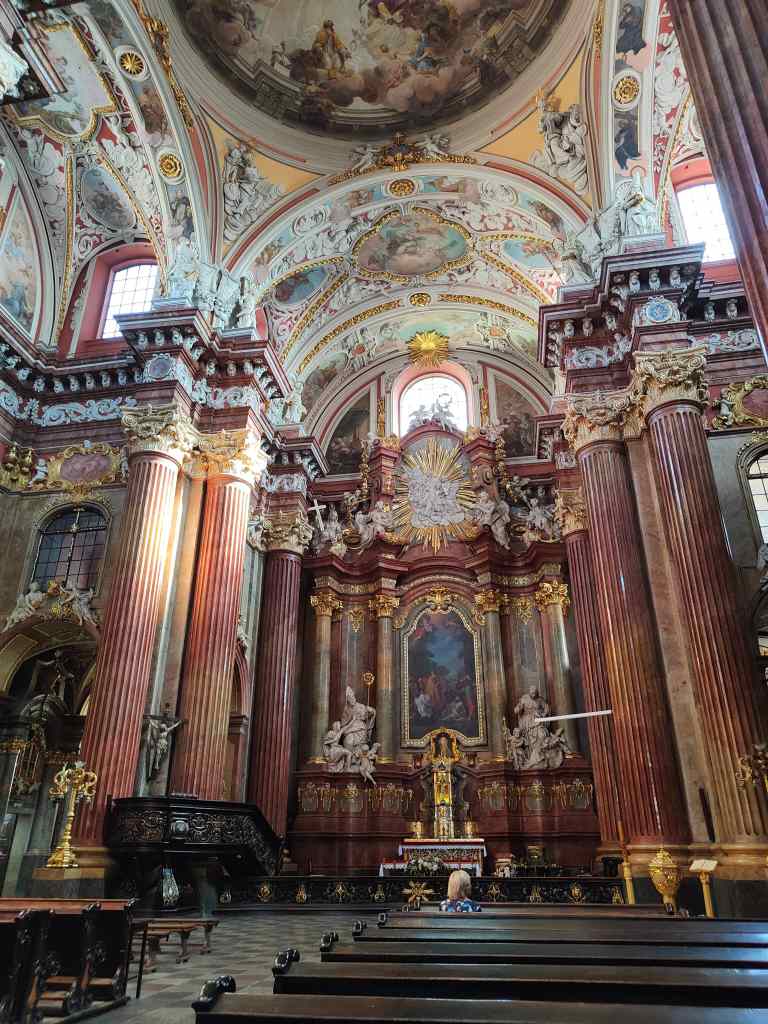
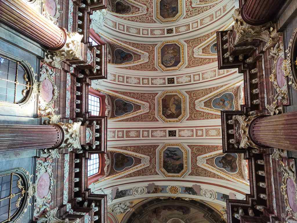
I strolled back to the old town and visited a magnificent baroque church, the Basilica of our Lady of Perpetual Help, which is one of the most beautiful I had ever seen.

Outside and Inside Poznan’s beautiful basilica
Inside Poznan’s Basilica

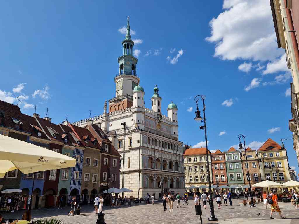
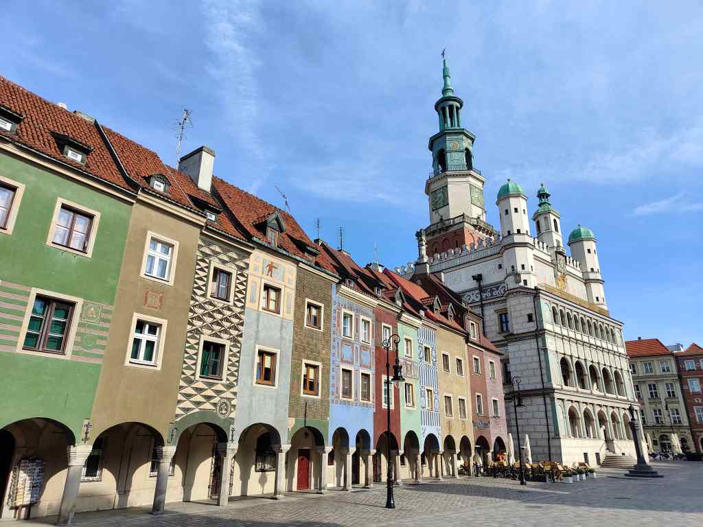
The centre of many Polish cities is the old market square, and Poznan had a very photogenic one, with a particularly beautiful town hall. The latter was first built in 1253, rebuilt in its current style in the 16th century, badly damaged during the second world war and reconstructed in the 1950s. Except for a few scattered groups of England fans (who were much quieter than they had been in Berlin!) there were almost no tourists, no tacky souvenir shops and no money changers.

Poznan’s market square and town hall in the afternoon

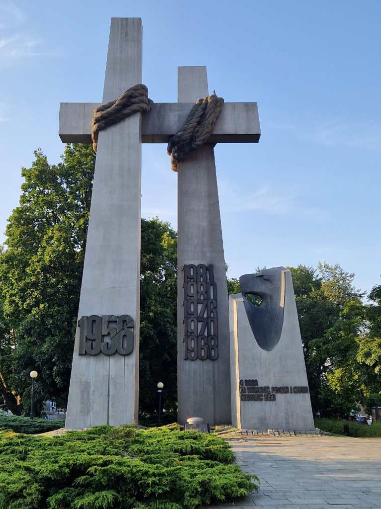
After coffee on the square, I continued my exploration. On first appearances, the centre of town appeared small, and I thought I would soon run out of things to do. But the more I walked, the more interesting things I found – old buildings, monuments, small parks, little squares, and lots more beautiful churches.

A monument to the victims of the 1956 anti-soviet uprising

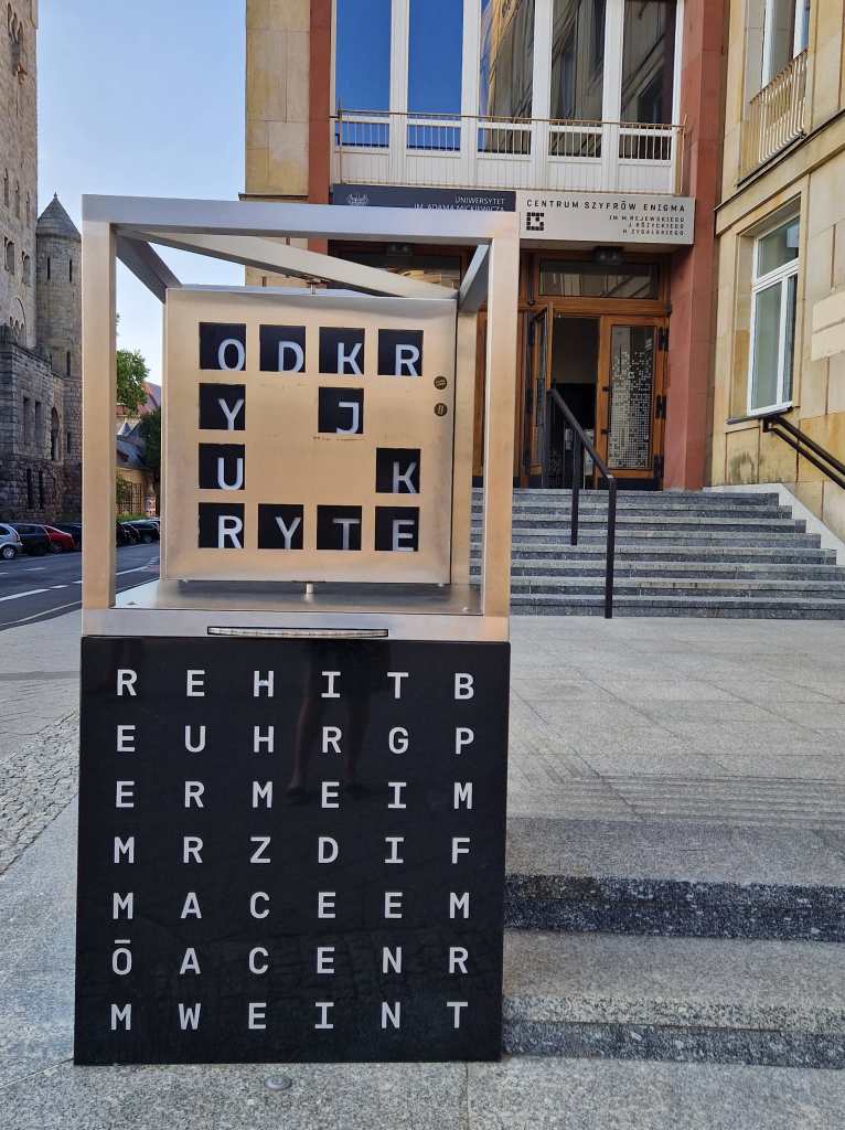
I also stumbled upon the “Imperial castle”, built under German occupation for Kaiser Wilhelm II of Germany in 1910, but which is now part of Poznan’s university and was where Polish mathematicians first started working to break the German Army’s Enigma code.

A monument to the Enigma code breakers

I ended up enjoying the early evening sun in a pleasant park with a few locals….

Relaxing in a pleasant park in Poznan

….before having dinner on the square and then a cocktail in one of the many of busy bars in a nearby street  – many students study in Poznan, and the nightlife scene reflects this.

Partying in Poznan

The next morning I had a couple of hours to continue exploring before my train at noon. I revisited the market square to take pictures without any other people around…

Poznan square in the morning

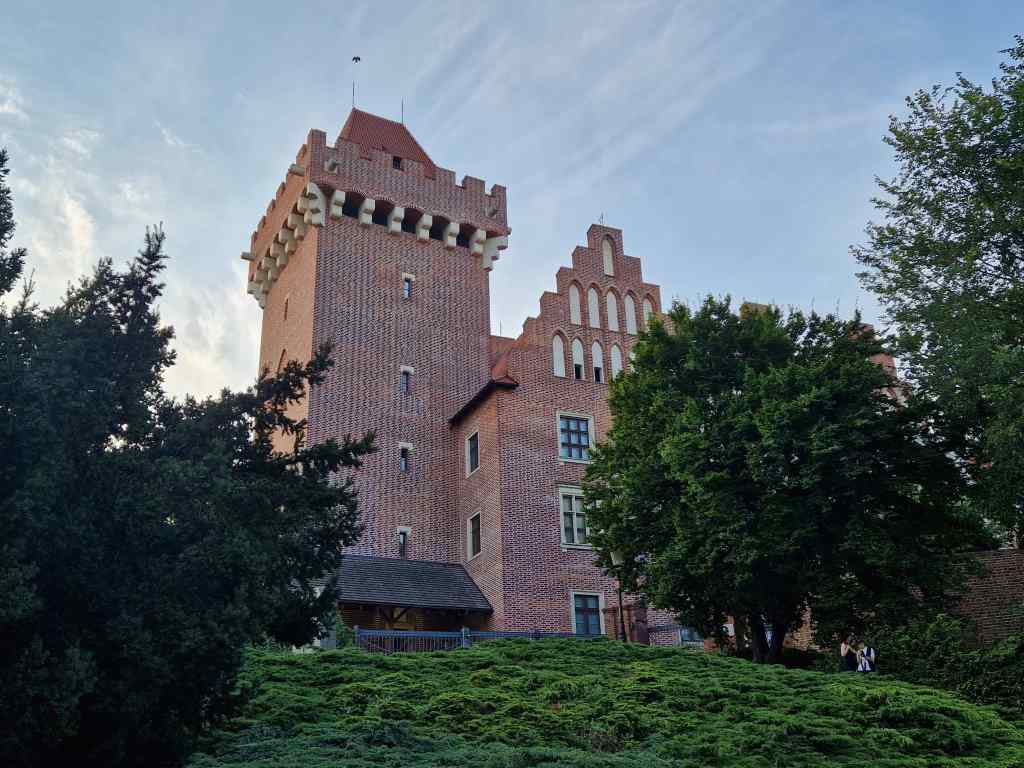
…..and then found that the old “Royal” castle was open and took the lift to the top of its tower for a last view of the city.  Unlike the Imperial Castle, this one was built for a Polish king, and originally dates from the 13th century. Most of what you can see today is reconstructed, after heavy damage suffered during the second world war.

Poznan’s “Royal” Castle, largely reconstructed

I had been very impressed by Poznan – a pretty, clean place with lots of things to do. And like everything else in Poland, amazingly cheap. I think I will be back some time on the direct flight from London, but for now my next destination was the ancient town of Torun, another two hours’ train ride further east.

Next post – Torun

Previous post – East Berlin

East Berlin and the East Side Gallery

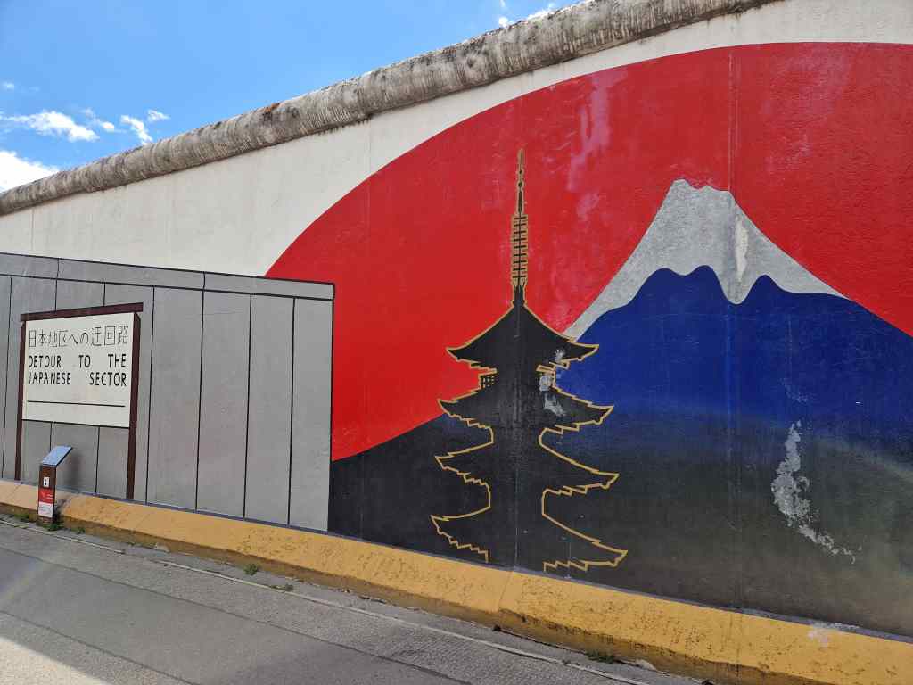
Today was my last full day in Berlin and I used it to explore the city’s eastern part. I hopped on the S-Bahn to the Ostbahnhof and made the short walk to see a roughly 1.3km section of the former Berlin Wall. Its western side is covered with uninteresting crude street graffiti – just like it was when it functioned to imprison the citizens of East Berlin. In contrast, its eastern side is now the world’s longest open-air art gallery – the East Side Gallery. 128 artists from around the world started painting immediately after the wall fell in 1989, and their work has been preserved and occasionally repainted ever since.

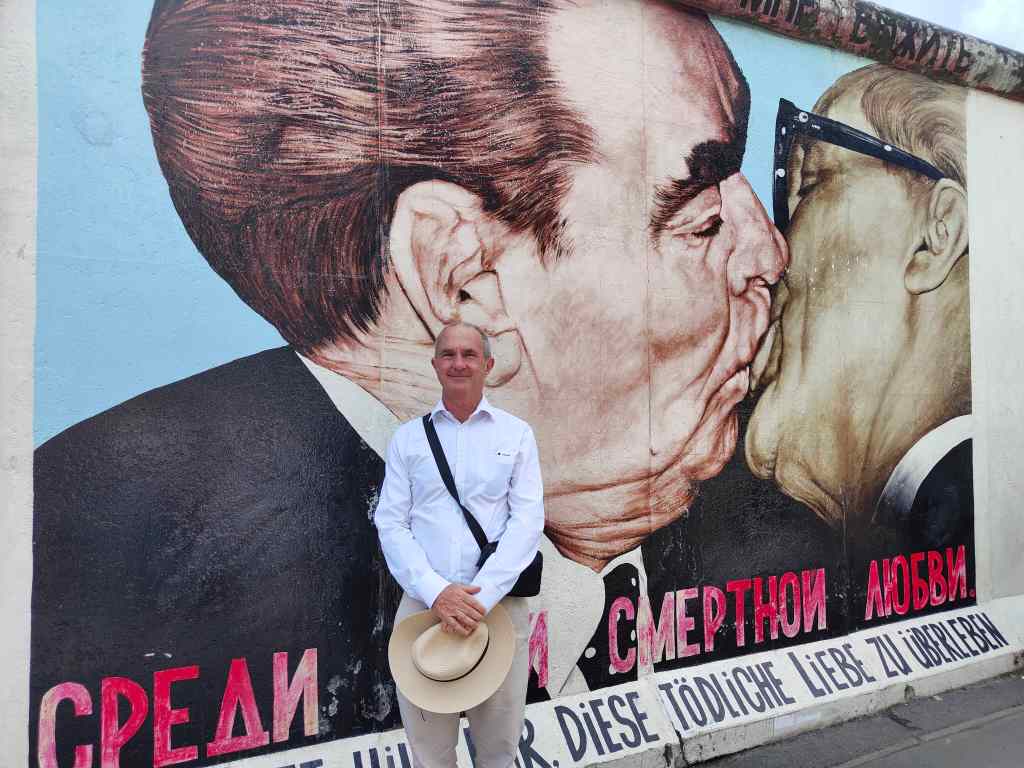
The gallery has about 100 modern art paintings, often on topical political themes of the time. Some have become famous, such as Honecker and Brezhnev’s socialist kiss, which was so popular it was impossible to photograph without a fellow tourist posing for a picture….

This famous East Side Gallery picture is impossible to photograph without people getting in the way…

I had more luck with this well-known picture of an East German Trabant car breaking through the wall………

“Trabi” – East Side Gallery

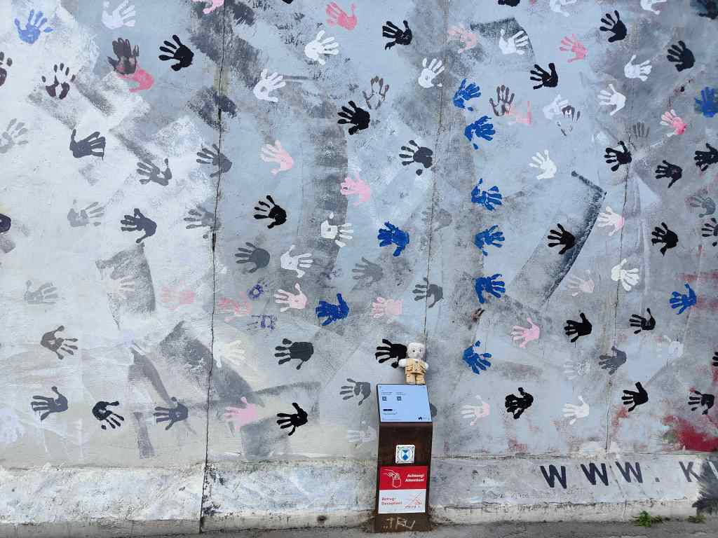
….and this painting of hands…….

Hands – East Side Gallery

I continued my stroll east and found that the city began to resemble Moscow, with the style of its architecture and gas pipes sticking out of the ground.

Typical East Berlin street scene

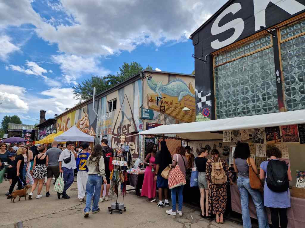
Next, my walk took me to the RAW area – formerly a site for repairing trains, but now a centre of post-industrial Berlin counterculture, with galleries, clubs, street food and skateboarding arenas. It was a bit like Camden market in London, only less commercial. I felt a little out of place as I was by far the oldest visitor (of course I was also the only bear, but I have got used to that).

The RAW area in East Berlin

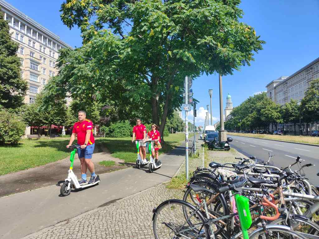
From RAW I headed north to an area where the communist East German government had constructed a long, broad avenue lined with tall buildings in an attempt to show off to the west – Frankfurter and Karl Marx Allees. I found the architecture interesting rather than spectacular – it reminded me of the great Moscow streets like Tverskaya, only rather less impressive. I found myself almost alone except for small groups of Spanish football fans – this part of the city does not attract many tourists.

Frankfurter Allee and Spanish football fans

Feeling underwhelmed by the communists’ architectural efforts, I continued to the very heart of Berlin to the city’s last unmissable sight – the Brandenburg Gate, a triumphal arch built over 1788-1791 on the orders of….yes you guessed it…..Frederik II. Now there was a king who knew how to build impressive monuments!

The symbol of Berlin – the Brandenburg Gate (courtesy Nino Keller/Pexels)

Next, I headed home on the U-Bahn. My line continued all the way to the Olympic Stadium, where the finals of the European Football Championships were being held that evening, so I shared the train with lots of football supporters. Most were English and sang happily and noisily. The few Spanish fans sat quietly in their seats, trying not to draw attention to themselves. I was relieved to get off at Charlottenburg and leave the noise behind, and to watch the match over dinner with friends on television rather than at the stadium. We ate pizza and the traditional German football food – currywurst and chips. Tomorrow is farewell to Berlin as I head on to Poland.

Next Post – Poznan (Poland)

Previous Post- Potsdam

Potsdam – an exceptional day out from Berlin

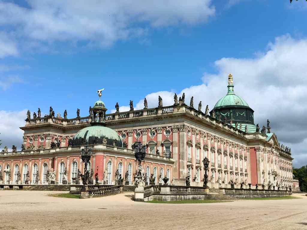
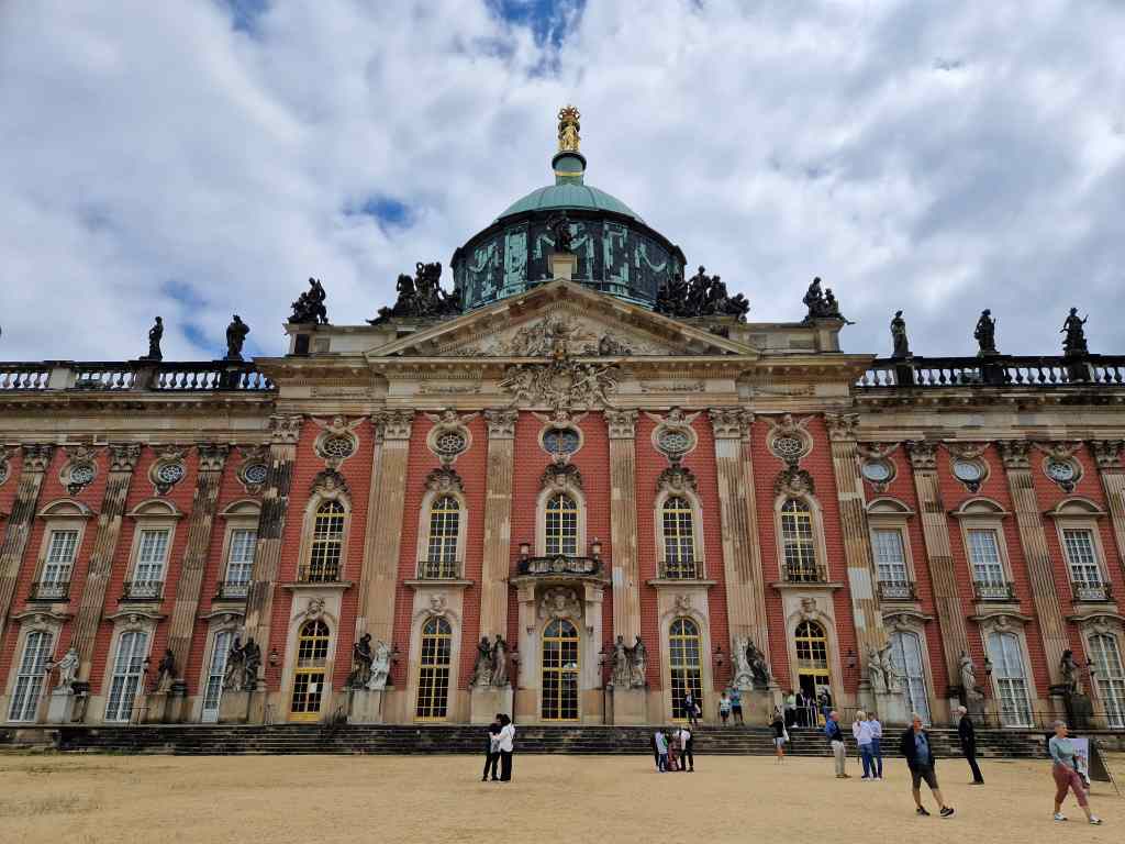
Today I went to Potsdam, a town to the west of Berlin with an amazing collection of things to visit. My first destination was the Neues Palais, a huge palace commissioned in 1764  by King Frederik II of Prussia and completed in only five years. It was built to house and entertain visiting dignitaries – although it had rooms for Frederik, he rarely stayed there, preferring to return to his favourite Sans Souci residence a short distance away (covered later in this post). The colossal Neues Palais was partly modelled on Versailles and built to impress……..which it certainly does.

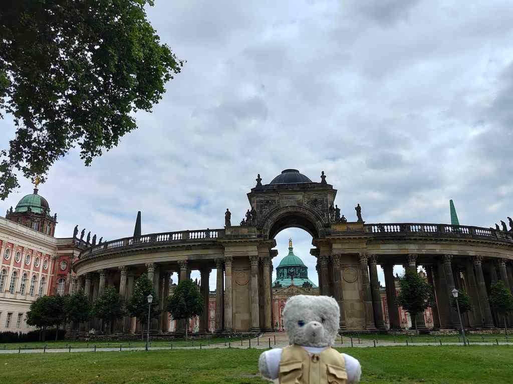
Views of the colossal Neues Palais, Potsdam
The entrance to the Neues Palais, Potsdam
Posing in front of the Neues Palais

I could only visit as part of a guided tour, which was conducted only in German. They gave foreign visitors an audio guide, but from the reactions of the local visitors, its descriptions were much shorter and less amusing than the guide’s anecdotes. All the same, no explanation was needed to be taken aback by the magnificent rooms – first an unusual, sea-shell themed Grotto Hall……

The Grotto Hall in the Neues Palais

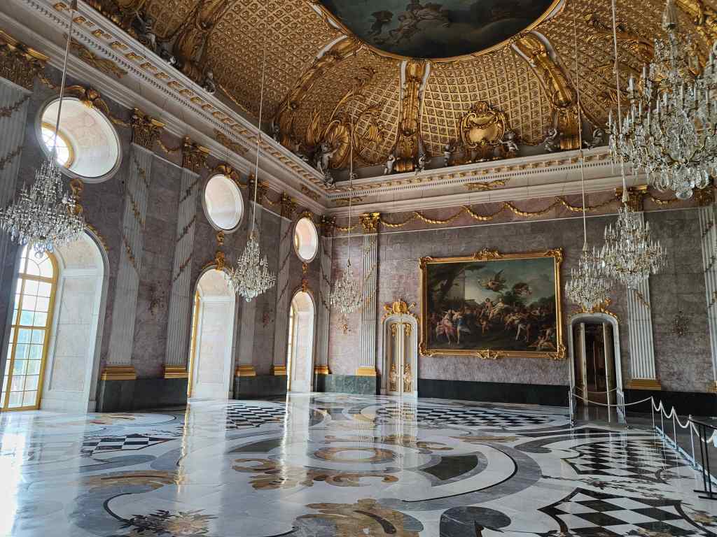
…and then a bit later the amazing Marble Hall located directly above the grotto.

The amazing Marble Hall

Frederik was actively involved in designing the Neues Palais and he insisted that no extra supporting pillars be added to the grotto underneath to carry the huge weight of the Marble Hall. This requirement led almost immediately to structural problems which engineers have wrestled with over the centuries.

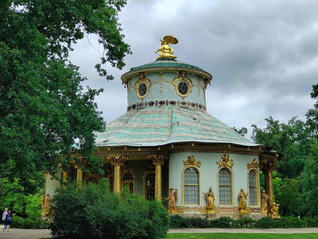
From the Neues Palais I headed through an attractive park back into the town of Potsdam. On the way I stumbled across the incredibly cute Chinese House.

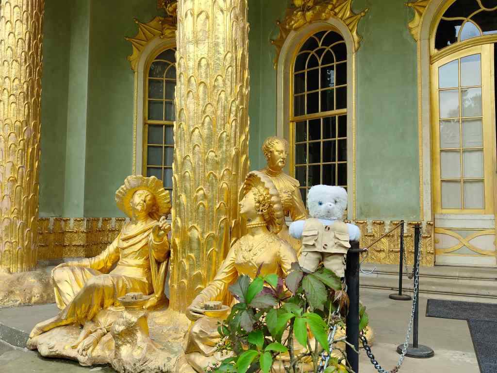
The achingly cute Chinese House
Chinese House figures, Potsdam

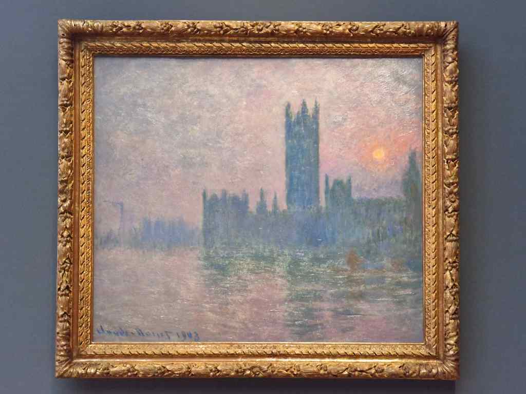
I grabbed some lunch in Potsdam, a pretty town, before heading to the Barberini Museum, housed in a baroque palace also built by Frederik II. It had both an impressive temporary Modigliani exhibition and an amazing permanent collection of impressionist paintings, assembled quite recently by Hasso Plattner, billionaire founder of the SAP software company and patron of the arts.

Part of Hasso Plattner’s collection of impressionists in the Barberini Museum

After a couple of hours in the museum I had to hurry back towards the royal park to visit Potsdam’s main attraction – Sans Souci Palace.

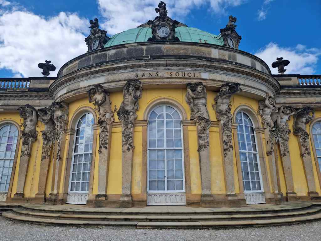
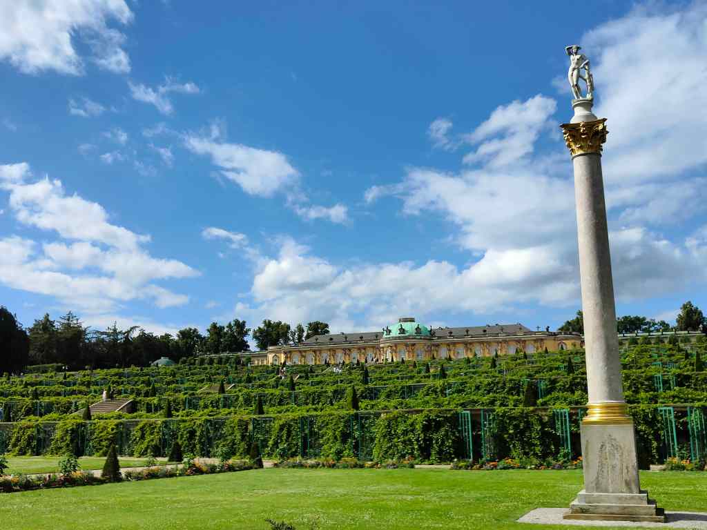
Sans Souci – the pinnacle of baroque taste

This is a much more modest construction than the Neues Palais, and Frederik much preferred to spend his time in this more intimate and relaxing residence, whose name means “without worry” in English. Sans Souci is exquisite and tasteful, and if I had the choice, I would probably agree with Frederik and choose it as my home. However, although it is the best known and most popular attraction in Potsdam, I would rate it as the least interesting tourist experience of a day that had so many highlights. Entry is by timed slot, and since space inside is limited, you join a continuous dense stream of fellow tourists, all attentively listening to their audioguides.

Sans Souci’s steady stream of visitors

It felt rather mechanical and cramped compared to our tour around the vast spaces of the Neues Palais. After my visit I had time to stroll around the park and enjoy the gardens and glimpses of yet more huge royal edifices. The early evening was enhanced by the fact that the sun had finally emerged.

Sans Souci park, Potsdam
Sans Souci Park
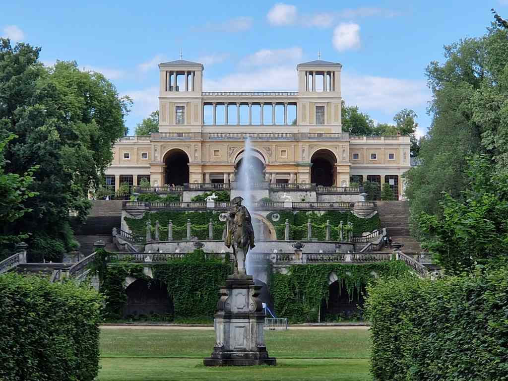
More Potsdam palaces….

I rounded they day off with dinner with my friends at a restaurant on the banks of the nearby Wannsee lake – a perfect way to end an exceptional day.

Next Post – East Berlin

Previous Post – Berlin

The Bear is Back! in Berlin and Museum Island

The Bear is Back!  And what better place to start a new trip than Berlin, a city that has a bear as its symbol.

The author with the coat of arms of Berlin

I am here for two reasons – firstly to visit friends, and secondly on a long-term project to completely cross the earth in multiple trips by land or by boat, without using a plane. I have already crossed Russia by train, the USA by bus and most of Europe by car or rail. I am missing a final section through Eastern Europe, either from Krakow to Kiev (which looks difficult for the moment) or from Berlin to Kaunas in Lithuania. So, after Berlin my trip will carry on through Poland to Warsaw covering about half of the missing section.

Museum Island – one of Berlin’s highlights

On this trip I was also hoping to get some much-needed sun after the wettest, coldest start to a summer in London that anyone can remember. Sure enough, I arrived in Berlin’s new Brandenburg airport (finally complete years late and well over budget) in bright sunshine in the late afternoon and found my flat in the west of the city without trouble. Imagine my disappointment when, contrary to the forecast, I woke up the next morning to hear heavy rain beating against the windows.

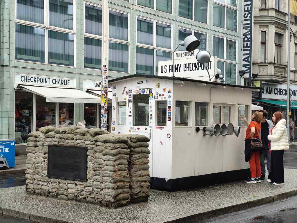
I had a visit of the Reichstag terrace booked for the morning, but in view of the weather changed my plans and started with stroll around town, including Checkpoint Charlie, the main point of entry or exit between the west and east parts of the city during the period when the city was partitioned by the Berlin Wall. I was last here in 1985 when I made the crossing to the east and it was a functioning US/Soviet checkpoint. Today it is a popular tourist destination with a small booth remaining from the US side, an interesting display about the history of the Wall, and lots of tacky tourist shops.

Checkpoint Charlie, Berlin

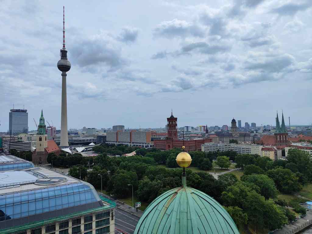
From Checkpoint Charlie, I headed east to Museum Island, home to some of Europe’s best museums. Unfortunately, the most famous of them all, the Pergamon, had recently closed for major repairs and is scheduled to reopen in 2028 (but given Germany’s record for public construction projects, don’t hold your breath). But there was still plenty of choice. It had stopped raining, so first I visit Berlin’s impressive cathedral (Dom) with its cavernous interior and then climbed the tower for the good views from its roof.

Inside Berlin’s Dom
The view from the roof of the Dom on a rainy day

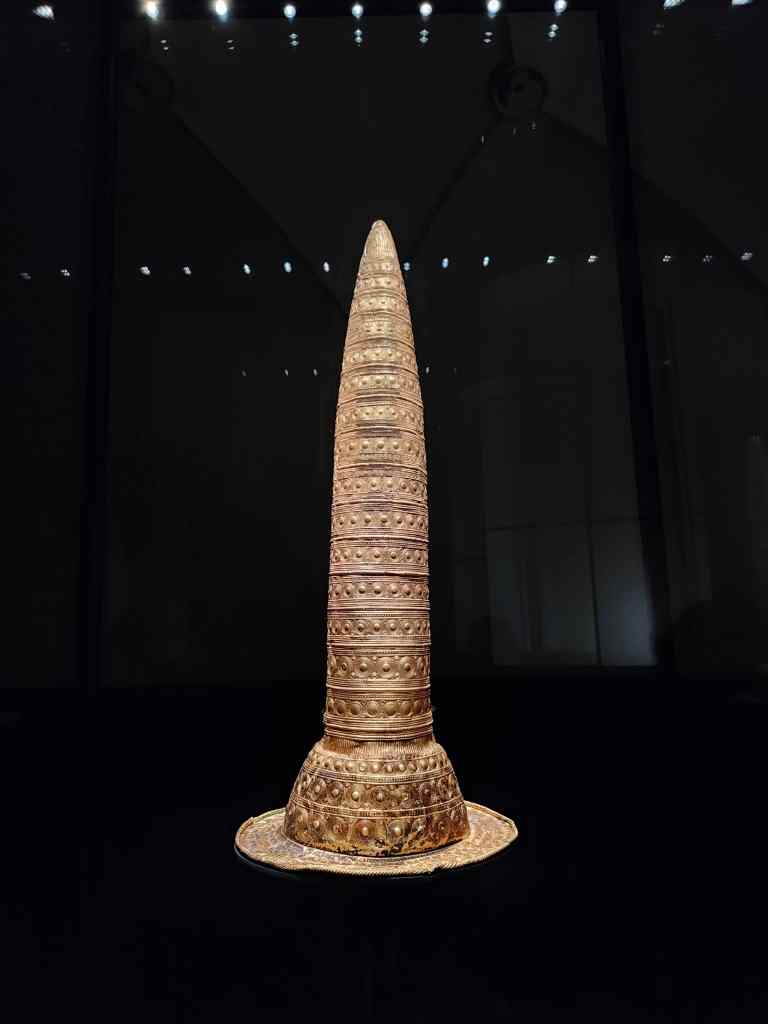
Next, I visited the Neues Museum, built in the middle of the 19th century, but looking a lot older, having been damaged by bombs in the second world war and then neglected during communist rule. It was brilliantly restored after reunification – in many of the rooms the original brickwork is left exposed, giving an old, decaying atmosphere that I found was a great way to present the exhibits. Highlights included a famous bust of the Egyptian queen Nefertiti (no photos allowed here!), a ceremonial gold hat from the bronze age which made me think of Hogwart’s sorting hat in the Harry Potter books, and parts of the treasure of Troy found by the enterprising German business and amateur archaeologist Schliemann.

Inside the Neues Museum, Berlin
The hat from Hogwarts? – Neues Palace, Berlin

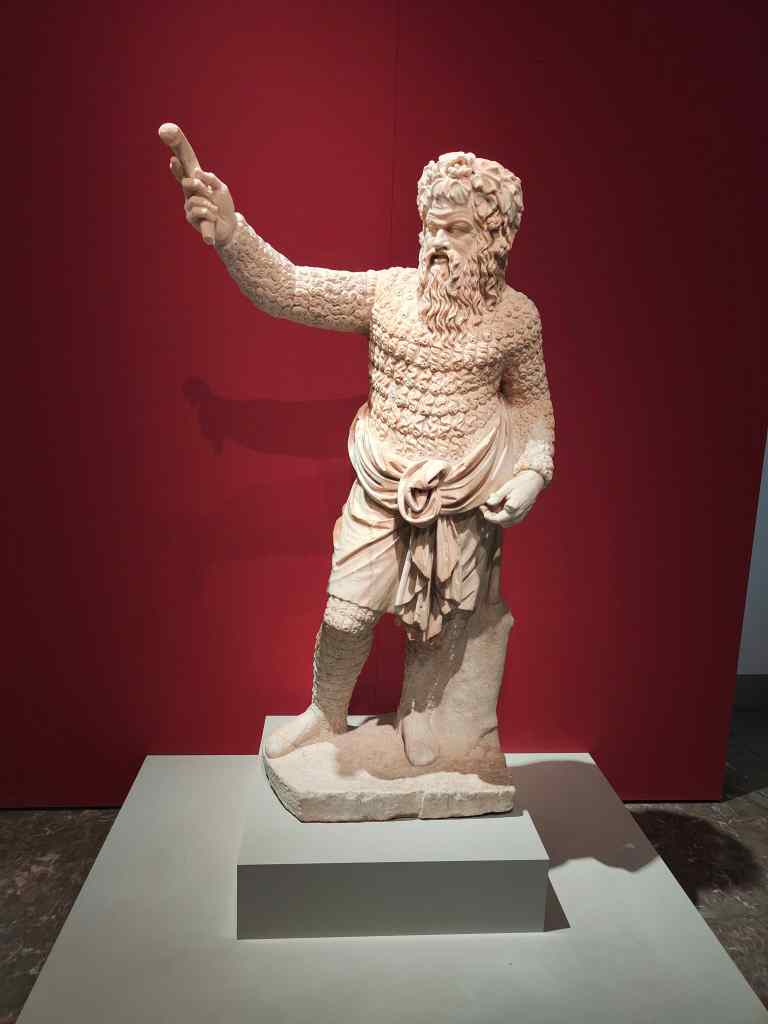
After a wonderful couple of hours wandering around, I visited the nearby Altes Museum, built slightly earlier and looking much older from the outside, but modern on the inside with bright white walls. Its collection is not quite as good as its neighbour’s, but it does have some great pieces like this statue of a roman actor.

Exhibit in the Altes Museum, Berlin

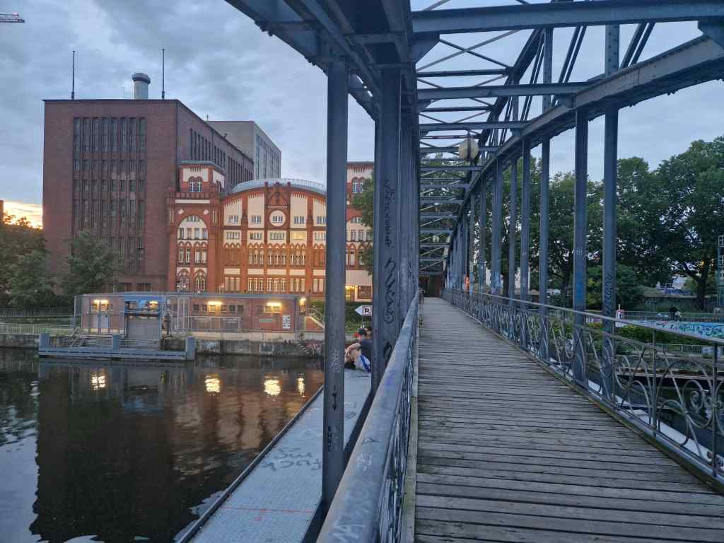
Originally I had planned to visit one more attraction on the island, the Alte Nationalgalerie, but there was long queue outside even for people who already had tickets. I didn’t fancy waiting for an hour in the rain, so headed home to relax. I had dinner with old friends who live in the Charlottenburg area of western Berlin. During our meal it had finally stopped raining, so afterwards we strolled around to explore the area, which had an interesting mix of architecture………

Post-industrial architecture in Charlottenburg, Berlin

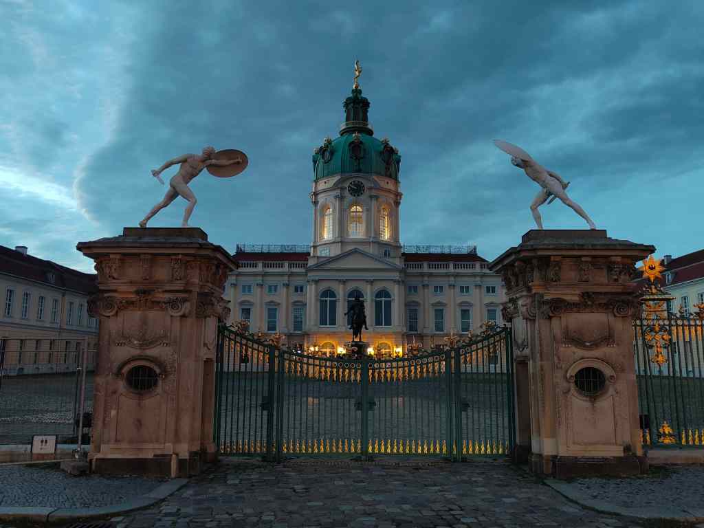
….and was also home to Charlottenburg Palace, whose construction was started around 1700 by Frederick I, King of Prussia and continued through the first half of the 18th century until it became one of the biggest palaces in Europe. I could only admire the building from the outside but did not mind, since on the next day I planned to visit an even more impressive place…….

Charlottenburg Palace at dusk

Next Post – Potsdam

Shop until you drop – Cape Town’s V+A Waterfront

I spent today exploring the V+A Waterfront. This was the first part of Cape Town to be settled and claims to be the oldest working harbour in the southern hemisphere. The Victoria and Alfred (Victoria’s son) docks were busy during Cape Town’s role as a centre for gold and diamond exports from South Africa in the late nineteenth century. In the 1990s, the area was redeveloped. One working dry dock for ship repairs remains, but the remaining shipping activity is now entirely pleasures cruises. The warehouses have been converted to shops, restaurants, offices and a conference centre.

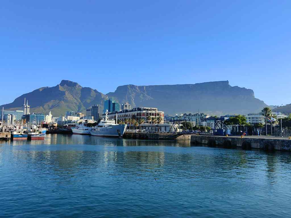
The conversion was very successful. The area was beautiful, with the spectacular backdrop of Table Mountain.

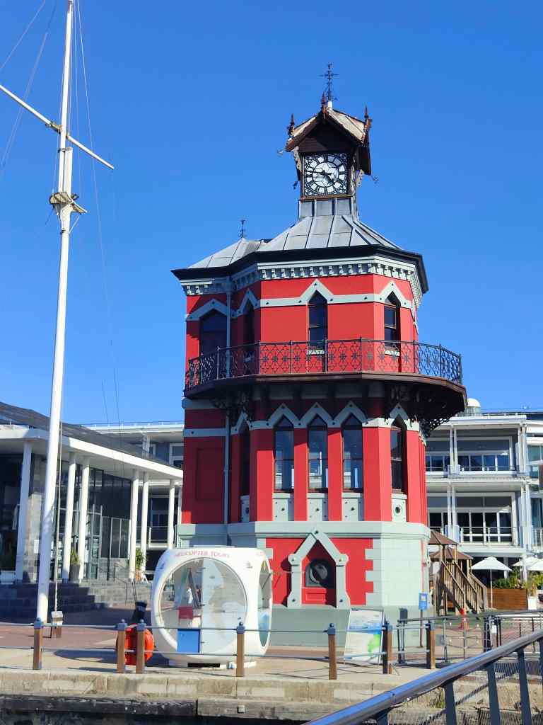
Scenes from the V+A Waterfront

The souvenir shops sold lots of interesting articles. My favourite place was the African Trading Post. Its ground floor housed traditional souvenirs, plus some unusual ones – like Zimbabwe bank notes. The highest denomination I found was for fifty trillion Zimbabwe dollars.

You can be a trillionaire in Zimbabwe it seems

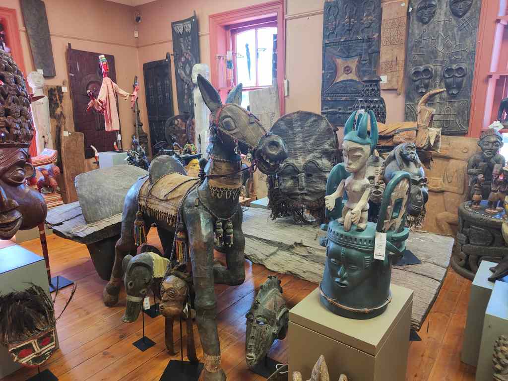
Its three upper floors were given over to increasingly exuberant carvings and sculptures, with finally a museum on the top floor.

Second floor of the African Trading Post

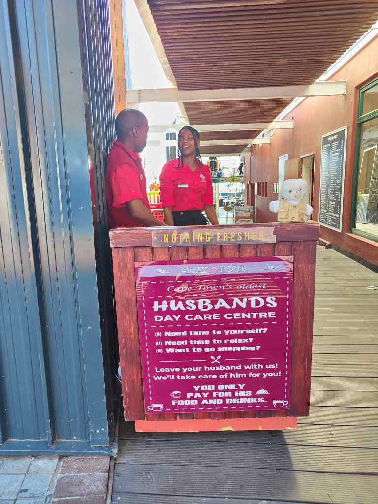
The Waterfront has lots of open-air restaurants and cafés. Recognising that shopping might be stressful for men, one place had set up a day care centre for husbands where wives could leave their partners before going round the countless shops.  

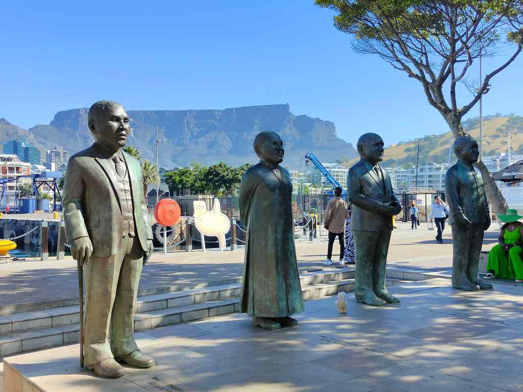
The area also had statues of famous people…….

Four giant figures in the ending of Apartheid, and one small bear

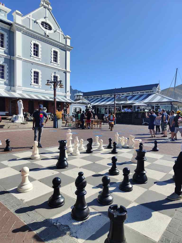
……..and a popular large scale chess set.

There were security guards everywhere, meaning the atmosphere was more relaxed than the rest of Cape Town. People gathered to enjoy a range of high quality street performers, including an excellent young people’s choir. My shopping completed, I headed back to my flat, and then later went out for dinner in the City Bowl area at the Sea Breeze restaurant, where I had a tasty fish curry.

Sadly that was my last day of my brief tour around South Africa before my flight back to London. It was a country I had liked a lot, with its beautiful scenery, great food and friendly people. These more than made up for the night-time insecurity and need to be constantly vigilant in Cape Town. I will be back, probably returning to Cape Town but heading further east next time, as far as Durban.

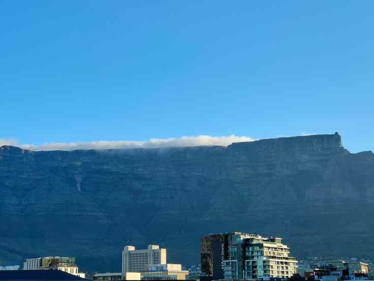
Farewell, Table Mountain!

Previous Post: Cape Point and Cape of Good Hope – to the end of the world…

Cape Point and Cape of Good Hope – to the end of the world…

Today was my last day in South Africa, and it was busy. I woke early to pick up a hire car and set off immediately to drive down to Cape Point and the nearby Cape of Good Hope, about an hour and half south of the city. Unlike my previous experience driving in Cape Town, the road along the coast was very scenic and quiet. It went through several affluent suburbs before I reached Chapman’s Drive, a famously scenic toll road. It did not disappoint.

The view from Chapman’s Drive

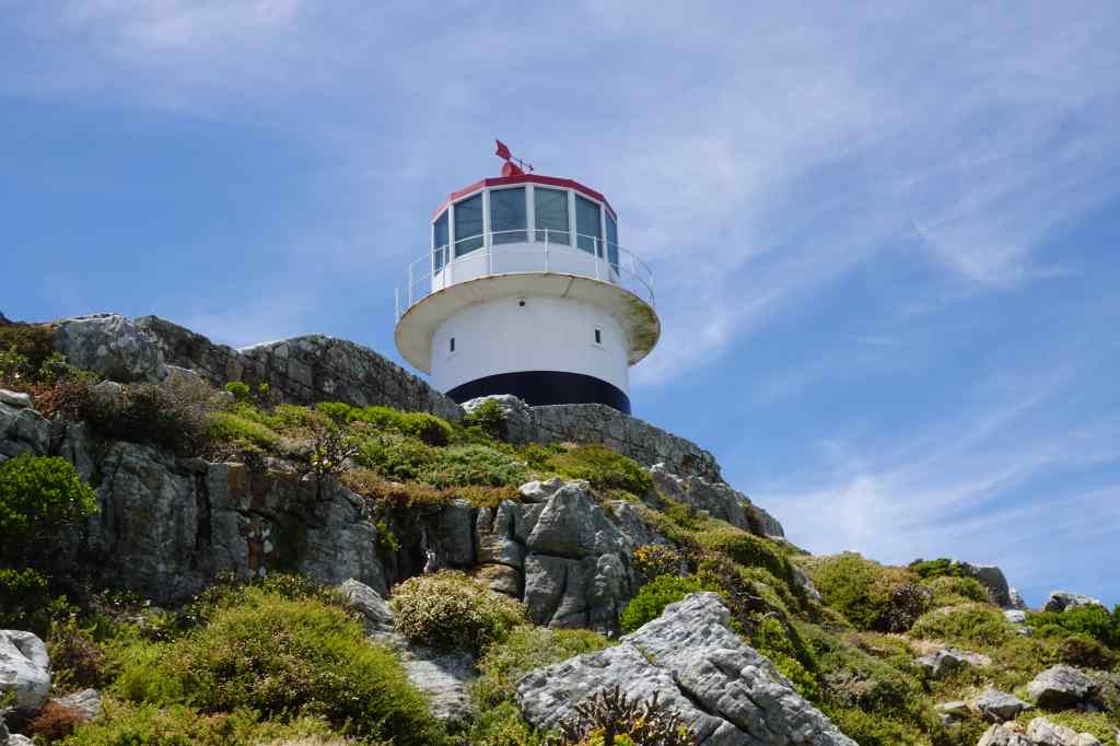
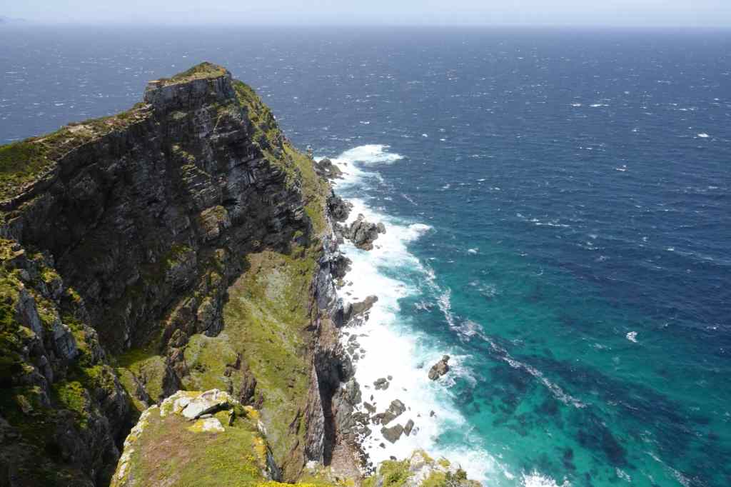
The Cape Point area is part of a large national park. I paid my entrance fee and drove in, as the views became more and more spectacular. I finally arrived at a car park below a lighthouse; I had reached the southwestern tip of the African continent.

The new lighthouse at Cape Point

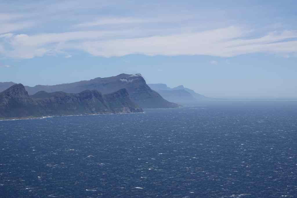
To my left, miles and miles of stunning coastline presented itself in a 180-degree arc, first heading east and then further south – the southernmost point of Africa is in fact not Cape Point but Cape Agulhas, about 180km to the east. The Indian and Atlantic Oceans meet between these two capes.

From Cape Point looking east…
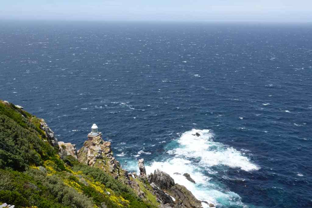
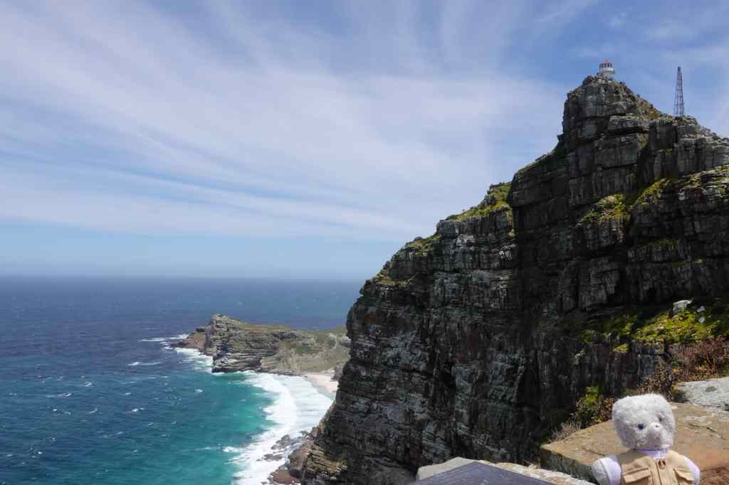
…looking forwards towards the old lighthouse….

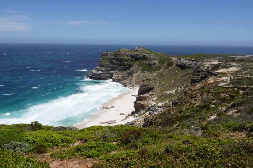
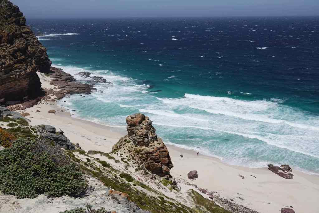
A short distance to my right was the famous Cape of Good Hope. This marks the point where ships, having travelled thousands of kilometres down Africa’s Atlantic coast, finally begin to travel more east than south.

…and looking west to the Cape of Good Hope

I walked up to the base of the lighthouse and stood admiring the view, whilst trying to keep my camera steady in the face of a ferocious wind. This area was quite busy with other tourists, but I soon found a small track to the old lighthouse, which was even closer to the tip of the point. This path was deserted, and when I got to the end, I was the only person there. The views – and the wind – were breath-taking.

Views from near the old lighthouse

After soaking in the panorama, I returned to the new lighthouse and took the more popular route to the Cape of Good Hope. On the way I spotted a group of elands, quietly browsing – I was very pleased, since at Etosha in Namibia I had only managed to see one of these animals in the far distance.

Eland grazing near Cape Point

The path offered more brilliant scenery, before I got to the famous Cape.

On the way to the Cape of Good Hope

I imagined the excitement of Bartolomeu Dias’ sailors as they finally reached this beautiful place and confirmed that there was an end to the African continent. Later I learnt that on their outward voyage they actually sailed further south, out of sight of land, and landed further east at Mossel Bay, only discovering the Cape on their way back.

On the Cape of Good Hope, looking towards Cape Point and yet more capes in the far distance

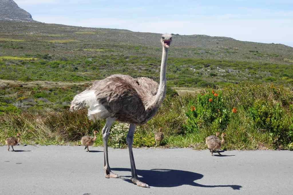
I regained my car and headed to the exit of the park. On the way, there was an unusual traffic jam caused by a pair of ostriches and their chicks. I got of out my car to take photos, but soon realised I had taken a silly risk. The mother ostrich perceived me as a threat and approached me aggressively. I remembered what the guide at the ostrich farm had told me about the birds being able to kill with a single blow from their feet and hurried back to my car. Maybe I was lucky to be a small teddy, and less of a threat then a taller human, because mother ostrich did not pursue me.

A close escape!

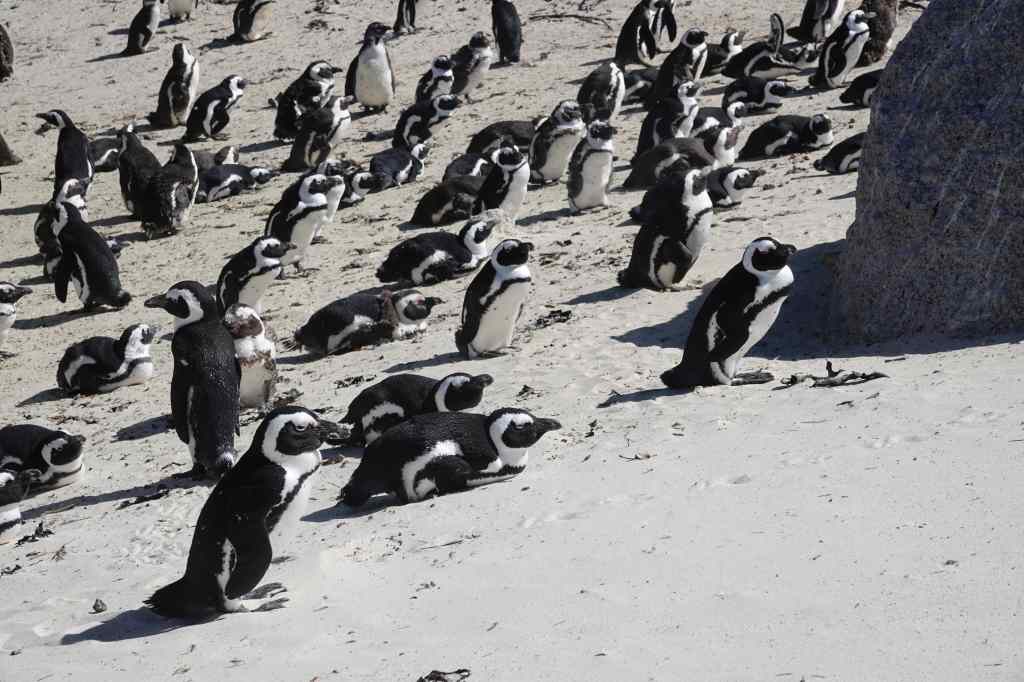
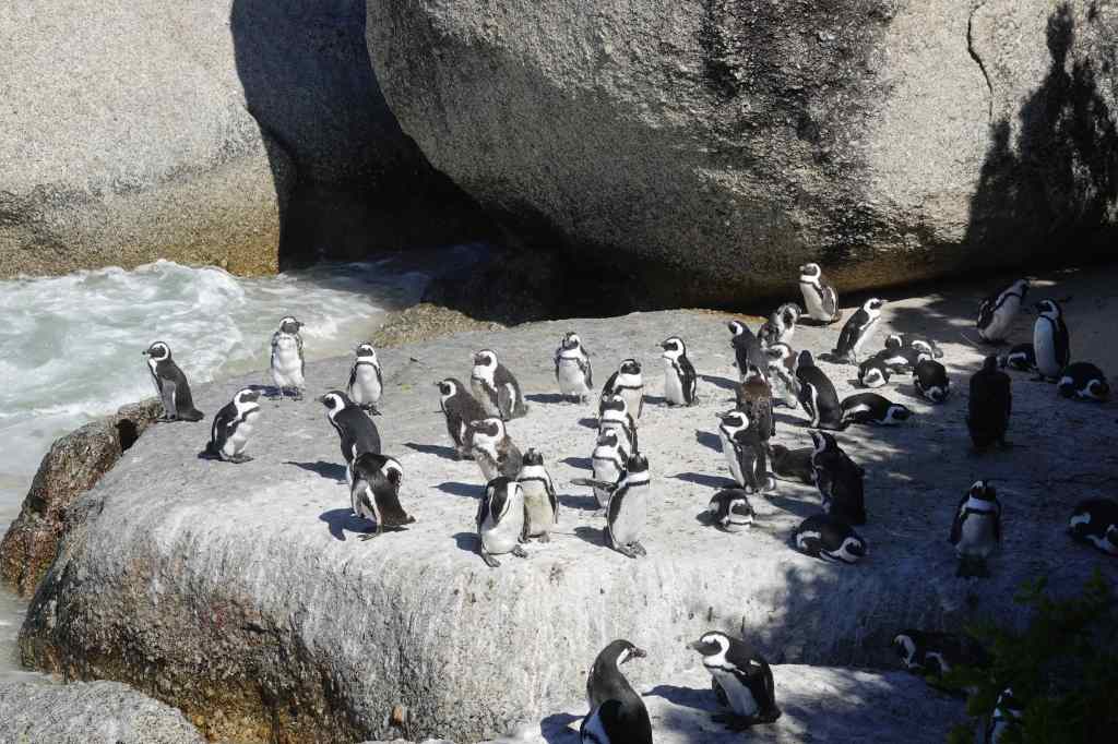
After my close shave, I drove north for one last visit – to the penguin colony at Boulders. The site was very busy with penguins – and tourists. Visitors had to stay on a wooden walkway which went right over the beach where the colony was living. This allowed me to observe the birds much more closely than had been possible in Namibia and to take some great photos, albeit at the cost of having to endure a much more “touristy” experience with crowds of tour groups.

Close up and personal with penguins

I returned to Cape Town along the same spectacular coast road that I had travelled in the morning, arriving just in time to return my car. It had been a brilliant day – pleasant driving, spectacular scenery, history, penguins, elands, and a close encounter with an ostrich.

Next Post: Shop until you drop – Cape Town’s V+A Waterfront

Previous Post: Three Different Faces of Cape Town – Langa Township, Bo-Kaap and City Bowl

Three Different Faces of Cape Town – Langa Township, Bo-Kaap and City Bowl

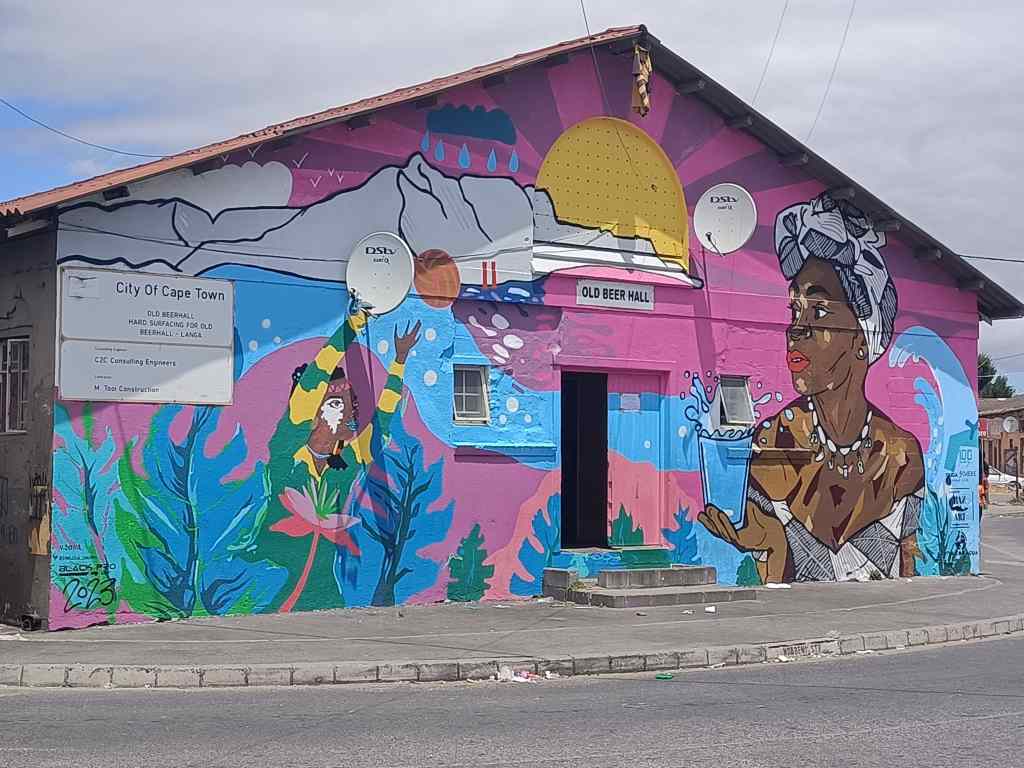
beer hall at Langa township
The Old Beer Hall at Langa Township

Today I saw three very different aspects of Cape Town. The day started with a tour of Langa, Cape Town’s first township. Our arrival was delayed by nearly ninety minutes as the guide and his driver searched frantically and ineptly around the city for the remaining tour participants, in a performance worthy of Laurel and Hardy. Fortunately, we managed to arrive at Langa intact, without having killed anyone, despite our driver ignoring several no entry signs and nearly hitting a pedestrian on a crossing .

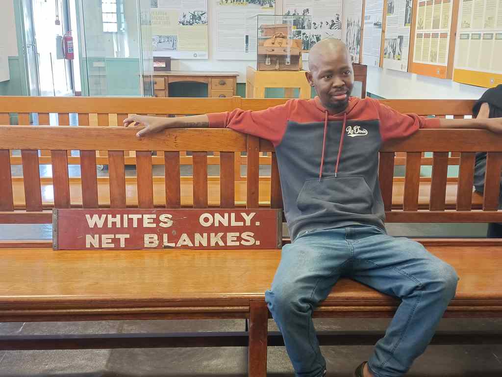
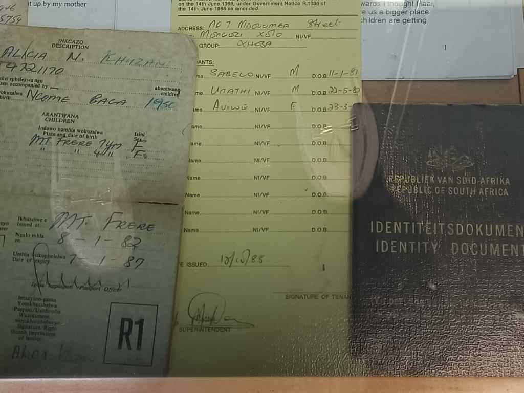
Our first stop was the township’s museum, where the curator was impossibly enthusiastic and told us more about the history of the place in a rapid, sometime confusing, babble. Langa was the Cape Town’s first township, where black people were forced to live, segregated from whites. The conditions they lived in were close to slavery, with dozens of black men sharing single sex dormitory accommodation in order to work for white businesses. Every black had to carry a “dompas” which allowed them to travel; it had to be renewed every two weeks. The hated dompas was the focus of the first demonstrations against the Apartheid system, which had been introduced by the National Party in 1948.  Further demonstrations flared up over the decades, each time being suppressed violently by the police. Apartheid continued until the 1990s, until the South African President FW de Clerk realised that minority white rule was unsustainable, released Nelson Mandela from prison and allowed coloured people to vote in elections.

A “White’s Only” sign on a bench, with the curator’s son
The hated Dompas and other ID documents

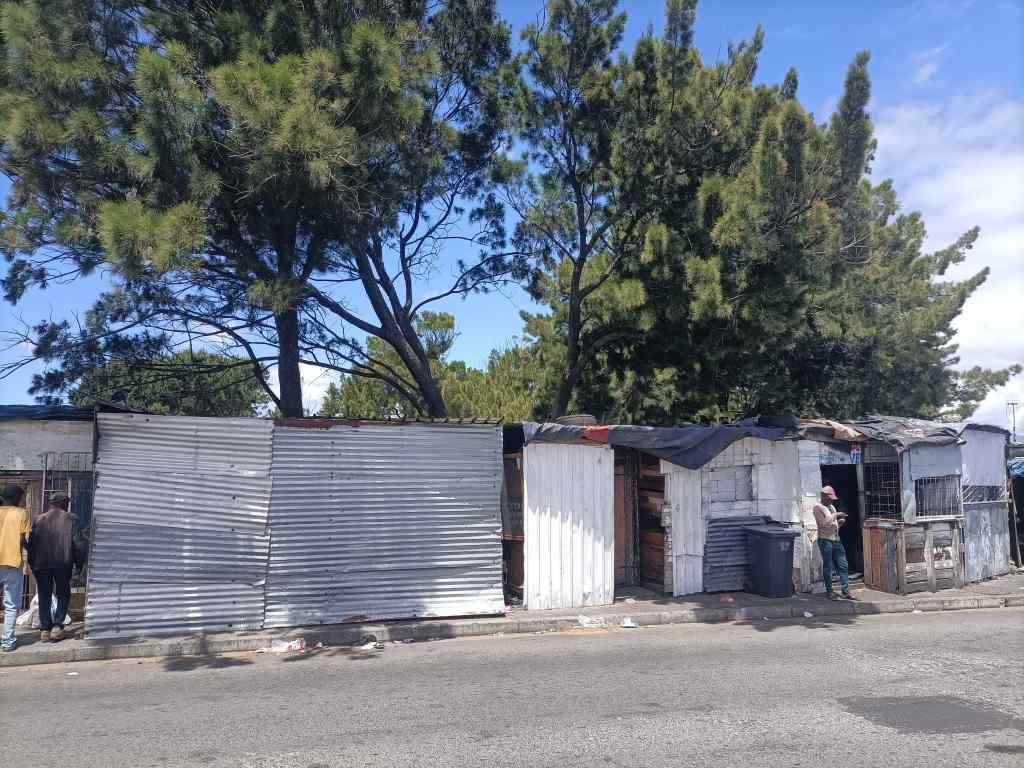
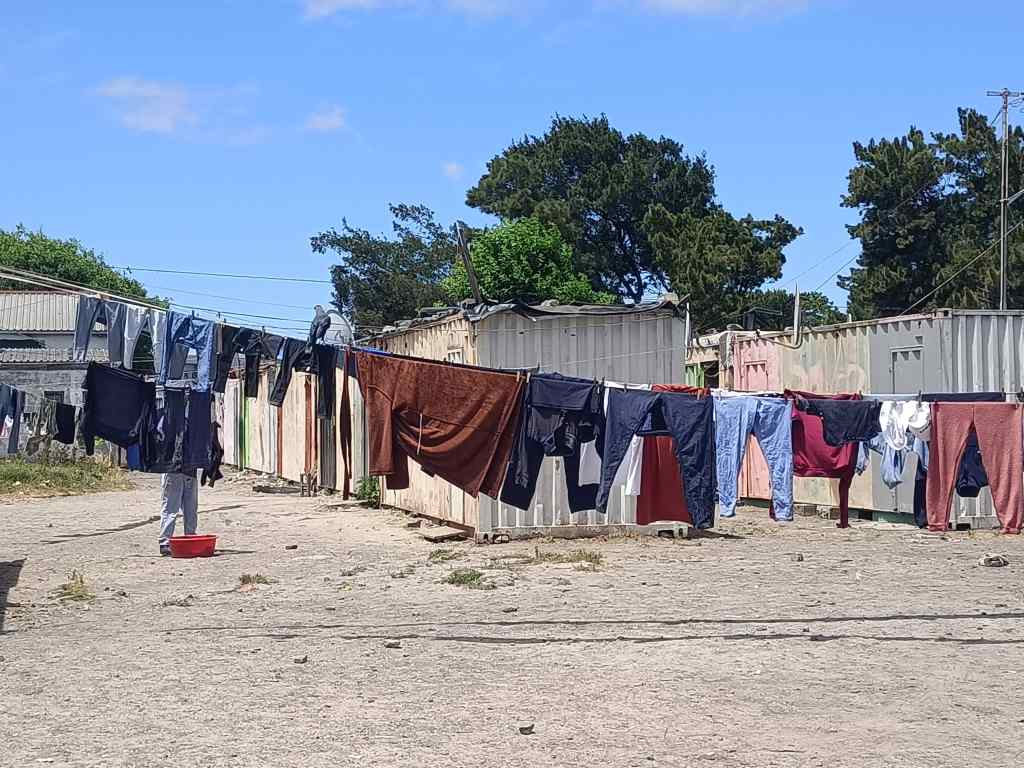
The township had many different types of housing. At one end of the scale, there were shanty houses built out of corrugated iron. People living here had to borrow electricity from neighbours and get water from a pump outside.

Shacks in Langa

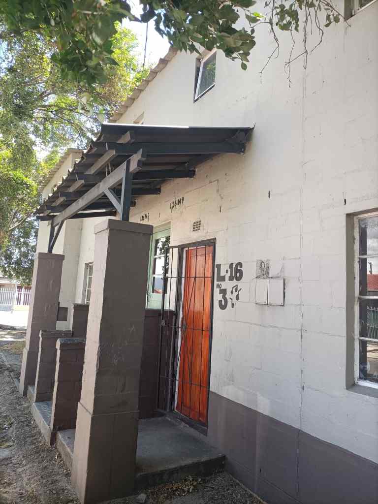
The lived in the hope that the government would need the land they occupied and would then build them a proper house, like the mid-range accommodation that made up most of the township….

house, Langa Township
Mid-range housing, Langa township

At the top end, the township had an area nicknamed “Beverly Hills” with very nice modern houses. These were given to people like teachers or nurses who had worked for the government for a long time. They even had brilliant views over Cape Town.

“Beverly Hills”, Langa Township

Our guide assured us that there was very little crime in Langa. The fancy houses in Beverly Hills were not a source of resentment, but one of inspiration, where people could see what was possible if they worked. Walking around the streets, the atmosphere was very friendly and relaxed. Lots of people came to greet our guide, who seemed to know almost everyone. One resident came to embrace one of our group, because he was wearing a South Africa rugby shirt. Lots of children would approach us and spontaneously hug their white visitors.

“Free hugs” at Langa

Langa certainly seemed to be a friendly community, which had become a pleasant place to live – overcoming tough obstacles on the way. Its residents were proud to be there. However, our guide told us that many other townships were not like this, with many suffering from rule by criminal gangs and harsher poverty than what we had seen in Langa.

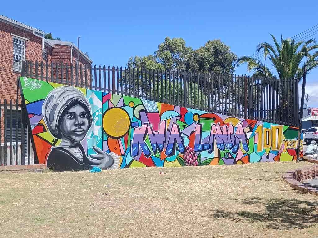
Mural at the entrance to Langa

Our trip ended – inevitably – in a building housing several art galleries, selling painting, carved wooden goods or ceramics. The owner of the latter business told me about the difficulties of operating with unreliable power supply – like all of South Africa, Cape Town experiences scheduled power cuts of two to three hours per day, called “load shedding”.

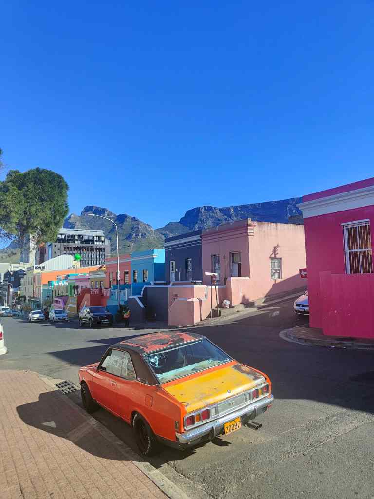
After the township tour, I set off to see two other areas of Cape Town. The first was Bo-Kaap, the city’s oldest surviving residential area, dating from the mid-18th century. The area is famous for its brightly coloured houses.

Street scene in Bo-Kaap

Many of the people who live here are descendants of Muslim workers who arrived from southeast Asia over a century ago, and the area has many mosques.

A mosque in Bo-Kaap
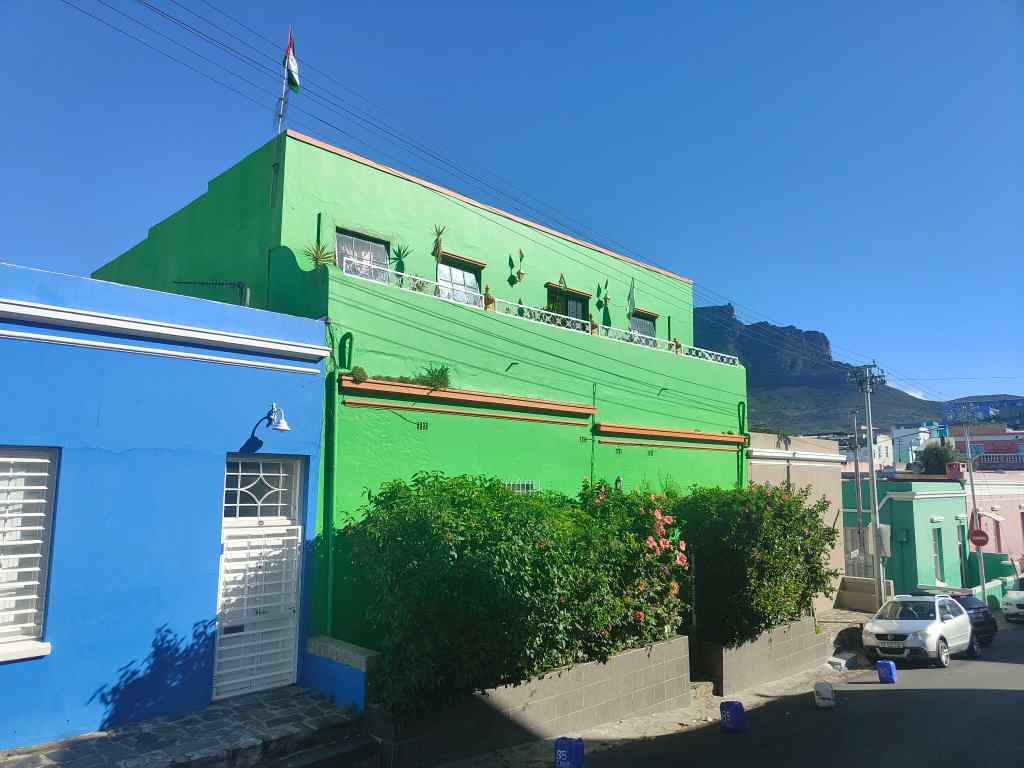
Lots of Palestinian flags in this Muslim area of Bo-Kaap

There were a few people hanging around on the street corners. One group shouted a greeting to me and, relaxed after my visit to the friendly Langa township, I replied to them. Another person walking nearby whispered to me urgently. “Don’t talk to them” he said. “They will try to steal your phone”.

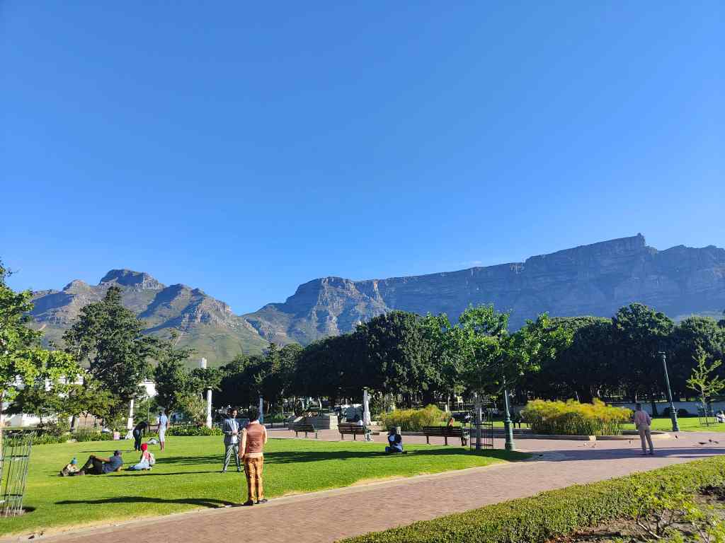
From Bo-Kaap, I walked to the City Bowl area – the heart of Cape Town. This is the main business area, and has shops, restaurants, high rise buildings (not quite skyscrapers though) and lots of top end hotels. By day, it was a pleasant and obviously affluent area, with people strolling from café to café. I soon found the Company’s Garden, which is the city’s oldest green space. It was set up by the East India Company in 1652 to grow fruit and vegetables for the fledgling Cape Town colony. In the following century it was transformed into ornamental gardens, and became famous around the world. On this late Sunday afternoon, centuries later, it was full of people enjoying the collections of exotic trees and flowers or just sitting on the grass. Couples enjoyed picnics together, parents played with their children, and at least one marriage was being celebrated.

The Company’s Garden, City Bowl
Memorial to Smuts and the National Art Gallery

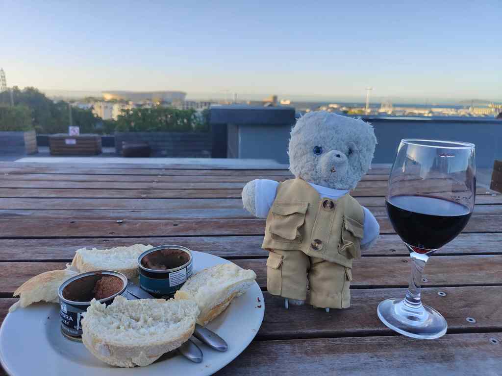
I walked through to the west end of the garden, where there was an open area, with a few monuments and the national art gallery. There were also a lot of homeless people stretched out on the grass. As the sun began to set, the shadows in the gardens lengthened. A sudden transition occurred. The happy, relaxed crowd I had seen earlier rapidly disappeared leaving behind the homeless and beggars. The remaining visitors walked faster, and looked around frequently. I followed suit, and walked quickly back to my hotel via the local shop, where I brought some excellent springbok paté and wine for dinner. I ate this on the roof terrace of my hotel,  contemplating the day’s events, and my good fortune in life compared to many of the other people I had seen today.

Springbok paté and wine

Next Post: Cape Point and Cape of Good Hope – to the end of the world…

Previous Post: Cape Town – Kirstenbosch Gardens and Table Mountain

Cape Town – Kirstenbosch Gardens and Table Mountain

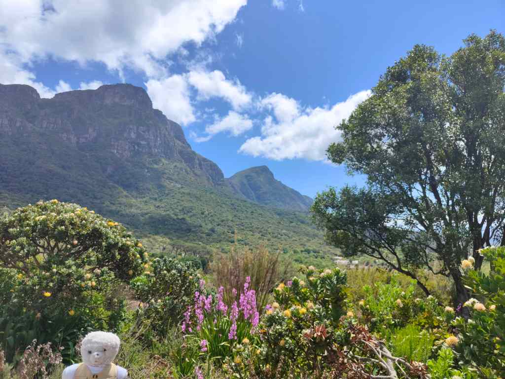
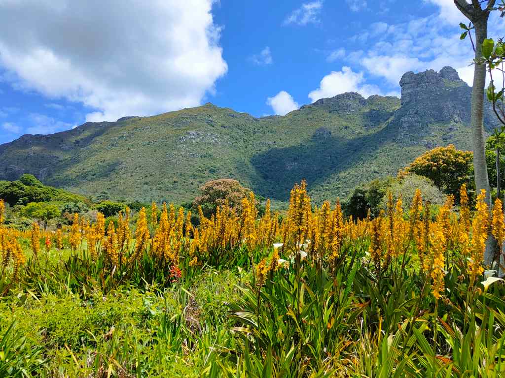
Today my original plan was to visit the Botanical Gardens and then explore the City Bowl area of Cape Town’s centre. I reached the Kirstenbosch Gardens without problem by taxi. They are among the oldest botanical gardens in the world, being founded in 1903, and sit in a magnificent setting at the foot of Table Mountain.

Kirstenbosch Gardens have an amazing location
Kirstenbosch Gardens Cape Town

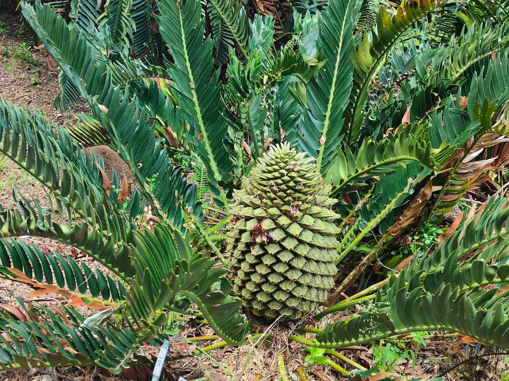
The gardens showcase a collection of typical South African flora, of which I particularly liked the cycads.

A cycad, a type of plant that first appeared when dinosaurs roamed the earth

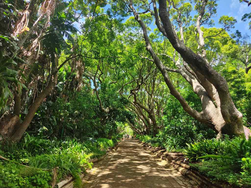
They also had some pretty walkways, shaded by trees, that provided protection from the hot morning sun.

A shady walkway, Kirstenbosch Gardens

When I reached the eastern edge of the garden, I saw an intriguing sign to “Skeleton Gorge”. I remembered that this was one of routes to climb Table Mountain. It was not part of my plan for the day, and I was not equipped for walking, since I had town shoes on my feet, and no cold weather clothing. But despite the lack of preparation, I could not resist and set off on a path that led steeply upwards.

At the top of Skeleton Gorge

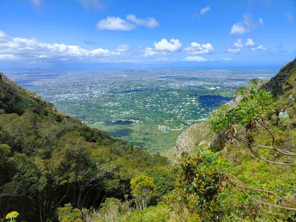
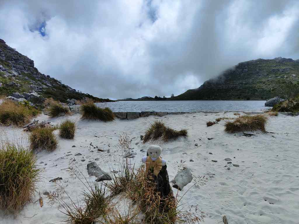
After climbing fifty minutes, I reached the “table” of Table Mountain – the place where the ground becomes flat(tish). There were great views back over Cape Town, and an intriguing small lake surrounded by sand.

Table Mountain is home to a small, sandy lake

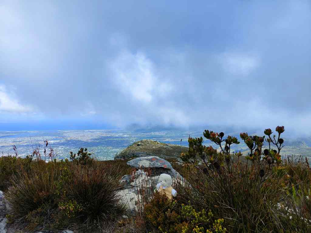
I had more walking to do – first another forty minutes to find the highest point on the mountain, Maclear’s Beacon, and then another forty minutes to the upper cable car station. The weather had become cloudy, but the sun broke through occasionally to light up more amazing views and stop me getting cold. There were also lots of pretty flowers, including some proteas.

View from Table Mountain
On top of Table Mountain – pretty flowers, amazing views…
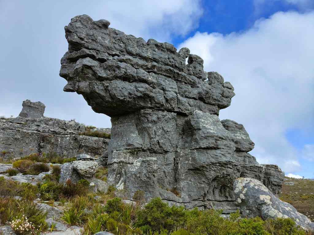
…strange rock formations
table mountain view over Cape Town
…and more views. It was getting cold…

At Maclear’s Beacon, the clouds became thicker and a strong wind gusted. I knew I was not equipped for such conditions and hurried onwards, occasionally stopping to take some atmospheric photos of the scenery.

Table Mountain view
More jaw-dropping scenery

I finally reached a crossroads, at a place I knew was near the cable car station. The signs were not clear, and the mountain was now covered in thick mist. I took what I thought was the right path, but it continued for longer than I expected, finally reaching a sign saying “This is not an easy way down”. I was cold and confused but was saved by two girls walking up towards me. They told me that this was the “Indian Fenster” route, which had been a tough climb for them and would be an even harder descent for me. I had gone the wrong way. I retraced my steps with the girls and found the junction where I had gone wrong earlier. This time, I could just make out another path in the mist. It was lined with posts and chains, and had to be the way to the cable car. I jogged along to warm up a bit, and on arrival headed straight to the café to order a hot chocolate.

The ride down in the cable car gave more opportunities for photos. The cabin had a revolving floor, so that everyone could get to see the full range of views over Cape Town and back to the mountain itself.

view from cable car, descending Table Mountain
Table Mountain cable car
View from the cable car, going down from Table Mountain

Back at ground level I stood in the sun for a bit to warm up, and then ordered a taxi back to my flat. It had been a memorable day, even if I had to have a long hot shower to recover from the cold weather on the mountain. My visit to Kirstenbosch and Table Mountain had confirmed that Cape Town is indeed one of the world’s most beautiful cities.

Next Post: Three Different Faces of Cape Town

Previous Post: Hermanus Whale Watching

Blog at WordPress.com.

Up ↑