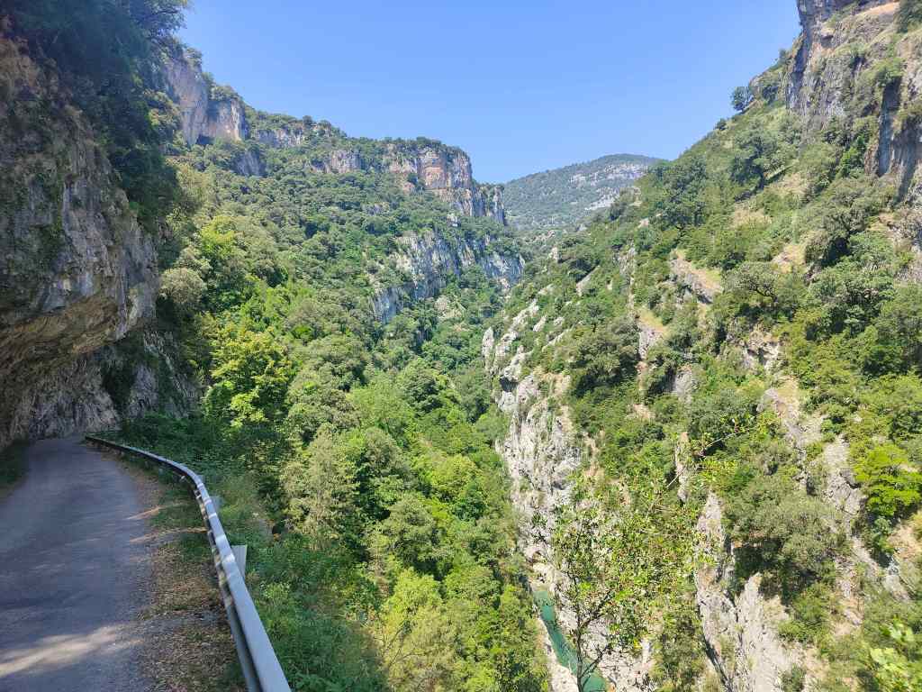
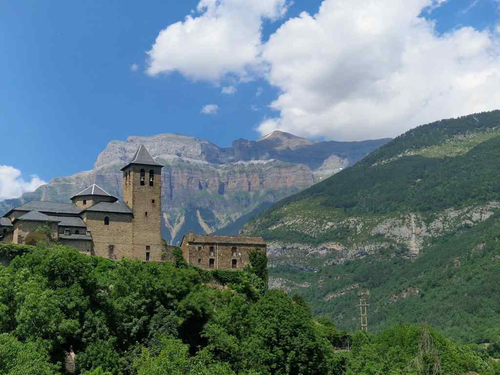
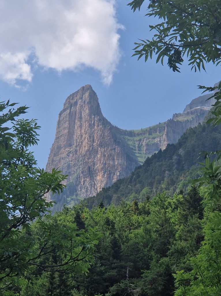
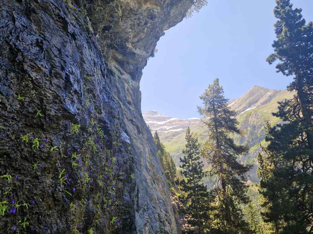
Today I set off from Bielsa on what turned out to be a spectacular driving tour. I headed south, before turning off onto a small side road to the Canyon d’Añisclo. The road entered a deep river gorge, with steep sides before splitting into two separate one-way tracks.
Approaching the Canyon d’Añisclo
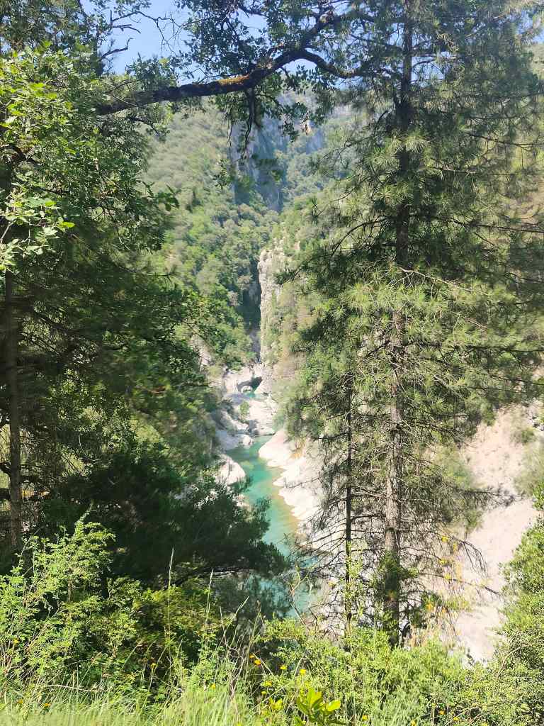
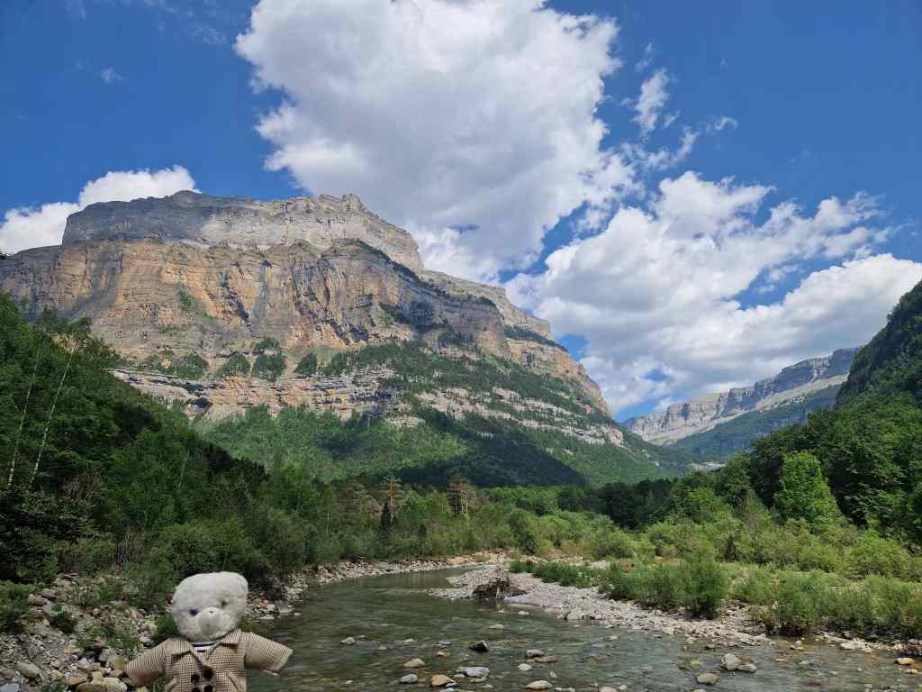
My route wound along the side of a small river, with steep cliffs towering far above me.
Deep in the Anisclo Gorge
I made slow progress – not because the driving was difficult, but because I made so many stops to take pictures of the amazing scenery.
Scenery in the Canyon d’Añisclo
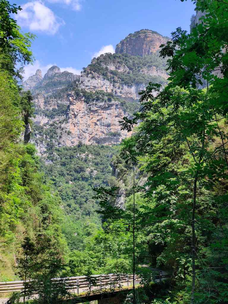
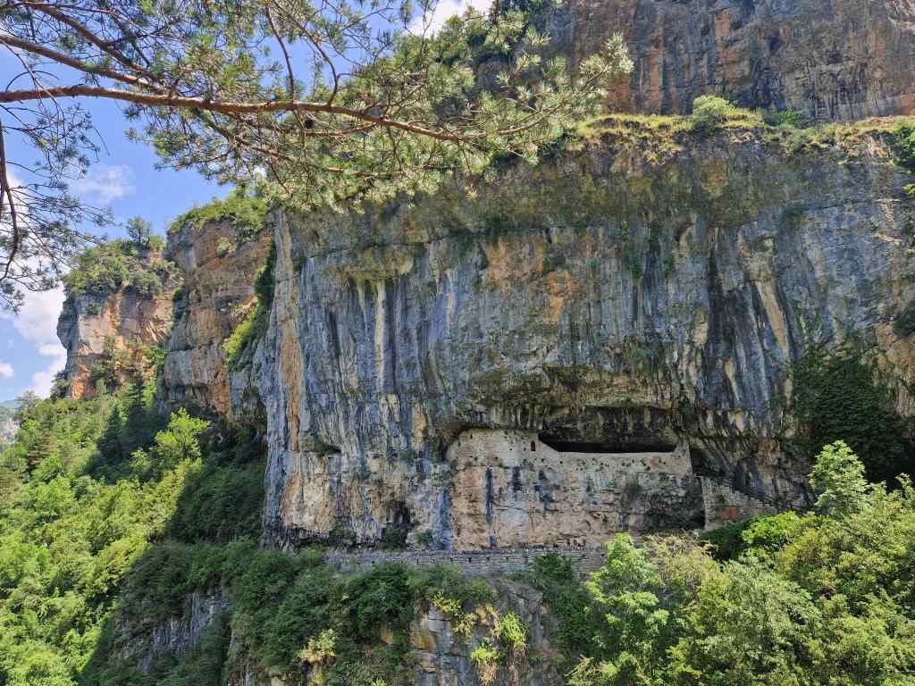
I arrived at a small parking area and got out to stretch my legs and have a look around. The car park offered spectacular views up and down the canyon, and to the other side where some sort of chapel had been carved into the cliff face.
Is that…..a little chapel in the cliff face?Yes! The chapel of San Urbez
A sign advertised a short circular walk named after San Urbez, a local hermit who lived in the area.
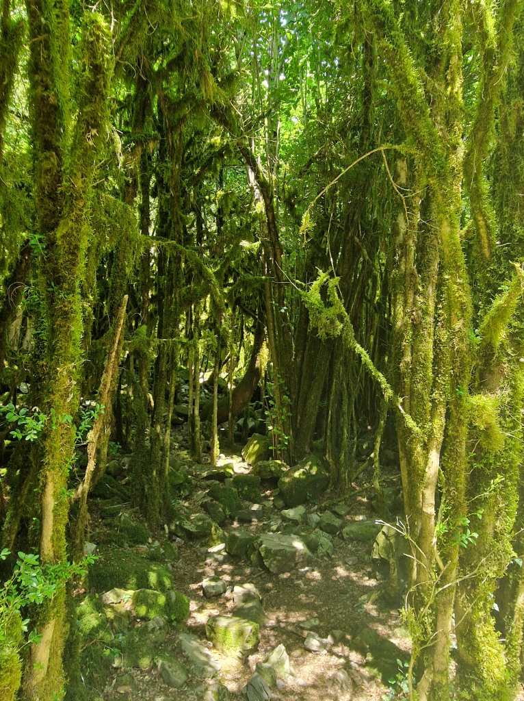
An interesting forest in the Canyon d’Añisclo
The path led down through a pretty forest, crossed a bridge and then climbed up to the chapel – which was furnished with simple pews, as if it was still in occasional use.
The chapel of San Urbez
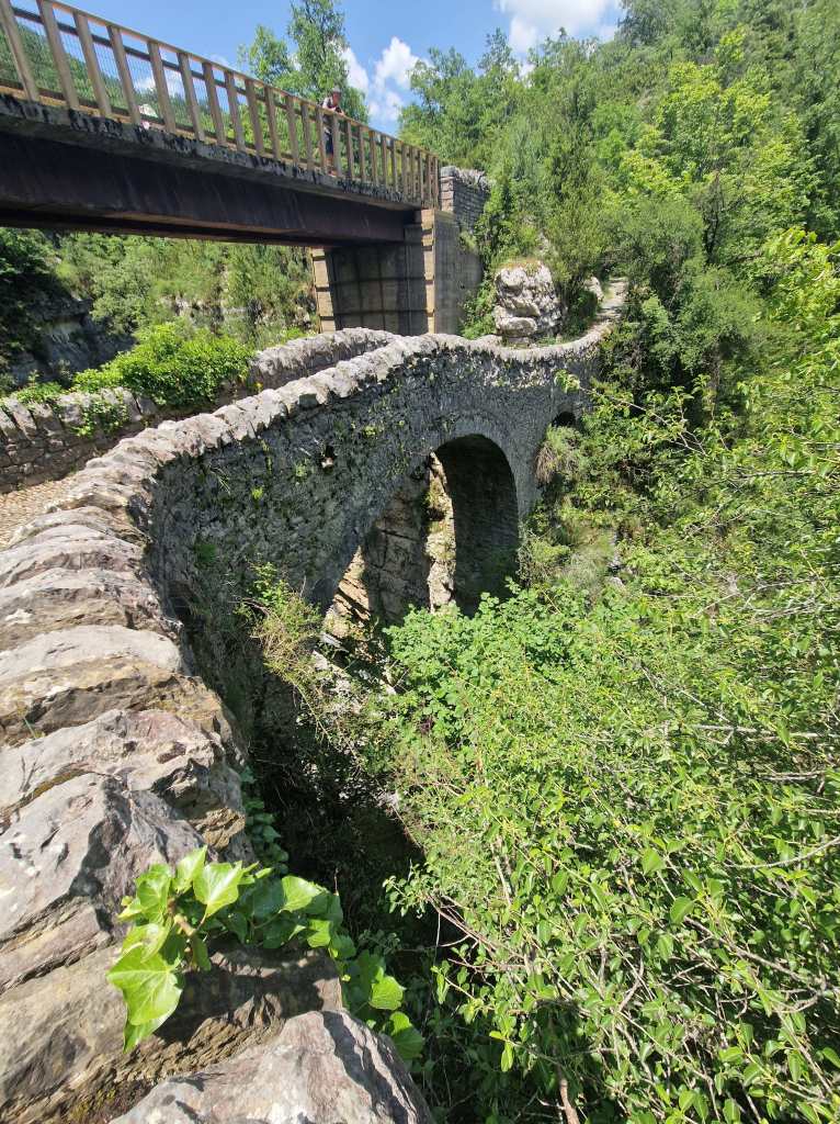
After the chapel I had the choice of using an ancient bridge or a new one built on top of it to regain my car.
A choice of bridges
I spent another hour driving through some impressive mountain scenery, noticing that the Spanish Pyrenees are different to the French ones – steeper, and much drier. I stopped for a drink at Torla, a pretty old town that is the gateway to the Ordesa and Monte Perdido National Park.
Photogenic Torla
The road into the park followed a gorge with steep mountains on either side, finally arriving at a large car park. Looking around, I felt myself transported to some of the most spectacular national parks I had seen in America – on all sides mountains towered above me, some of them twisted into fantastical shapes. I had read that the car park was the starting point for some amazing hikes, but sadly I did not have the time to do anything more than stroll a short way up the river valley and absorb the jaw-dropping views. I resolved to come back and explore Ordesa properly another time.
In Ordesa and Monte Perdido National ParkAmazing mountains in Ordesa and Monte Perdido National Park
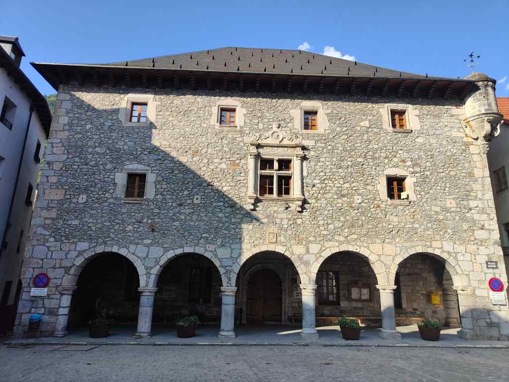
Finally, it was time to head back, and in a couple of hours I was back in Bielsa – for once, getting home early enough to be able to relax a bit, sort out my photos and write my blog. I stopped by the local supermarket to buy dinner and stock up on a typically Spanish tradition – sweet, fortified wines and sherries served directly from big casks.
Minimum two litre purchase!
The minimum amount you could buy was two litres, which cost a derisory seven euros. I bought some sherry and enjoyed a glass sitting on the town’s main square in the early evening sun, reflecting on an exceptional day.
Old building in Bielsa’s plaza
As my regular readers know I am a well-travelled bear but finding such scenery in a place only a few hours flying/driving from London was something really special. I will be back.
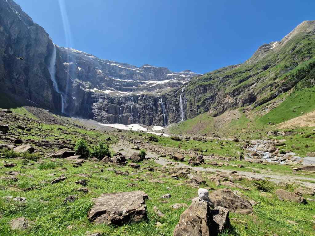
Today I enjoyed one of the Pyrenees’ most famous sights – the Cirque de Gavarnie. This time I set off from Tarbes without a cloud in the sky and was soon driving up a beautiful river valley towards the high mountains. The road passed some pretty spa towns, but my busy itinerary for the day did not allow me the time to stop at any of them. After an hour and half, I reached the village of Gavarnie, the base for my hike.
The hike to the Cirque de Gavarnie is one of the most famous and popular in France, and when I arrived at 11.00, the car park was already quite busy. Along with many other walkers, I set off on a flat easy track which followed the banks of the valley’s fast-running river – the same one I had been following on my drive to get here.
The cirque seen from the start of the walk at Gavarnie
Even from the walk’s starting point, there was quite a good view of the cirque – a semi-circular wall of mountains with waterfalls cascading down their sides. This view got more and more impressive as I approached my destination.
Further along the walk
After a few kilometres the easy, wide path ended at a bar/restaurant and turned into a mountain track which passed over a mini glacier. At first, I wondered whether this was safe to cross – the ice had two large holes, through which you could hear the river bubbling below. But the much heavier human walkers set across confidently, so I followed in their footsteps (literally) and was soon clambering up the rocky scree that lies at the base of the cirque.
A glacier with worrying holes
I sat down and had a long picnic, soaking up some of the most beautiful mountain scenery I had ever seen.
A well-earned break inside the Cirque de Gavarnie
Rested, I put on waterproofs and clambered up to the largest waterfall – La Grande Cascade – getting a close as I could without getting totally soaked.
Near the waterfalls, Cirque de Gavarnie
I chose to return to Gavarnie by a different, more difficult track that climbed up the side of a mountain. I turned around frequently to see the cirque flitting in and out of view, as if it was playing hide and seek with me. The path also offered impressive views of other mountains….
More pretty mountains
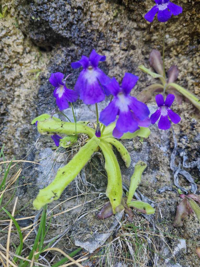
A final bonus of my return route was spotting a large group of butterworts (carnivorous plants) clinging to the rock face. These plants secrete a sticky liquid onto their leaves which traps insects, which the plant then digests.
Butterworts near the Cirque de GavarnieA Butterwort – the black spots on its leaves are dead insects
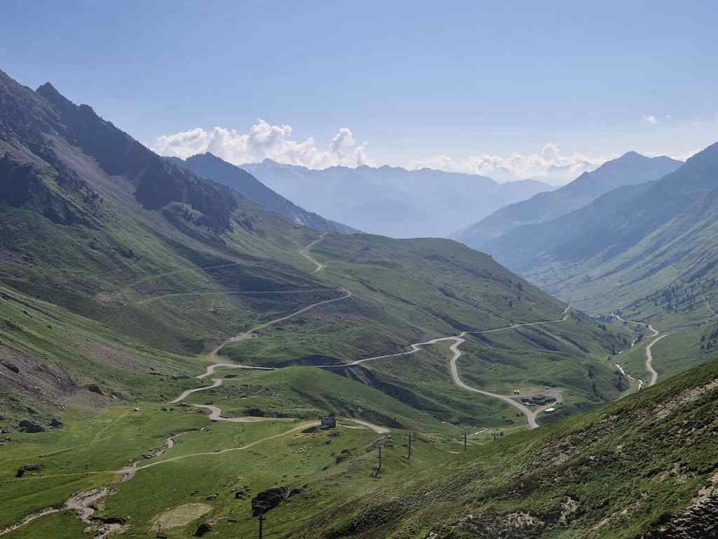
I got back to my car later than I had expected – probably I had spent too long sitting contemplating the beauty of the site – and my satnav gave me the unpleasant surprise that I had two and half hours driving to reach my destination for the night, the small town of Bielsa in Spain. On the sinuous mountain roads (which Google always underestimates) I knew it would probably take me even longer.
At first, I enjoyed the drive, as it passed some spectacular high Pyrenees sights, including the famous Col de Tourmalet…
View from the top of the Col de Tourmalet
….and the Pic Du Midi, an observation point served by a very expensive cable car, which due to lack for time I had to drive past (I was also not sure that the view would really be any better than what I had seen already, and probably not worth the exorbitant 60€ cost of the ride).
The Pic du Midi observation platform
Descending from the Col de Tourmalet I felt tired so stopped to refresh myself in the pretty village of Arreau, before heading on towards the Tunnel de Bielsa leading into Spain.
The pretty town of Arreau in the Pyrenees
I finally reached Bielsa at 20.30, but my driving was not over. Google kept proposing routes to reach my lodgings along tiny lanes so narrow that even a motorbike would struggle to get through. I called the house’s owners and explained my predicament in faltering Spanish. When they eventually understood me, they send their daughters to help guide me through the maze of streets, and I finally arrived in my room a tired and slightly grumpy teddy around nine o’clock. I had probably tried to tackle too much in one day, and all I wanted to do now was to sit down and have a drink in the café on the town’s main plaza. Although Bielsa was a very small town, there were several bars and restaurants still open and small groups of people sitting on tables in the square. The pleasant atmosphere and cold beer helped improved my mood and prepare me for a good night’s sleep after a very long but fulfilling day.
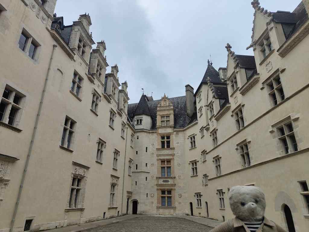
Today I pulled back the shutters of my room to reveal thick clouds handing over Tarbes. My plans for walking in the high Pyrenees would have to be postponed for another day. Instead, I headed along the autoroute to Pau, a historic city less than an hour away from Tarbes. I was heading for Pau castle, but on entering the city was caught in an impossible one way system and ended up parking and walking the last kilometre, passing along a pretty promenade which would have yielded wonderful views of the high Pyrenees had the weather been better.
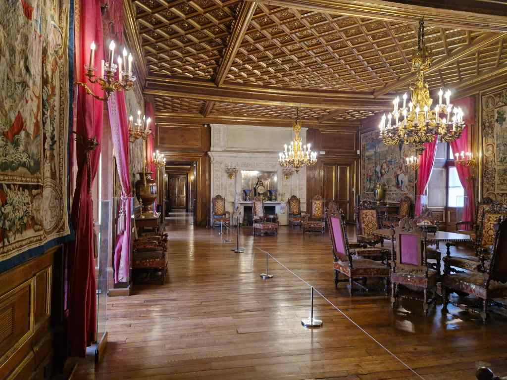
The Chateau de Pau is an impressive structure built up over many centuries. At its centre is a typical chateau fort of purely defensive nature – with thick walls and few windows. Around this structure were built the wings of a renaissance castle, built to impress and to be comfortable to live in. It was originally the base for the kings of Navarre, an independent French province in the Middle Ages. The Chateau de Pau is most famous as the birthplace in 1553 of Henry, later to become King of Navarre and still later Henry IV – one of France’s most famous kings and founder of the Bourbon dynasty.
The Chateau de Pau from the oustide
I enjoyed a guided tour of the castle, admiring its state rooms and many statues of Henry IV – a king always depicted with a slight smile on his face.
Reception room at the Chateau de Pau
One of the highlights was the display of the shell of a sea turtle, which had been the traditional crib for the newly born kings of Navarre, including Henry. During the French revolution, anti-royalist feelings ran high, and the authorities decided to remove and destroy this relic. However, a local royalist heard about this plan and managed to substitute the original shell with a different one. The copy was removed and destroyed, only for the original to be returned after it the restoration of the French monarchy.
Henry IV’s crib at the Chateau de Pau
After the visit, I strolled around the city of Pau. After its glory as the birthplace of Henry IV, it had another golden era as a spa town, and has some wonderful old houses built along a promenade looking out over the Pyrenees. However some of these grand old “maisons” were replaced by rather tasteless modern constructions, and the city today is an odd mix of the old and the new, its boarded-up branch of Galeries Lafayette a witness to its glorious past and uncertain present. Barber shops and tattoo parlours on its high street further emphasised the impression of a city in decline.
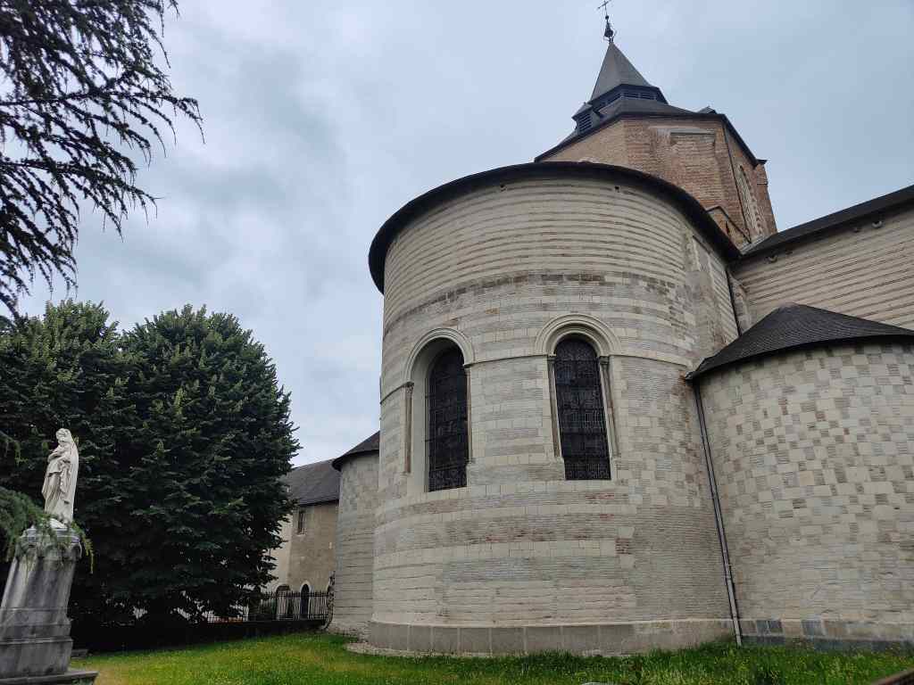
I headed back to Tarbes, which at first on a cloudy Sunday afternoon felt a bit like the slightly depressing city of Pau. However a stroll around town showed that with a little digging, Tarbes was a pleasant an interesting place – albeit well off the main tourist trail. Its cathedral dates from the 12th century and has an impressive interior – including, for some bizarre reason a marble plaque carrying Louis XVI’s last will and testament before his execution.
Tarbes CathedralInterior of Tarbes Cathedral
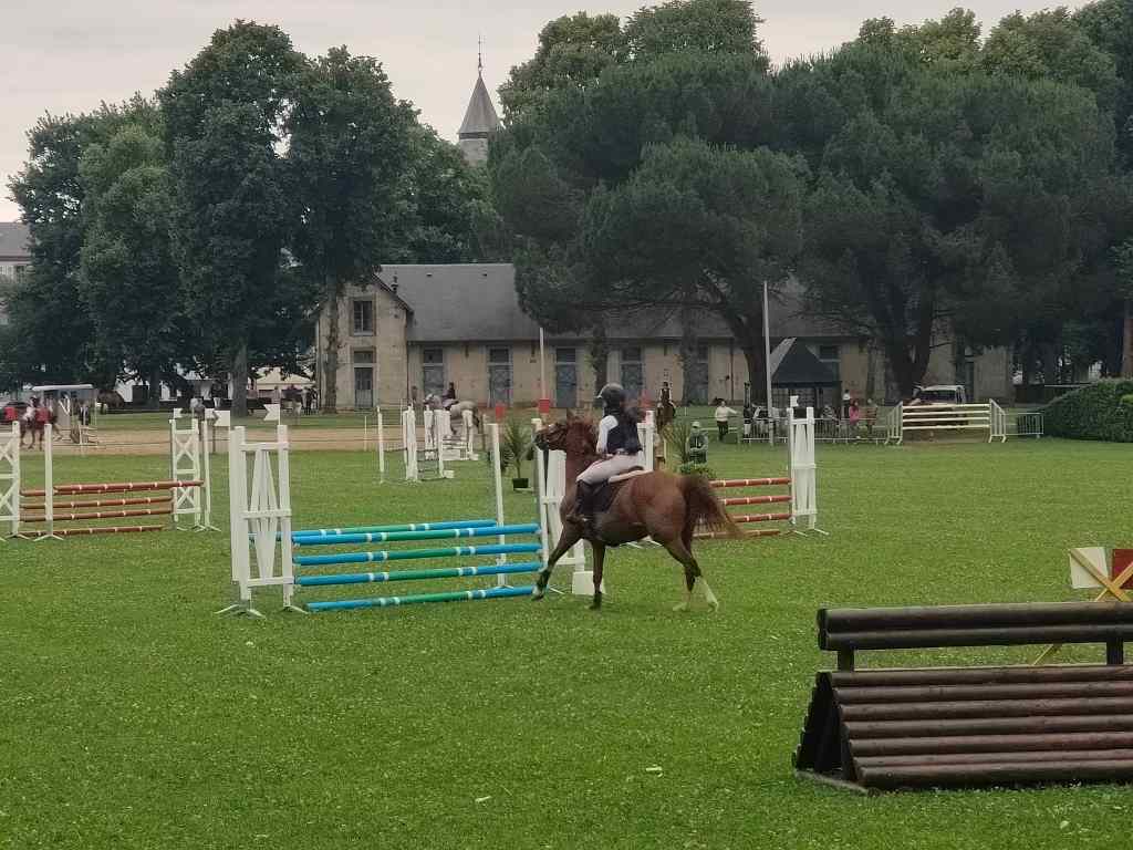
A further stroll brought me to the Haras, a stud farm and centre of equestrian learning established by Napoleon in1806 and now owned by the French army. I was lucky enough to visit during a show jumping competition, something I never seen before.
Show jumping competition at the Haras of Tarbes
I enjoyed watching the competition before heading back to my hotel – La Maison aux Murs Anciens – for the evening. It deserves a special mention as one of the most memorable places I have ever stayed. It was a house built into the old walls of the city of Tarbes, and converted by its owner, an architect and mason, into a small hotel. The room I stayed in had had one other famous guest – Bernadette Soubirous, the girl whose visions of the Virgin Mary in 1858 eventually caused Lourdes to become a major pilgrimage site (and ultimately grow into a much bigger city than Tarbes). She stayed – or was kept – there for a year as the Catholic church investigated her story.
In the same room as Bernadette Soubirous!
It was one of those days where you have to adapt your plan and expectations to the weather. In the circumstances, I had quite enjoyed my exploration of a couple of small Pyreneen cities. It turned out that a relaxing day exploring some low key attractions was exactly what I needed ahead of two exceptionally busy days in the high Pyrenees.
The Bear is Back! After my last trip to far away New Zealand, this one is much closer to home – the Pyrenees. I flew from London to Toulouse in just under 2 hours (compared to 25h for my return from Auckland), picked up a hire car and was soon in my hotel in Tarbes, my base for the first few days (more about Tarbes in a future post).
The next day I set off in the direction of the high Pyrenees, ready to tackle the demanding hike to the Breche de Roland, a gap in the mountain range which by legend was formed when the hero Roland, mortally wounded at Roncesvalles, through away his sword. It landed 200km away and cut a cleft in the mountains. However, just after leaving Tarbes I noticed that the high mountains were covered with thick cloud, and I was unlikely to see anything on my walk. So, I changed plans and went for a driving tour of the Pyrenees foothills.
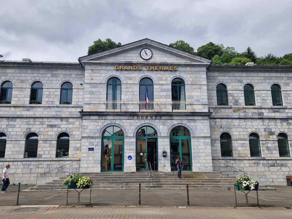
My first stop was the spa town of Bagnères-de-Bigorre. I refreshed myself with a coffee before exploring the many interesting buildings in the town, including a museum built by a rich resident…
Bagneres-de-Bigorre’s Museum
…the main thermal complex…..
The baths, Bagnères-de-Bigorre
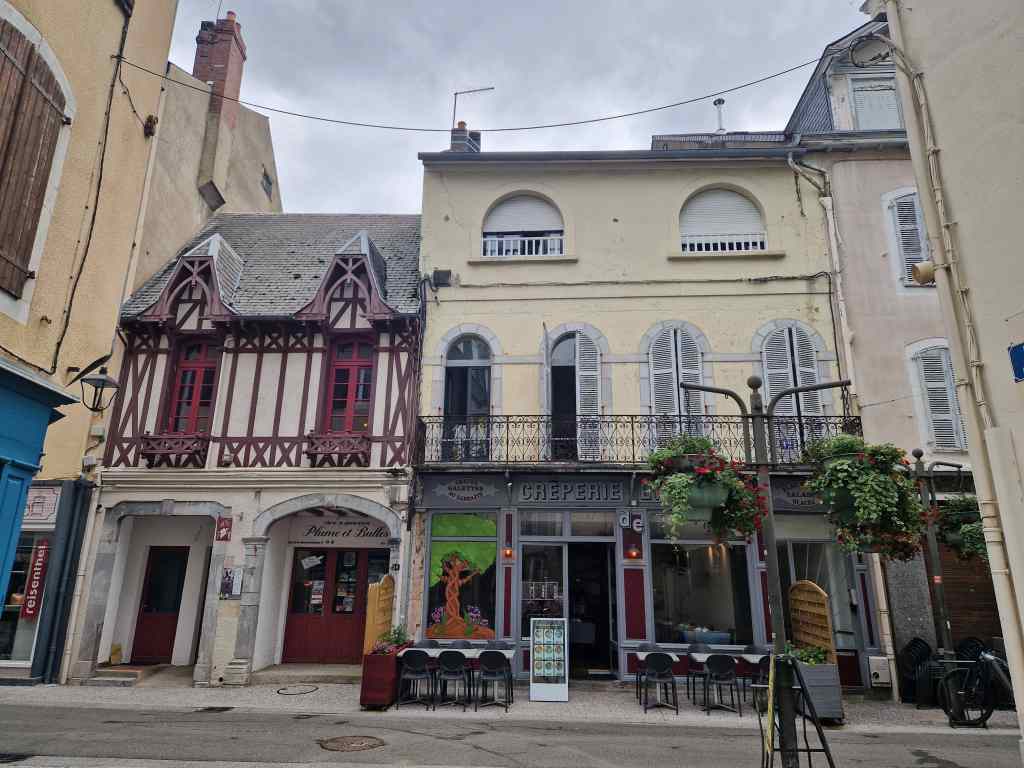
…quaint old houses…
Street scene in Bagnères-de-Bigorre
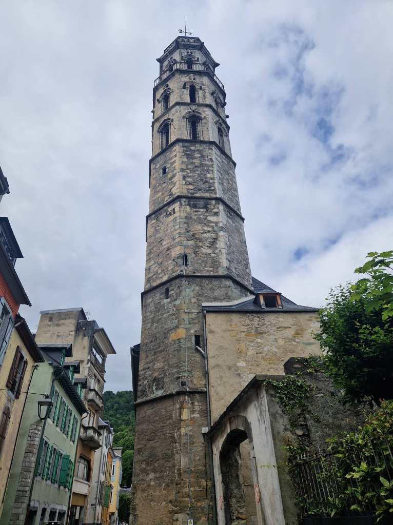
….and an ancient tower, all that is now left of a former church.
Tower, Bagnères-de-Bigorre
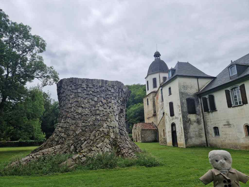
From Bagnères-de-Bigorre my trip took me deep into the countryside to the former Cistercian abbey of Escaldieu. The abbey and its grounds were the setting for a rather good contemporary art exhibition. The outdoor exhibits were particularly imaginative….
Escaldieu Abbey and some impressive modern artMore modern at at Escaldieu Abbey
After the abbey, I passed the impressive castle of Mauvezin…
Mauvezin Castle
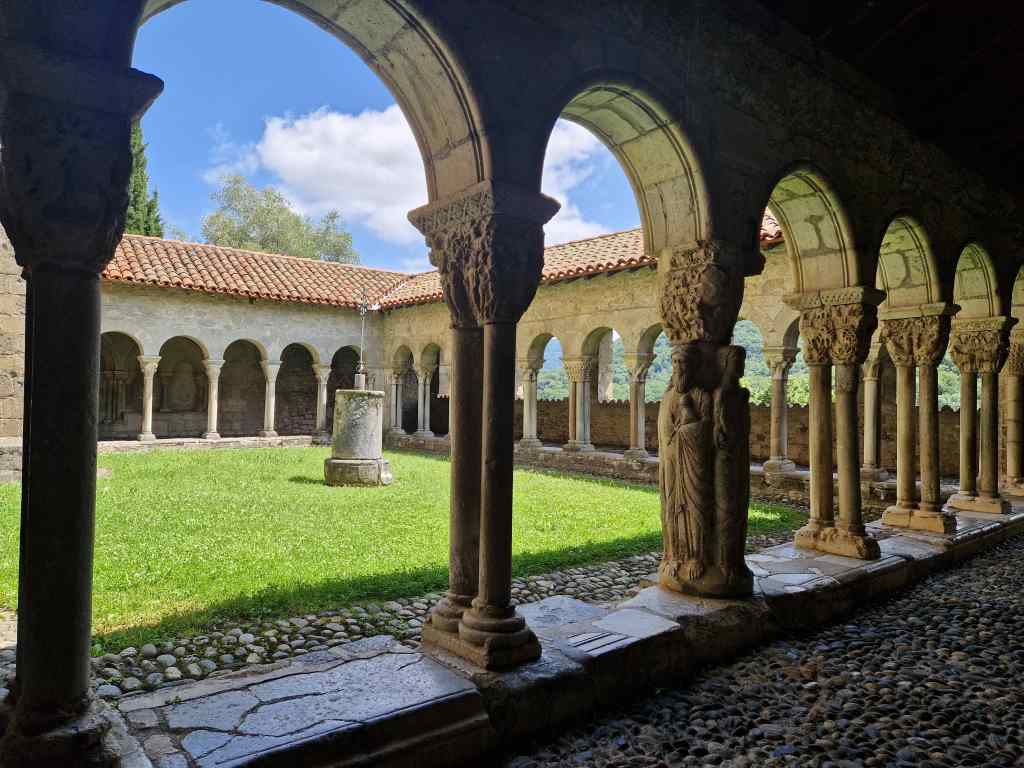
….before driving east through pretty countryside to Saint-Betrand-de-Comminges. This small town started as a Roman settlement, which eventually became an important centre of the Christian faith. It fell into decline after the fall of the Roman empire but remained a bishopric and came back into prominence when Bertrand of Comminges, a French knight, was nominated as its bishop in 1083. He organised construction of the cathedral that stands to this day, was later canonised, and gave his name to the town that he had put back on the map.
Saint-Betrand-de-Comminges’ cathedral seen from below
Today, Saint-Betrand-de-Comminges is a wonderfully preserved and peaceful medieval French town.
Street scene, Saint-Betrand-de-Comminges
Aside from the tomb of St Bertrand himself, its cathedral has cloisters with a great view of the surrounding countryside…
the cathedral’s peaceful cloisters
…. some beautifully carved wooden stalls….
The stalls in the cathedral, Saint-Betrand-de-Comminges
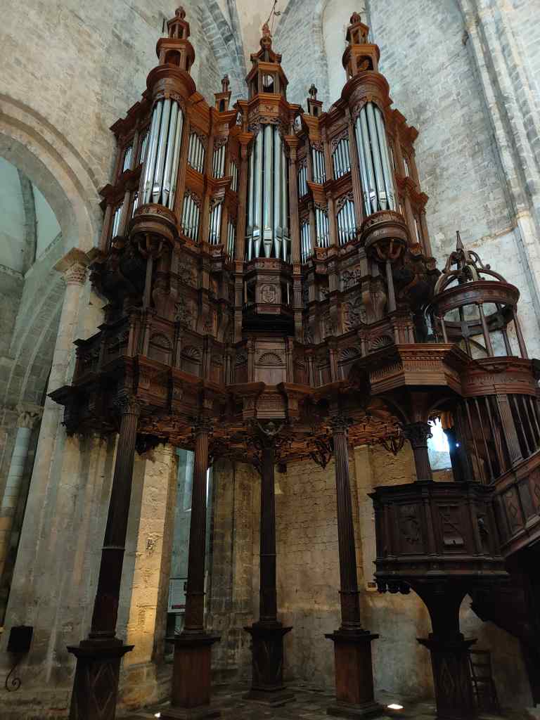
….and a huge organ, supported by wooden beams and hanging in mid-air.
The magnificent organ, Saint-Betrand-de-Comminges Cathedral
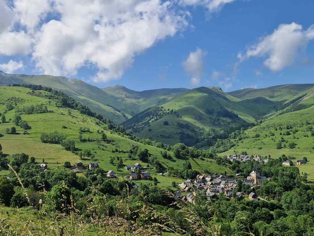
I spent a pleasant hour soaking up the atmosphere and enjoying a cold drink before heading back to Tarbes, over mountain roads that hinted at the grandeur of the high Pyrenees that I would see over the next few days.
The foothills of the Pyrenees
It had been a great day – pretty French towns, some modern art, a medieval castle, and an ancient cathedral – all against the backdrop of the beautiful green countryside of the low Pyrenees.
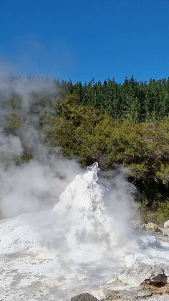
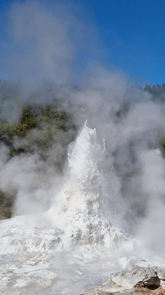
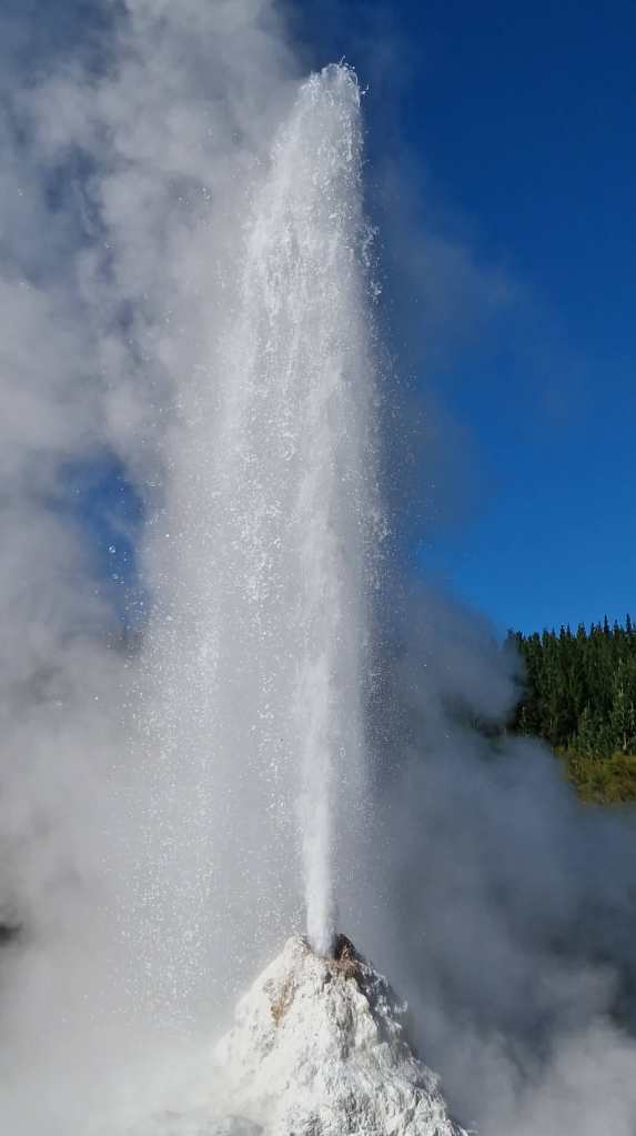
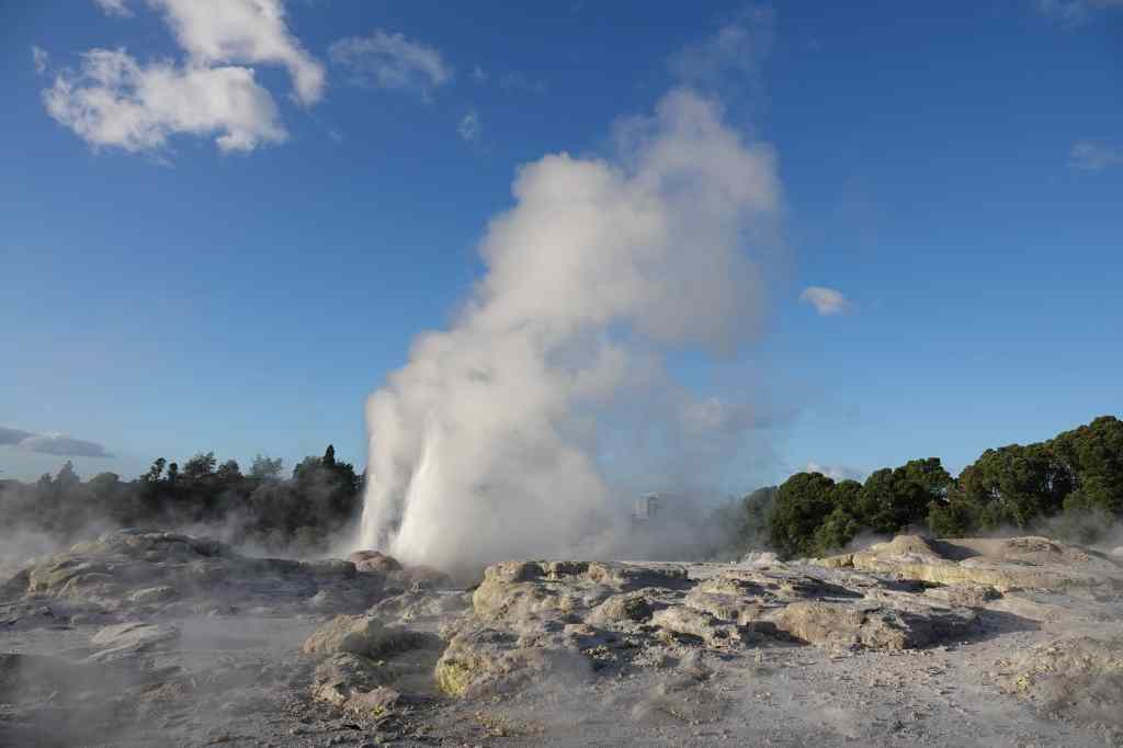
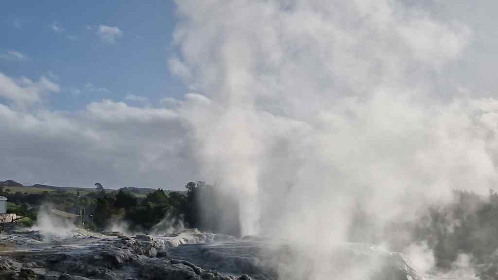
Today was my last day in New Zealand. I have been here nearly four weeks, and the time has flown past. I visited one last geothermal park outside of Rotorua called Wai-O-Tapu. My visit started at Lady Knox Geyser, which erupts at 10.15 every day. I was a little puzzled by the precision of this event – surely a natural phenomenon like a geyser should be at least a bit variable, and what happens when New Zealand goes from summertime to wintertime (as it just had)? All was revealed when I joined a large group of tourists sitting in an amphitheatre around the geyser. One of the park employees explained that the geyser had been discovered when a group of workers had been washing their clothes in the nearby hot springs. They introduced some detergent into the water, which triggered a spectacular eruption (and panic amongst the surprised workers, who ran around naked to escape). In modern times, at 10.15 every day, a park employee puts some detergent down the hole of the geyser to trigger an impressive, if partially artificial, spectacle.
Loading detergent into Lady Knox geyserBubbling…..….spurting….…and erupting
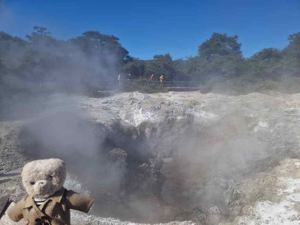
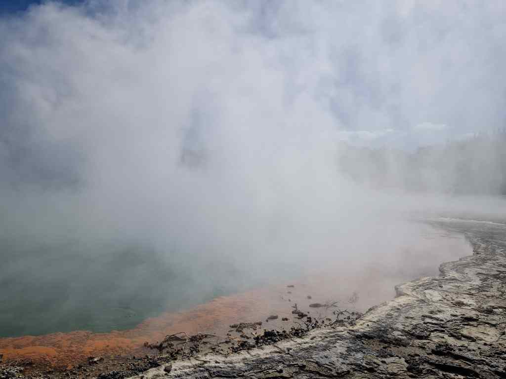
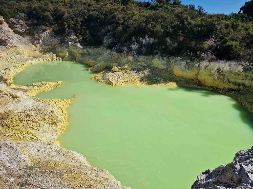
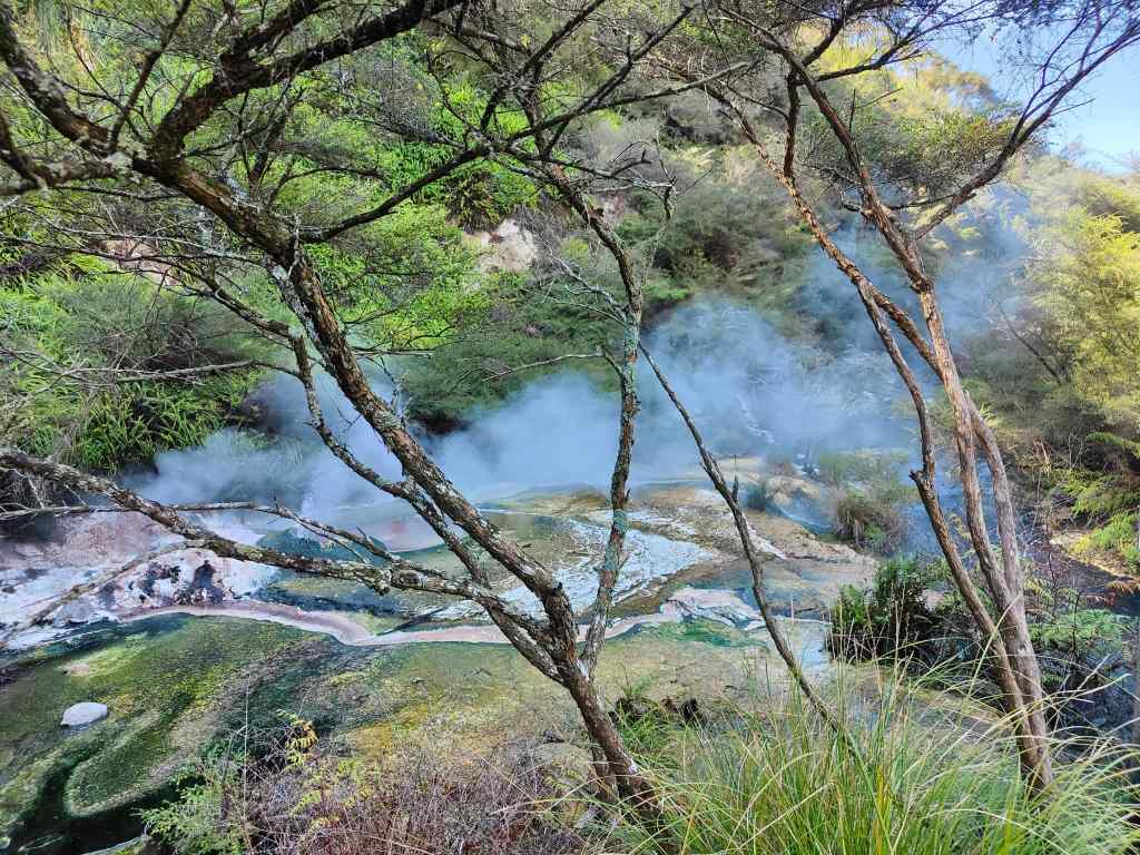
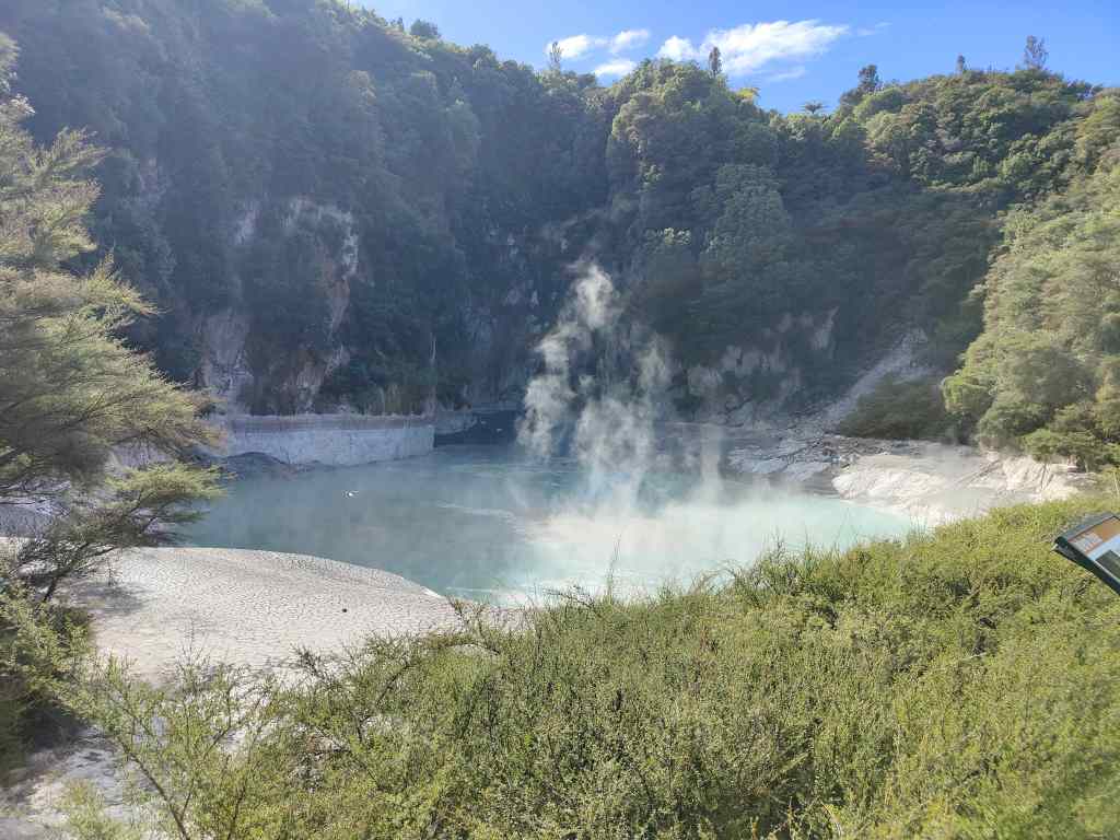
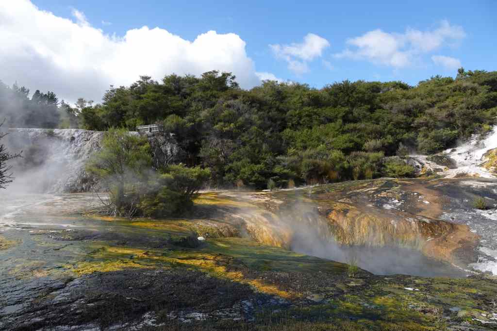
With the geyser show over, the crowd headed to the park’s main entrance to start out on a path through a prehistoric landscape of bubbling mud pools, smoking hot springs and tranquil lakes. Wai-O-Tapu park is particularly known its brightly coloured rock formations, including the famous Champagne Pool.
Steaming Crater at Wai-O-TapuWai-O-Tapu – the Champagne PoolWai-O-Tapu – sulphur lined poolDetail of sulphur at Wai-O-Tapu
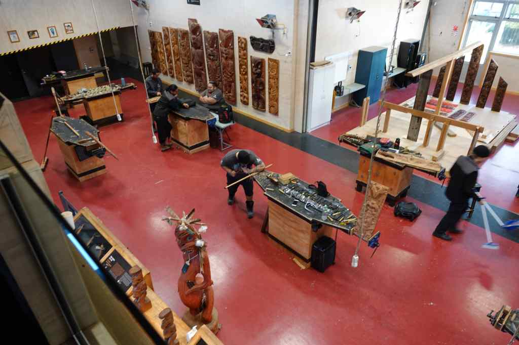
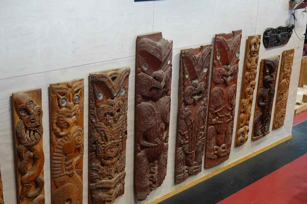
After a couple of hours exploring Wai-O-Tapu, it was time for a complete change – a tour of the Maori cultural centre Te Puia. After the slightly sad experience of visiting the neighbouring village of Whakarewarewa, my expectations were not so high, but I was pleasantly surprised. The visit started with a visit to a training centre where students learn Maori crafts like sculpture (a male activity) or weaving (a female one), where we got to see some wonderful pieces of art.
The carving workshop at Te Puia…and some of its work
Next, there was a rapid visit to a kiwi conservation centre where I got a glimpse of their recently born, but still very large, kiwi chick. The birds are nocturnal, so during tour hours their enclosures are kept in near darkness, and no photos were allowed. After that was a visit to the Pohutu geyser area, for yet another look at Rotorua’s geothermal area. The viewing area at Te Puia was much closer than at Whakarewarewa, so I could get a really good look, but sadly Pohutu was not very active.
Pohutu geyser at Te Puia
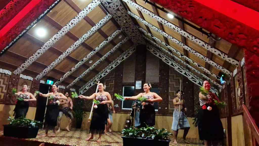
After a buffet dinner our group was treated to a performance of Maori songs and dances in the marae, the large meeting house found in all Maori settlements. Before we could enter, there was an elaborate ritual in which a succession of warriors came to challenge and intimidate the leader of our group, swirling their weapons through the air, sticking out their tongues and making their eyes bulge.
Warriors line up to challenge visitors at Te Puia marae
When that didn’t work the final warrior put down a leaf on the floor in front of our leader, a peace offering showing that we were welcome to visit them. Once everyone was inside and seated, there was another Maori tradition, the powhiri, or speech of welcome – spoken only in Maori. With the lengthy formalities over, our hosts switched to English to welcome us and explain the series of Maori songs and dances they presented, including the famous haka war dance.
Maori song at Te Puia
This all probably sounds very touristy, and of course, it was. However, the show was presented with such enthusiasm that I soon found myself thoroughly enjoying the occasion and clapping wildly at the end. The evening still had not quite finished though, and we were invited for one last look at Pohotu – this time at night, with the geyser lit up by floodlights. Around the observation area there were stone terraces heated geothermally, and I sat on one to watch as the staff distributed hot chocolate. I stayed nearly an hour, as our Maori hosts passed among the crowds chatting to people, and was finally rewarded by a small eruption of Pohotu.
Pohutu at Night
It had been a great day and a good way to end my trip to New Zealand and Australia. Tomorrow I will make the 2-3 hour drive up to Auckland airport, and then the even longer twenty-nine-hour flight back home to London via Doha. New Zealand has been a special place with many amazing things to see, but it is a looooong way from anywhere. Memories that will stay with me forever include flying around Mount Cook, seeing blue whales in Kaikoura, the geothermal areas around Rotorua, hiking to Mount Aspiring’s glacier and sailing Milford Sound. Had the weather been kinder to me, maybe the Marlborough Sounds, Abel Tasman Park and the Tongariro Alpine Crossing would also have made my list of highlights. I think I will be back one day to give them another look, and to visit some of the areas I missed this time – like the country’s sub-tropical far north. But with the huge distance, I suspect it will be part of a round-the-world tour rather than a dedicated trip.
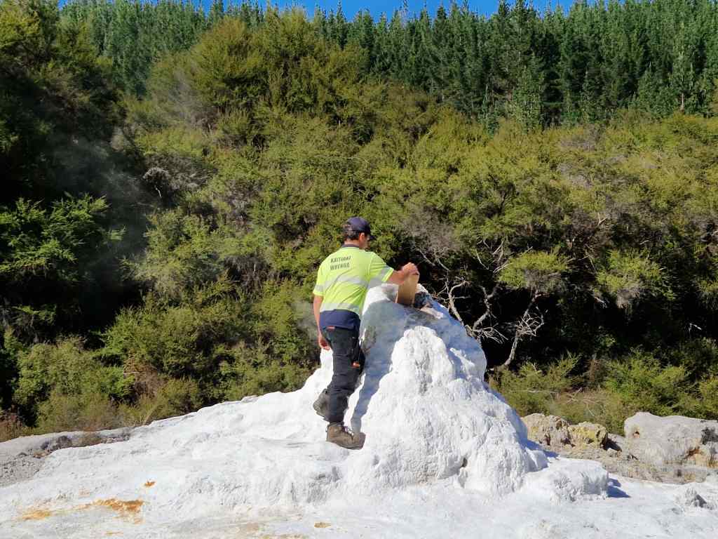
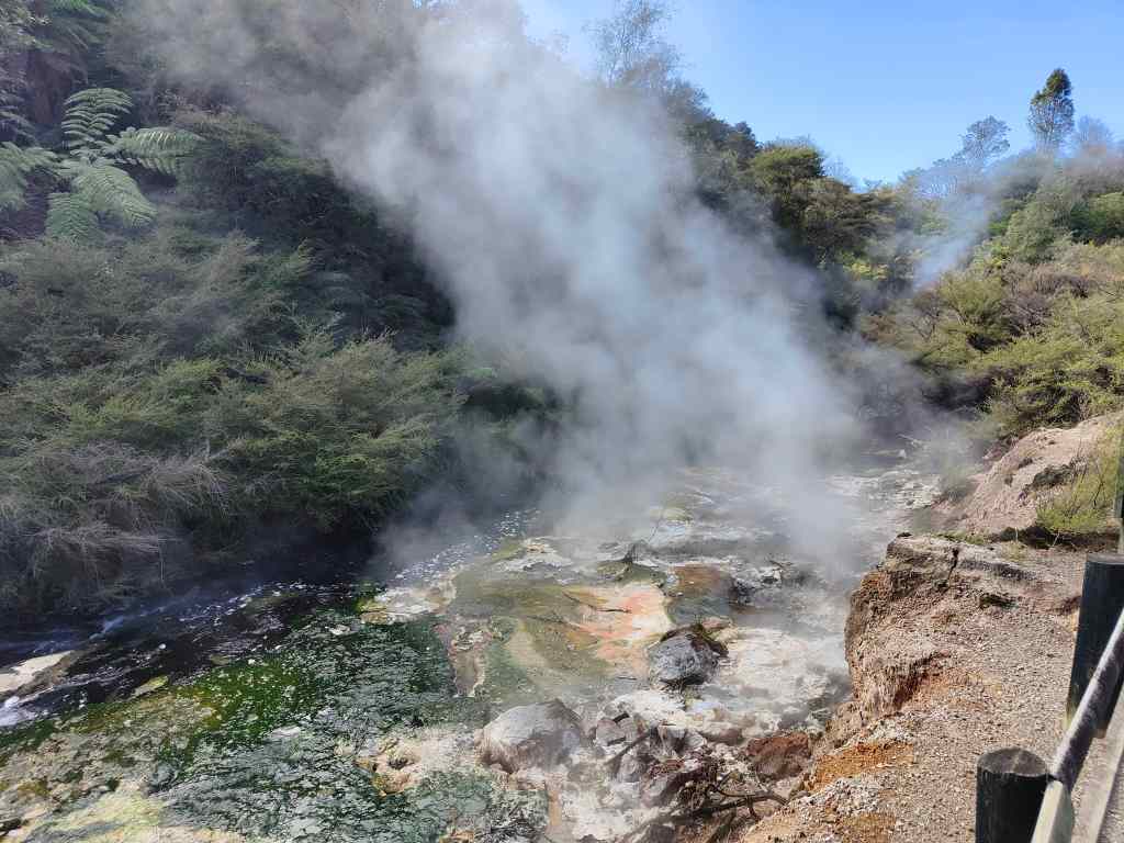
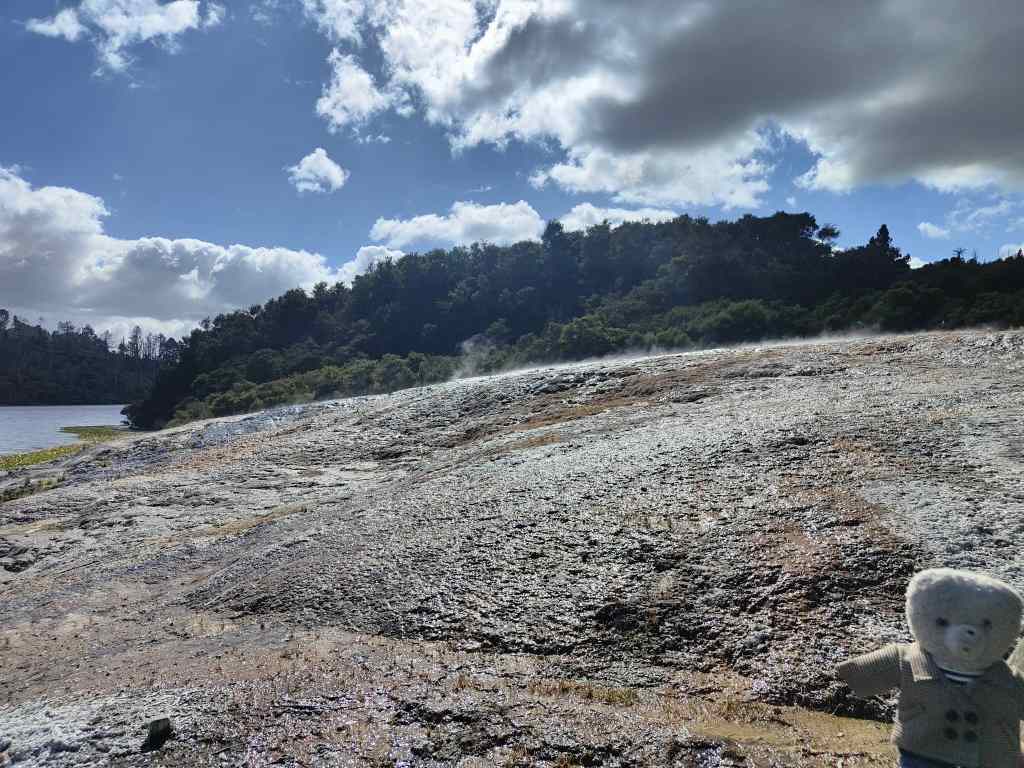
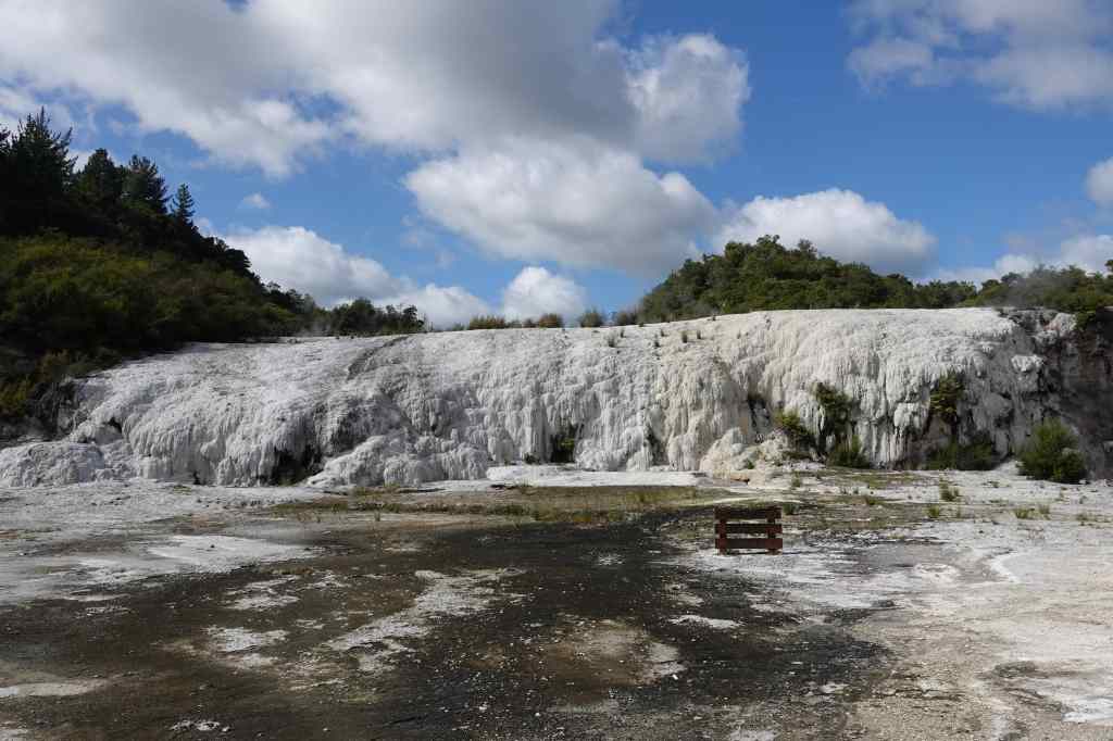
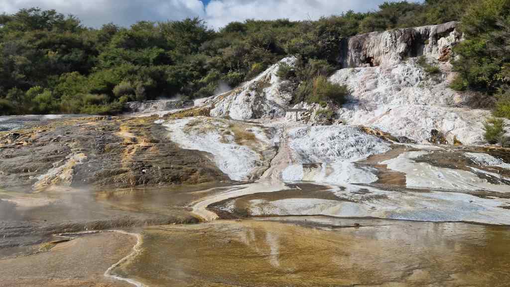
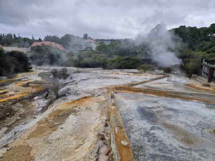
Today I visited a different geothermal park – the Waimangu Volcanic Valley, an area formed when Mount Tarawera erupted in 1886. The eruption levelled several Maori villages, killing many people, and destroyed the Pink and White Terraces which had been a major tourist attraction and were claimed to be the “8th wonder of the world”. It left a caldera, which over the years filled with water to become a much-expanded Lake Rotomahana (a smaller lake of that name had existed earlier). Today, the Waimangu valley is the world’s youngest geothermal ecosystem, and the only one created as a direct result of a volcanic eruption. It is also once again a tourist attraction, although a less popular one than others in the Rotorua area and I was pleasantly surprised that I often had the place to myself. The park is visited by walking an 8km path downhill, starting at a huge pool of boiling water (Frying Pan Lake, one of the world’s biggest hot springs)………
Frying Pan Lake, Waimungu Park
…. and following a boiling stream of water that runs through a pleasant valley, past lots of smaller springs…..
The path at Waimungu follows this boiling stream
…. and a boiling caldron of water called Inferno Crater.
Inferno Crater at Waimungu Volcanic Valley
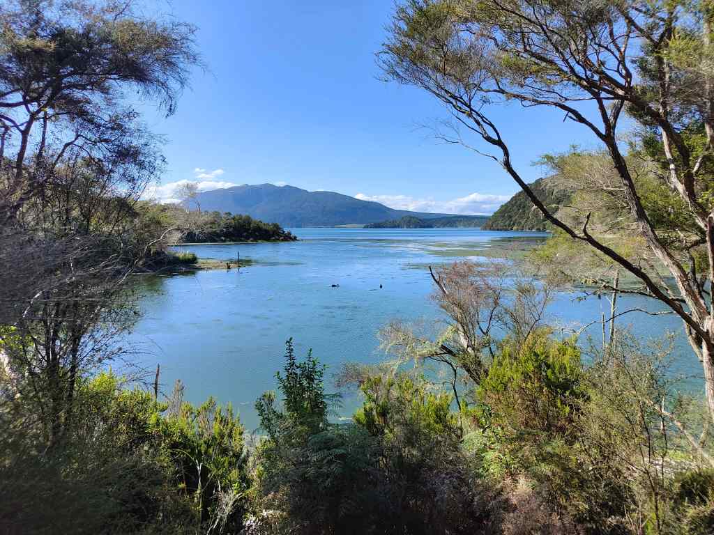
The stream eventually arrives at peaceful Lake Rotomahana, home to much birdlife, including black swans, from where most people use the park’s shuttle bus to return to its entrance.
Lake Rotomahana at the end of the Waimungu Volcanic Valley
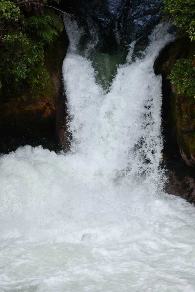
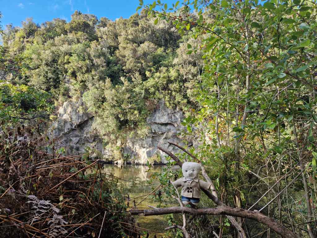
From Waimungu I went to visit something completely different – the waterfalls on the Kaituna River. These are found in a scenic valley, to the northeast of Rotorua.
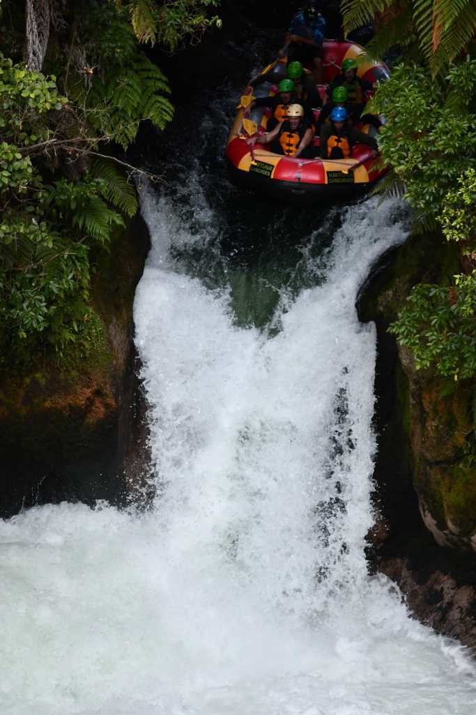
Okere waterfall on the Kaituna River
The area is beautiful, but the real attraction here is the possibility to go white water rafting, a trip that includes descending a 7-metre waterfall (the highest in the world that is open to commercial rafting operators). Unfortunately, the rafting company had a minimum height requirement for passengers, so teddy bears are unable to participate, but I did let my human assistant editor have a go. I watched as his raft approached the famous waterfall….
The Raft approaches Okere Waterfall
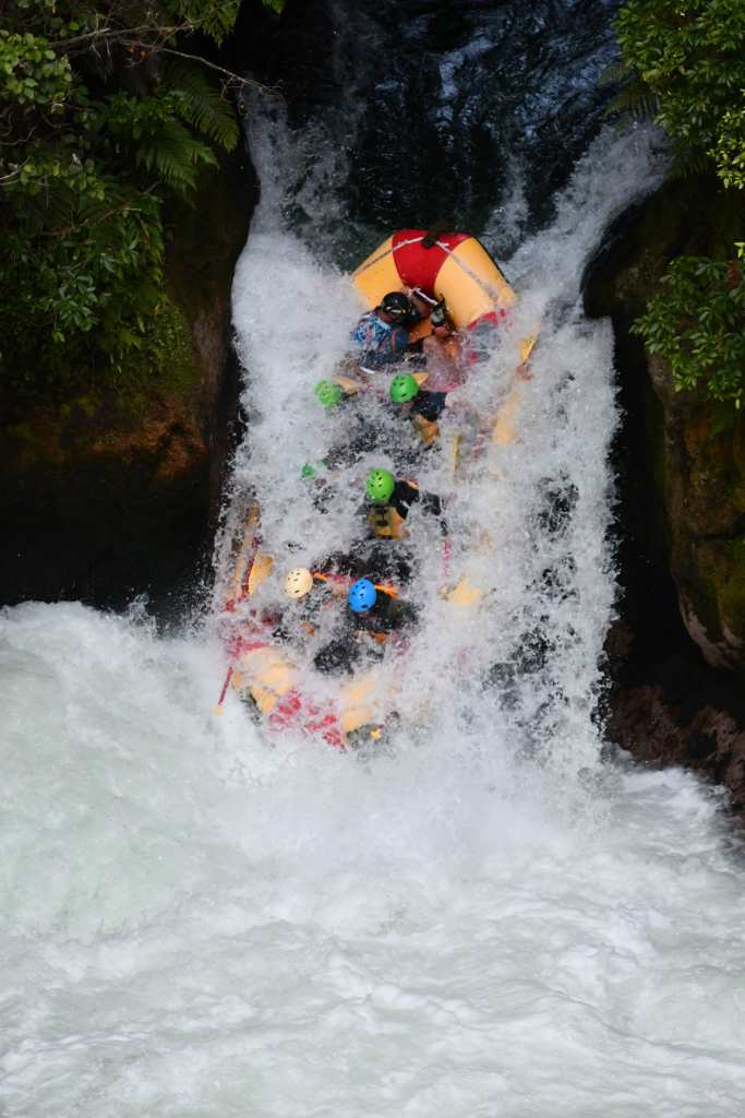
and then plunged down….
Half way down Okere Waterfall
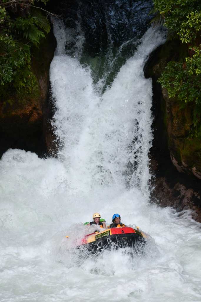
….completely disappearing under the water.
Time to look for a new assistant!
I briefly wondered if I should start advertising for a new assistant, but then the raft reappeared from under the foam with all its crew members still on board.
The raft reemerges from the water on the Kaituna River
It was now late afternoon, and I headed back home. After a difficult introduction I was beginning to like Rotorua. The geothermal sites are really exceptional, and it was nice to let my assistant have some fun with the rafting, even if it would have been even better to try this for myself. It is a demanding job working for Trouspinet and my subordinates need to let their hair down occasionally…….
Letting my assistant have some fun for a change (he is in the front)
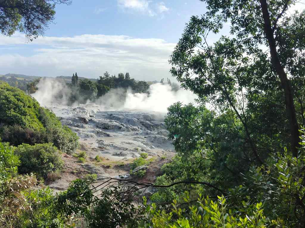
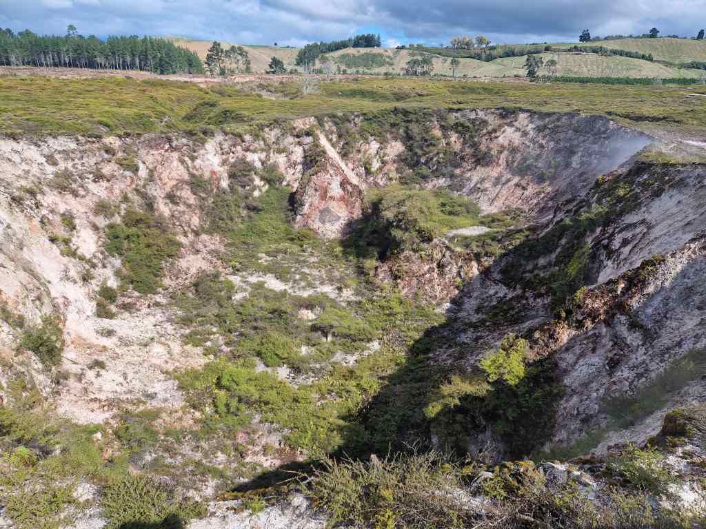
From Lake Taupo I headed north to Rotorua, a small city that is a centre of Maori culture and also of New Zealand’s volcanic activity. On the way there I stopped at Oreiko Karako, a geothermal park, found after a pleasant twenty-minute detour through picturesque countryside off the main Taupo to Rotorua road. Its relative remoteness meant that there were very few guests.
Typical New Zealand scenery
The geothermal area is accessed by a short boat trip across a lake.
The ferry to Oreiko KarakoEntry to Oreiko Karako Geothermal Park
Once on the other side, a raised pathway led past a series of pools of nearly boiling water surrounded by a stunning display of rocks coloured by volcanic minerals. I spent a wonderful hour there, happy to have the place almost to myself.
A spectacular geothermal displayWonderful colours at Oreiko Karako
Form Oreiko Karako I drove on to Rotorua. Like many other New Zealand towns, first impressions were not favourable. There was a sprawl of ugly commercial development stretching out along the road entering the city. It also looked much rougher than the sleepy places I had seen before; I saw the first beggars of my trip, and also some drunks shouting abuse at each other. I checked in to my bed and breakfast and immediately set off to explore. My first stop was a tour of Whakarewarewa, a Maori village sitting around hot springs and a geyser. Guided tours by local Maori have a long history in this area, first starting in the 1830s to nearby geothermal features called the Pink and White Terraces. These were buried by a devasting volcanic eruption in 1886, but the tradition of Maori showing visitors around Rotorua’s geothermal features and their village lives on to this day.
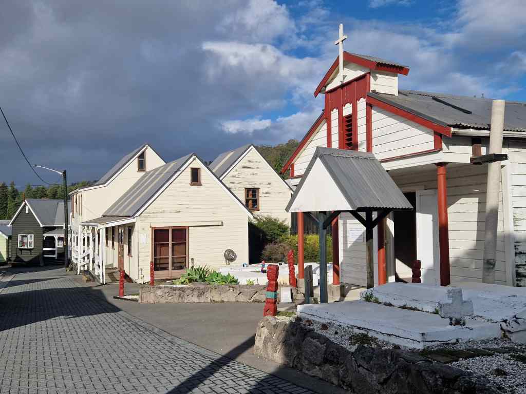
Houses and the church at WhakarewarewaThe bathing area at Whakarewarewa
Whakarewarewa is one of the last remaing Maori villages and the only one to be located on geothermal land. The Maori houses today are simple modern wooden structures, and the village was quiet with very few people about. It somehow felt rather sad, a feeling reinforced when our guide talked of the damage done to Maori culture by colonialists. The most interesting part of the tour was seeing how the local people use the abundant boiling hot water in everyday life – particularly for cooking and bathing. These gifts of nature have been used in this way ever since the village was first settled, probably around 1325, and made the land a valuable asset that the local tribe often had to defend against marauders – successfully, since village of Whakarewarewa was never once taken in battle and has remained the ancestral home of the Tūhourangi Ngāti Wāhiao people all this time. The tour ended on a viewing platform overlooking several geysers. The biggest one of the group, Pohutu, erupts roughly every hour, so I waited patiently, and sure enough after twenty minutes, a stream of steam and water spurted into the air. The jet from the geyser can reach a height of 30 metres, making it the biggest geyser in the southern hemisphere.
Waiting for Pohutu geyser….Pohutu delivers
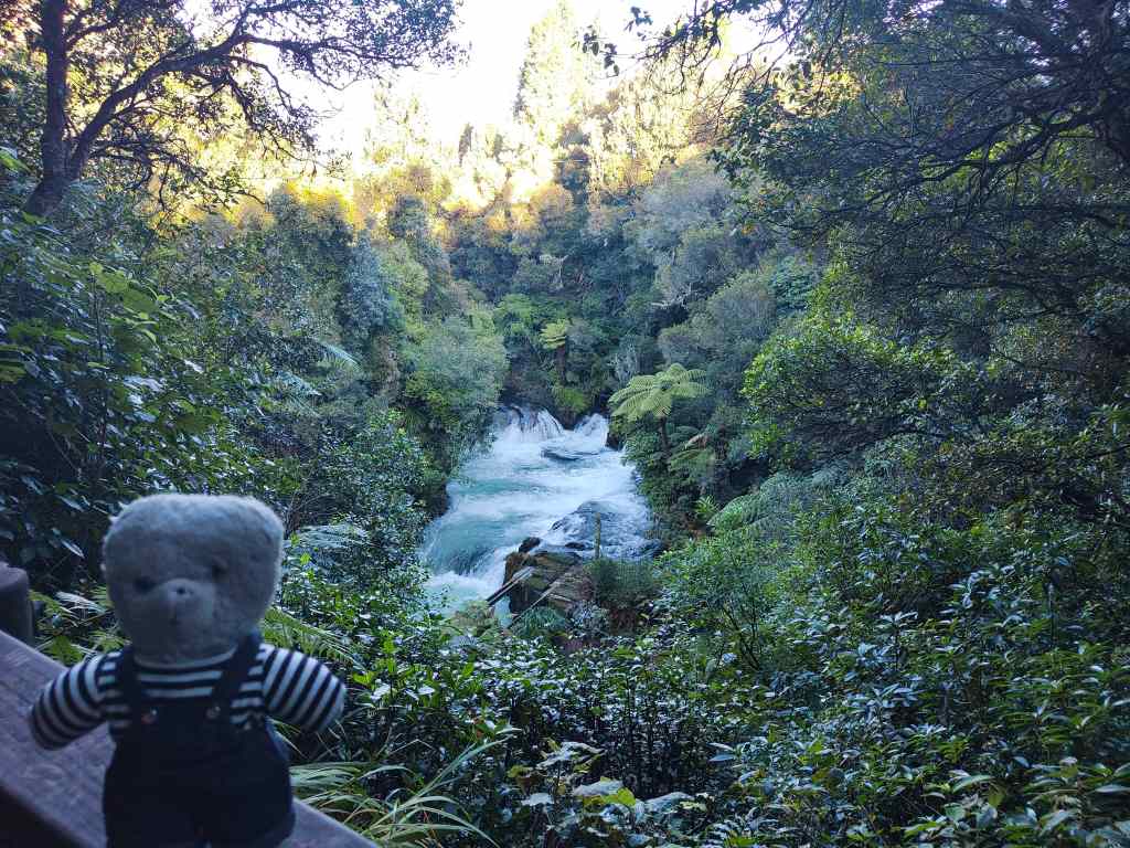
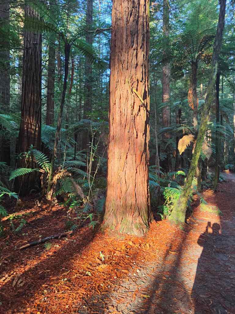
To end my day, I made a visit to Whakarewarewa Forest, which draws visitors to admire its tall redwood trees. You can pay to go on a raised walkway through the trees, but it did not look very high, so I preferred to simply stroll along a short trail in the evening light. The redwoods were impressive…..
Redwoods in the forest
….but in my view the real stars of the forest were the giant tree ferns.
…and giant ferns
It had been a very varied day, with a geothermal park, a Maori village and a forest walk all making up for the less than impressive modern city of Rotorua. But the area still had a lot more to offer, and I looked forward to tomorrow, when I was due to see visit the Te Puia Maori cultural centre and another geothermal park, which was supposed to be even better than Oreiko Karako.
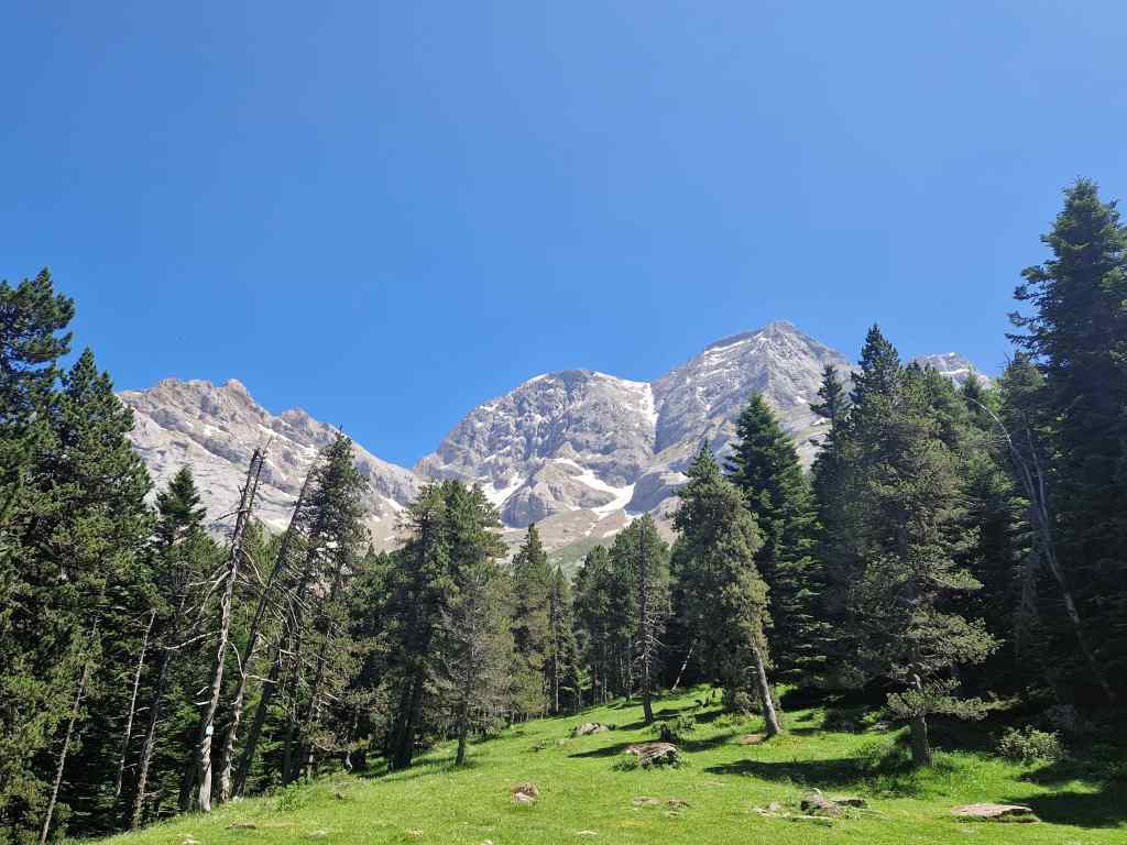
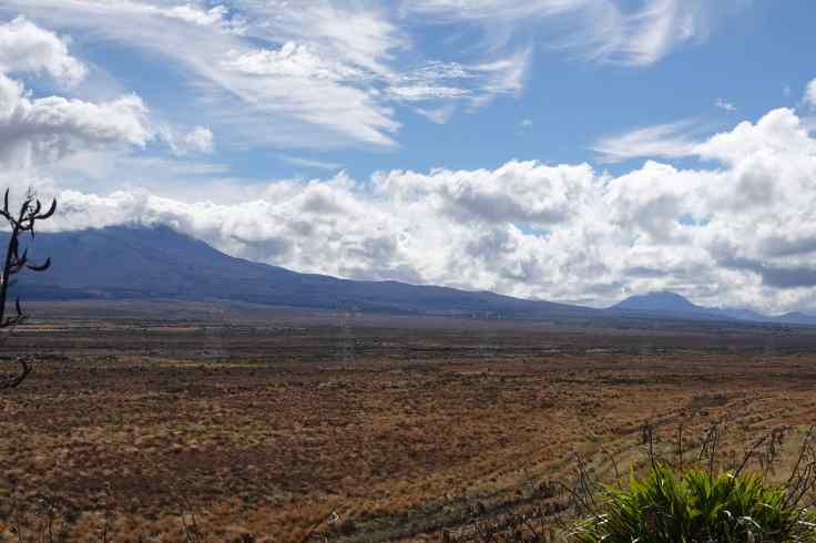
After one night in Wellington I made the long drive half the way up the North Island to a small village sitting on the southern shore of Lake Taupo. At first the drive was a fast but dull motorway, but after a couple of hours State Highway 1 – New Zealand’s main artery – turned into a regular road with one lane each way. At the same time it became scenic, passing through rolling hills and sheep farms. Sadly though there were no rest areas to stop and take pictures from. Then the road climbed and entered a plain of barren scrubland, with three majestic volcanoes towering in the distance. This was the so-called Desert Road and the mountains were in Tongariro National Park, my intended destination for a short walk later in the afternoon and a much bigger on the next day – I planned to do the famous Tongariro Alpine Crossing, a moderately tough 20km hike through spectacular volcanic landscapes. I stopped to take pictures, noticing a strong wind as I left the car and that the tops of the mountains were shrouded in cloud.
Tongariro National Park from the “Desert Road”
When I reached my guest house, my host had bad news for me. The park authorities had closed the Alpine Crossing route due to forecast bad weather. I was surprised; the conditions at ground level looked good to me, but when I checked on the park’s website, I saw that on the mountains, there would be heavy rain, an average visibility of 20 metres, freezing cold and wind gusts of up to 150km/h. A little teddy would be blown all the way across the Pacific to South America, and even if I managed to stay on the ground I would not see anything. The Alpine Crossing was out of the question and even my short afternoon walk would be pointless. Somewhat disappointed, I went for a brief but pretty walk around the local area…..
My short hike near Lake TaupoView over Lake Taupo from the hill above our village
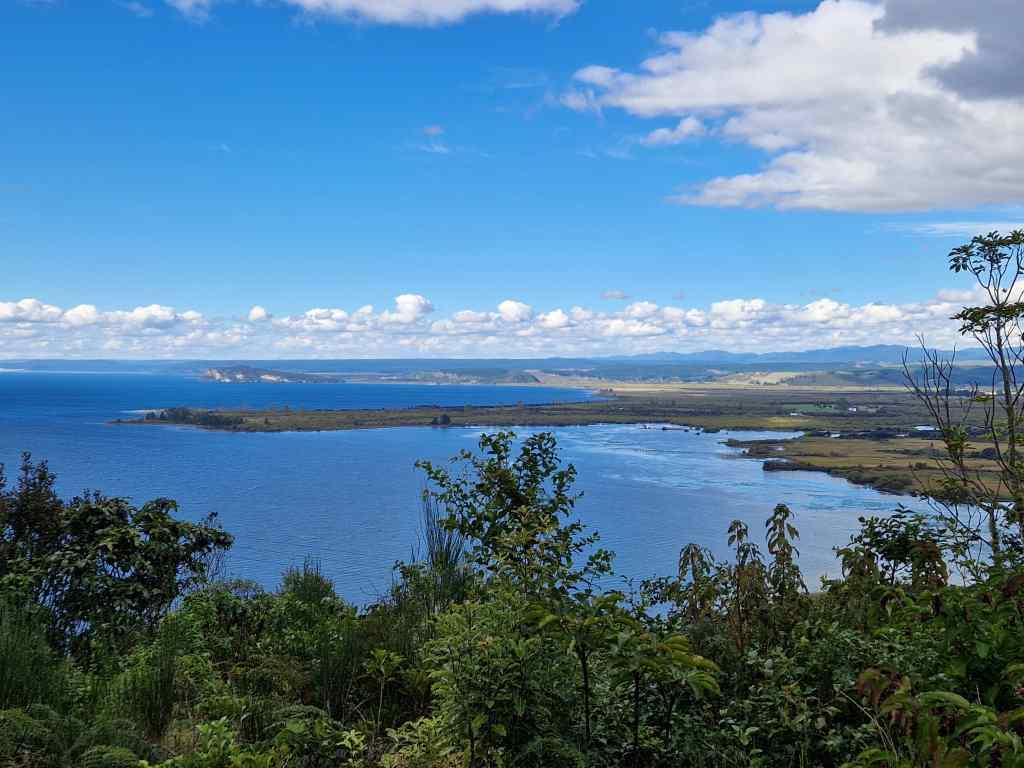
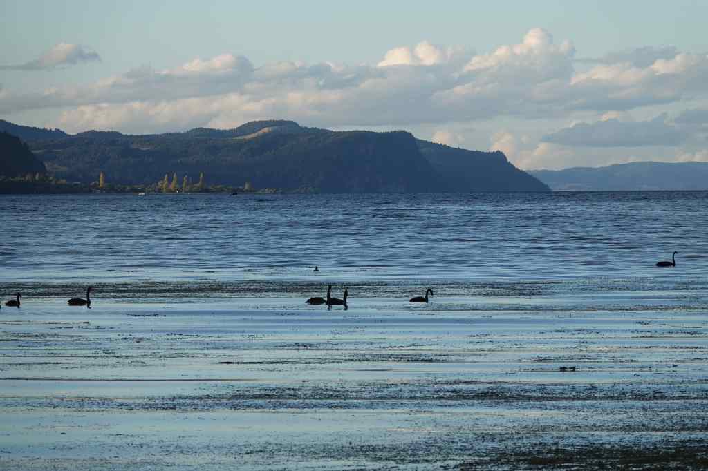
….and then admired Lake Taupo from its shore. The lake was formed out of the caldera of a huge volcano that erupted around 1800 years ago.
Black swans on Lake Taupo
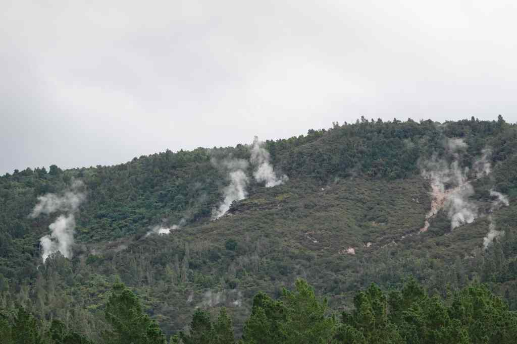
The area remains highly volcanic to this day and just behind me I could see the first of many areas of geothermal activity that I would see over the coming days – the Steaming Cliffs.
The Steaming Cliffs
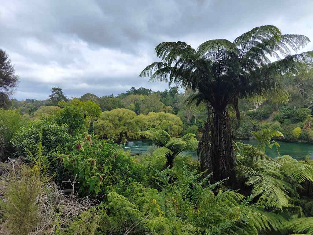
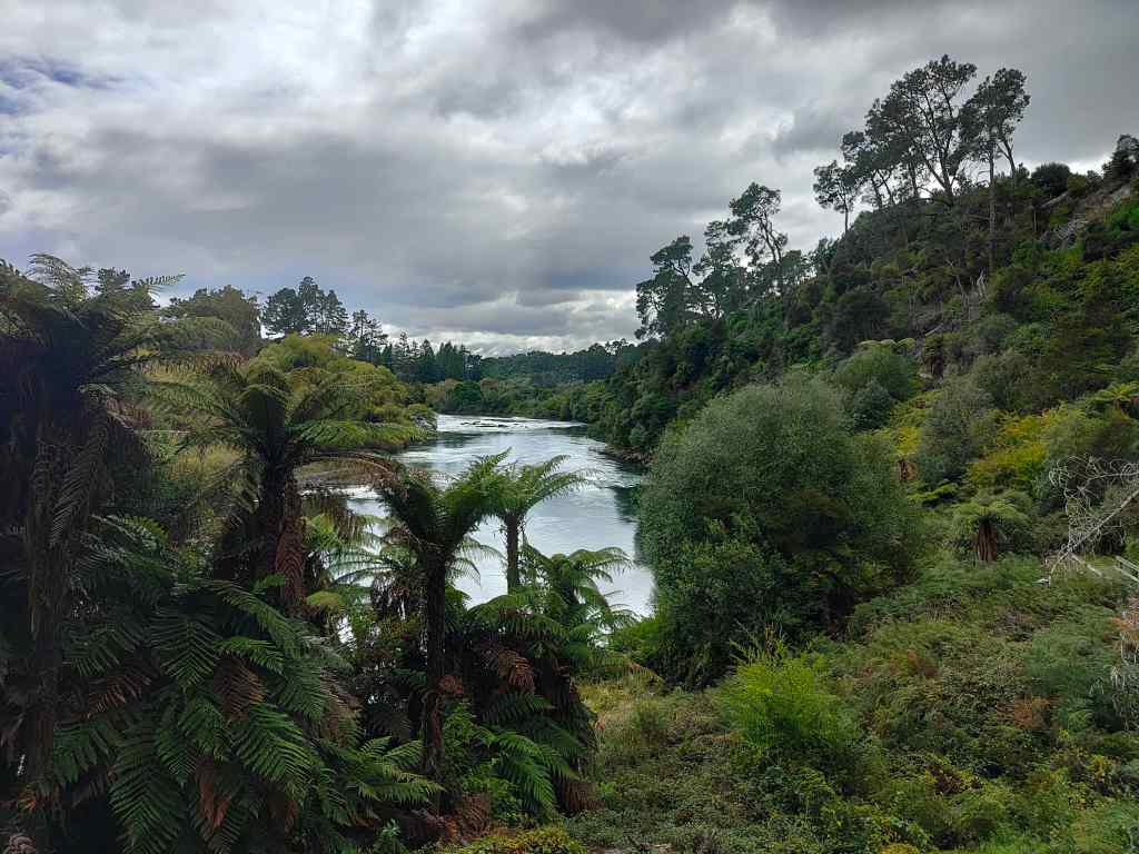
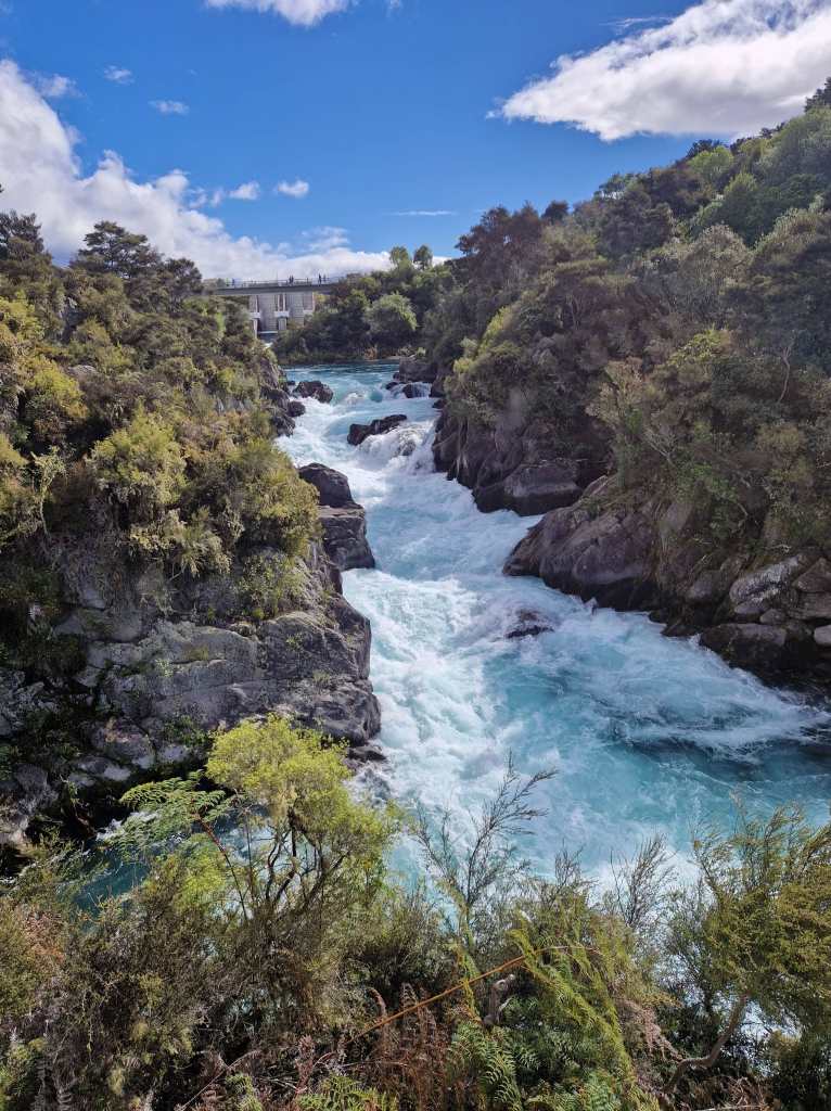
The next day I changed plans and drove to Taupo, a town on the opposite side of the huge lake. My first stop were the Huka Falls, a very scenic spot where the Waikato River surges through a small channel.
Huka Falls near Taupo
The area around the falls was extremely pretty and I stopped to explore for a bit.
Scenery near Huka Falls
Next I drove further up river to the Aratiatia Dam, where the river narrows again. Usually the water level after the dam is quite low, but three times a day, water is released from the dam to surge down the canyon and create another set of rapids. I waited patiently until 2pm, camera in paw, and was rewarded with the sight of the transformation of a gentle stream into a raging torrent.
Aratiatia Dam – before openingAratiatia Dam – ten minutes after opening
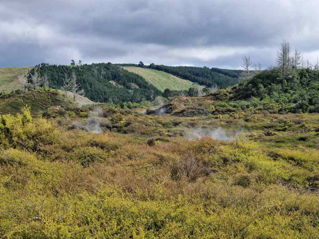
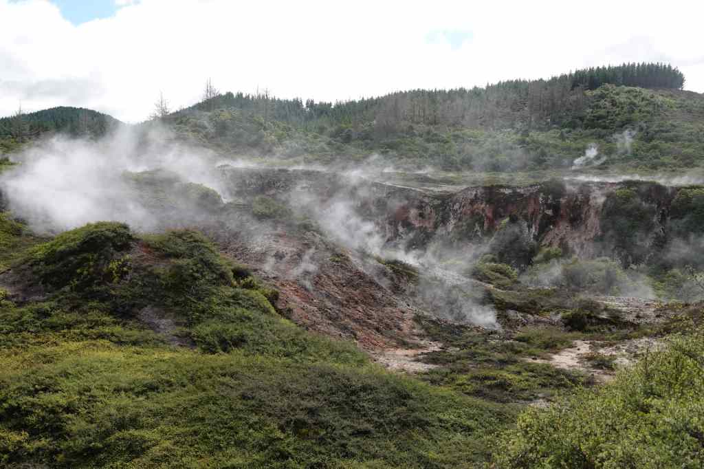
My next stop of the day was a geothermal area called the Craters of the Moon. I walked on a raised pathway over an area where hot steam hissed out of vents in the ground.
Approaching the Craters of the Moon
There were several small craters – results of a vent getting blocked, causing pressure to build and eventually an eruption of steam. It was an interesting walk and a good taster for some of the more famous volcanic sites I planned to visit later on my trip.
Craters formed by steam eruptions
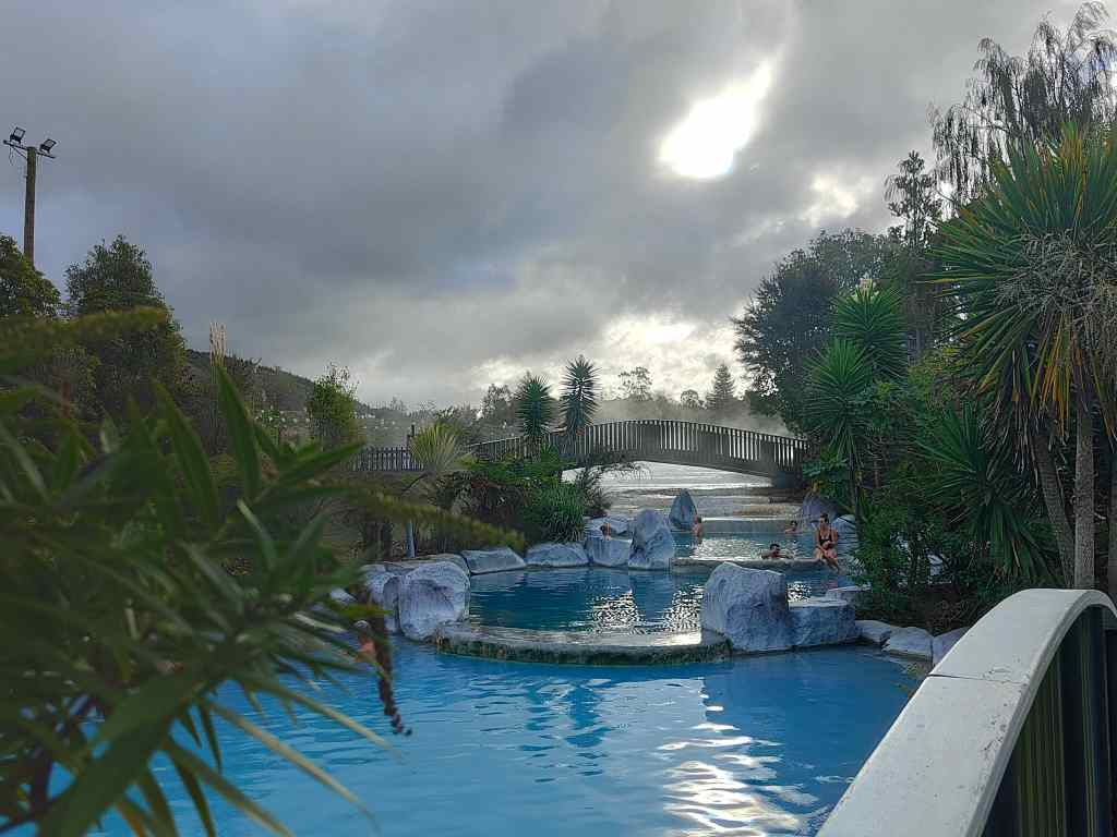
My final stop of the day was at some volcanic thermal baths. I soaked in 39C water for a pleasant hour, watching the clouds go by (I had spent most of the afternoon dodging heavy showers). I had expected to be ending the day exhausted but excited after a long hike through spectacular high-altitude volcanic scenery. Instead, I was chilling in hot water after several pleasant but short hikes. Maybe it was not such a bad outcome after all.
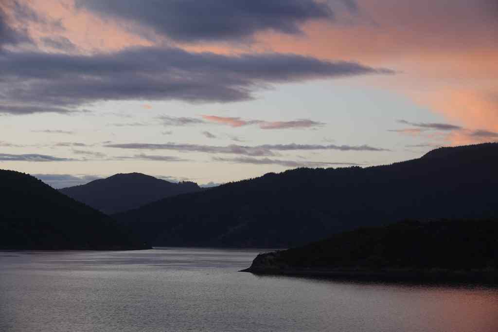
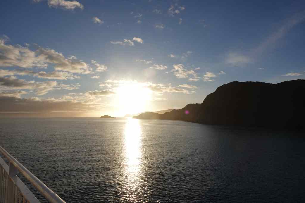
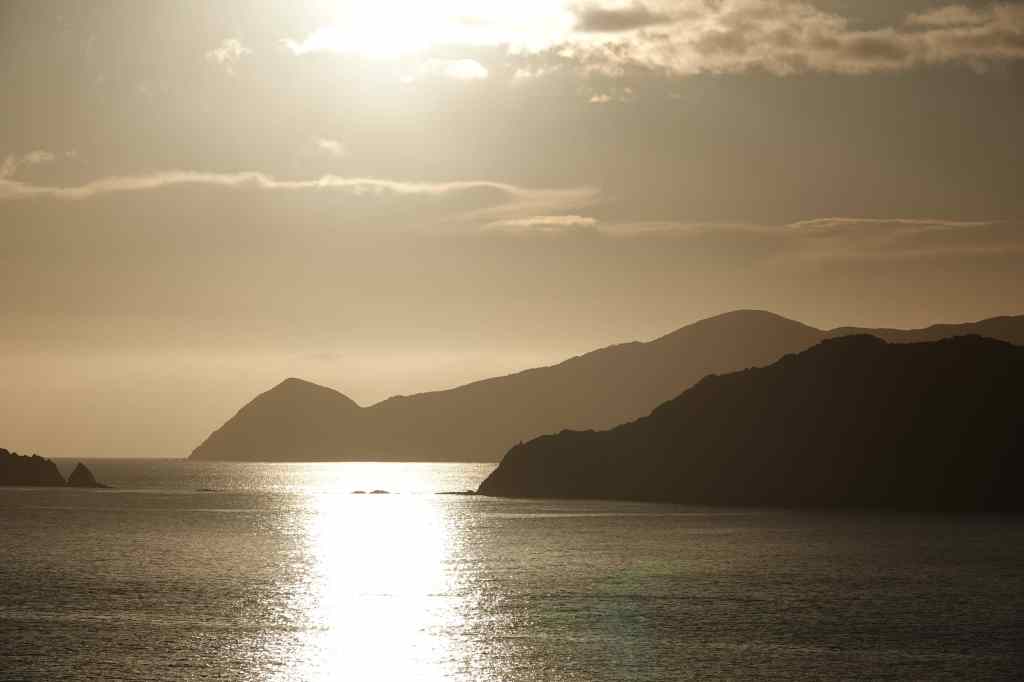
This morning I had to get up unreasonably early to check in for my ferry across the Cook Strait from Picton on the South Island to Wellington on the North Island. I had booked a crossing at 09.30 but the ferry company brought this forward to 07.30 and also required that I turn up at least sixty minutes before to check in, so I had to sit for an hour in the dark in a queue of cars waiting to board. The ferry was not full and after boarding I had lots of space to sit and relax in front of a large (and – shame on Interislander Ferries – also dirty) viewing window in the passenger lounge. We set sail just as the sun began to rise and I went out on deck to get some last views of Queen Charlotte Sound.
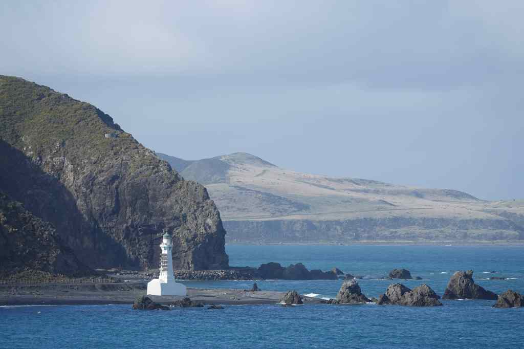
Just before sunrise in the Marlborough Sounds….…and at sunrise….…and after……and a lighthouse on the North Island near Wellington
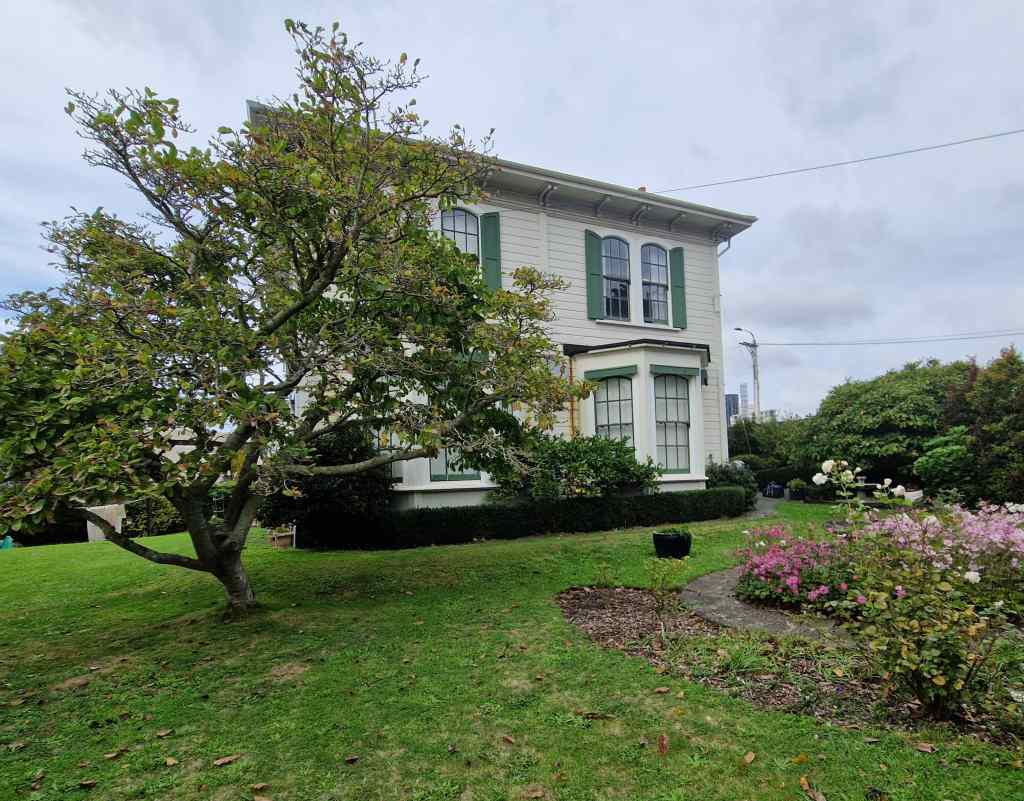
After three and half hours of sailing we arrived in Wellington, the capital of New Zealand and its third biggest city – albeit with a population of only 212,000 people. My accommodation was in a pretty villa in the scenic and historic Thorndon area of the city.
My accommodation in Wellington
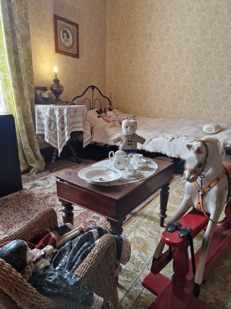
Right next to my accommodation was a similar house, which hosted a museum devoted to New Zealand writer Katherine Mansfield.
In the Katherine Mansfield Museum, Wellington
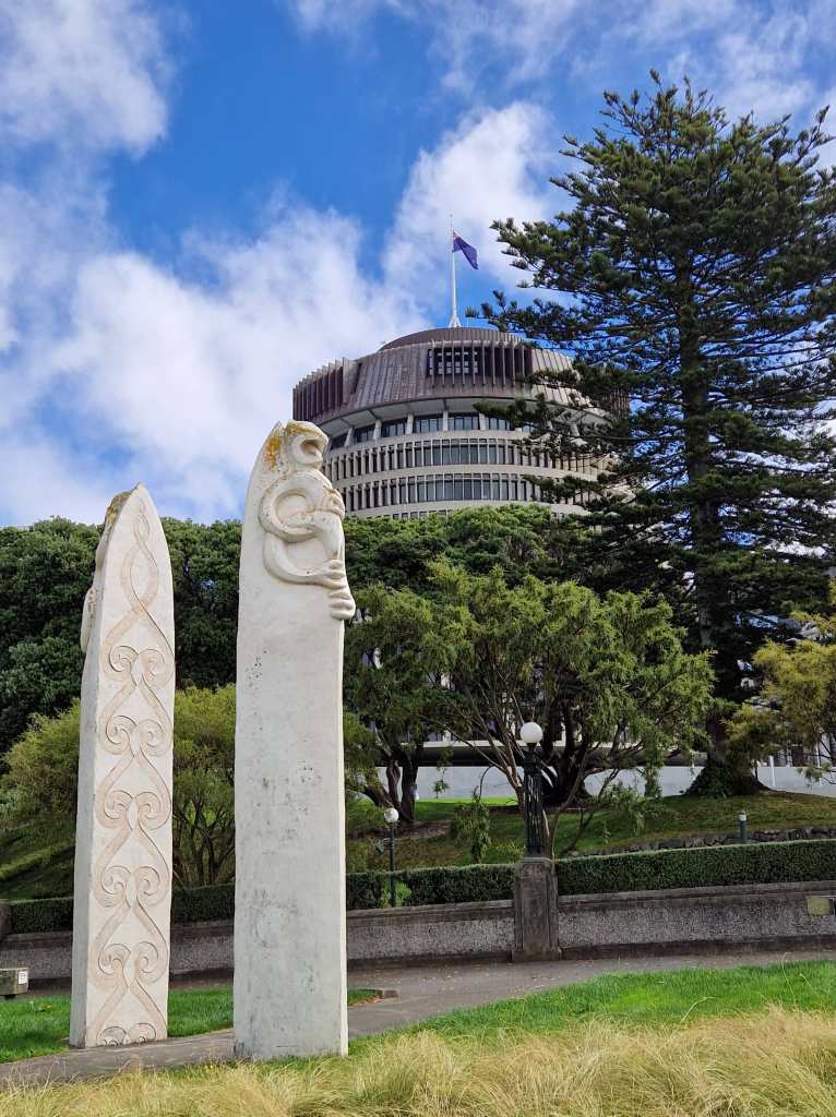
I made a brief visit before strolling into the city centre. My walk took me past the “Beehive” – part of a complex of government buildings which houses the offices of the prime minister and cabinet ministers….
The “Beehive”, Wellington
…..and then further on to Wellington’s pleasant waterfront.
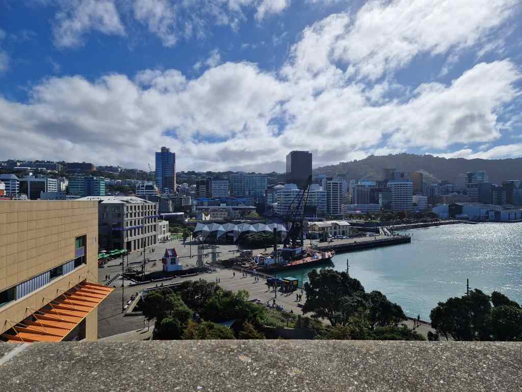
Wellington’s waterfront taken from Te Papa Tongarewa
There I checked out the Museum of New Zealand or Te Papa Tongarewa, dedicated to the history, wildlife and geology of the country. Amongst many other things, I was surprised to learn that the Maori only discovered New Zealand about 800 years ago, probably on boats from the South Cook Islands further north – and that it was the very last large land mass to be settled by humans. The museum had a large exhibit about a very special part of the country’s history – the signing of the Treaty of Waitangi between the British government and 500 Maori chiefs. It gave the British sovereignty over the islands in return for protection of the rights of the Maori. However the treaty was, perhaps deliberately, poorly translated with big differences between the English and Maori versions, leading to confusion and conflict.
Maori exhibits in Te Papa Tongarewa
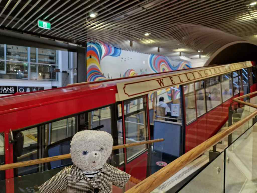
From the museum I followed a traditional tourist route, taking a cable car up to the steep hill dominating the city. The café on top offered an excellent view of Wellington.
Wellington’s touristy but fun cable car…and the view over Wellington from the cable car station
From the top of the hill, I strolled down through the city’s pretty botanical gardens and then through the suburb of Thorndon back to my house. Despite the very early start it had been a good day – and after two days of rain it was a pleasure to see the sun again. Wellington had been an interesting stop – one of the smallest capital cities in the world, with a wonderful setting, a world class museum and the laid-back vibe typical of a minor provincial town in most other countries. Plus I had finally taken some good pictures of the Marlborough Sounds!
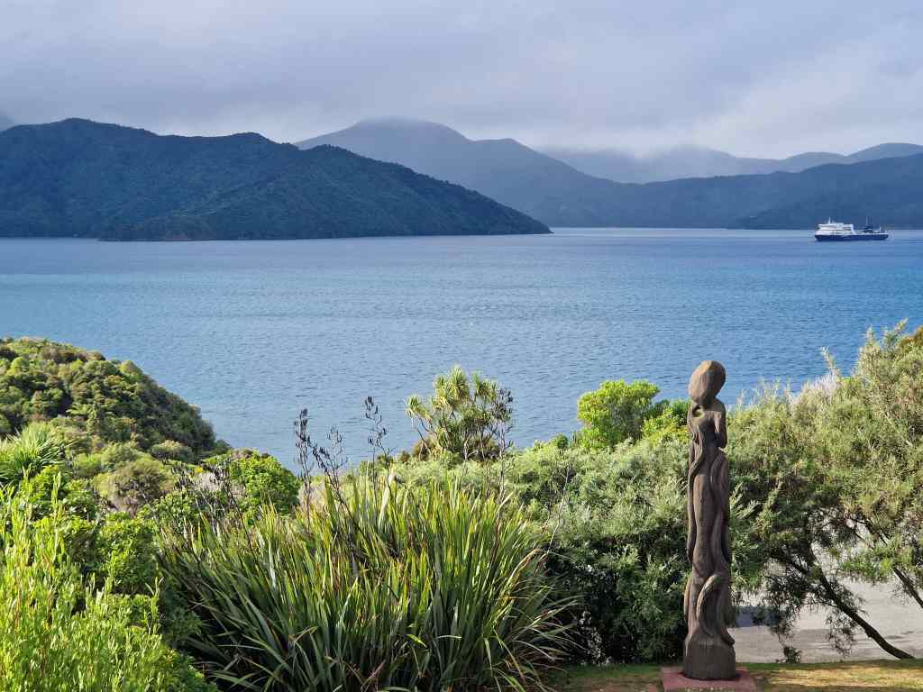
So far, most of my posts have covered one day of travelling. This post will cover four days visiting two of New Zealand’s highlights – the Marlborough Sounds and Abel Tasman Park. There is a simple reason why two such memorable places get so little text – the weather was awful, and two of these days were almost completely washed out. After my whale-watching flight in Kakoura, I headed north to the tip of the North Island. State Highway One was scenic, with nice sea and mountain views, but slow going, with more than its usual share of roadworks. I reached Blenheim, the capital of Marlborough’s wine country, in the early afternoon. I thought about visiting the city for a coffee break, or even the famous nearby Cloudy Bay winery for a tasting, but Blenheim’s outskirts were so ugly that I hurried on to Picton on the north coast, the entrance point to the Marlborough Sounds.
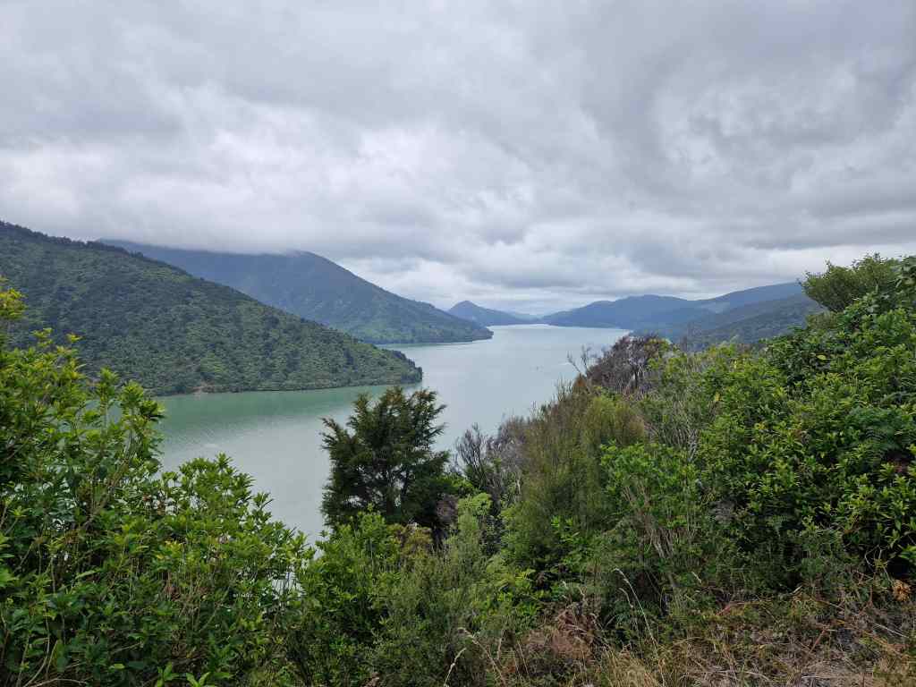
The Queen Charlotte Sound near Picton on a cloudy dayThe view of Pelorus Sound from Cullen Point
The Marlborough Sounds are the estuaries of a series of rivers emptying into the Cook Strait between New Zealand’s North and South Islands, which form a jagged coast with countless islands and peninsulas. Indeed, this relatively small area contains around a quarter of the total length New Zealand’s coastline. The Sounds are very thinly populated, with a few fishing towns, holiday homes, campsites and resorts. Much of the area – and many of the resorts – is only accessible by boat, but a few narrow, winding roads also lead into the region. I had booked a resort on one of side roads leading off from the popular Queen Charlotte’s Drive scenic route which links Picton and the small port of Havelock. The route would have been beautiful….had the sun made an appearance to bring out the colours of the water and vegetation. But instead the weather was stubbornly overcast, and the sea remained a dull grey colour. After an hour of scenic but slow driving I arrived at my resort.
The Mahua Sound near my hotel
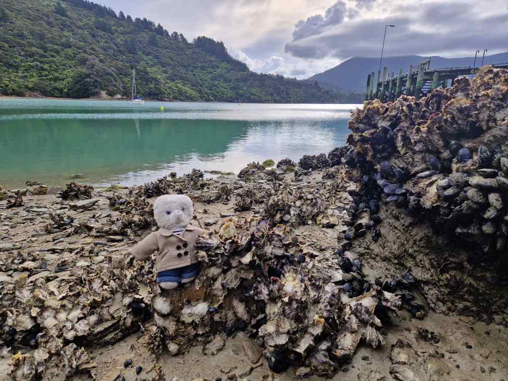
It was a beautiful, utterly remote and so laid-back that the hotel did not give guests room keys – this part of rural New Zealand has so little crime that people do not bother to lock their doors. It was just a shame that the sky remained overcast, and the sea water which was bright blue in my guide book remained a dull grey. It was possible to go hiking or to hire kayaks or paddleboards to explore the Sounds, but the weather did not inspire me to try any physical activities and instead I explored the beach a bit, where I found some wild oysters……
…..and then sat reading, admiring the view from my room as the sun set.
The view of the Mahua Sound from my room
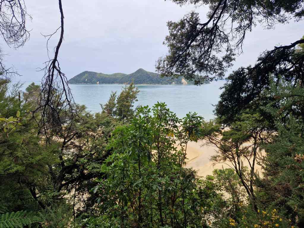
The next day I had originally planned to explore the Sounds some more and then devote the whole of the day after to visiting another of New Zealand’s highlights, the Abel Tasman Park. However, seeing a forecast of very bad weather coming, I drove west straight to the park. It has a spectacular 60km coastal track, which takes 3 to 5 days, and the best way to experience the area is either to walk the whole path, or take a water taxi into the heart of the park, walk a section, and come back on a return boat trip. But I arrived too late to take an outward boat and had to content myself with a short walk from the park entrance to Apple Tree Bay, about 5km in.
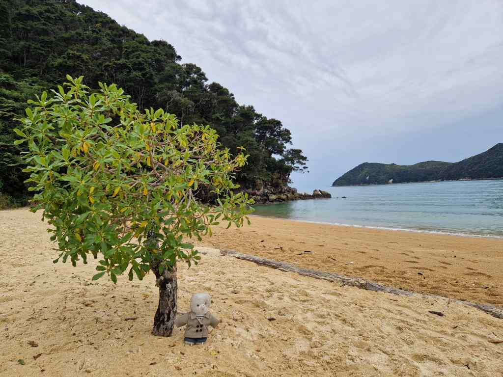
The Entrance to Abel Tasman Park
Despite my limited programme, I was immediately enchanted by my walk. The path led from the park entrance gates, across the a river estuary…..
River Estuary at the start of Abel Tasman Park
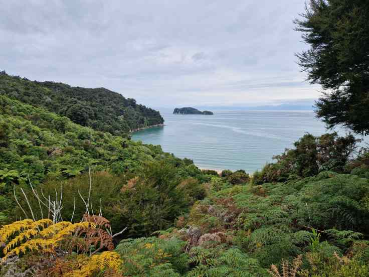
…and then along the coast, past many bays with sandy beaches.
Typical view from the coastal path at Abel Tasman Park
The sides of the path were lined with lush vegetation, including many giant ferns. Not only were the views impressive but the hike was also a treat for other senses; I was accompanied by unusual and beautiful birdsong, quite unlike what I hear back home, and in many places the path had a strong, sweet smell of honey. To this day I still don’t know which plants make this scent, which I smelt often in New Zealand.
Luxuriant vegetation and giant ferns at Abel Tasman Park
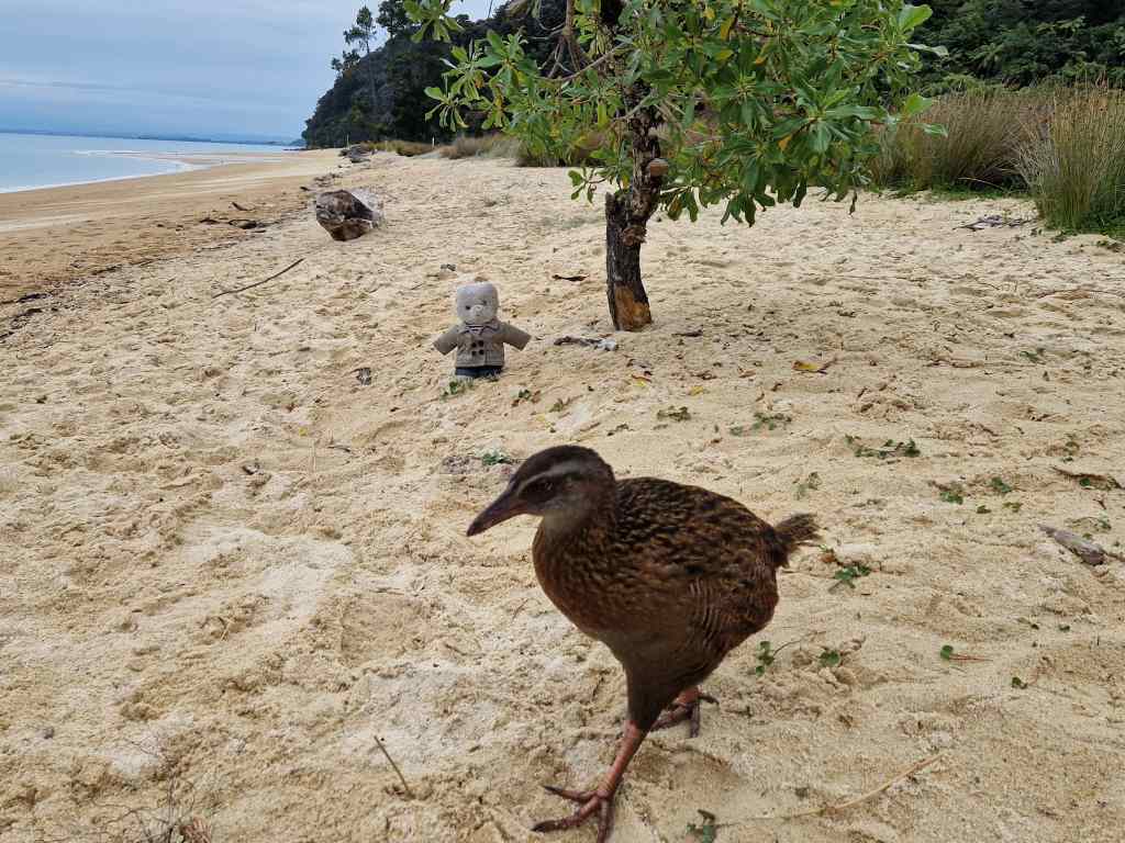
I spent a pleasant half an hour on the beach at Apple Tree Bay……..
Apple Tree Beach
…and met a new friend, a weka, one of New Zealand’s many flightless bird species.
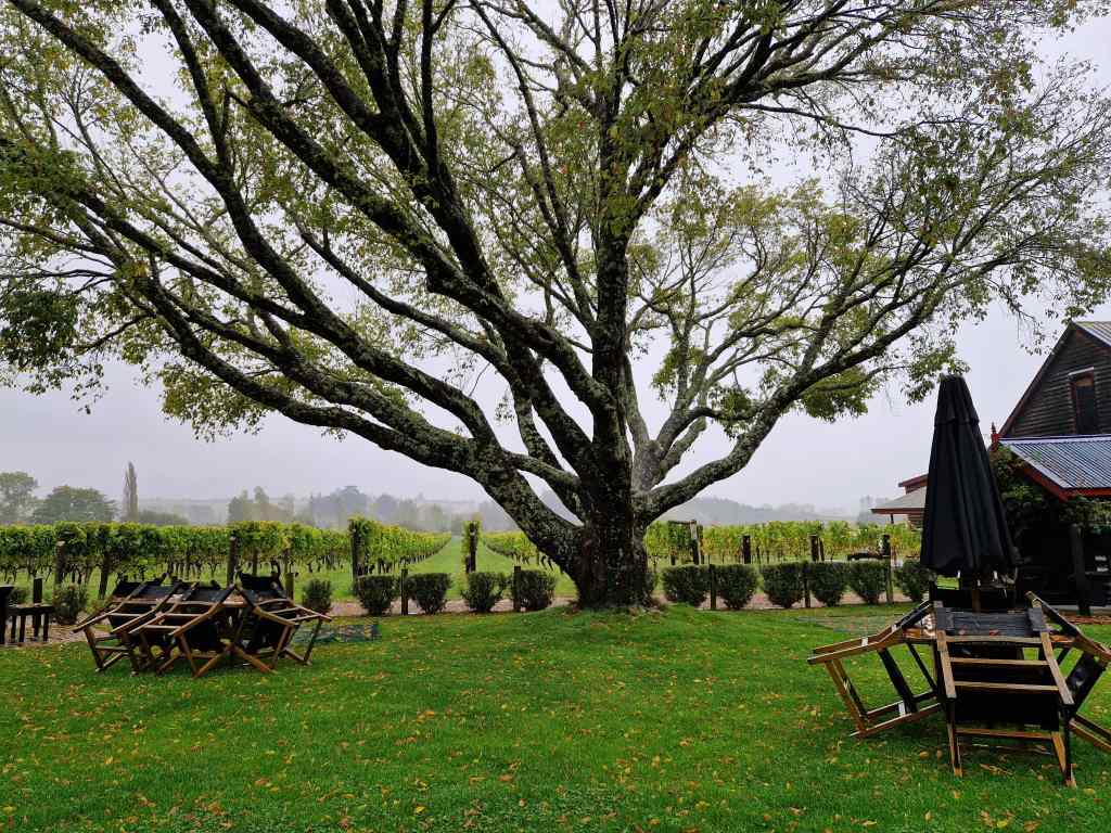
On my way back from Apple Tree Bay it started raining. I got back to my car without getting too wet, but then the skies opened and it rained hard all evening and all of the next day. Fortunately, my accommodation was probably the best value placed I have ever stayed in – a large and beautifully furnished apartment looking out over the bay of the city of Nelson. It was the perfect place to sit out some impossibly bad weather. My only activity for the next day was visiting a local winery for a tasting and a light lunch……
Neudorf winery in the rain, near Nelson, New Zealand
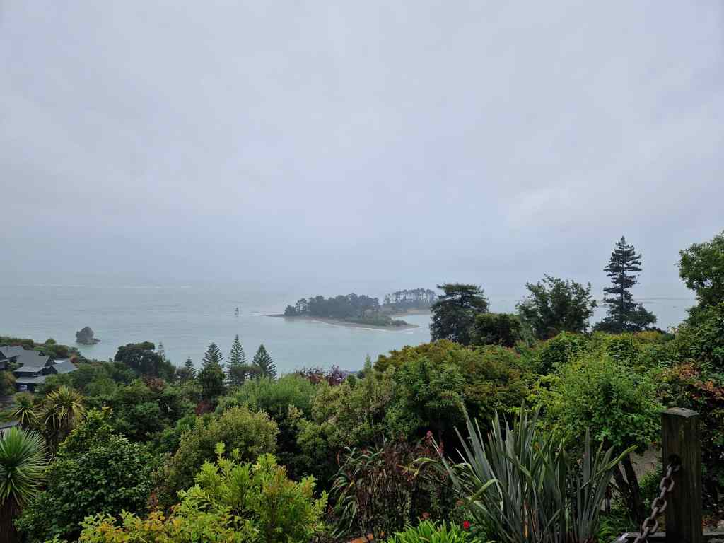
…..after which it was all to easy to sit back and admire the view from my flat. I ventured out once to buy some excellent turbot for dinner from a nearby shop on the seafront. Somehow, when the weather outside is this bad, staying in a nice place with a good view gives you a really cosy feeling.
The view from my flat in Nelson
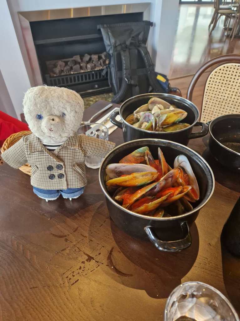
On day two of the storm, I had to check out and made the short drive east back to Picton in heavy rain. I stopped for lunch on the way in the town of Havelock, which is known for its greenshell mussels – which are enormous and very tasty.
Greenshell Mussels in Havelock
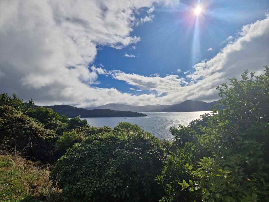
I reached Picton in the late afternoon and the sun finally put in an appearance. I used the remaining two hours of daylight driving around the area, seeing what the past two days could have been like if the weather had been kinder.
Picton – Queen Charlotte Sound in the sun this timeThe bright blues seas of the Marlborough Sounds finally appear!
Still, I cannot complain – so far I have been fairly lucky overall with the weather, and even under clouds, the Marlborough Sounds and Abel Tasman Park were pretty. At least I have an excuse to come back and visit the area again, hopefully when the sun is out.