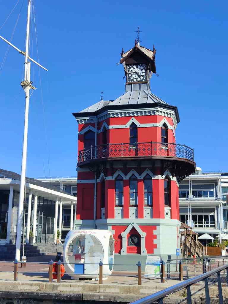
I spent today exploring the V+A Waterfront. This was the first part of Cape Town to be settled and claims to be the oldest working harbour in the southern hemisphere. The Victoria and Alfred (Victoria’s son) docks were busy during Cape Town’s role as a centre for gold and diamond exports from South Africa in the late nineteenth century. In the 1990s, the area was redeveloped. One working dry dock for ship repairs remains, but the remaining shipping activity is now entirely pleasures cruises. The warehouses have been converted to shops, restaurants, offices and a conference centre.
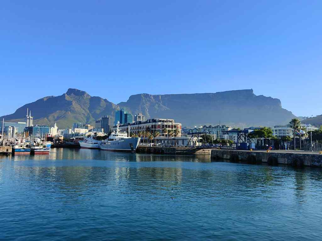
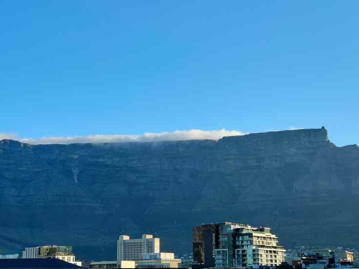
The conversion was very successful. The area was beautiful, with the spectacular backdrop of Table Mountain.
Scenes from the V+A Waterfront
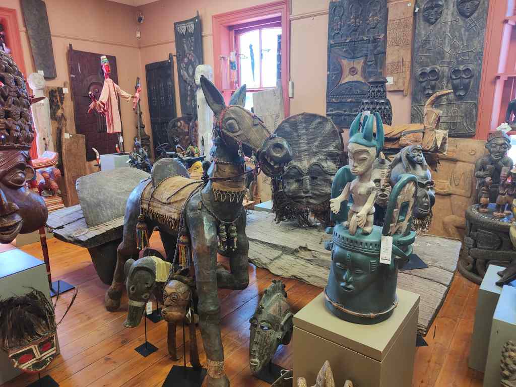
The souvenir shops sold lots of interesting articles. My favourite place was the African Trading Post. Its ground floor housed traditional souvenirs, plus some unusual ones – like Zimbabwe bank notes. The highest denomination I found was for fifty trillion Zimbabwe dollars.
You can be a trillionaire in Zimbabwe it seems
Its three upper floors were given over to increasingly exuberant carvings and sculptures, with finally a museum on the top floor.
Second floor of the African Trading Post
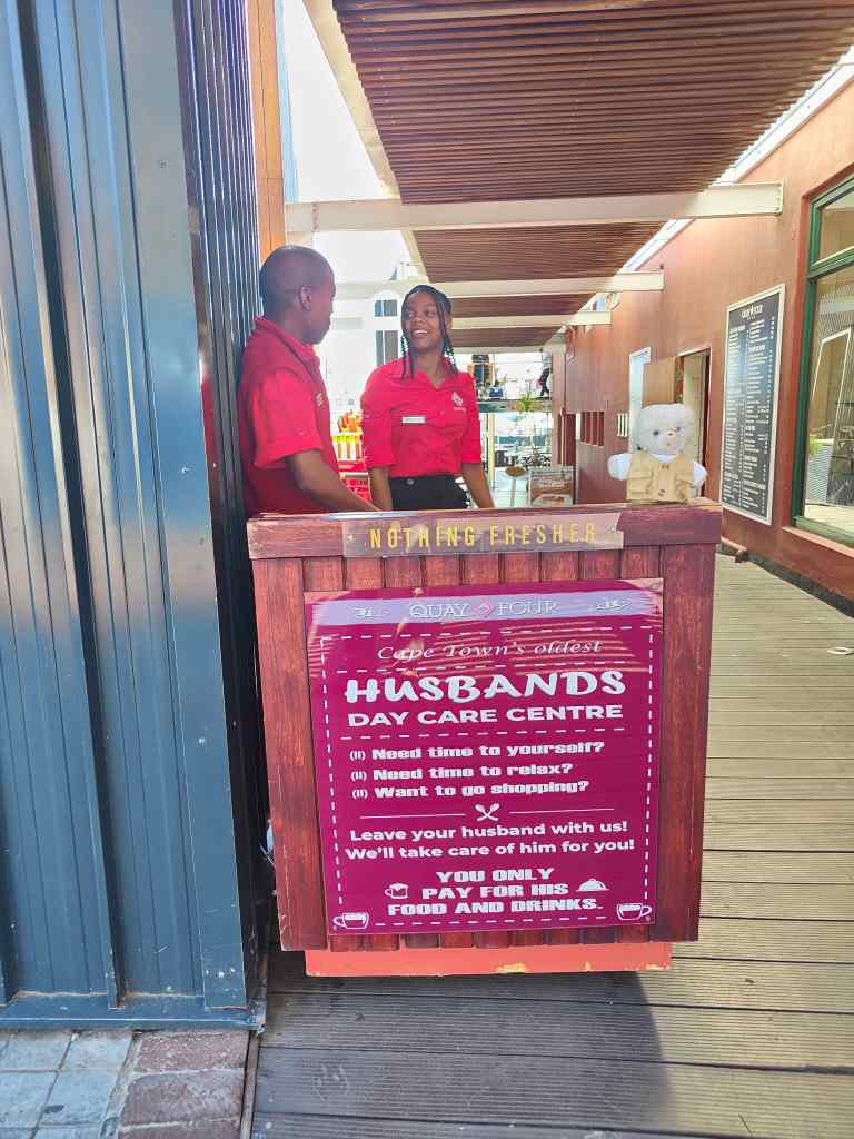
The Waterfront has lots of open-air restaurants and cafés. Recognising that shopping might be stressful for men, one place had set up a day care centre for husbands where wives could leave their partners before going round the countless shops.
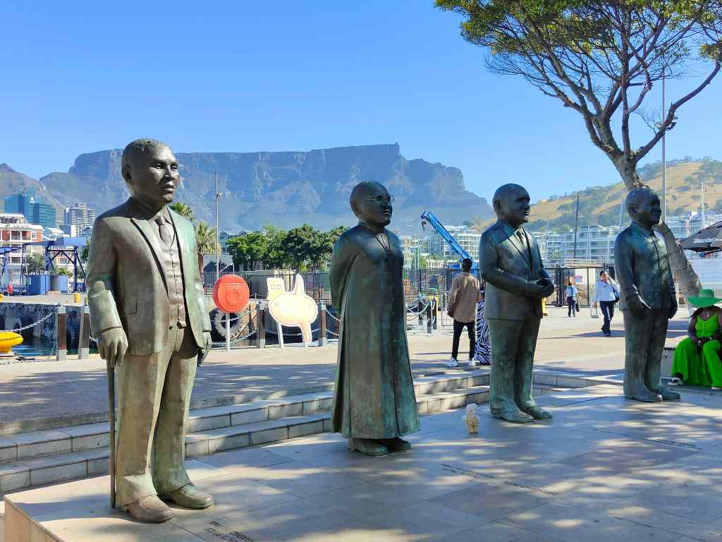
The area also had statues of famous people…….
Four giant figures in the ending of Apartheid, and one small bear
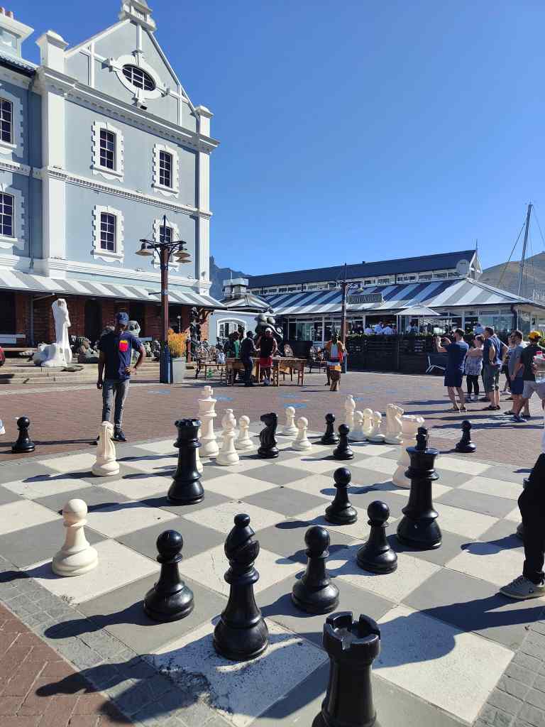
……..and a popular large scale chess set.
There were security guards everywhere, meaning the atmosphere was more relaxed than the rest of Cape Town. People gathered to enjoy a range of high quality street performers, including an excellent young people’s choir. My shopping completed, I headed back to my flat, and then later went out for dinner in the City Bowl area at the Sea Breeze restaurant, where I had a tasty fish curry.
Sadly that was my last day of my brief tour around South Africa before my flight back to London. It was a country I had liked a lot, with its beautiful scenery, great food and friendly people. These more than made up for the night-time insecurity and need to be constantly vigilant in Cape Town. I will be back, probably returning to Cape Town but heading further east next time, as far as Durban.
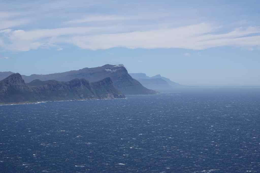
Today was my last day in South Africa, and it was busy. I woke early to pick up a hire car and set off immediately to drive down to Cape Point and the nearby Cape of Good Hope, about an hour and half south of the city. Unlike my previous experience driving in Cape Town, the road along the coast was very scenic and quiet. It went through several affluent suburbs before I reached Chapman’s Drive, a famously scenic toll road. It did not disappoint.
The view from Chapman’s Drive
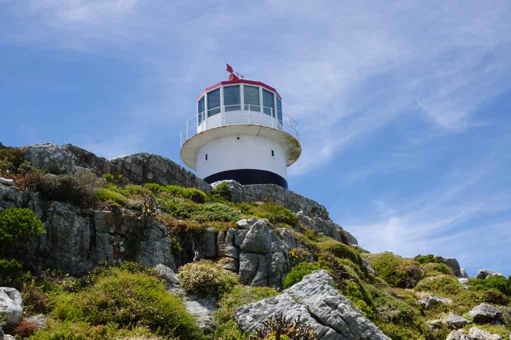
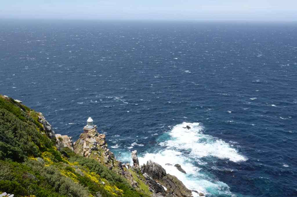
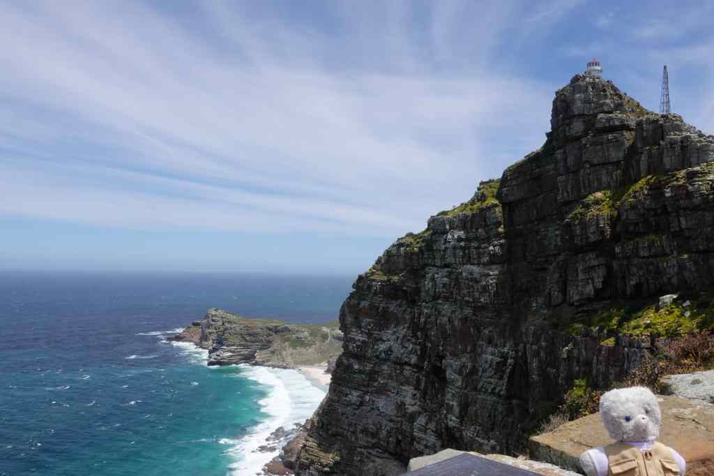
The Cape Point area is part of a large national park. I paid my entrance fee and drove in, as the views became more and more spectacular. I finally arrived at a car park below a lighthouse; I had reached the southwestern tip of the African continent.
The new lighthouse at Cape Point
To my left, miles and miles of stunning coastline presented itself in a 180-degree arc, first heading east and then further south – the southernmost point of Africa is in fact not Cape Point but Cape Agulhas, about 180km to the east. The Indian and Atlantic Oceans meet between these two capes.
From Cape Point looking east……looking forwards towards the old lighthouse….
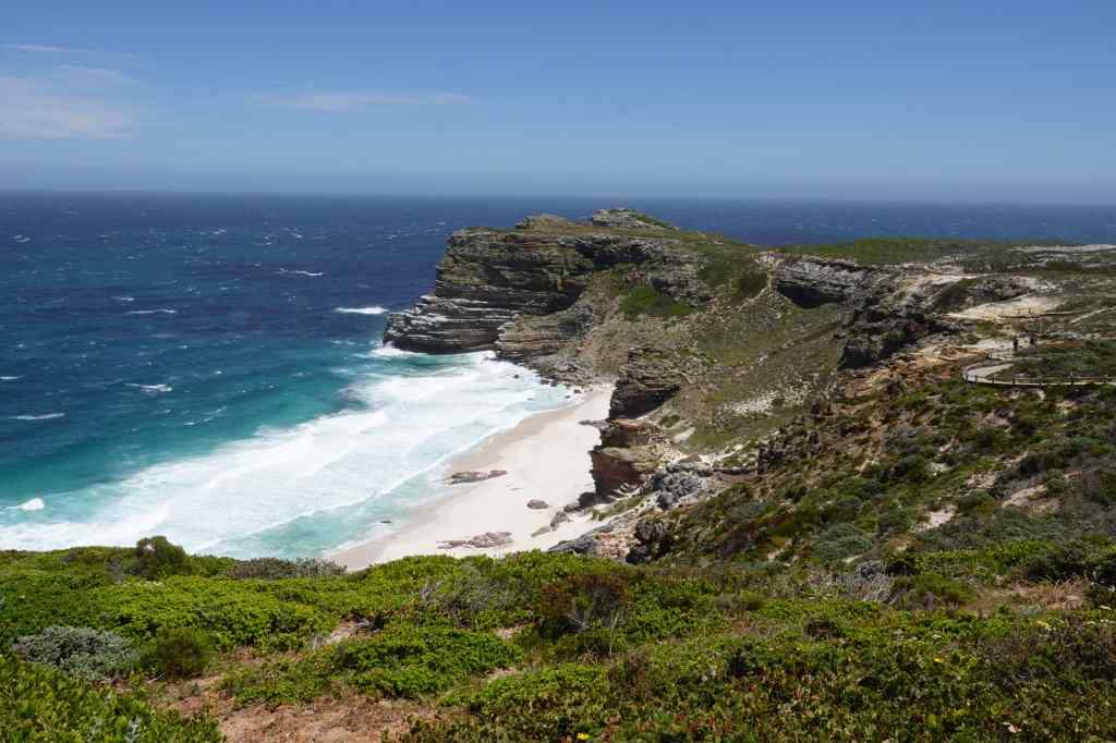
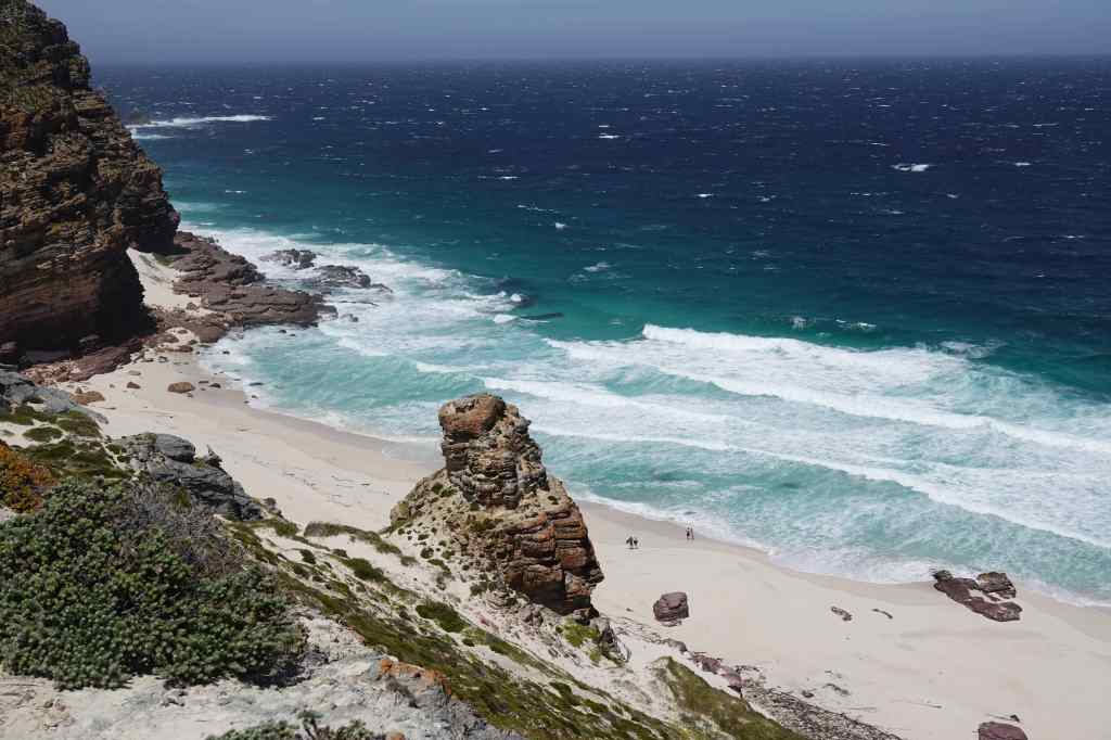
A short distance to my right was the famous Cape of Good Hope. This marks the point where ships, having travelled thousands of kilometres down Africa’s Atlantic coast, finally begin to travel more east than south.
…and looking west to the Cape of Good Hope
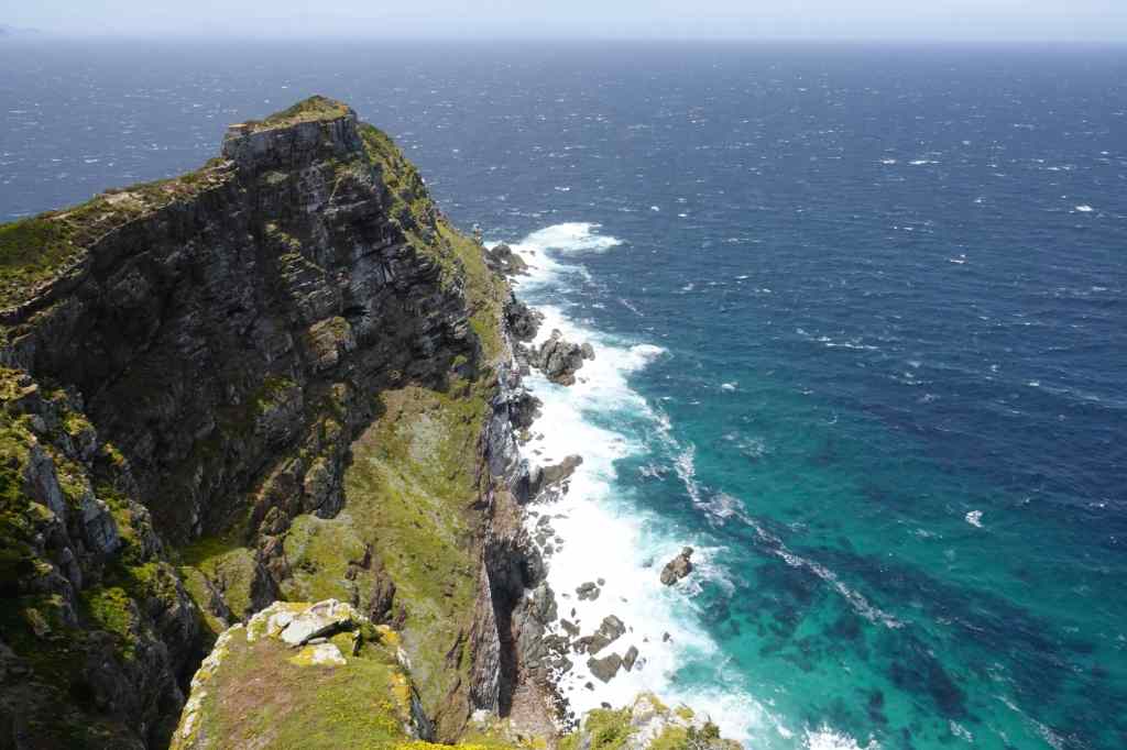
I walked up to the base of the lighthouse and stood admiring the view, whilst trying to keep my camera steady in the face of a ferocious wind. This area was quite busy with other tourists, but I soon found a small track to the old lighthouse, which was even closer to the tip of the point. This path was deserted, and when I got to the end, I was the only person there. The views – and the wind – were breath-taking.
Views from near the old lighthouse
After soaking in the panorama, I returned to the new lighthouse and took the more popular route to the Cape of Good Hope. On the way I spotted a group of elands, quietly browsing – I was very pleased, since at Etosha in Namibia I had only managed to see one of these animals in the far distance.
Eland grazing near Cape Point
The path offered more brilliant scenery, before I got to the famous Cape.
On the way to the Cape of Good Hope
I imagined the excitement of Bartolomeu Dias’ sailors as they finally reached this beautiful place and confirmed that there was an end to the African continent. Later I learnt that on their outward voyage they actually sailed further south, out of sight of land, and landed further east at Mossel Bay, only discovering the Cape on their way back.
On the Cape of Good Hope, looking towards Cape Point and yet more capes in the far distance
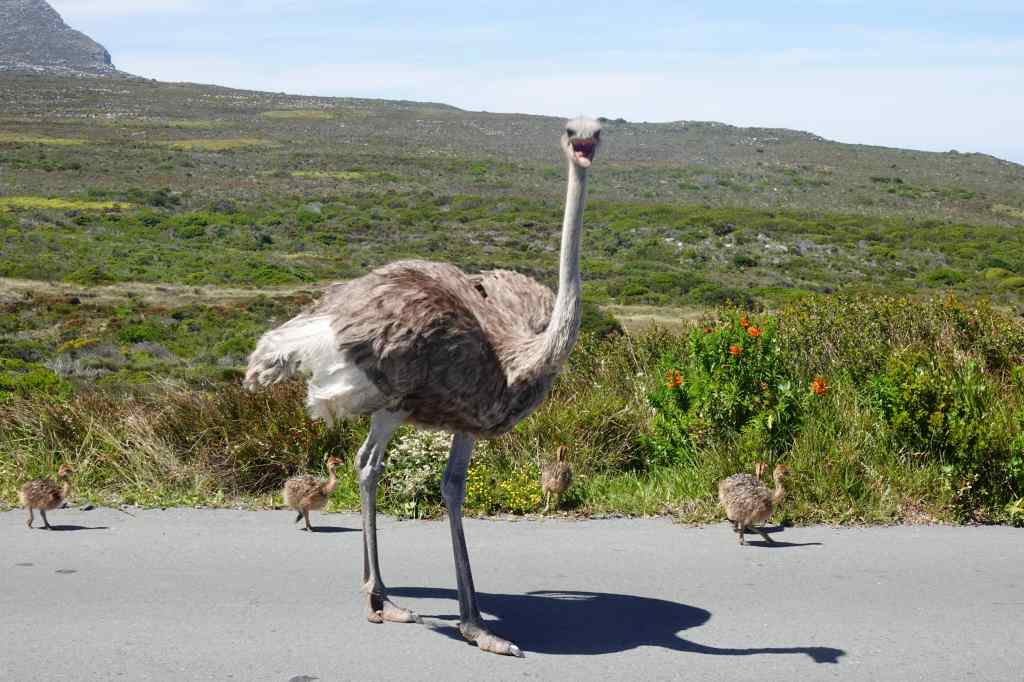
I regained my car and headed to the exit of the park. On the way, there was an unusual traffic jam caused by a pair of ostriches and their chicks. I got of out my car to take photos, but soon realised I had taken a silly risk. The mother ostrich perceived me as a threat and approached me aggressively. I remembered what the guide at the ostrich farm had told me about the birds being able to kill with a single blow from their feet and hurried back to my car. Maybe I was lucky to be a small teddy, and less of a threat then a taller human, because mother ostrich did not pursue me.
A close escape!
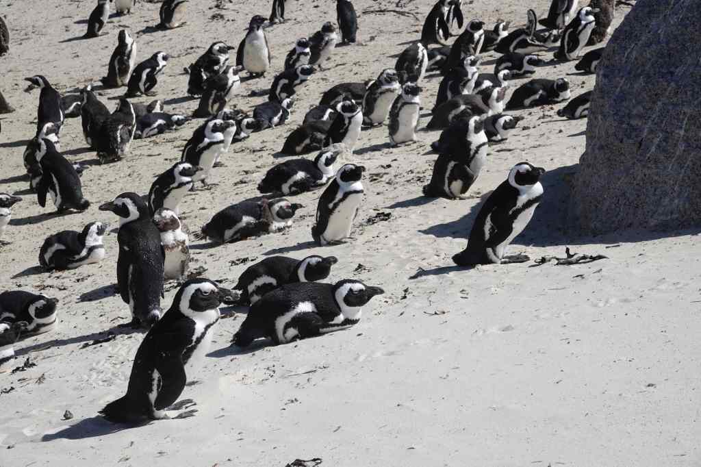
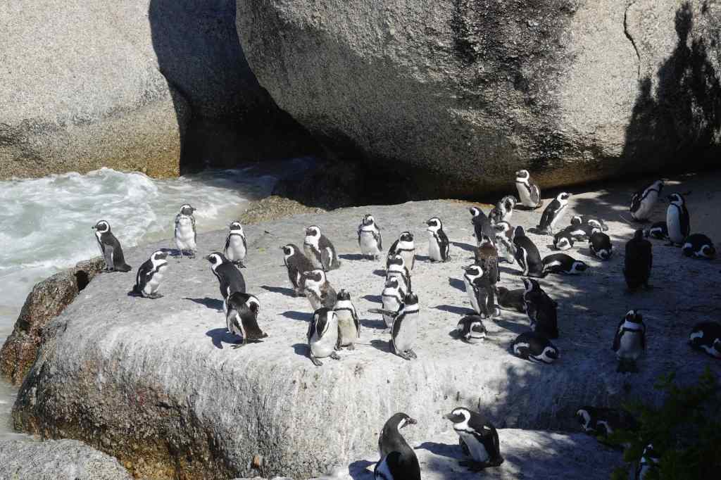
After my close shave, I drove north for one last visit – to the penguin colony at Boulders. The site was very busy with penguins – and tourists. Visitors had to stay on a wooden walkway which went right over the beach where the colony was living. This allowed me to observe the birds much more closely than had been possible in Namibia and to take some great photos, albeit at the cost of having to endure a much more “touristy” experience with crowds of tour groups.
Close up and personal with penguins
I returned to Cape Town along the same spectacular coast road that I had travelled in the morning, arriving just in time to return my car. It had been a brilliant day – pleasant driving, spectacular scenery, history, penguins, elands, and a close encounter with an ostrich.
Today I saw three very different aspects of Cape Town. The day started with a tour of Langa, Cape Town’s first township. Our arrival was delayed by nearly ninety minutes as the guide and his driver searched frantically and ineptly around the city for the remaining tour participants, in a performance worthy of Laurel and Hardy. Fortunately, we managed to arrive at Langa intact, without having killed anyone, despite our driver ignoring several no entry signs and nearly hitting a pedestrian on a crossing .
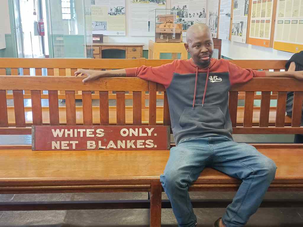
Our first stop was the township’s museum, where the curator was impossibly enthusiastic and told us more about the history of the place in a rapid, sometime confusing, babble. Langa was the Cape Town’s first township, where black people were forced to live, segregated from whites. The conditions they lived in were close to slavery, with dozens of black men sharing single sex dormitory accommodation in order to work for white businesses. Every black had to carry a “dompas” which allowed them to travel; it had to be renewed every two weeks. The hated dompas was the focus of the first demonstrations against the Apartheid system, which had been introduced by the National Party in 1948. Further demonstrations flared up over the decades, each time being suppressed violently by the police. Apartheid continued until the 1990s, until the South African President FW de Clerk realised that minority white rule was unsustainable, released Nelson Mandela from prison and allowed coloured people to vote in elections.
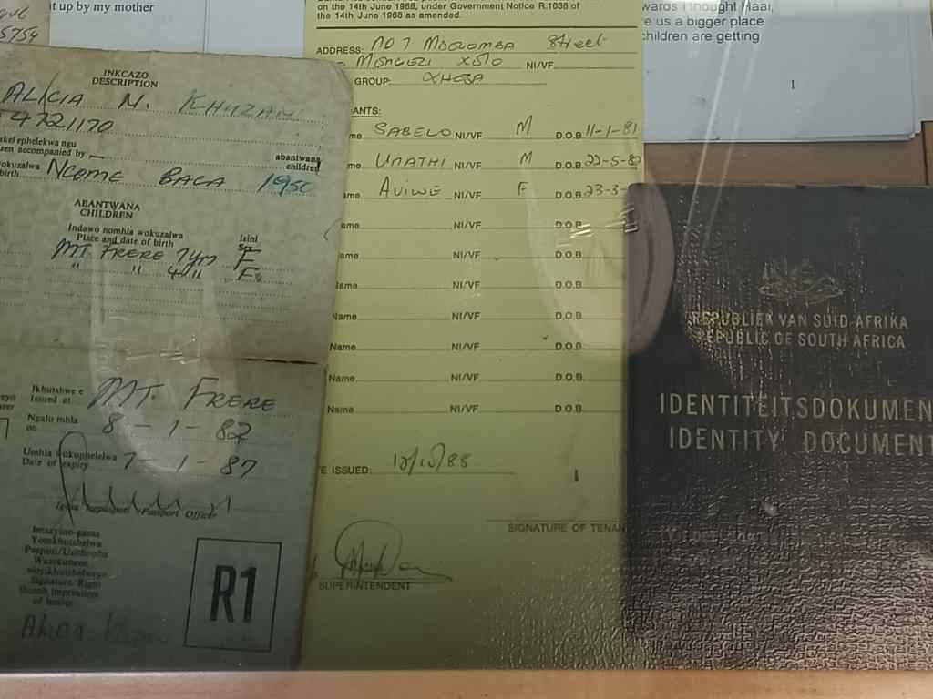
A “White’s Only” sign on a bench, with the curator’s sonThe hated Dompas and other ID documents
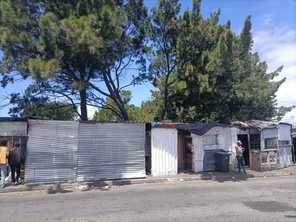
The township had many different types of housing. At one end of the scale, there were shanty houses built out of corrugated iron. People living here had to borrow electricity from neighbours and get water from a pump outside.
Shacks in Langa
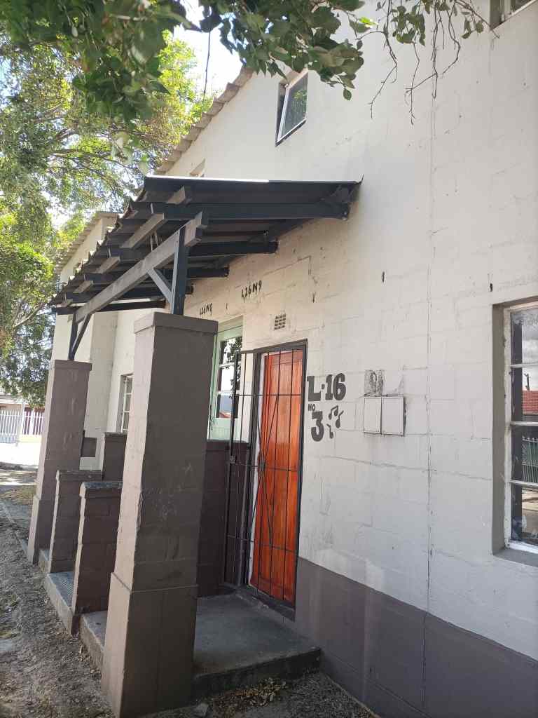
The lived in the hope that the government would need the land they occupied and would then build them a proper house, like the mid-range accommodation that made up most of the township….
Mid-range housing, Langa township
At the top end, the township had an area nicknamed “Beverly Hills” with very nice modern houses. These were given to people like teachers or nurses who had worked for the government for a long time. They even had brilliant views over Cape Town.
“Beverly Hills”, Langa Township
Our guide assured us that there was very little crime in Langa. The fancy houses in Beverly Hills were not a source of resentment, but one of inspiration, where people could see what was possible if they worked. Walking around the streets, the atmosphere was very friendly and relaxed. Lots of people came to greet our guide, who seemed to know almost everyone. One resident came to embrace one of our group, because he was wearing a South Africa rugby shirt. Lots of children would approach us and spontaneously hug their white visitors.
“Free hugs” at Langa
Langa certainly seemed to be a friendly community, which had become a pleasant place to live – overcoming tough obstacles on the way. Its residents were proud to be there. However, our guide told us that many other townships were not like this, with many suffering from rule by criminal gangs and harsher poverty than what we had seen in Langa.
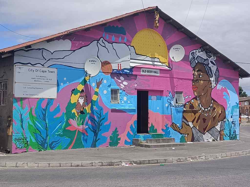
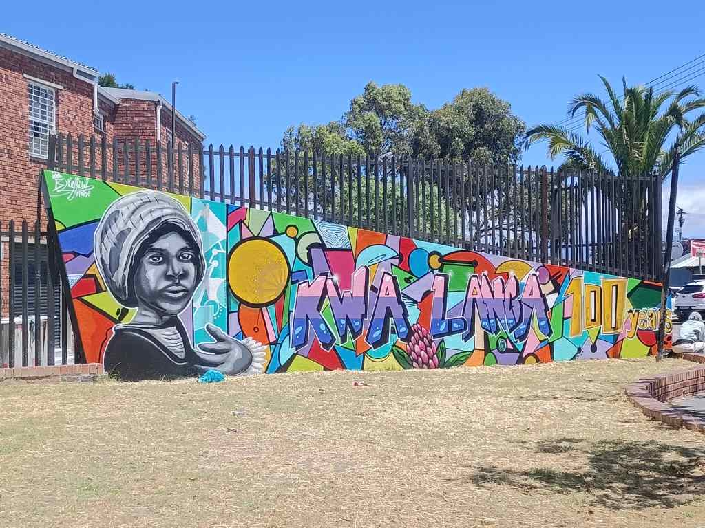
Mural at the entrance to Langa
Our trip ended – inevitably – in a building housing several art galleries, selling painting, carved wooden goods or ceramics. The owner of the latter business told me about the difficulties of operating with unreliable power supply – like all of South Africa, Cape Town experiences scheduled power cuts of two to three hours per day, called “load shedding”.
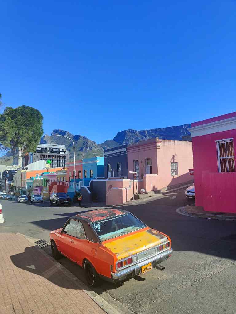
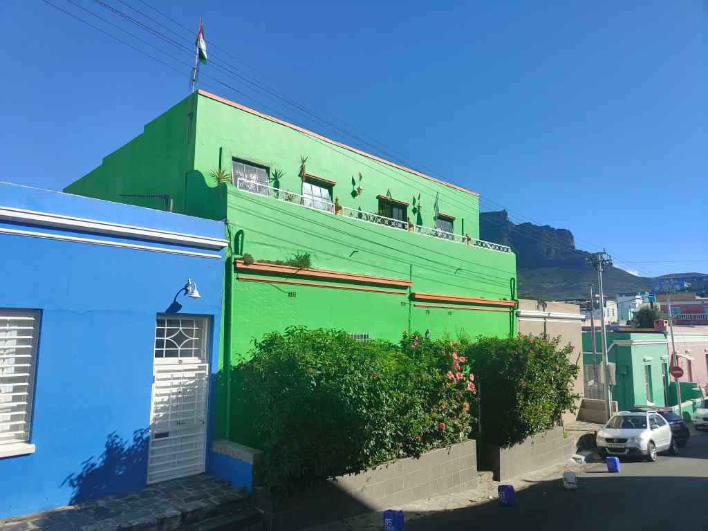
After the township tour, I set off to see two other areas of Cape Town. The first was Bo-Kaap, the city’s oldest surviving residential area, dating from the mid-18th century. The area is famous for its brightly coloured houses.
Street scene in Bo-Kaap
Many of the people who live here are descendants of Muslim workers who arrived from southeast Asia over a century ago, and the area has many mosques.
A mosque in Bo-KaapLots of Palestinian flags in this Muslim area of Bo-Kaap
There were a few people hanging around on the street corners. One group shouted a greeting to me and, relaxed after my visit to the friendly Langa township, I replied to them. Another person walking nearby whispered to me urgently. “Don’t talk to them” he said. “They will try to steal your phone”.
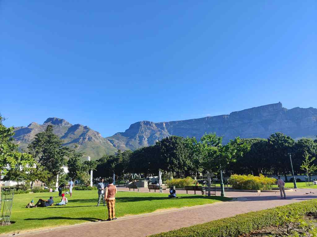
From Bo-Kaap, I walked to the City Bowl area – the heart of Cape Town. This is the main business area, and has shops, restaurants, high rise buildings (not quite skyscrapers though) and lots of top end hotels. By day, it was a pleasant and obviously affluent area, with people strolling from café to café. I soon found the Company’s Garden, which is the city’s oldest green space. It was set up by the East India Company in 1652 to grow fruit and vegetables for the fledgling Cape Town colony. In the following century it was transformed into ornamental gardens, and became famous around the world. On this late Sunday afternoon, centuries later, it was full of people enjoying the collections of exotic trees and flowers or just sitting on the grass. Couples enjoyed picnics together, parents played with their children, and at least one marriage was being celebrated.
The Company’s Garden, City BowlMemorial to Smuts and the National Art Gallery
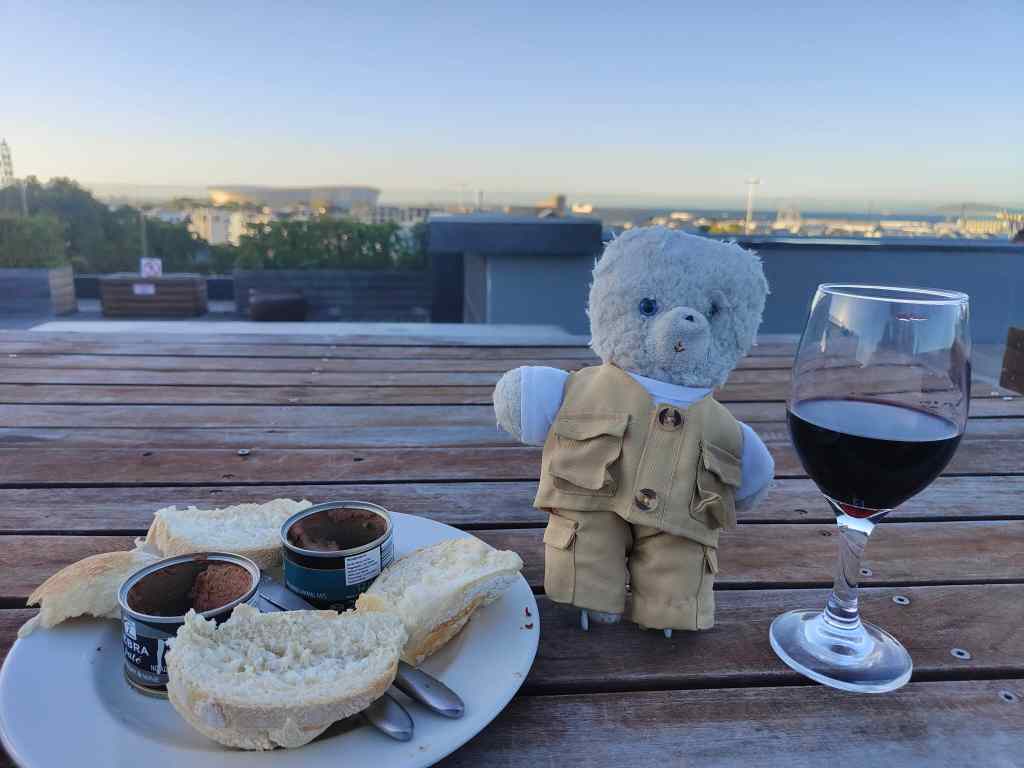
I walked through to the west end of the garden, where there was an open area, with a few monuments and the national art gallery. There were also a lot of homeless people stretched out on the grass. As the sun began to set, the shadows in the gardens lengthened. A sudden transition occurred. The happy, relaxed crowd I had seen earlier rapidly disappeared leaving behind the homeless and beggars. The remaining visitors walked faster, and looked around frequently. I followed suit, and walked quickly back to my hotel via the local shop, where I brought some excellent springbok paté and wine for dinner. I ate this on the roof terrace of my hotel, contemplating the day’s events, and my good fortune in life compared to many of the other people I had seen today.
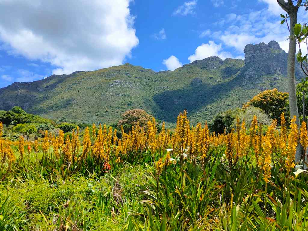
Today my original plan was to visit the Botanical Gardens and then explore the City Bowl area of Cape Town’s centre. I reached the Kirstenbosch Gardens without problem by taxi. They are among the oldest botanical gardens in the world, being founded in 1903, and sit in a magnificent setting at the foot of Table Mountain.
Kirstenbosch Gardens have an amazing location
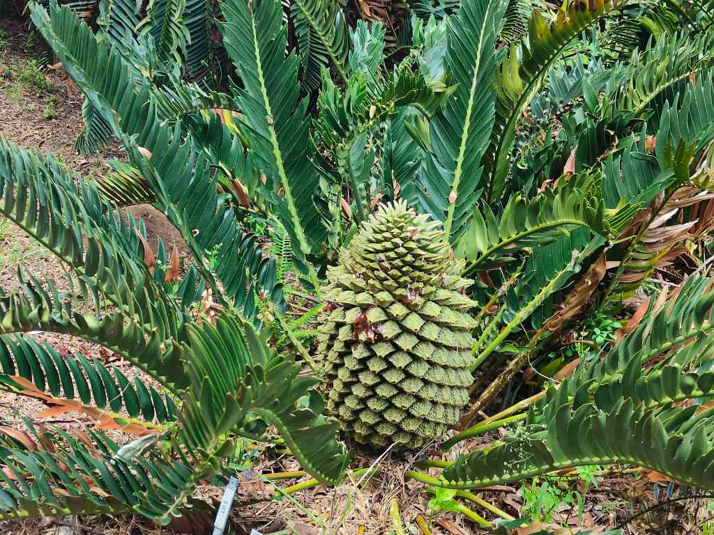
The gardens showcase a collection of typical South African flora, of which I particularly liked the cycads.
A cycad, a type of plant that first appeared when dinosaurs roamed the earth
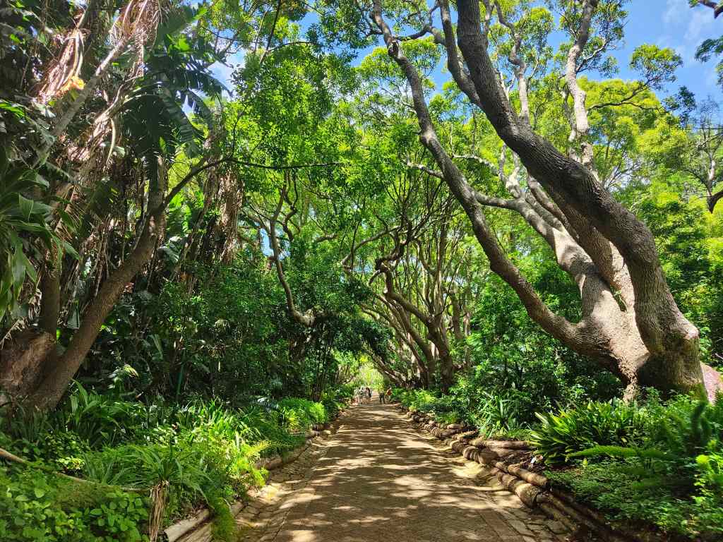
They also had some pretty walkways, shaded by trees, that provided protection from the hot morning sun.
A shady walkway, Kirstenbosch Gardens
When I reached the eastern edge of the garden, I saw an intriguing sign to “Skeleton Gorge”. I remembered that this was one of routes to climb Table Mountain. It was not part of my plan for the day, and I was not equipped for walking, since I had town shoes on my feet, and no cold weather clothing. But despite the lack of preparation, I could not resist and set off on a path that led steeply upwards.
At the top of Skeleton Gorge
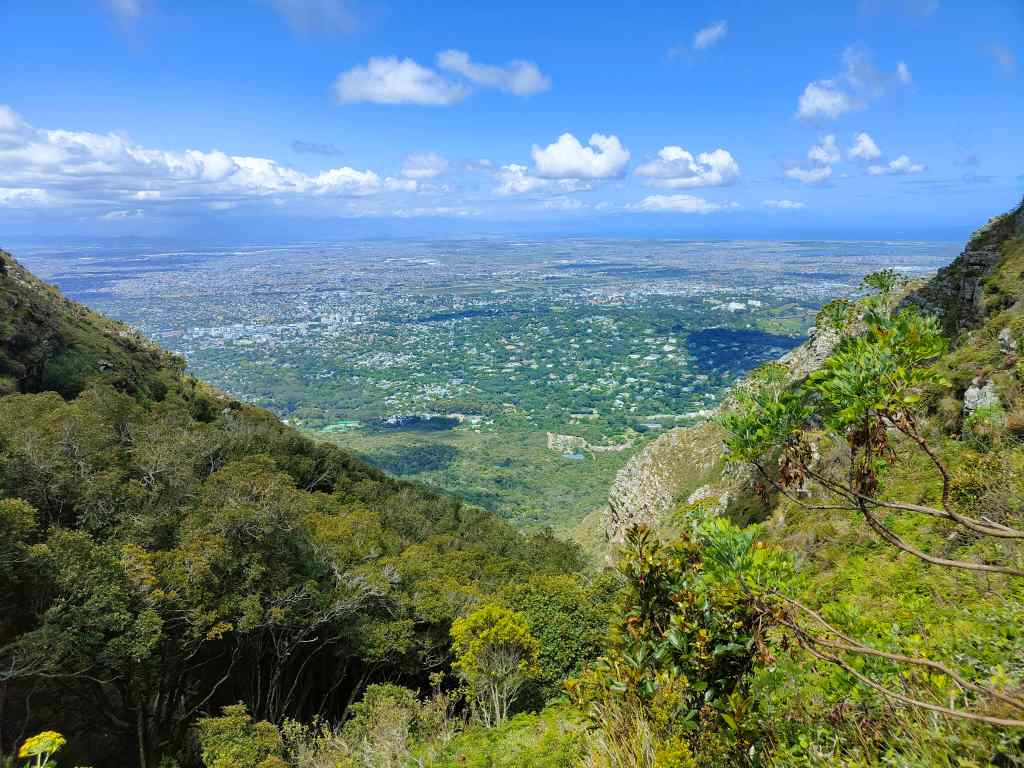
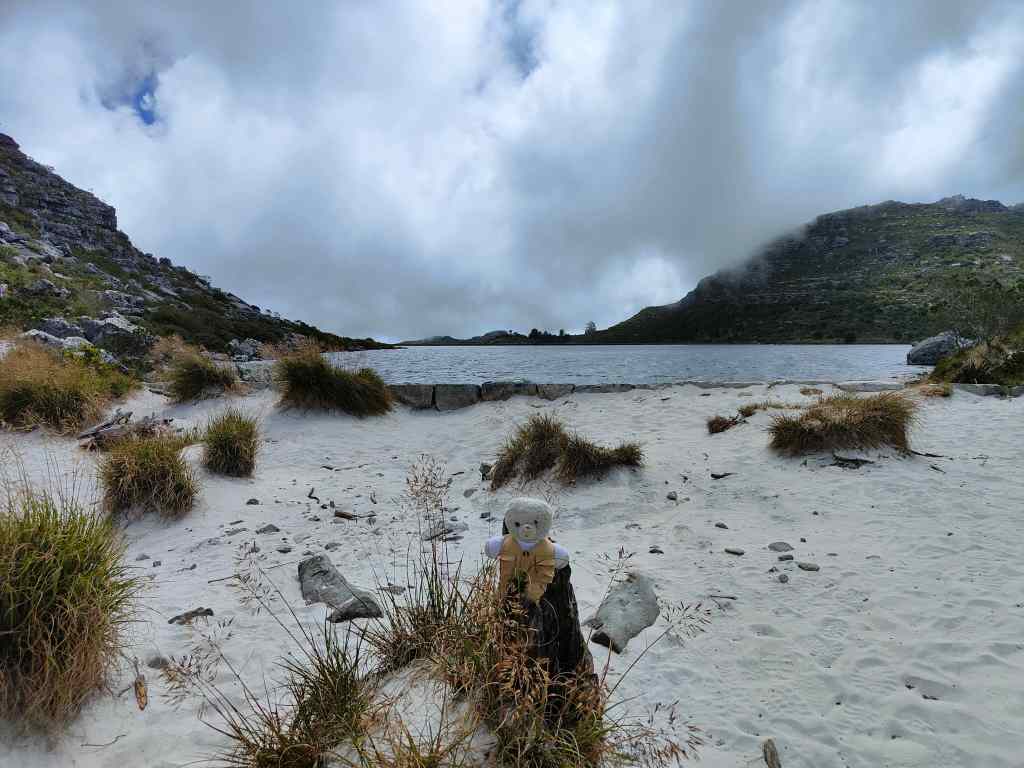
After climbing fifty minutes, I reached the “table” of Table Mountain – the place where the ground becomes flat(tish). There were great views back over Cape Town, and an intriguing small lake surrounded by sand.
Table Mountain is home to a small, sandy lake
I had more walking to do – first another forty minutes to find the highest point on the mountain, Maclear’s Beacon, and then another forty minutes to the upper cable car station. The weather had become cloudy, but the sun broke through occasionally to light up more amazing views and stop me getting cold. There were also lots of pretty flowers, including some proteas.
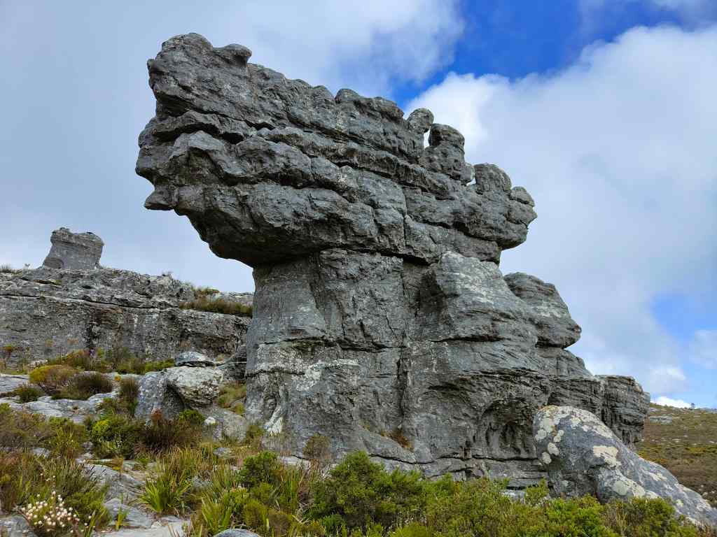
On top of Table Mountain – pretty flowers, amazing views……strange rock formations…and more views. It was getting cold…
At Maclear’s Beacon, the clouds became thicker and a strong wind gusted. I knew I was not equipped for such conditions and hurried onwards, occasionally stopping to take some atmospheric photos of the scenery.
More jaw-dropping scenery
I finally reached a crossroads, at a place I knew was near the cable car station. The signs were not clear, and the mountain was now covered in thick mist. I took what I thought was the right path, but it continued for longer than I expected, finally reaching a sign saying “This is not an easy way down”. I was cold and confused but was saved by two girls walking up towards me. They told me that this was the “Indian Fenster” route, which had been a tough climb for them and would be an even harder descent for me. I had gone the wrong way. I retraced my steps with the girls and found the junction where I had gone wrong earlier. This time, I could just make out another path in the mist. It was lined with posts and chains, and had to be the way to the cable car. I jogged along to warm up a bit, and on arrival headed straight to the café to order a hot chocolate.
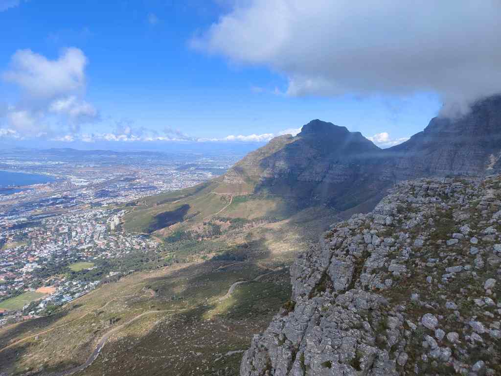
The ride down in the cable car gave more opportunities for photos. The cabin had a revolving floor, so that everyone could get to see the full range of views over Cape Town and back to the mountain itself.
Table Mountain cable carView from the cable car, going down from Table Mountain
Back at ground level I stood in the sun for a bit to warm up, and then ordered a taxi back to my flat. It had been a memorable day, even if I had to have a long hot shower to recover from the cold weather on the mountain. My visit to Kirstenbosch and Table Mountain had confirmed that Cape Town is indeed one of the world’s most beautiful cities.
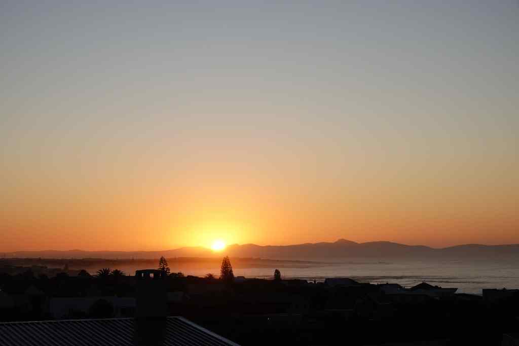
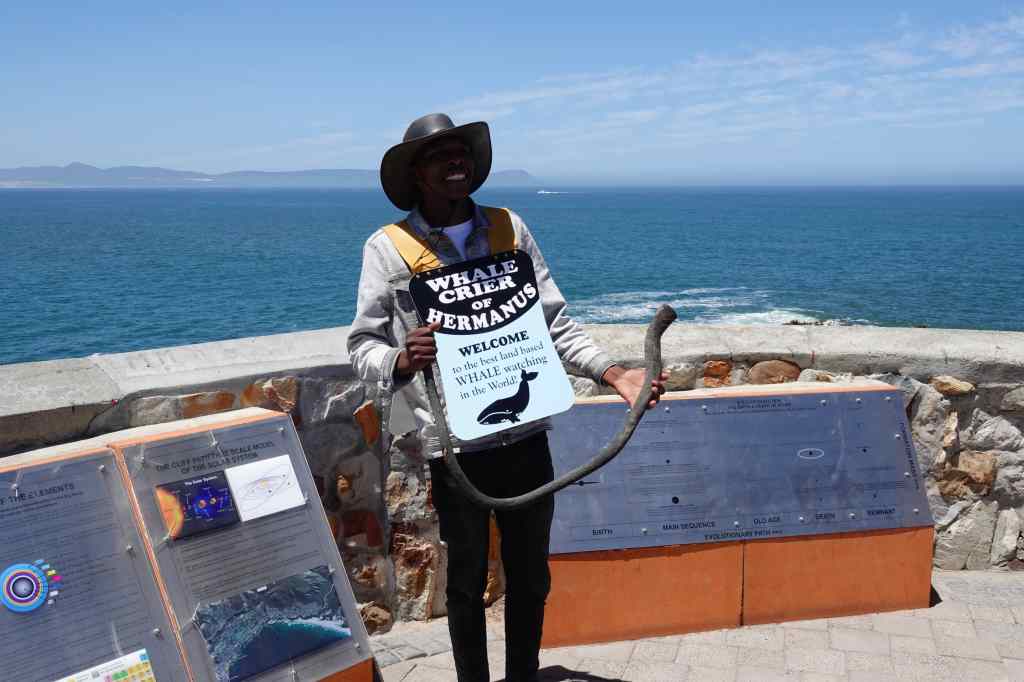
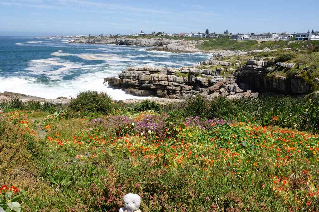
The next day I woke early and enjoyed watching the sunrise over the mountains behind the town of Hermanus. Then I got ready, had breakfast on my terrace and set off to visit the town, which is famous for being the best place in the world to see whales from the shore. The most frequently seen whale is the Southern Right Whale, which comes to the area to mate from August to November. This species of whale was given its name by whalers, which considered it the “right” whale to hunt, since it spends long periods of time on the surface of the water. At the town’s sea front, I met this cheerful fellow – Hermanus’ “whale crier”. He scans the sea for whales and blows his horn if he sees anyway.
Hermanus Whale Crier
I was quite pleased that I managed to see a whale before he did. It was clearly visible through my binoculars, although it still looks a bit small in photos……
Honestly, it looked bigger in real life…
Apparently whales sometimes come to within 5 metres of the shore in Hermanus, but I was not so lucky. I settled down in a sea front café, scanning the sea for more whales whilst enjoying a cappuccino. In the distance at the other end of the bay, another whale duly appeared. This one appeared to be in playful mood, and breached right out of the water, making a big splash on its return. Again, it was frustratingly hard to capture the whale’s play on film.
The best shot I could manage of the second whale at play
The whale crier had told me that the best time for sightings was the morning or evening, so as noon approached I decided to go to a walk along Hermanus’ popular cliff path. It was a very pretty route, with some artwork….
On the cliff path
…. Great views of the bay……..
On Hermanus’ Cliff Path
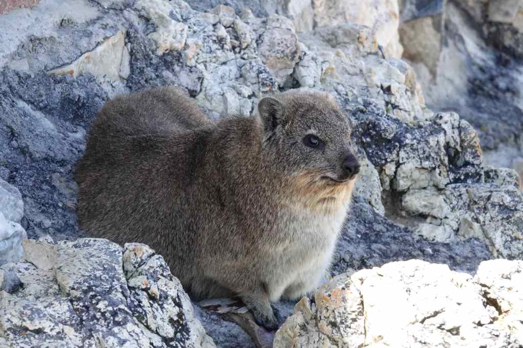
……and some unusual and cute little creatures formally known as rock hyrax but informally called dassies. They look like rabbits, but are in fact the closest living relative of…the elephant.
The rock hyrax – the elephant’s relative
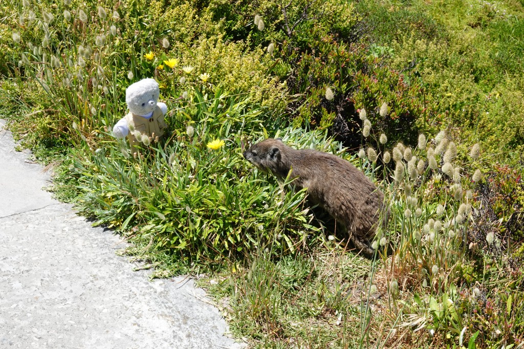
One of the dassies came to warn me about the danger from eagles. I thanked him, looked up anxiously, and hurried on.
A friendly dassie
I’d spent a very pleasant half day in Hermanus, and could have spent a lot longer in the area. But the deadline for returning my car was looming, so I set off for the last leg of my holiday – Cape Town. As I approached the city, the traffic became quite dense, and at first, I found the place quite intimidating. Big SUVs crowded the road, and beggars gathered at road junctions to ask for money. I was relieved when I checked into my flat and could head out to a nearby bar to enjoy a beer. I asked the waitress if it was safe to walk around at night – and the answer was a firm “NO”. So I bought some food to cook at home and headed back before sunset to enjoy my flat’s direct view of the iconic Table Mountain, which sits right in the middle of the city.
Table Mountain in late afternoon, as seen from my flat
Cape Town had intrigued me. Visually, it was a stunning city. But it also had an edge, and clearly had problems with crime and poverty. I was looking forward to exploring it over the next few days.
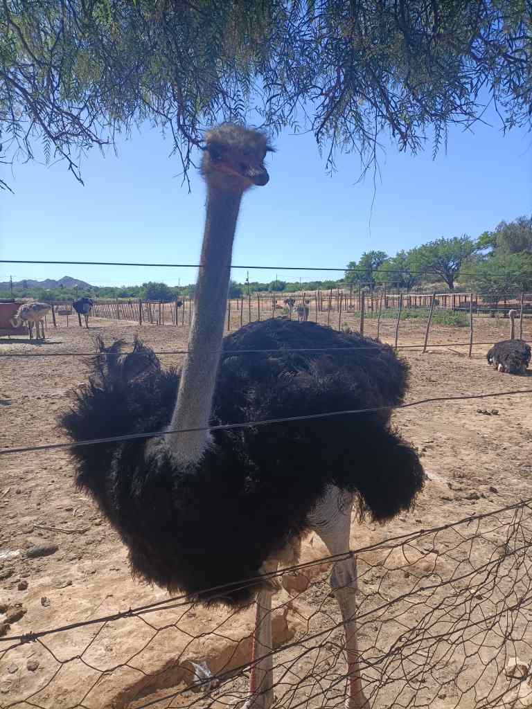
The next morning I visited Highgate Ostrich Farm, which claims to be Oudtshoorn’s oldest. The farm buildings were set around a pleasant garden with cacti.
Garden of Highgate Ostrich Farm, Oudtshoorn
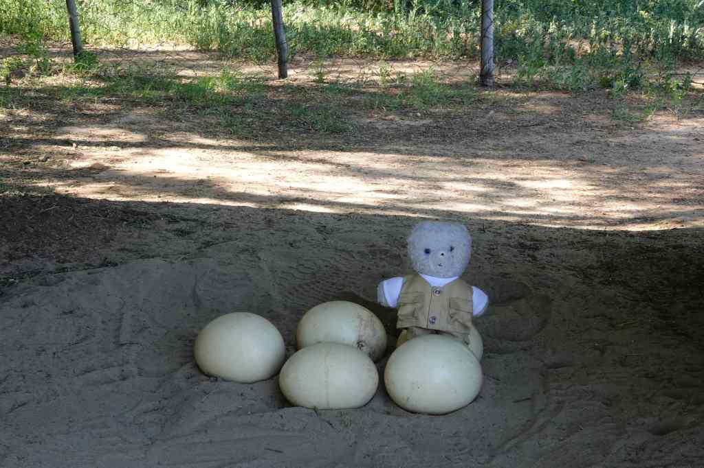
Highgate is a “show farm” which raises chicks for sale to other farms, but does not slaughter its ostriches. So logically enough the first stop on my tour was to see some eggs – these are surprisingly tough, and can withstand a weight of 120kg if it is applied gently. They are though vulnerable to sudden shocks, and are a favourite food for scavenging baboons.
Nearly as big as me!
The farm workers remove the eggs from the ostriches’ enclosures. To do this, they arm themselves with a branch from a thorn tree, to keep the birds at bay. Ostriches can be dangerous, being able to deliver a lethal kick, where their sharp toes rip open the stomach of the victim.
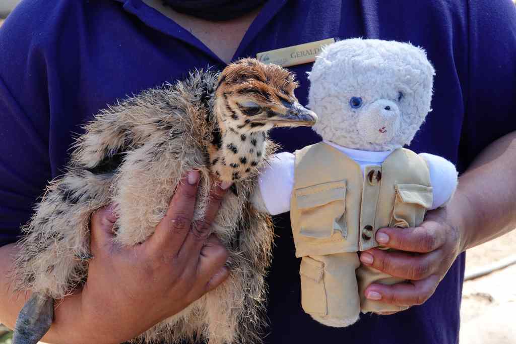
The eggs are taken away to be incubated and the chicks are reared until they are old enough to be sold to neighbouring farms. The chicks are rather cuter than the adult birds.
My knowledgeable guide introduces me to a new friend
In the early 1900s, ostrich feathers were a very expensive fashion accessory that were hugely popular in Europe. On a per weight basis, feathers were more valuable than gold, and a booming ostrich industry grew up around Oudtshoorn, which became known as the ostrich capital of the world. However, with the outbreak of the first world war, extravagant displays of wealth went out of fashion, and the value of feathers plummeted. Today, ostrich farming continues but mostly for the bird’s meat, which tastes like a leaner version of beef. Its skin is used as leather and its bones as fertiliser – nothing is wasted.
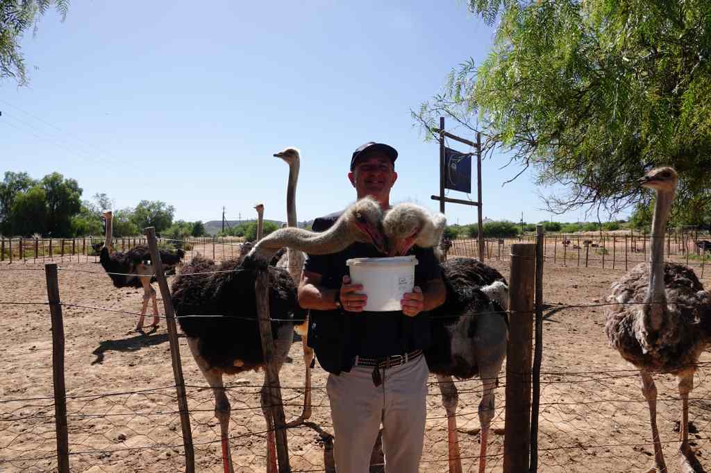
The next part of our tour involved feeding some adult ostriches. Our guide tricked one of our group into turning their back on the hungry birds whilst holding a bucket of grain……..
No escape until they have finished the bucket
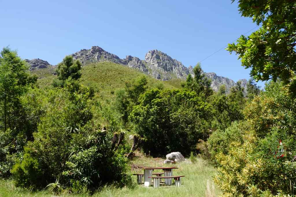
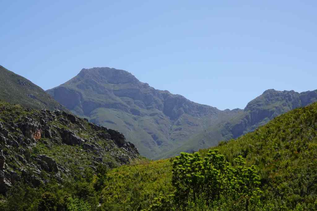
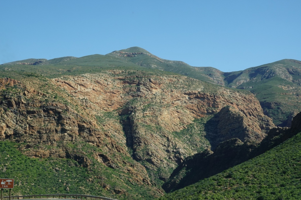
After the ostrich farm, I had to head back west again. If I had had more time I could have continued along South Africa’s famous Garden Route, but it was not to be (this time). At first, my route took me back along the scenic Route 62, which I could now enjoy in the morning light. After an hour, I took a side road leading through an impossibly scenic mountain pass…….
Perhaps the most scenic roadside rest stop I have ever seen
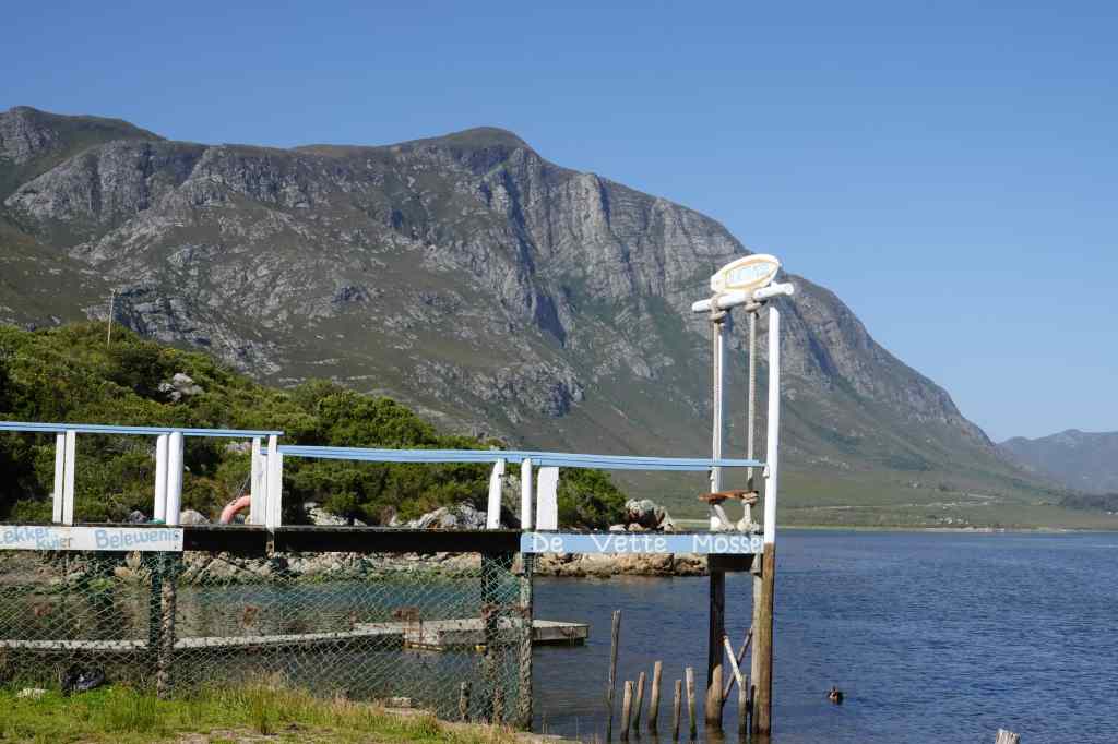
The road eventually joined the main N2 road that runs almost all the way along South Africa’s coast (and is Africa’s longest numbered road). The scenery changed again, becoming flat and greener, with lots of farms. I left the N2 to head south, eventually arriving at the sea near the town of Hermanus. The scenery was again stunning, and quite different to what had gone before. Tall, steep, green mountains plunged almost directly onto to a narrow strip of land with my road and endless beaches of white sand.
Scenery east of Hermanus
My accommodation was a short way west of Hermanus in an affluent residential area. I couldn’t quite believe how good a place I had booked for only 50€ – it was a large first floor flat with a 180-degree balcony giving views over both the sea and the mountains.
After dropping my luggage, I took a short walk. The area was quiet, with lots of nice houses……all prominently displaying signs that they were protected by security services. I did not meet any other pedestrians until I reached the sea, where a few walkers and joggers cross my path.
Look over the sea to Hermanus at sunset
I enjoyed the sound of the waves and the changing colours of the landscape as the sun set, before returning to have pizza and wine on my balcony. I am getting to like South Africa…..
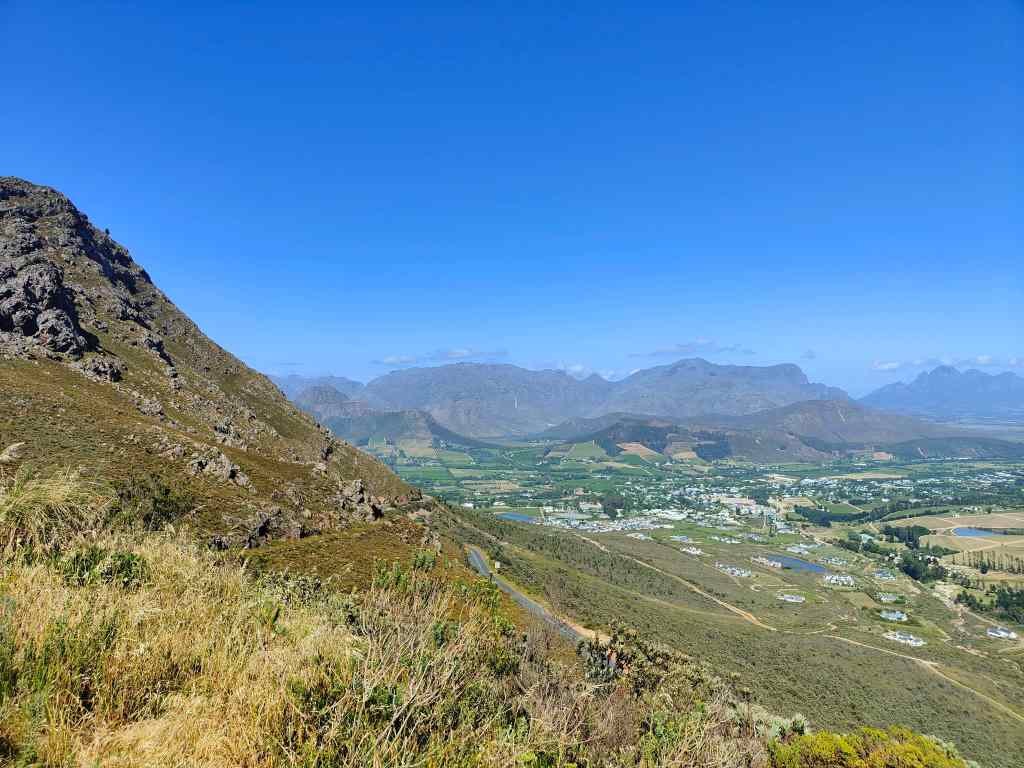
From Franschhoek I drove east, towards the small town of Oudtshoorn, about 400km away. My route took me first over the Franschhoek pass, which offered the first of many spectacular views.
After some more driving, I reached Route 62, famous as one of South Africa’s most scenic drives. It went through a mountain pass up to plateau known as the Klein Karoo. Normally this area is semi-desert, but this year the South African winter has seen unusually heavy rain, and now the road was flanked by green plants and flowers. It was a pleasant change after the relentlessly dry landscapes of Namibia.
Flowers on the approach to Route 62The first mountain pass on Route 62
The road was good, traffic was light, and my progress was fast. To make driving even more pleasant, Route 62 heads through some nice towns like Montagu and Ladismith, which had excellent cafés.
The Barn on 62 restaurant and café, an excellent coffee stopStreet scene in Ladismith
After a final mountain pass……
The final pass on the way to Oudtshoorn
…….I reached Oudtshoorn in the late afternoon. The town is known as the ostrich capital of the world, and was the centre of a brief boom in the early 1900s, when ostrich feathers were fashionable in Europe and extremely expensive. Now Oudtshoorn is a sleepy, pleasant provincial town and still a centre for ostrich farming. More about this in tomorrow’s post!
Women selling ostrich feathers at the entrance to Oudtshoorn
I relaxed in my hotel and had dinner in a local restaurant. Despite once again spending most of my time in the car, I had enjoyed the day. The scenery was spectacular and very varied, the driving fast and easy, and the small towns along the way had been welcoming and offered good coffee. South Africa lends itself to road trips.
On the way to Franschhoek – typical Wine Country in South Africa
As with my last visit to Cape Town airport, the experience was very positive. I breezed through immigration, picked up my bags and collected my hire car. I was soon driving east from the city. First the road passed some sprawling shanty towns, with houses made from corrugated iron. But soon these gave way to some impressive mountain scenery…..and eventually vineyards.
Typical Wine Country scenery near Franschhoek
My destination was Franschhoek, a small town in the heart of South Africa’s wine country. The town is one of the country’s oldest, and was founded in 1688 by Huguenots refugees who fled France when the protestant religion was banned there. The new settlers brought vines with them, and started to make wine. Many of today’s vineyards have French names, though the town’s own name is Afrikaans – meaning “French corner”.
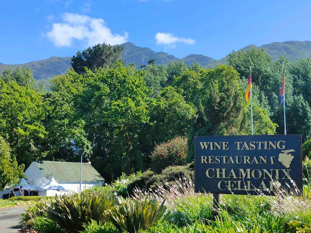
I found my accommodation without difficulty. The owner recommended me a few wineries to visit out of the dozens located around the area, and the next day I set off to explore them. First was a trip to Chamonix vineyard to buy some white wine. Like many of the other places I was to visit today, the setting was amazing, with the vines stretching away to the base of imposing mountains.
Stop number 1 – the Chamonix estate, Franschhoek
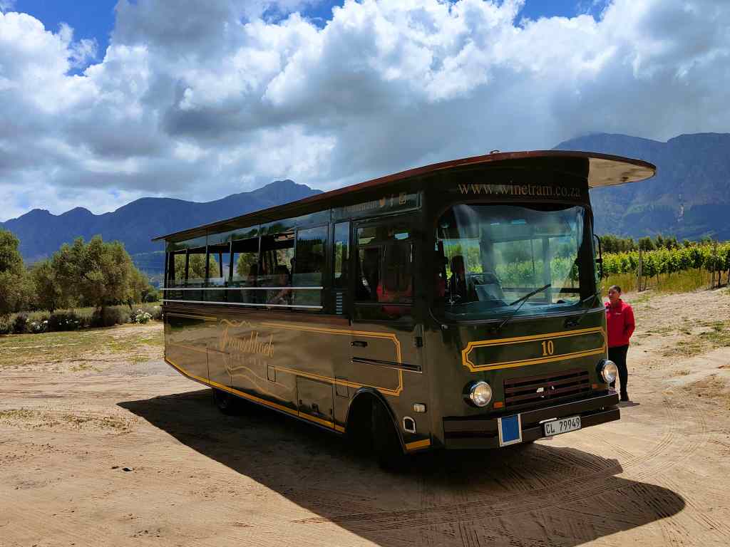
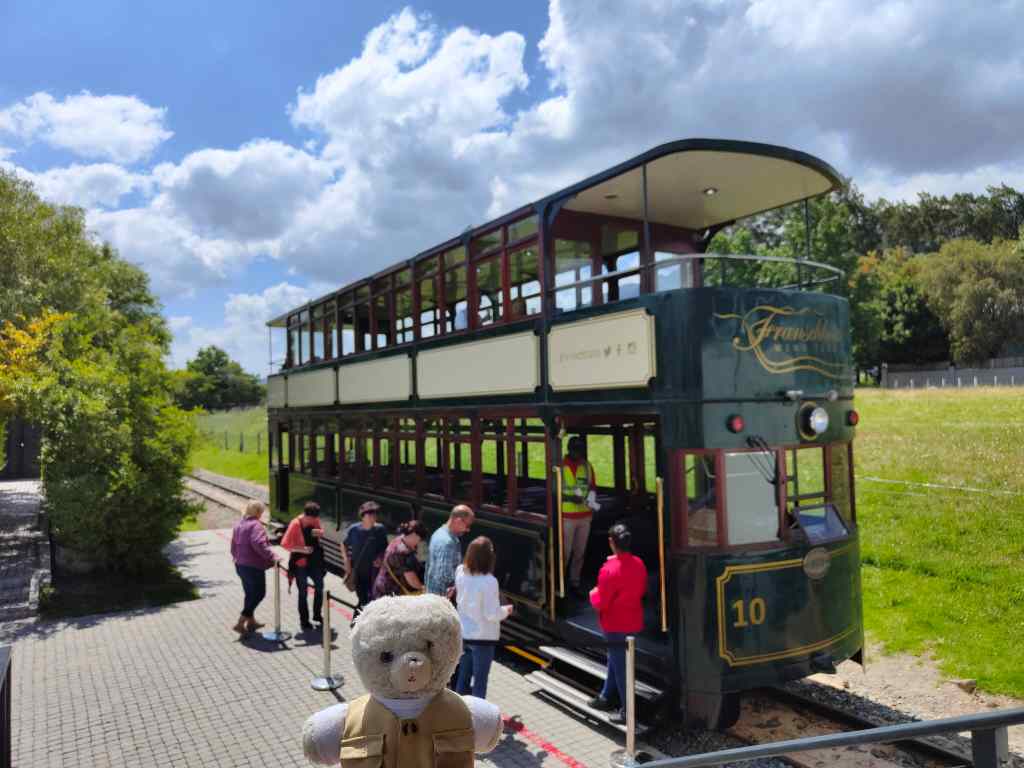
After that, I took the very touristy option of trying one of Franschhoek’s famous wine tasting tours. Many of the local vineyards have got together to offer visitors many different wine routes, with transportation by tram or by bus. The system is a little complicated, and I had to read the instructions a few times before understanding. The most popular route is the Orange one, where buses leave every thirty minutes, and where it is theoretically possible to do tastings in twelve vineyards.
The wine bus
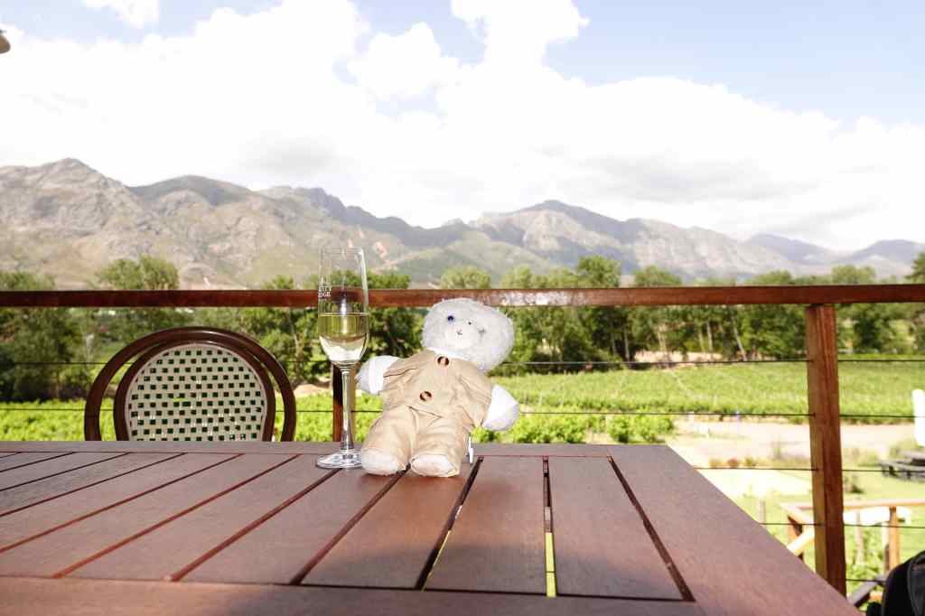
I chose the more sedate Purple Route*, whose buses depart every hour and where you can visit a maximum of six wineries if you start early (I did not) and move on every hour (again, I did not). First on the route was “La Bri”, which offered a rather nice wine and chocolate tasting.
Wine tasting with a knowledgeable sommelier at La Bri, Franschhoek
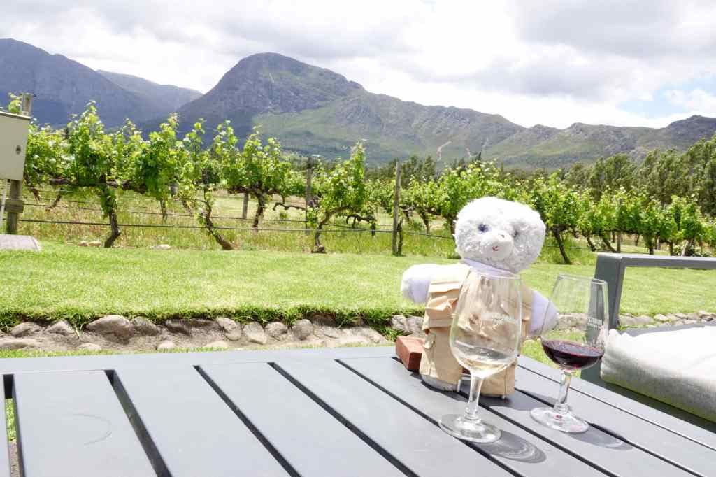
After an hour, the bus arrived to take me to Holden Manz – where I tried a range of white and red wines on a sunny terrace surrounded by mountains. I loved the setting, and since my tasting included six wines, I ended up staying there for two hours. I ordered some lunch, in an attempt to soak up some of the alcohol.
Holden Manz and more wine tasting…
From there, I changed my mode of transportation and took the famous Franschhoek wine tram to Rickety Bridge vineyard, where I tasted some sparkling wines. I was beginning to feel like a rickety bridge myself!
The wine tram at FranschhoekView from the Franschhoek wine tramMy wine tour nears its end – strange how my photos seem to be getting blurry…
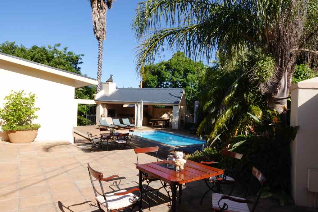
I had time to visit one more vineyard for a tasting but told myself that this would be a little too much, especially since I had booked an excellent restaurant for dinner. So instead, I headed home for a bear nap to sleep off some of the alcohol. On the way I walked through the town, which had very pretty architecture and where every second building seemed to be a restaurant, coffee house or art gallery. I mused that the galleries must do good business from those who slightly overindulge in their wine tastings.
I spent a happy couple of hours napping by the pool of my flat…
My accommodation in Franschhoek
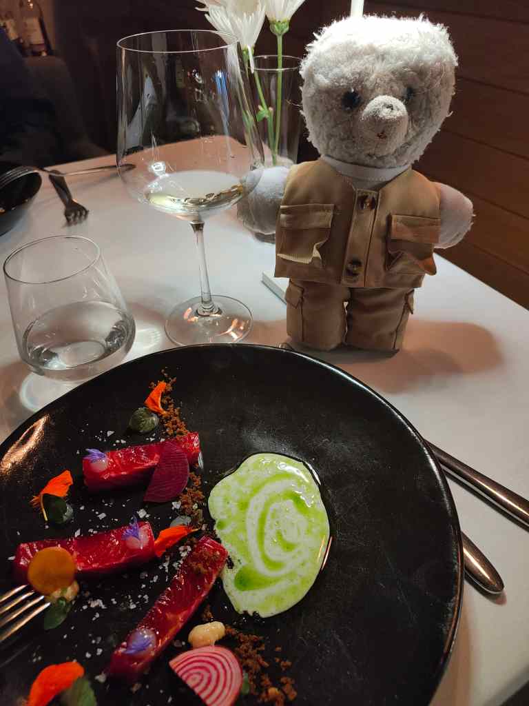
……before heading off for dinner at “le Coin Francais”, one of South Africa’s best restaurants, for a gourmet meal………and another bottle of wine of course. My host had explained, with some pride, that it was possible to walk safely at night in Franschhoek – which was just as well after a day in which I had probably drunk more wine in 12 hours than ever before in my life.
Dinner at “Le Coin Francais”, Franschhoek
*Actually my tram route was the Blue Route. I think. My memory is strangely fuzzy. Purple Haze made a good title for the post though.