Farewell to New Zealand – Wai-o-Tapu and Te Puia

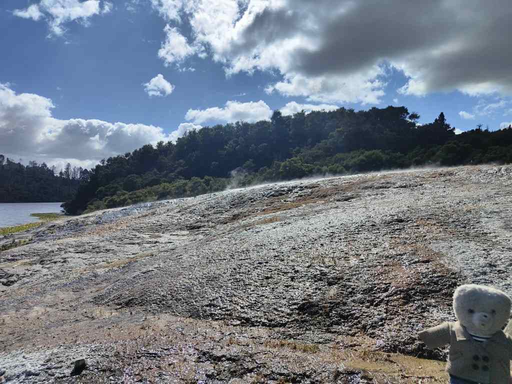
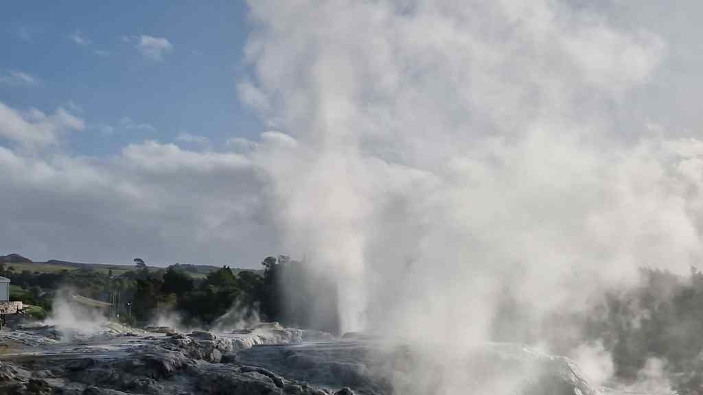
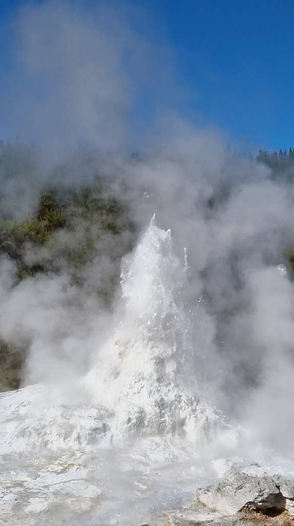
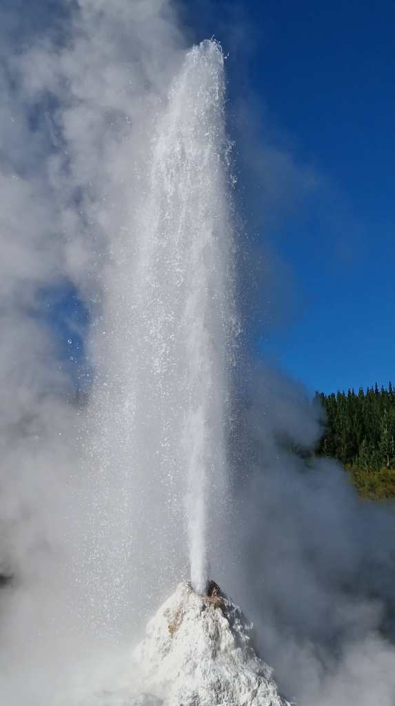
Today was my last day in New Zealand. I have been here nearly four weeks, and the time has flown past. I visited one last geothermal park outside of Rotorua called Wai-O-Tapu. My visit started at Lady Knox Geyser, which erupts at 10.15 every day. I was a little puzzled by the precision of this event – surely a natural phenomenon like a geyser should be at least a bit variable, and what happens when New Zealand goes from summertime to wintertime (as it just had)? All was revealed when I joined a large group of tourists sitting in an amphitheatre around the geyser. One of the park employees explained that the geyser had been discovered when a group of workers had been washing their clothes in the nearby hot springs. They introduced some detergent into the water, which triggered a spectacular eruption (and panic amongst the surprised workers, who ran around naked to escape). In modern times, at 10.15 every day, a park employee puts some detergent down the hole of the geyser to trigger an impressive, if partially artificial, spectacle.

Loading detergent into Lady Knox geyser
Bubbling…..
….spurting….
…and erupting

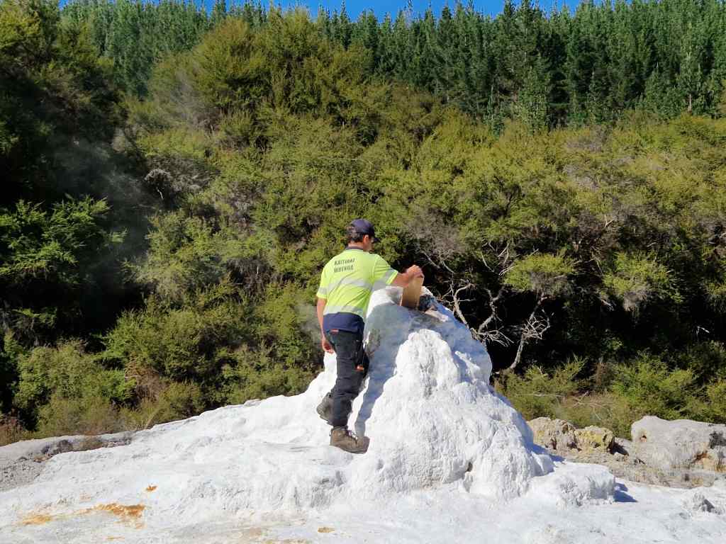
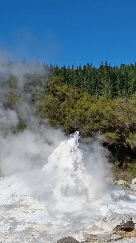
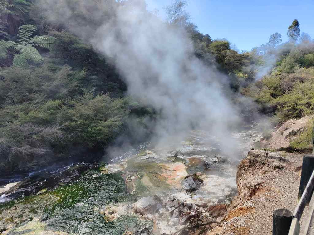
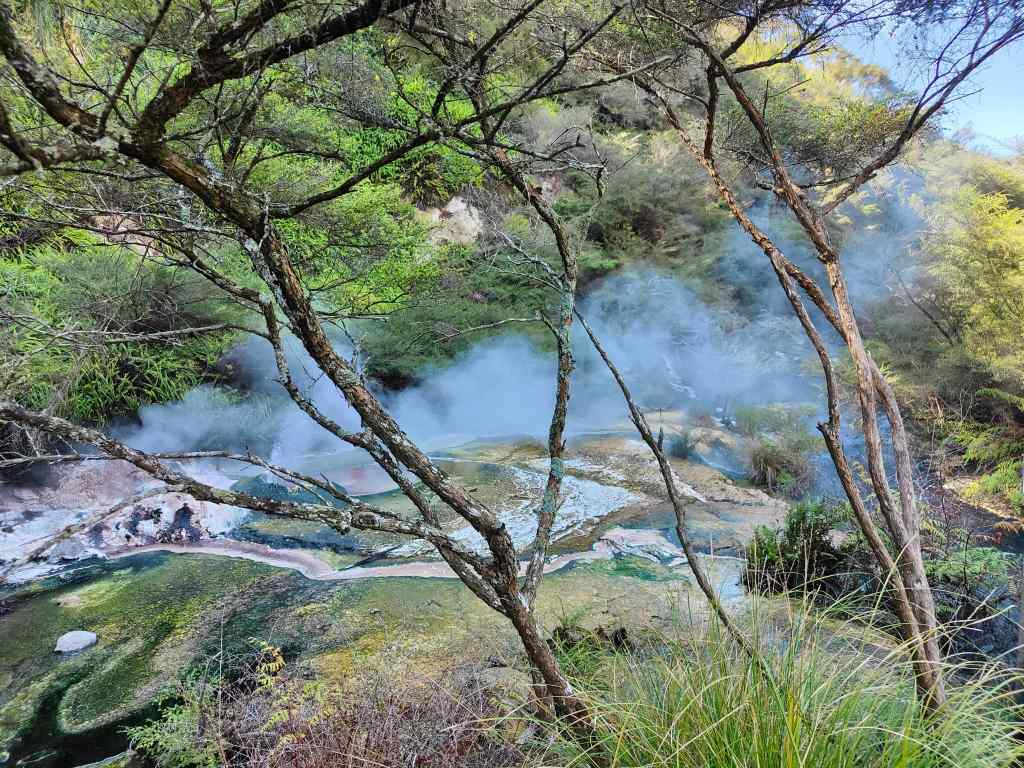
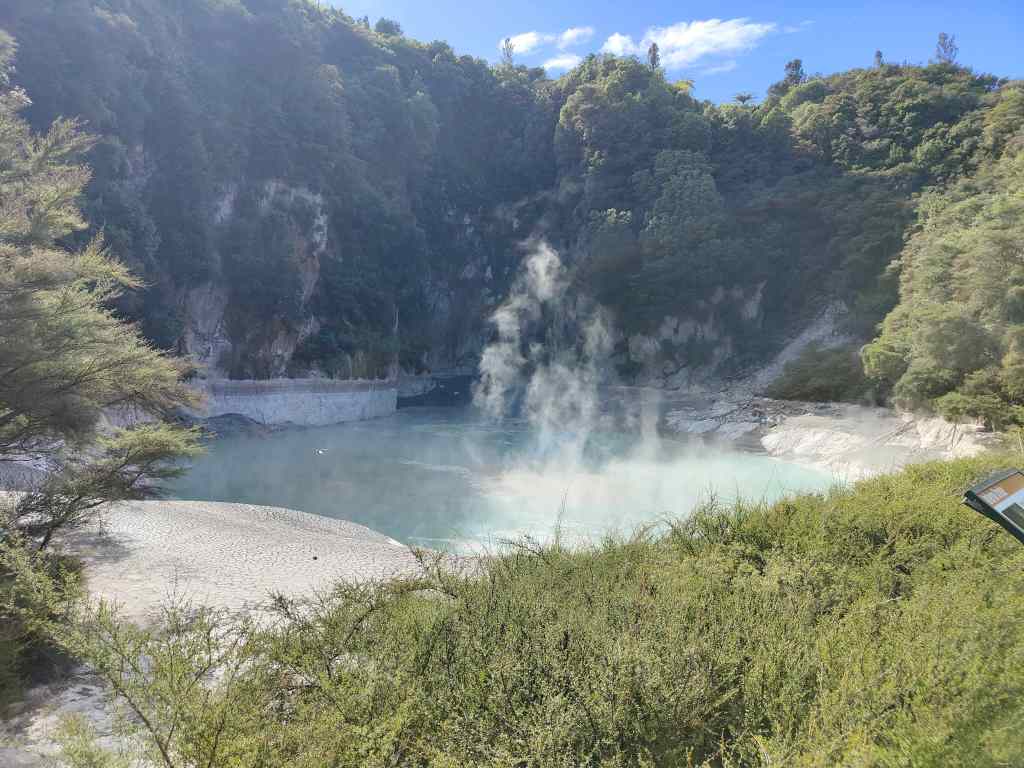
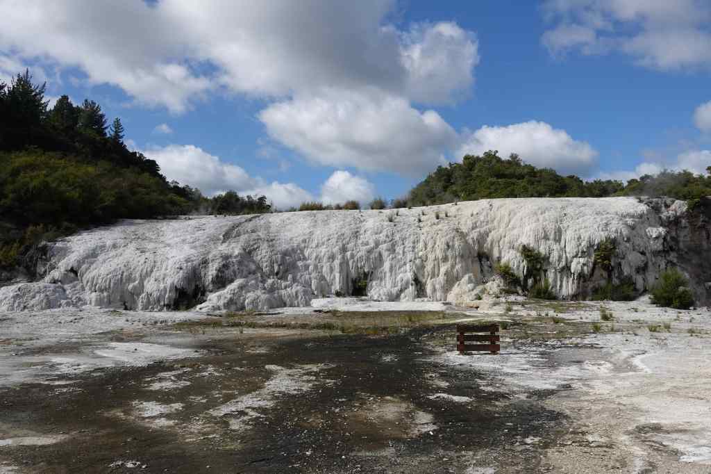
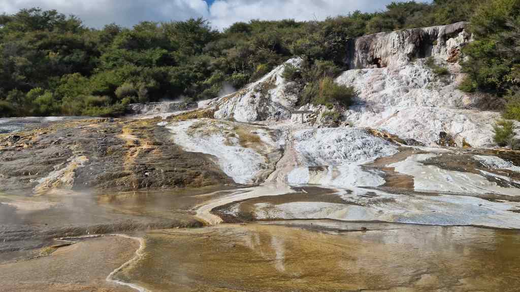
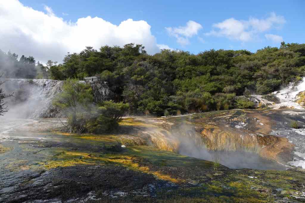
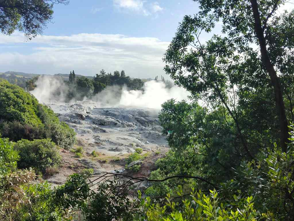
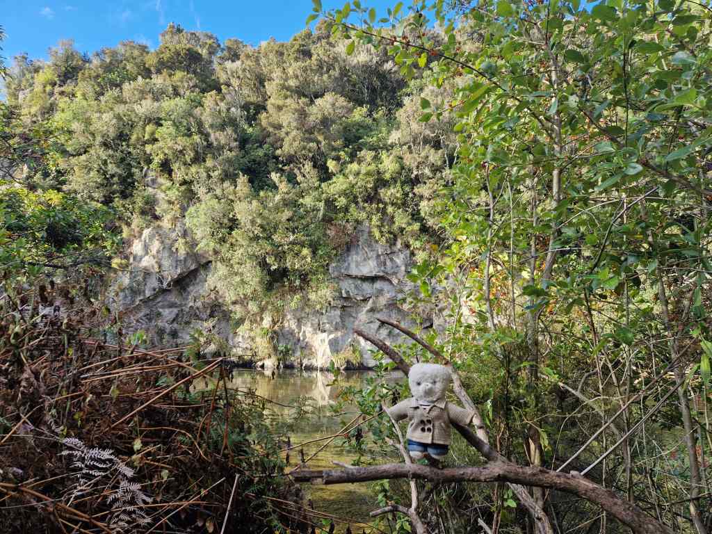
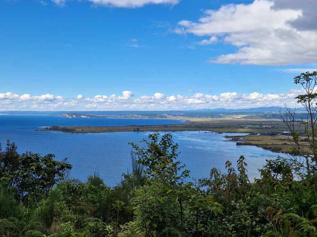
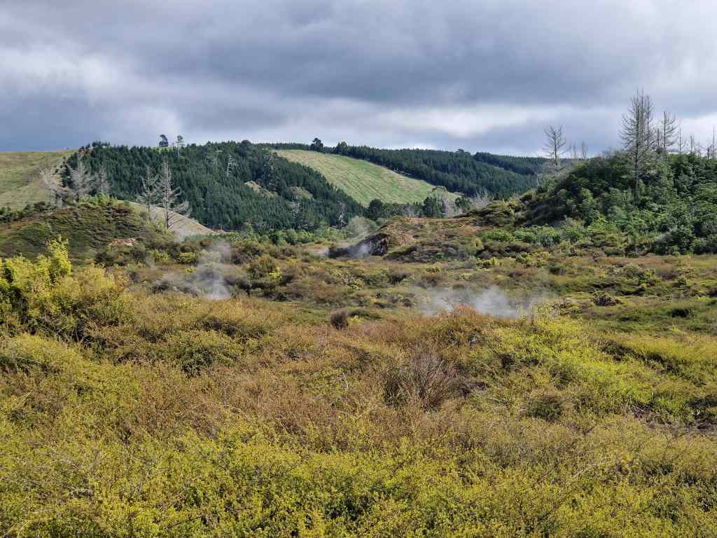
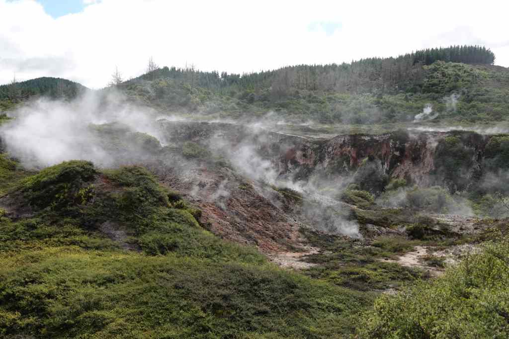
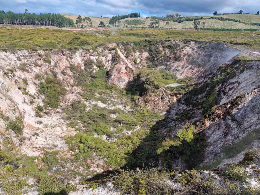
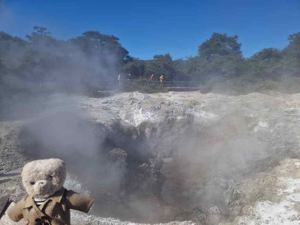
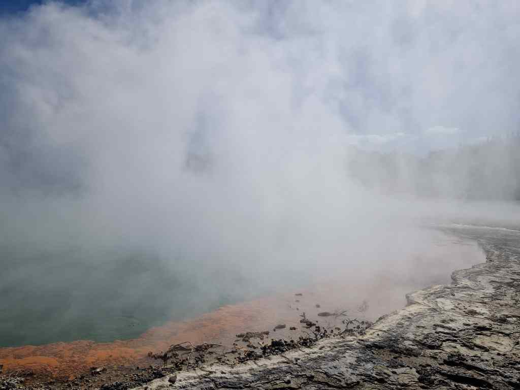
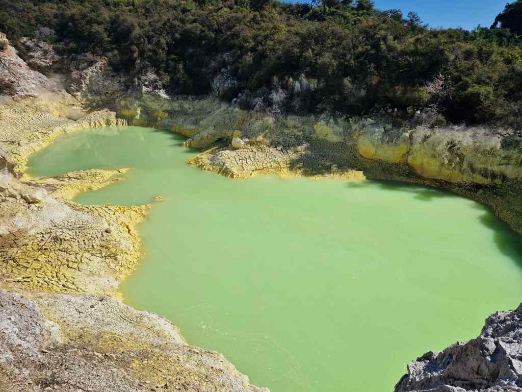
With the geyser show over, the crowd headed to the park’s main entrance to start out on a path through a prehistoric landscape of bubbling mud pools, smoking hot springs and tranquil lakes. Wai-O-Tapu park is particularly known its brightly coloured rock formations, including the famous Champagne Pool.

Steaming Crater at Wai-O-Tapu
Wai-O-Tapu – the Champagne Pool
Wai-O-Tapu – sulphur lined pool
Detail of sulphur at Wai-O-Tapu

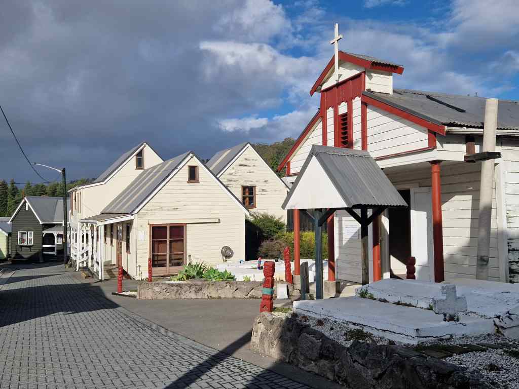
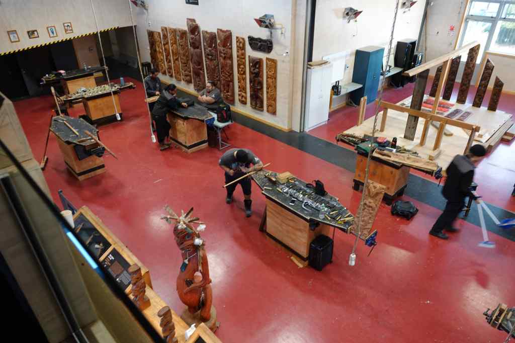
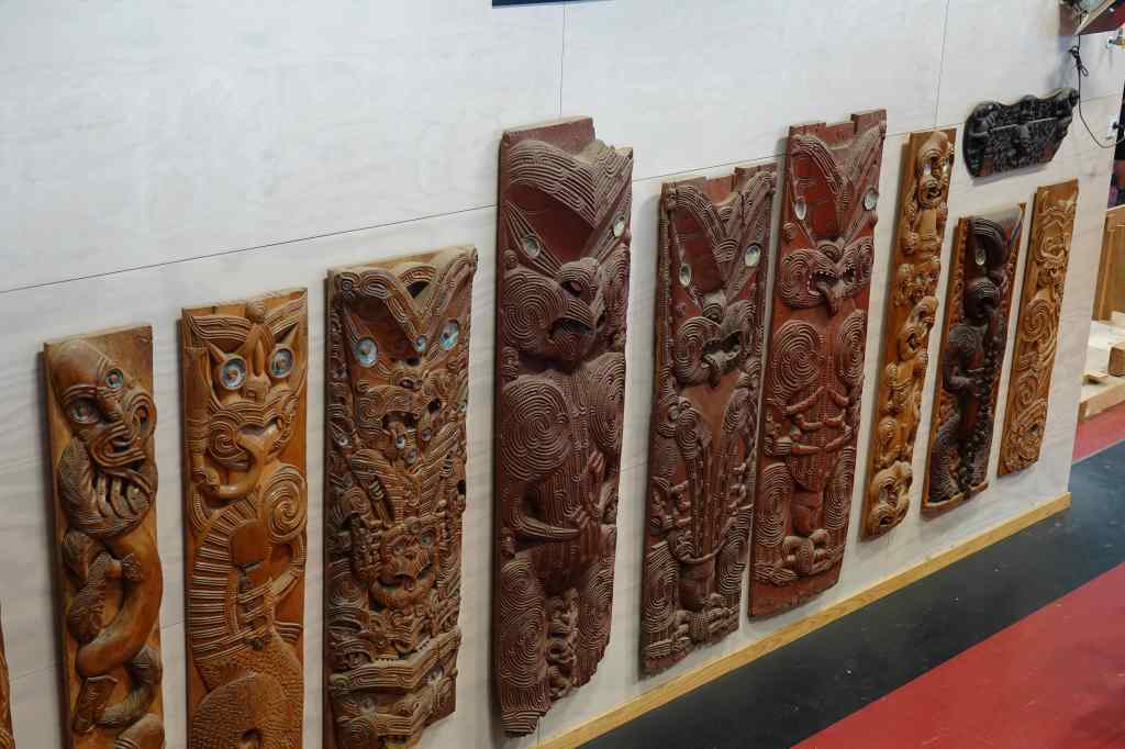
After a couple of hours exploring Wai-O-Tapu, it was time for a complete change – a tour of the Maori cultural centre Te Puia. After the slightly sad experience of visiting the neighbouring village of Whakarewarewa, my expectations were not so high, but I was pleasantly surprised. The visit started with a visit to a training centre where students learn Maori crafts like sculpture (a male activity) or weaving (a female one), where we got to see some wonderful pieces of art.

The carving workshop at Te Puia
…and some of its work

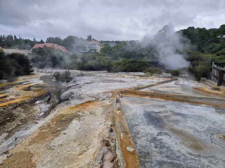
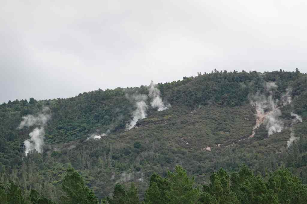
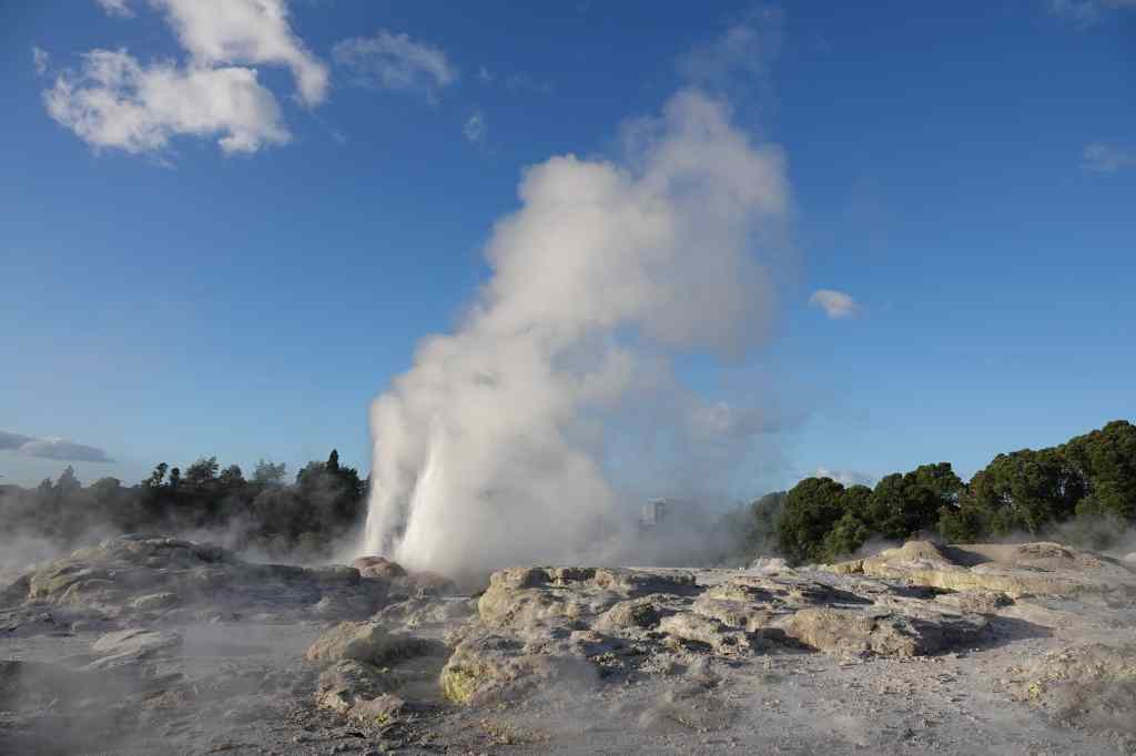
Next, there was a rapid visit to a kiwi conservation centre where I got a glimpse of their recently born, but still very large, kiwi chick. The birds are nocturnal, so during tour hours their enclosures are kept in near darkness, and no photos were allowed. After that was a visit to the Pohutu geyser area, for yet another look at Rotorua’s geothermal area. The viewing area at Te Puia was much closer than at Whakarewarewa, so I could get a really good look, but sadly Pohutu was not very active.

Pohutu geyser at Te Puia

After a buffet dinner our group was treated to a performance of Maori songs and dances in the marae, the large meeting house found in all Maori settlements. Before we could enter, there was an elaborate ritual in which a succession of warriors came to challenge and intimidate the leader of our group, swirling their weapons through the air, sticking out their tongues and making their eyes bulge.

Warriors line up to challenge visitors at Te Puia marae

When that didn’t work the final warrior put down a leaf on the floor in front of our leader, a peace offering showing that we were welcome to visit them. Once everyone was inside and seated, there was another Maori tradition, the powhiri, or speech of welcome – spoken only in Maori. With the lengthy formalities over, our hosts switched to English to welcome us and explain the series of Maori songs and dances they presented, including the famous haka war dance.

Maori song at Te Puia

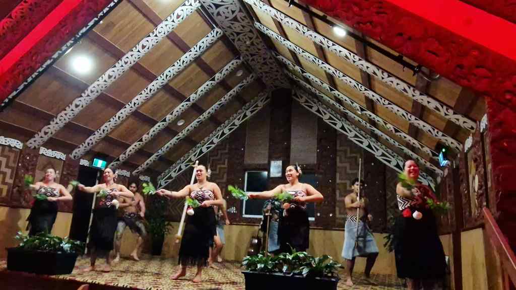
This all probably sounds very touristy, and of course, it was. However, the show was presented with such enthusiasm that I soon found myself thoroughly enjoying the occasion and clapping wildly at the end. The evening still had not quite finished though, and we were invited for one last look at Pohotu – this time at night, with the geyser lit up by floodlights. Around the observation area there were stone terraces heated geothermally, and I sat on one to watch as the staff distributed hot chocolate. I stayed nearly an hour, as our Maori hosts passed among the crowds chatting to people, and was finally rewarded by a small eruption of Pohotu.

Pohutu at Night

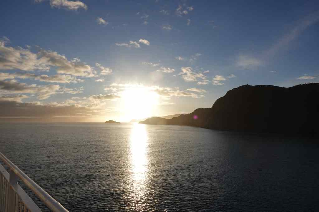
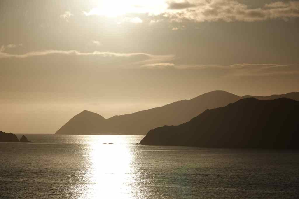
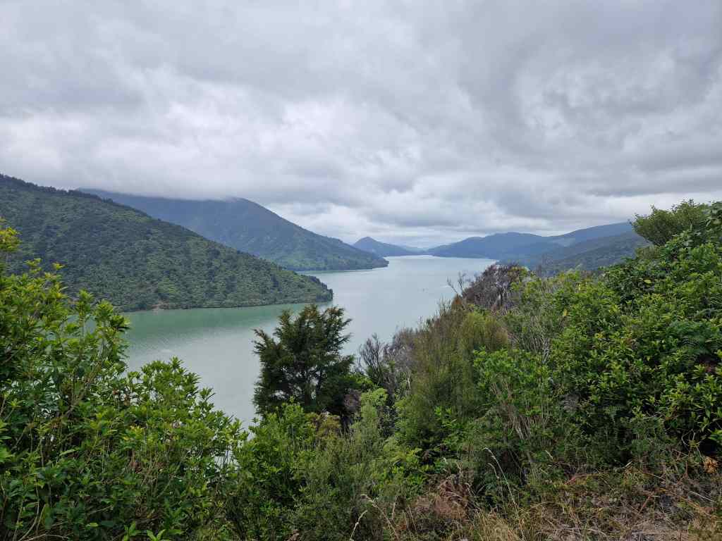
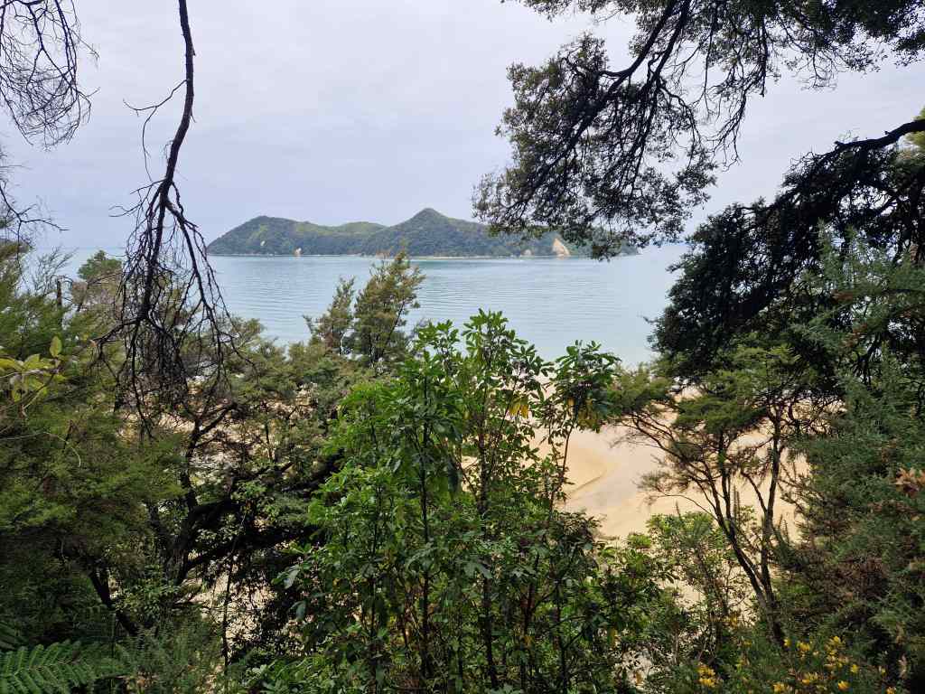
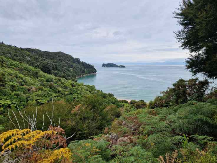
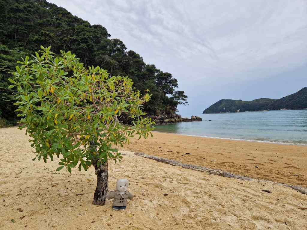
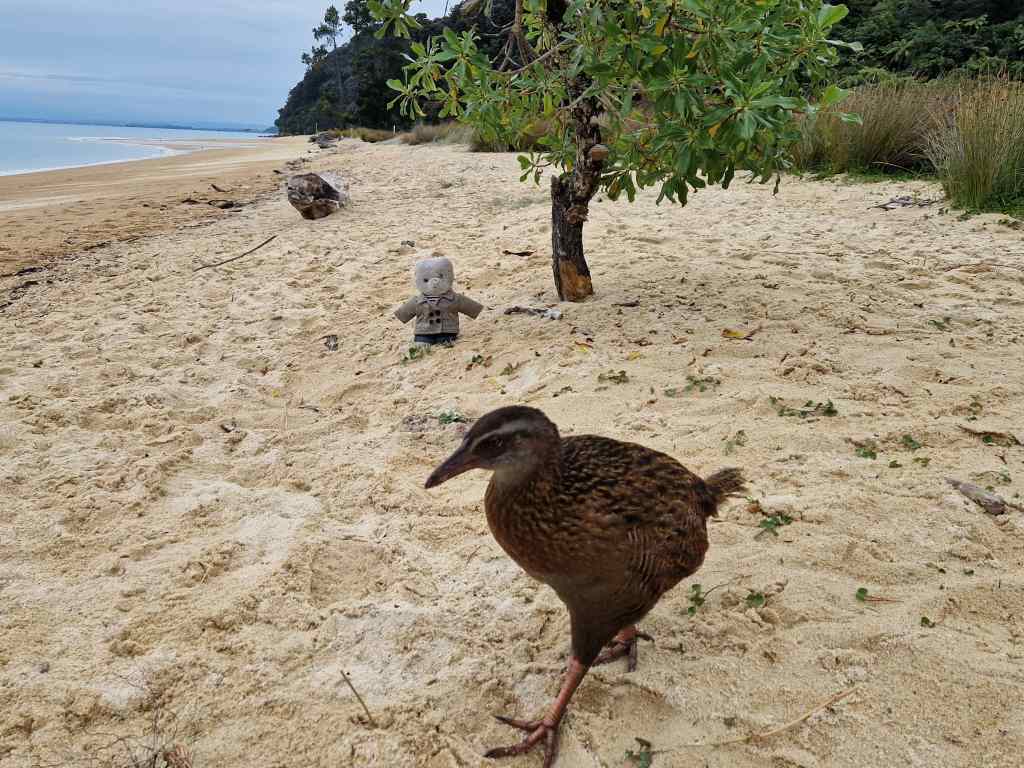
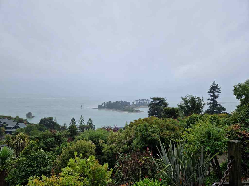
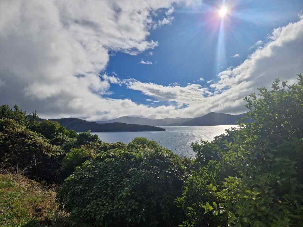
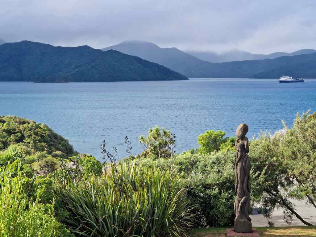
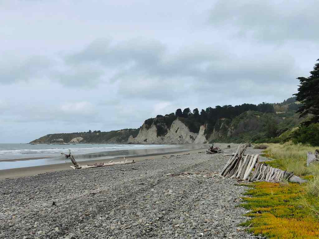
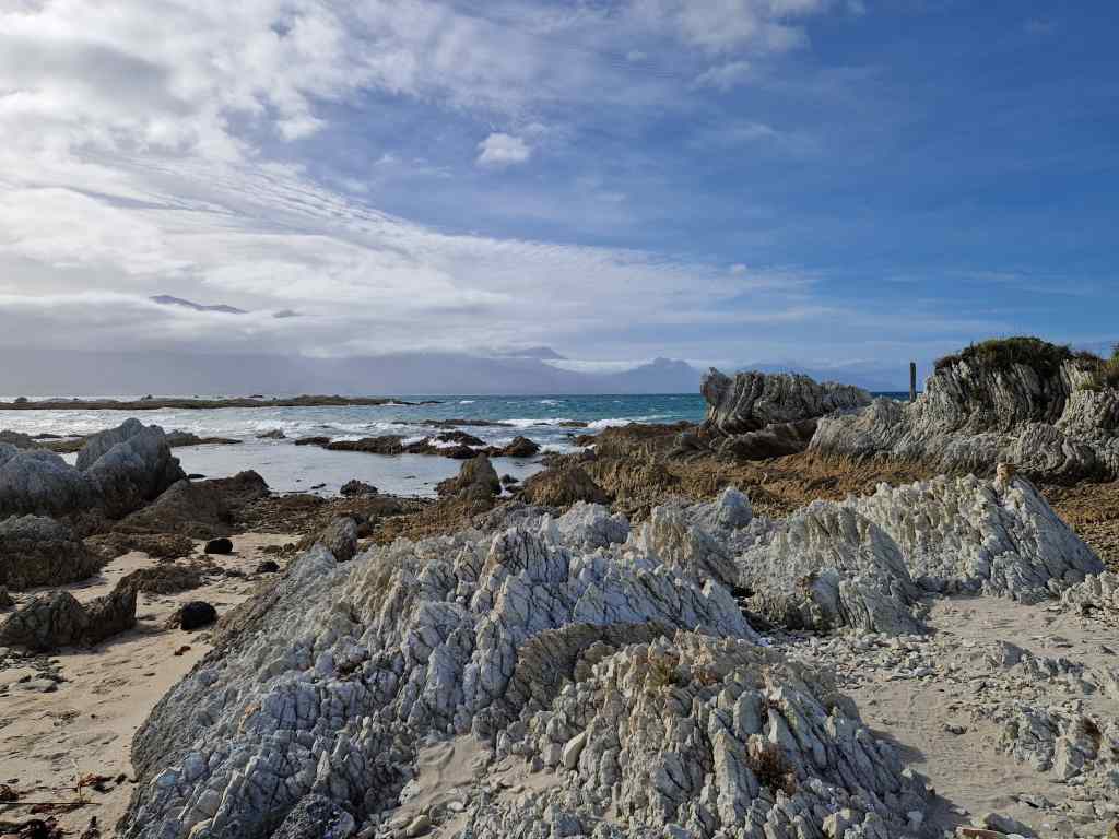
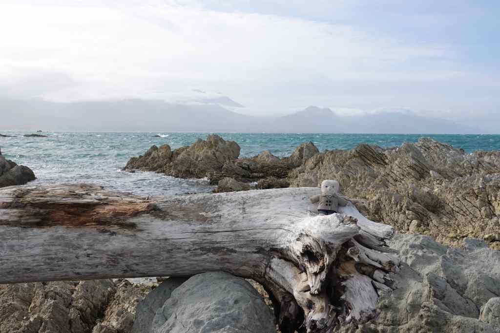
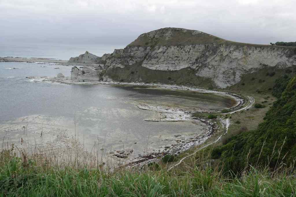
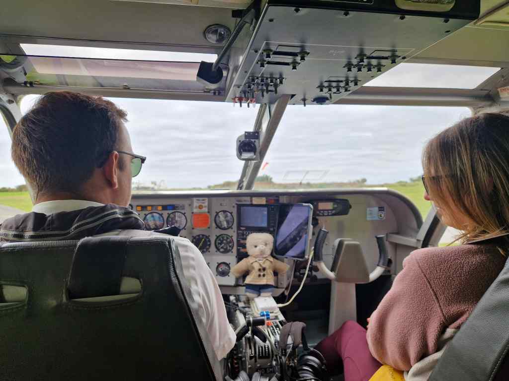
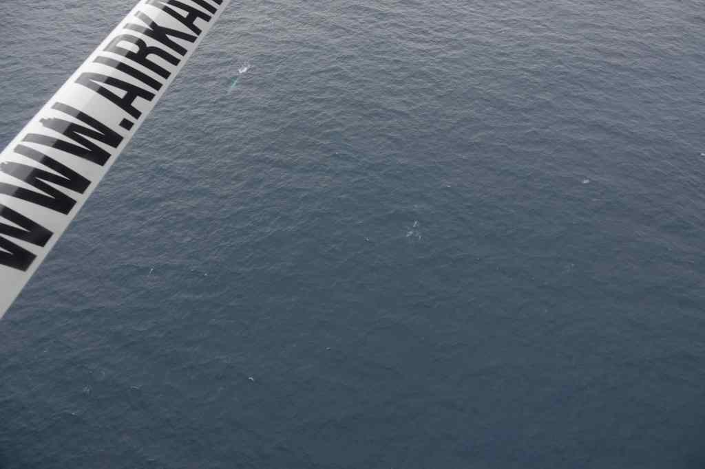
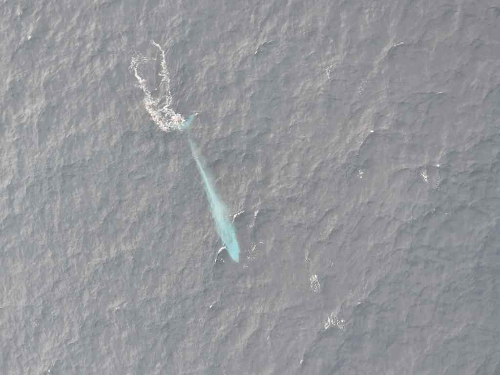
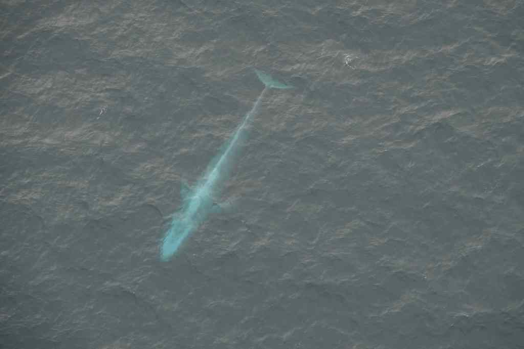
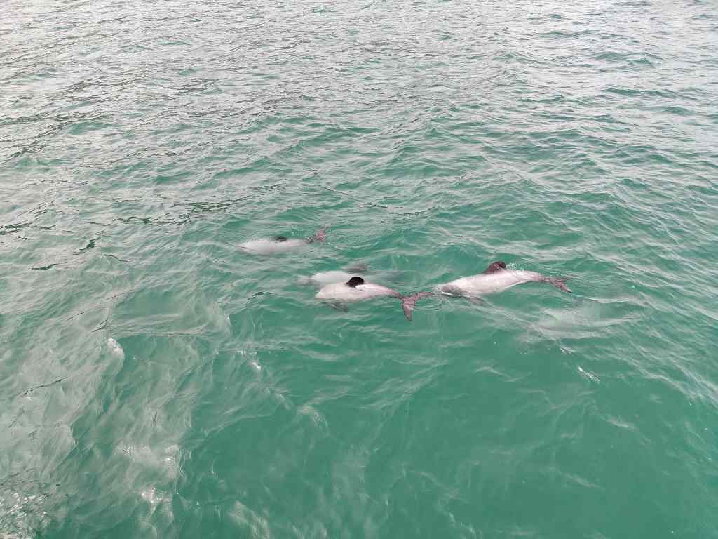
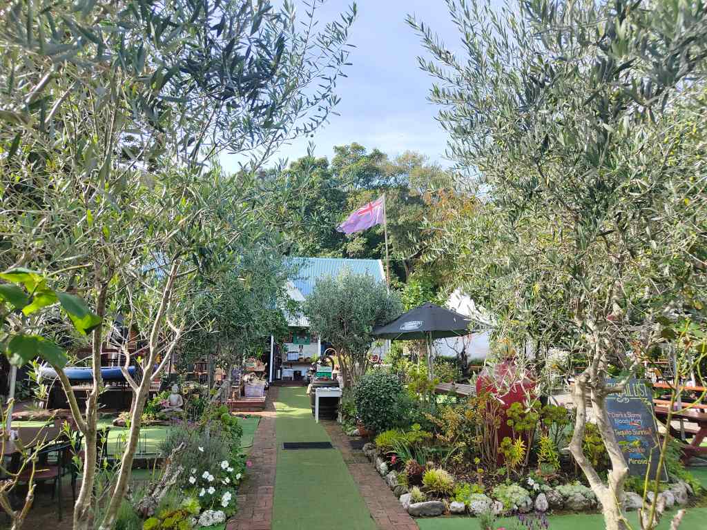
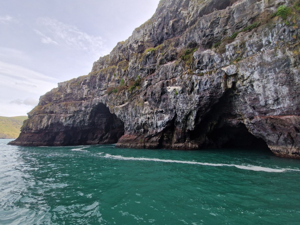
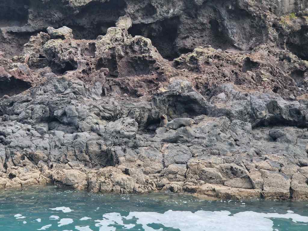
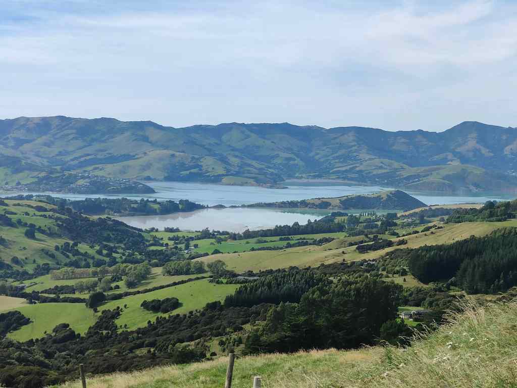
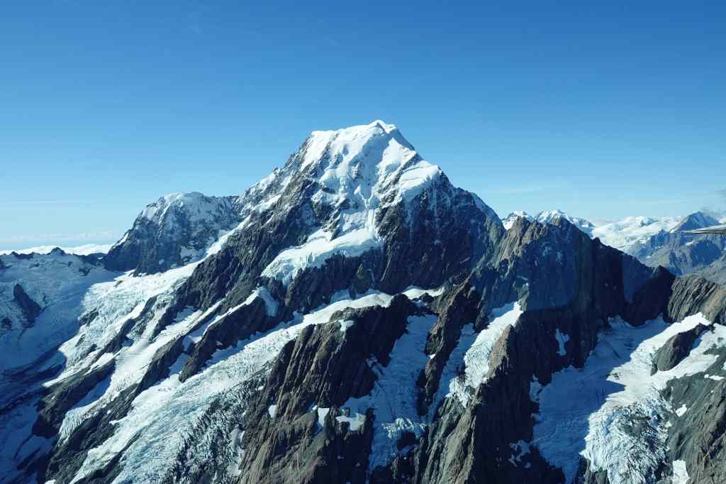
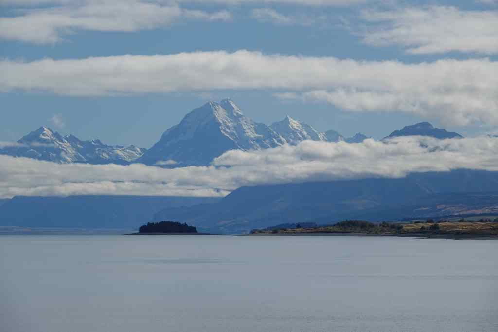
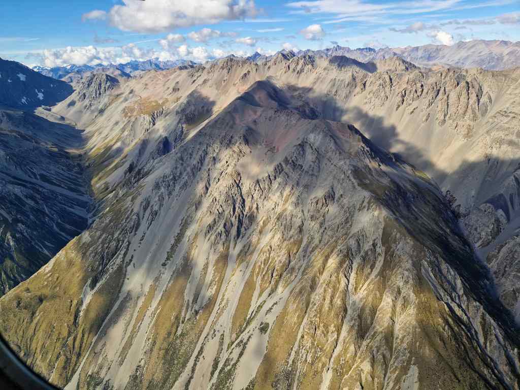
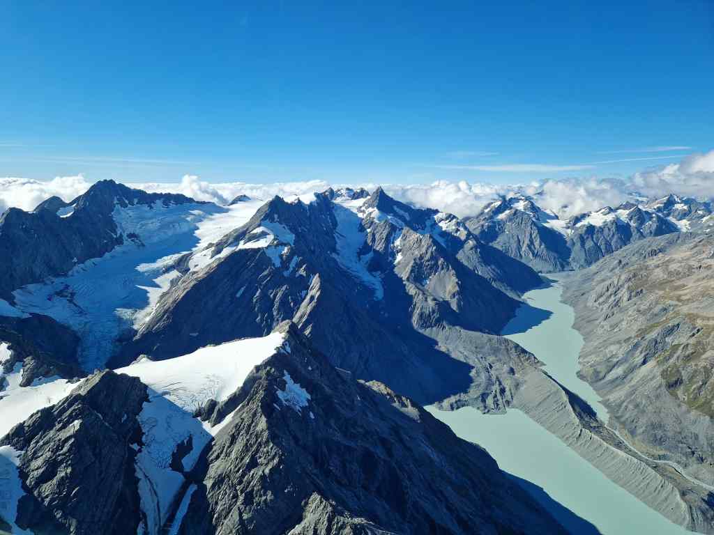
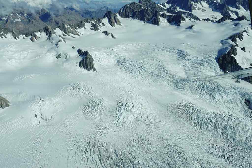
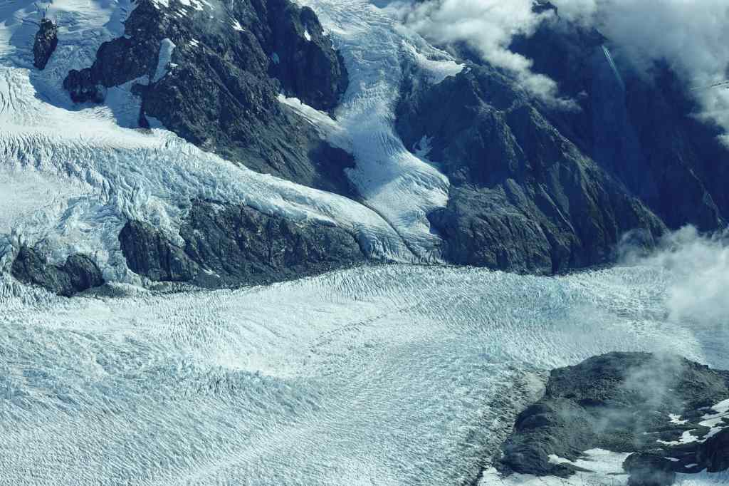
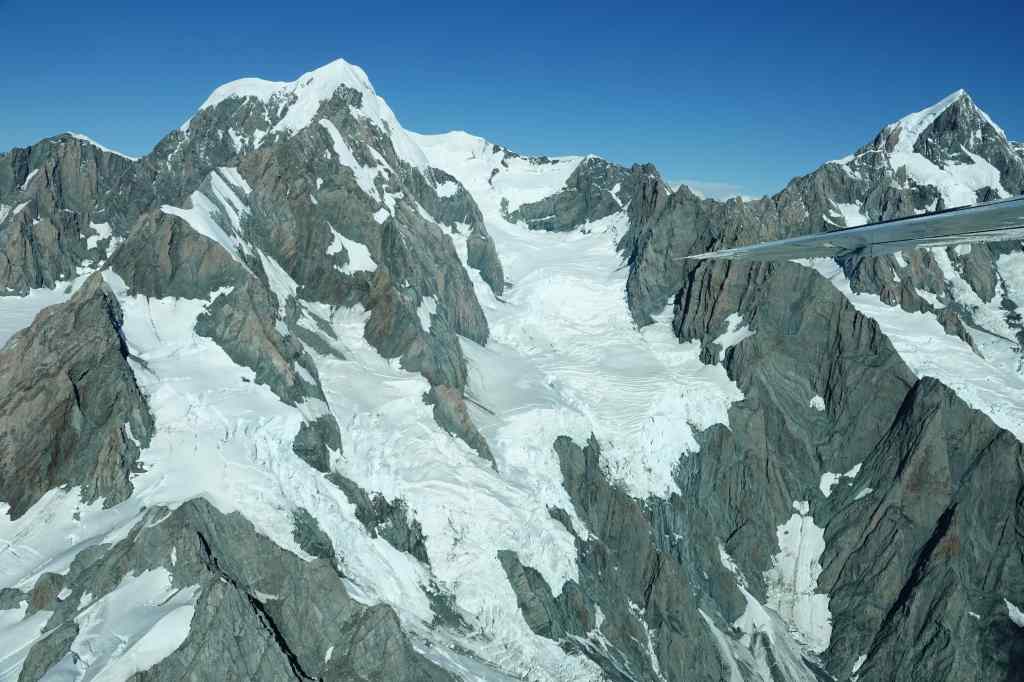
It had been a great day and a good way to end my trip to New Zealand and Australia. Tomorrow I will make the 2-3 hour drive up to Auckland airport, and then the even longer twenty-nine-hour flight back home to London via Doha. New Zealand has been a special place with many amazing things to see, but it is a looooong way from anywhere. Memories that will stay with me forever include flying around Mount Cook, seeing blue whales in Kaikoura, the geothermal areas around Rotorua, hiking to Mount Aspiring’s glacier and sailing Milford Sound. Had the weather been kinder to me, maybe the Marlborough Sounds, Abel Tasman Park and the Tongariro Alpine Crossing would also have made my list of highlights. I think I will be back one day to give them another look, and to visit some of the areas I missed this time – like the country’s sub-tropical far north. But with the huge distance, I suspect it will be part of a round-the-world tour rather than a dedicated trip.

Melbourne Street Art

Previous Post: Rotorua – Kaituna Falls and Waimangu

Rotorua Day 2 – Hiking Waimangu and rafting the Kaituna River

Today I visited a different geothermal park – the Waimangu Volcanic Valley, an area formed when Mount Tarawera erupted in 1886. The eruption levelled several Maori villages, killing many people, and destroyed the Pink and White Terraces which had been a major tourist attraction and were claimed to be the “8th wonder of the world”. It left a caldera, which over the years filled with water to become a much-expanded Lake Rotomahana (a smaller lake of that name had existed earlier).
Today, the Waimangu valley is the world’s youngest geothermal ecosystem, and the only one created as a direct result of a volcanic eruption. It is also once again a tourist attraction, although a less popular one than others in the Rotorua area and I was pleasantly surprised that I often had the place to myself.
The park is visited by walking an 8km path downhill, starting at a huge pool of boiling water (Frying Pan Lake, one of the world’s biggest hot springs)………

Frying Pan Lake, Waimungu Park

…. and following a boiling stream of water that runs through a pleasant valley, past lots of smaller springs…..

The path at Waimungu follows this boiling stream

…. and a boiling caldron of water called Inferno Crater.

Inferno Crater at Waimungu Volcanic Valley

The stream eventually arrives at peaceful Lake Rotomahana, home to much birdlife, including black swans, from where most people use the park’s shuttle bus to return to its entrance.

Lake Rotomahana at the end of the Waimungu Volcanic Valley

From Waimungu I went to visit something completely different – the waterfalls on the Kaituna River. These are found in a scenic valley, to the northeast of Rotorua.

Okere waterfall on the Kaituna River

The area is beautiful, but the real attraction here is the possibility to go white water rafting, a trip that includes descending a 7-metre waterfall (the highest in the world that is open to commercial rafting operators). Unfortunately, the rafting company had a minimum height requirement for passengers, so teddy bears are unable to participate, but I did let my human assistant editor have a go. I watched as his raft approached the famous waterfall….

The Raft approaches Okere Waterfall

and then plunged down….

Half way down Okere Waterfall

….completely disappearing under the water.

Time to look for a new assistant!

I briefly wondered if I should start advertising for a new assistant, but then the raft reappeared from under the foam with all its crew members still on board.

The raft reemerges from the water on the Kaituna River

It was now late afternoon, and I headed back home. After a difficult introduction I was beginning to like Rotorua. The geothermal sites are really exceptional, and it was nice to let my assistant have some fun with the rafting, even if it would have been even better to try this for myself. It is a demanding job working for Trouspinet and my subordinates need to let their hair down occasionally…….

Letting my assistant have some fun for a change (he is in the front)

Previous Post: Rotorua Day 1

Next Post: Rotorua -Wai-o-tapu and Te Puia

Rotorua Day 1 – Oreiko Karako, Whakarewarewa and the Redwood Forest

From Lake Taupo I headed north to Rotorua, a small city that is a centre of Maori culture and also of New Zealand’s volcanic activity. On the way there I stopped at Oreiko Karako, a geothermal park, found after a pleasant twenty-minute detour through picturesque countryside off the main Taupo to Rotorua road. Its relative remoteness meant that there were very few guests.

Typical New Zealand scenery

The geothermal area is accessed by a short boat trip across a lake.

The ferry to Oreiko Karako
Oreko Karako
Entry to Oreiko Karako Geothermal Park

Once on the other side, a raised pathway led past a series of pools of nearly boiling water surrounded by a stunning display of rocks coloured by volcanic minerals. I spent a wonderful hour there, happy to have the place almost to myself.

A spectacular geothermal display
Wonderful colours at Oreiko Karako

Form Oreiko Karako I drove on to Rotorua. Like many other New Zealand towns, first impressions were not favourable. There was a sprawl of ugly commercial development stretching out along the road entering the city. It also looked much rougher than the sleepy places I had seen before; I saw the first beggars of my trip, and also some drunks shouting abuse at each other. I checked in to my bed and breakfast and immediately set off to explore. My first stop was a tour of Whakarewarewa, a Maori village sitting around hot springs and a geyser. Guided tours by local Maori have a long history in this area, first starting in the 1830s to nearby geothermal features called the Pink and White Terraces. These were buried by a devasting volcanic eruption in 1886, but the tradition of Maori showing visitors around Rotorua’s geothermal features and their village lives on to this day.

Houses and the church at Whakarewarewa
The bathing area at Whakarewarewa

Whakarewarewa is one of the last remaing Maori villages and the only one to be located on geothermal land. The Maori houses today are simple modern wooden structures, and the village was quiet with very few people about. It somehow felt rather sad, a feeling reinforced when our guide talked of the damage done to Maori culture by colonialists. The most interesting part of the tour was seeing how the local people use the abundant boiling hot water in everyday life – particularly for cooking and bathing. These gifts of nature have been used in this way ever since the village was first settled, probably around 1325, and made the land a valuable asset that the local tribe often had to defend against marauders – successfully, since village of Whakarewarewa was never once taken in battle and has remained the ancestral home of the Tūhourangi Ngāti Wāhiao people all this time. The tour ended on a viewing platform overlooking several geysers. The biggest one of the group, Pohutu, erupts roughly every hour, so I waited patiently, and sure enough after twenty minutes, a stream of steam and water spurted into the air. The jet from the geyser can reach a height of 30 metres, making it the biggest geyser in the southern hemisphere.

Waiting for Pohutu geyser….
Pohutu delivers

To end my day, I made a visit to Whakarewarewa Forest, which draws visitors to admire its tall redwood trees. You can pay to go on a raised walkway through the trees, but it did not look very high, so I preferred to simply stroll along a short trail in the evening light. The redwoods were impressive…..

Redwoods in the forest

….but in my view the real stars of the forest were the giant tree ferns.

…and giant ferns

It had been a very varied day, with a geothermal park, a Maori village and a forest walk all making up for the less than impressive modern city of Rotorua. But the area still had a lot more to offer, and I looked forward to tomorrow, when I was due to see visit the Te Puia Maori cultural centre and another geothermal park, which was supposed to be even better than Oreiko Karako.

Next Post: Rotorua – Kaituna river and Waimangu

Previous Post: Taupo

Taupo…. but NOT the Tongariro Alpine Crossing

After one night in Wellington I made the long drive half the way up the North Island to a small village sitting on the southern shore of Lake Taupo. At first the drive was a fast but dull motorway, but after a couple of hours State Highway 1 – New Zealand’s main artery – turned into a regular road with one lane each way. At the same time it became scenic, passing through rolling hills and sheep farms. Sadly though there were no rest areas to stop and take pictures from. Then the road climbed and entered a plain of barren scrubland, with three majestic volcanoes towering in the distance. This was the so-called Desert Road and the mountains were in Tongariro National Park, my intended destination for a short walk later in the afternoon and a much bigger on the next day – I planned to do the famous Tongariro Alpine Crossing, a moderately tough 20km hike through spectacular volcanic landscapes. I stopped to take pictures, noticing a strong wind as I left the car and that the tops of the mountains were shrouded in cloud.

Tongariro National Park from the “Desert Road”

When I reached my guest house, my host had bad news for me. The park authorities had closed the Alpine Crossing route due to forecast bad weather. I was surprised; the conditions at ground level looked good to me, but when I checked on the park’s website, I saw that on the mountains, there would be heavy rain, an average visibility of 20 metres, freezing cold and wind gusts of up to 150km/h. A little teddy would be blown all the way across the Pacific to South America, and even if I managed to stay on the ground I would not see anything. The Alpine Crossing was out of the question and even my short afternoon walk would be pointless. Somewhat disappointed, I went for a brief but pretty walk around the local area…..

My short hike near Lake Taupo
View over Lake Taupo from the hill above our village

….and then admired Lake Taupo from its shore. The lake was formed out of the caldera of a huge volcano that erupted around 1800 years ago.

Black swans on Lake Taupo

The area remains highly volcanic to this day and just behind me I could see the first of many areas of geothermal activity that I would see over the coming days – the Steaming Cliffs.

The Steaming Cliffs

The next day I changed plans and drove to Taupo, a town on the opposite side of the huge lake. My first stop were the Huka Falls, a very scenic spot where the Waikato River surges through a small channel.

Huka Falls near Taupo

The area around the falls was extremely pretty and I stopped to explore for a bit.

Scenery near Huka Falls

Next I drove further up river to the Aratiatia Dam, where the river narrows again. Usually the water level after the dam is quite low, but three times a day, water is released from the dam to surge down the canyon and create another set of rapids. I waited patiently until 2pm, camera in paw, and was rewarded with the sight of the transformation of a gentle stream into a raging torrent.

Aratiatia Dam – before opening
Aratiatia Dam – ten minutes after opening

My next stop of the day was a geothermal area called the Craters of the Moon. I walked on a raised pathway over an area where hot steam hissed out of vents in the ground.

Approaching the Craters of the Moon

There were several small craters – results of a vent getting blocked, causing pressure to build and eventually an eruption of steam. It was an interesting walk and a good taster for some of the more famous volcanic sites I planned to visit later on my trip.

Craters formed by steam eruptions

My final stop of the day was at some volcanic thermal baths. I soaked in 39C water for a pleasant hour, watching the clouds go by (I had spent most of the afternoon dodging heavy showers). I had expected to be ending the day exhausted but excited after a long hike through spectacular high-altitude volcanic scenery. Instead, I was chilling in hot water after several pleasant but short hikes. Maybe it was not such a bad outcome after all.

Volcanic Thermal Pools near Taupo

Next Post: Rotorua day 1

Previous Post: From Picton to Wellington

From Picton to Wellington

This morning I had to get up unreasonably early to check in for my ferry across the Cook Strait from Picton on the South Island to Wellington on the North Island. I had booked a crossing at 09.30 but the ferry company brought this forward to 07.30 and also required that I turn up at least sixty minutes before to check in, so I had to sit for an hour in the dark in a queue of cars waiting to board. The ferry was not full and after boarding I had lots of space to sit and relax in front of a large (and – shame on Interislander Ferries – also dirty) viewing window in the passenger lounge. We set sail just as the sun began to rise and I went out on deck to get some last views of Queen Charlotte Sound.

Just before sunrise in the Marlborough Sounds….
…and at sunrise….
…and after…
…and a lighthouse on the North Island near Wellington

After three and half hours of sailing we arrived in Wellington, the capital of New Zealand and its third biggest city – albeit with a population of only 212,000 people. My accommodation was in a pretty villa in the scenic and historic Thorndon area of the city.

My accommodation in Wellington

Right next to my accommodation was a similar house, which hosted a museum devoted to New Zealand writer Katherine Mansfield.

In the Katherine Mansfield Museum, Wellington

I made a brief visit before strolling into the city centre. My walk took me past the “Beehive” – part of a complex of government buildings which houses the offices of the prime minister and cabinet ministers….

The “Beehive”, Wellington

…..and then further on to Wellington’s pleasant waterfront.

Wellington’s waterfront taken from Te Papa Tongarewa

There I checked out the Museum of New Zealand or Te Papa Tongarewa, dedicated to the history, wildlife and geology of the country. Amongst many other things, I was surprised to learn that the Maori only discovered New Zealand about 800 years ago, probably on boats from the South Cook Islands further north – and that it was the very last large land mass to be settled by humans. The museum had a large exhibit about a very special part of the country’s history – the signing of the Treaty of Waitangi between the British government and 500 Maori chiefs. It gave the British sovereignty over the islands in return for protection of the rights of the Maori. However the treaty was, perhaps deliberately, poorly translated with big differences between the English and Maori versions, leading to confusion and conflict.

Maori exhibits in Te Papa Tongarewa

From the museum I followed a traditional tourist route, taking a cable car up to the steep hill dominating the city. The café on top offered an excellent view of Wellington.

Wellington’s touristy but fun cable car
…and the view over Wellington from the cable car station

From the top of the hill, I strolled down through the city’s pretty botanical gardens and then through the suburb of Thorndon back to my house. Despite the very early start it had been a good day – and after two days of rain it was a pleasure to see the sun again. Wellington had been an interesting stop – one of the smallest capital cities in the world, with a wonderful setting, a world class museum and the laid-back vibe typical of a minor provincial town in most other countries. Plus I had finally taken some good pictures of the Marlborough Sounds!

Next Post: Taupo

Previous Post: The Marlborough Sounds and Abel Tasman Park

The Marlborough Sounds and Abel Tasman Park

So far, most of my posts have covered one day of travelling. This post will cover four days visiting two of New Zealand’s highlights – the Marlborough Sounds and Abel Tasman Park. There is a simple reason why two such memorable places get so little text – the weather was awful, and two of these days were almost completely washed out. After my whale-watching flight in Kakoura, I headed north to the tip of the North Island. State Highway One was scenic, with nice sea and mountain views, but slow going, with more than its usual share of roadworks. I reached Blenheim, the capital of Marlborough’s wine country, in the early afternoon. I thought about visiting the city for a coffee break, or even the famous nearby Cloudy Bay winery for a tasting, but Blenheim’s outskirts were so ugly that I hurried on to Picton on the north coast, the entrance point to the Marlborough Sounds.

The Queen Charlotte Sound near Picton on a cloudy day
The view of Pelorus Sound from Cullen Point

The Marlborough Sounds are the estuaries of a series of rivers emptying into the Cook Strait between New Zealand’s North and South Islands, which form a jagged coast with countless islands and peninsulas. Indeed, this relatively small area contains around a quarter of the total length New Zealand’s coastline. The Sounds are very thinly populated, with a few fishing towns, holiday homes, campsites and resorts. Much of the area – and many of the resorts – is only accessible by boat, but a few narrow, winding roads also lead into the region. I had booked a resort on one of side roads leading off from the popular Queen Charlotte’s Drive scenic route which links Picton and the small port of Havelock. The route would have been beautiful….had the sun made an appearance to bring out the colours of the water and vegetation. But instead the weather was stubbornly overcast, and the sea remained a dull grey colour. After an hour of scenic but slow driving I arrived at my resort.

The Mahua Sound near my hotel

It was a beautiful, utterly remote and so laid-back that the hotel did not give guests room keys – this part of rural New Zealand has so little crime that people do not bother to lock their doors. It was just a shame that the sky remained overcast, and the sea water which was bright blue in my guide book remained a dull grey. It was possible to go hiking or to hire kayaks or paddleboards to explore the Sounds, but the weather did not inspire me to try any physical activities and instead I explored the beach a bit, where I found some wild oysters……

…..and then sat reading, admiring the view from my room as the sun set.

The view of the Mahua Sound from my room

The next day I had originally planned to explore the Sounds some more and then devote the whole of the day after to visiting another of New Zealand’s highlights, the Abel Tasman Park. However, seeing a forecast of very bad weather coming, I drove west straight to the park. It has a spectacular 60km coastal track, which takes 3 to 5 days, and the best way to experience the area is either to walk the whole path, or take a water taxi into the heart of the park, walk a section, and come back on a return boat trip. But I arrived too late to take an outward boat and had to content myself with a short walk from the park entrance to Apple Tree Bay, about 5km in.

The Entrance to Abel Tasman Park

Despite my limited programme, I was immediately enchanted by my walk. The path led from the park entrance gates, across the a river estuary…..

River Estuary at the start of Abel Tasman Park

…and then along the coast, past many bays with sandy beaches.

Typical view from the coastal path at Abel Tasman Park

The sides of the path were lined with lush vegetation, including many giant ferns. Not only were the views impressive but the hike was also a treat for other senses; I was accompanied by unusual and beautiful birdsong, quite unlike what I hear back home, and in many places the path had a strong, sweet smell of honey. To this day I still don’t know which plants make this scent, which I smelt often in New Zealand.

Luxuriant vegetation and giant ferns at Abel Tasman Park

I spent a pleasant half an hour on the beach at Apple Tree Bay……..

Apple Tree Beach

…and met a new friend, a weka, one of New Zealand’s many flightless bird species.

On my way back from Apple Tree Bay it started raining. I got back to my car without getting too wet, but then the skies opened and it rained hard all evening and all of the next day. Fortunately, my accommodation was probably the best value placed I have ever stayed in – a large and beautifully furnished apartment looking out over the bay of the city of Nelson. It was the perfect place to sit out some impossibly bad weather. My only activity for the next day was visiting a local winery for a tasting and a light lunch……

Neudorf winery in the rain, near Nelson, New Zealand

…..after which it was all to easy to sit back and admire the view from my flat. I ventured out once to buy some excellent turbot for dinner from a nearby shop on the seafront. Somehow, when the weather outside is this bad, staying in a nice place with a good view gives you a really cosy feeling.

The view from my flat in Nelson

On day two of the storm, I had to check out and made the short drive east back to Picton in heavy rain. I stopped for lunch on the way in the town of Havelock, which is known for its greenshell mussels – which are enormous and very tasty.

Greenshell Mussels in Havelock

I reached Picton in the late afternoon and the sun finally put in an appearance. I used the remaining two hours of daylight driving around the area, seeing what the past two days could have been like if the weather had been kinder.

Picton – Queen Charlotte Sound in the sun this time
The bright blues seas of the Marlborough Sounds finally appear!

Still, I cannot complain – so far I have been fairly lucky overall with the weather, and even under clouds, the Marlborough Sounds and Abel Tasman Park were pretty. At least I have an excuse to come back and visit the area again, hopefully when the sun is out.

Next Post: From Picton to Wellington

Previous Post: Kaikoura – lobster and blue whales

Kaikoura, lobster and my first blue whales

Today I drove up the east coast of New Zealand’s South Island from Christchurch to Kaikoura, a destination famous for its marine life. Around half way along the road, a sign offered a scenic drive around Gore Bay. It wasn’t in either of my guide books but I decided to give it a try, and was rewarded with one of those “off the beaten track” discoveries that makes travelling fun. After a bit of driving past some interestingly-shaped cliffs (the Cathedral Gully), a little path planted with sub-tropical flowers led from the road to the beach. I was almost the only one there, and took time to savour a moment of solitude.

A pretty path leads to Gore Beach
Gore Beach

Refreshed, I completed the rest of the day’s driving, checked into my hotel and spent the late afternoon wandering around Kaikoura’s wild peninsula, which was raised nearly two metres from the sea during a recent earthquake. There were views over the bay to far-off mountains……..

Scenery on the Kaikoura Peninsula track

……lots of fur seals……

Lazy fur seals on the Kaikoura Peninsula

…and birds……

Kaikoura Peninsula – a black and white shag

….and wild scenery and cliffs.

The scenic Kaikoura Peninsula

My hike was probably only about 10km but walking on the pebbly shore and then up and down steep slopes was quite tiring. It was getting dark and cold when I reached my car, with evening approaching. I needed a good dinner to warm me up…….and found one on my way back home at “Cod and Crayfish”, a fish and chip shop on the main road going through the city. What New Zealander’s call a crayfish – in Maori, Koura – would be more often called a rock lobster in other parts of the world. Kaikoura (meaning “eat lobster” in Maori) is supposed to be the best place in New Zealand to taste some, so I enjoyed a feast of lobster and blue cod with chips for my dinner.

A Kaikoura crayfish feast

Although the walk around Kaikoura’s peninsula was nice, most people come here to venture onto the sea in search of whales and dolphins. I was no exception, and next morning I checked in for a whale-watching flight with Air Kaikoura. It is also possible to look for whales by boat, but I remembered my unsuccessful excursion in Iceland when I spent four hours on the sea only to see one small minka whale, so I opted for a shorter and (surprisingly) cheaper option. I set off from Akaroa airfield with a group of six other tourists plus the pilot in a small Cessna plane for a forty-minute flight.

Setting off to look for whales with Air Kaikoura

We all scanned the sea intently, faces pressed to the plane’s windows and cameras in hands or paws, but saw nothing. The pilot’s initially enthusiastic commentary and explanation about the lives of whales trailed off, and slowly people began to drop their arms and sit back in their seats. I looked at my watch – our forty minutes was up. I had resigned myself to yet another unsuccessful whale hunt, when suddenly…..

What’s that? Maybe…..Yes, a blue whale!

…..a blue whale appeared. The blue whale is the largest animal ever to inhabit the earth, and a truly amazing sight. Soon, two more blue whales appeared out of nowhere.

Two more blue whales!

The pilot swooped down, circling so that each side of the plane could get a close look. He was visibly excited, and said that even he only saw blue whales once ever two or three weeks or so, and hardly ever three at once.

Close ups of one of the blue whales

It was a wonderful experience watching these majestic animals making their way through the ocean, and ticked off one of my bucket-list items, that I thought I might never achieve. I don’t normally mention commercial enterprises in my blog, but I really have to say thanks here to Air Kaikoura for extending our flight by nearly half so that we could observe the whales properly. It was a fitting end to my stay in Kaikoura, and I set off on the long coastal road up to far north of the North Island in good spirits.

Next Post: The Marlborough Sounds and Abel Tasman Park

Previous Post: The Banks Peninsula, Akaroa and Dolphins

The Banks Peninsula, Akaroa and Dolphins

Dolphins in the sea near Akaroa

Today I made a day trip from Christchurch to the Banks Peninsula, which was named by Captain Cook after the famous botanist Joseph Banks who sailed with him, and who particularly enjoyed taking samples of the area’s rich vegetation. My destination was the small town of Akaroa on the very tip of the peninsula. When I checked on my computer, the distance (85km) and time (90mins) for the trip were much longer than I had expected, so I hurriedly got dressed and set off. The trip took even longer than scheduled due to some extensive roadworks on the way out of the city. New Zealand roads are generally in excellent condition and driving is usually a pleasure – except when you run into their very frequent road repairs. I realised that I would not reach Akaroa in time for the morning boat ride I was targeting, so instead I booked a later trip and enjoyed driving through the rolling green countryside (reminiscent of England or Scotland) and made a coffee stop at a cute, quirky village Banks Peninsula village called Little River.

Lush Banks Peninsula scenery
A quirky hotel made from agricultural silos at Little River

As I approached Akaroa the names of the settlements began to have a distinctly French feeling – Duvauchelle, French Farm. This is a reflection of the town’s interesting history. in 1838, a French whaler visited the place and bought land there from local Maori chiefs. He returned to France and recruited a group of prospective settlers with the aim of creating a French colony, and they set sail for their new home in March 1840. However, in May of that year, the British signed the Treaty of Waitangi with the main Maori chiefs, giving sovereignty over the whole country to Britain. The French ship made a stop on the North Island of New Zealand on the way, and the budding colonists let slip their plan to form a colony in a local tavern. Keen to quash any idea of competing territorial claims, the British immediately dispatched their navy to Akaroa and the French arrived to be welcomed by the union jack flying over the settlement and a warship in the harbour. After long negotiations, the British offered the settlers five acres of land each or safe passage back to Europe, provided they accept British rule. Most opted for the land and many of their descendants live in Akaroa to this day.

Akaroa, which means “long harbour” in Maori, is a very pretty small town strung out along a couple of kilometres of a….very long harbour. It was full of arty shops and cafes, and most of the street names were French.

Cute café in Akaroa
Little Houses in Akaroa

I joined a small group of other tourists for my boat trip and we headed out to into a large arm of the sea, which stretched inland between tall mountains covered with lush vegetation. Millions of years ago, this had been the site of a huge volcano, about as high as Mount Cook. It exploded and its centre collapsed back into the ground, forming a huge caldera which is now underwater. Today this body of water is home to a big variety of wildlife, including the main target for our tour – Hector’s dolphin, the smallest and rarest of the different dolphin species. Onboard our boat was Buster, the dolphin-sniffing dog, who was supposed to bark at the smell of marine mammals.

Buster, the dolphin-sniffing dog

I was not sure Buster was on top of his game, because he only barked twice – once at the start, for apparently no reason, and once when the captain’s assistant distributed cookies to the passengers. After half an hour we had the first of three encounters with a pod of dolphins. They seemed to busy feeding and largely ignored our boat.

We encounter our first dolphin

With our main objective completed, the captain showed us some of the pretty coastline in the area, including interesting rock formations and some seals.

Sea scenery near Akaroa
Cliffs near Akaroa
Akaroa seals

On the way back, we had two more encounters with dolphins.

More Hector’s Dolphins, Akaroa

The bay is also occasionally visited by killer whales and penguins, but we didn’t see any.

A view from the scenic drive, Banks Peninsula

On the way back from Akaroa I took a scenic route which led up to the mountains surrounding the bay, for some excellent views of the area. It was a good way to end a very laid-back, relaxing excursion to an area with a wonderfully colourful history.

Next Post: Kaikoura, lobster and blue whales

Previous Post: Christchurch

Christchurch (the one in New Zealand)

A huge mural in Christchurch

Today I said goodbye to Lake Tekapo. Before hitting the road to Christchurch, I headed up to the Astro Café at Mt John’s Observatory, situated on top of a steep hill just outside of town. The coffee was good and the views amazing, offering me one last look at Mount Cook.

The view from the Astro Café

From there I made the pleasant drive and uneventful drive to Christchurch, the biggest city on New Zealand’s South Island – albeit with only 400,000 inhabitants. I started by exploring the small but richly stocked botanical gardens.

In the Botanic Gardens in Christchurch

Next, I headed into the city centre. Christchurch was devastated by a severe earthquake in 2011, which killed around 170 people and left extensive damage. It caused two major buildings to collapse and left many others badly damaged – around 1/3 of the city centre’s constructions had to be demolished and rebuilt as a result. On my visit, these efforts seemed to be nearing completion and had left an interesting mix of old and new architecture.

Cantebury University’s old buildings (1917) survived the earthquake

Work was still ongoing to repair the cathedral, whose spire collapsed in the earthquake. A temporary replacement had been built a short distance away and is nicknamed the “cardboard cathedral”.

The “Cardboard Cathedral”, Christchurch

The sides of the newer buildings often had impressive street art, like the huge mural at the top of the page and lots of other examples throughout the city.

Street Art in Christchurch

Christchurch seemed to have a very young population…….and a lot of bars and restaurants to keep them amused. I stopped to have a drink in one of them before heading back to my motel to cook dinner.

New Regent Street in Christchurch is lined with bars

Whilst Christchurch is not a place you would travel across the world to see, in the context of my New Zealand trip it came as a pleasant break from the succession of natural wonders I had seen so far, and I liked it a lot. It had a dynamic, young and above all resilient vibe to it – an impressive outcome after the destruction of the 2011 earthquake. My brief visit left me refreshed for more adventures in New Zealand…..

Next Post: The Banks Peninsula, Akaroa and Dolphins

Previous Post: More Mount Cook

Yet More Aspects of Mount Cook

Mount Cook from the air

Today I made one last short walk in the Mount Cook area to the Tasman Glacier. An easy thirty minute stroll took me a viewpoint over the glacier’s lake where groups of tourists were being taken out on boat tours.

The Tasman Glacial Lake

The glacier itself at the far end of the lake was a dirty gray colour; compared to my brilliant hikes of yesterday, today’s walk was rather disappointing, but at least the scenery around the lake was just as impressive as that which I had seen the day beforehand .

Scenery near the Tasman Lake

Soon it was time to head on to my next destination, Lake Tekapo. The road went back along the west bank of Lake Pukaki and then briefly along its south bank, where there was yet another great view of Mount Cook.

Mount Cook from the south shore of Lake Pukaki

Lake Tekapo was like so many of the other places I stayed in New Zealand – a sleepy small town located on a picturesque lake – in Lake Tekapo’s case the lake is fed by glacier water and is s striking light blue colour. On the lake shore stood the much-photographed and tiny Church of the Good Shepherd, built to commemorate the country’s early European settlers in 1935 (which makes it almost an ancient monument by New Zealand’s standards!).

Church of the Good Shepherd, Lake Tekapo

On the beach near the church, travellers had amused themselves building towers of rocks and pebbles to mark their passage, some of which were strikingly sophisticated.

An engineer must have made the bridge……

After checking in to my bed and breakfast I set off for my main activity of the day – a 50-minute flight around Mount Cook and over the Franz Josef and Fox Glaciers.

Our Cessna sight-seeing plane

The weather was perfect – sunny, no wind and a few clouds and soon I was in the air in a group of sixteen tourists admiring some amazing scenery.

Our route headed up over Lake Tekapo…

and then up a mostly dry river valley……

….lined with the foothills of the Mount Cook Range….

…to the glacial lakes I had seen on my previous walks in the area.

Glacial Lakes at the foot of the Mount Cook Range

Then the plane flew over the huge snow fields on the top of the high mountains….

Snow fields feeding the glaciers

….that feed three huge glaciers – the Tasman glacier (the longest), which flows east, and then the Franz Joseph and Fox glaciers which flow the other way, almost reaching New Zealand’s west coast (which was covered with cloud during my flight).

The starting point of the Fox and Franz-Joseph glaciers
Franz-Joseph glacier descending to the South Island’s west coast

Then we flew past Mount Tasman, New Zealand’s second highest peak…….

Mount Tasman

….before the pilot gave us a close up view of Mount Cook. It was a great way to remember the mountain that had followed me for the few two days.

Mount Cook

I am only a week in to my New Zealand holiday but I think I can already confidently say that the flight will be one of the highlights. My only complaint was that it was over all too quickly, and we were soon touching down at Lake Tekapo airport to reconnect with normal life.

The day had one last adventure in store. I spent the rest of the afternoon sorting out the hundreds of photos I had taken from the flight, before having dinner in a local restaurant. Later that night I headed out again to enjoy the night sky. Lake Tekapo is part of a “dark sky reserve” where light pollution is kept to a minimum – even the town’s street lighting is specially designed to project light only downwards. The organisation Dark Sky Project offers nighttime trips to observatories out of town to see a night sky almost untainted by artificial light; I wanted to book a tour but I was too late and they had all sold out. So instead, I headed to the town’s golf course, parked my car and looked up to see the magnificent spectacle of the Southern Hemisphere night sky. To my surprise, I even manged to take a few photos with my phone.

The diamond-shaped Southern Cross and the Milky Way

Stargazing was a great way to end a memorable and very varied day.

Previous Post: Mount Cook Hooker Valley Track

Next Post: Christchurch

Blog at WordPress.com.

Up ↑