My previous post covered the last full day of sightseeing I had in Namibia. The next day I woke early to see the rising sun casting long shadows over my lodge.
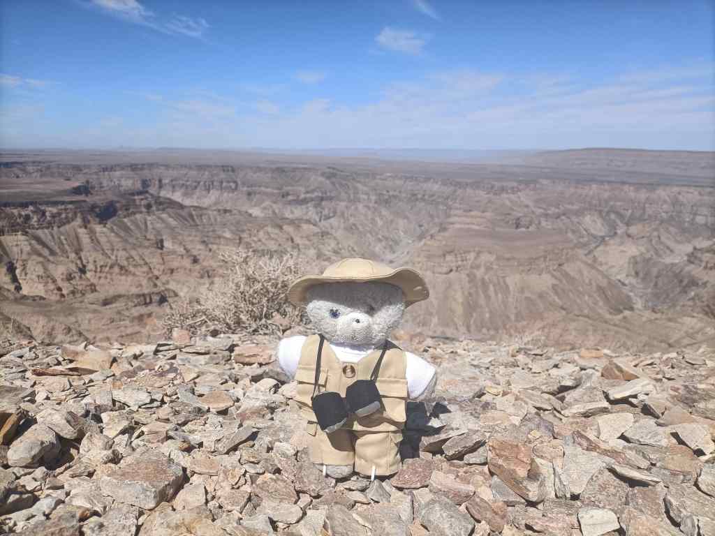
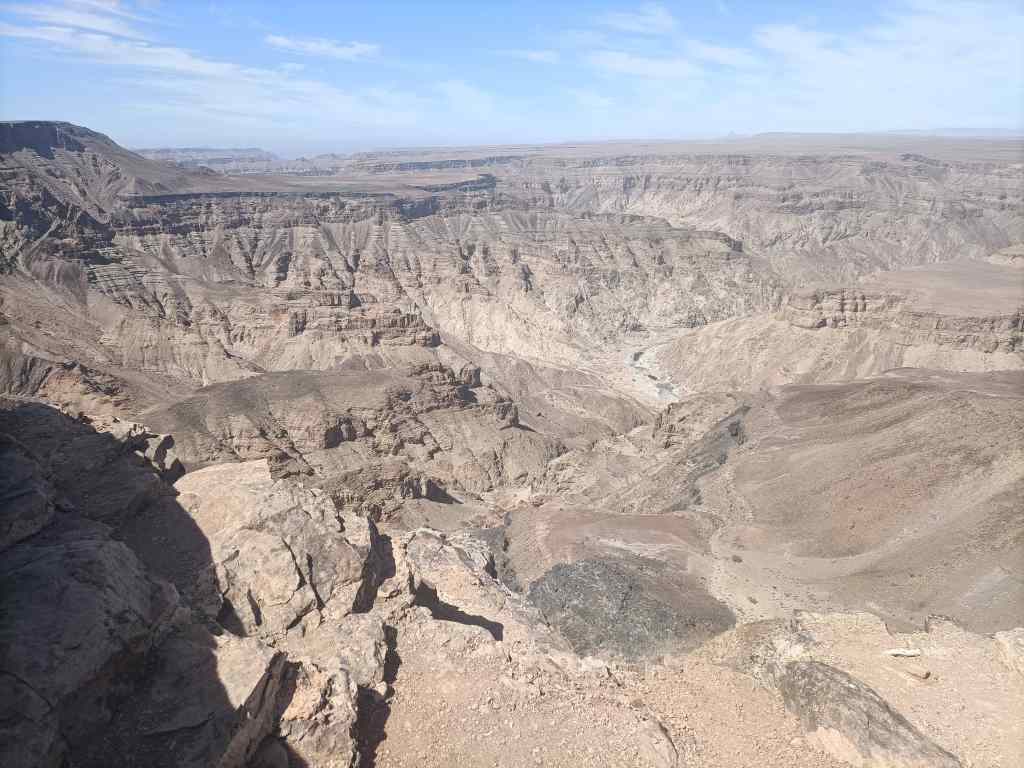
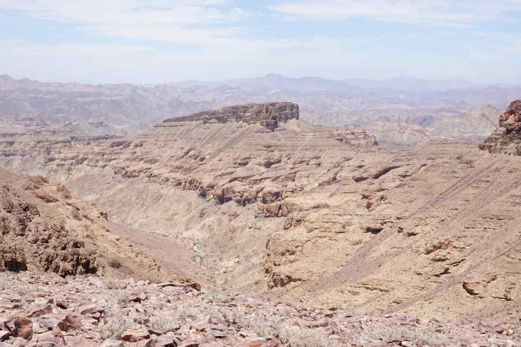
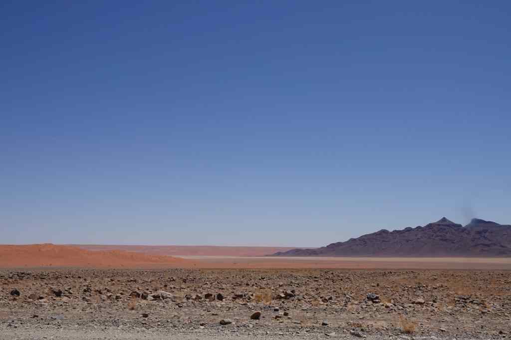
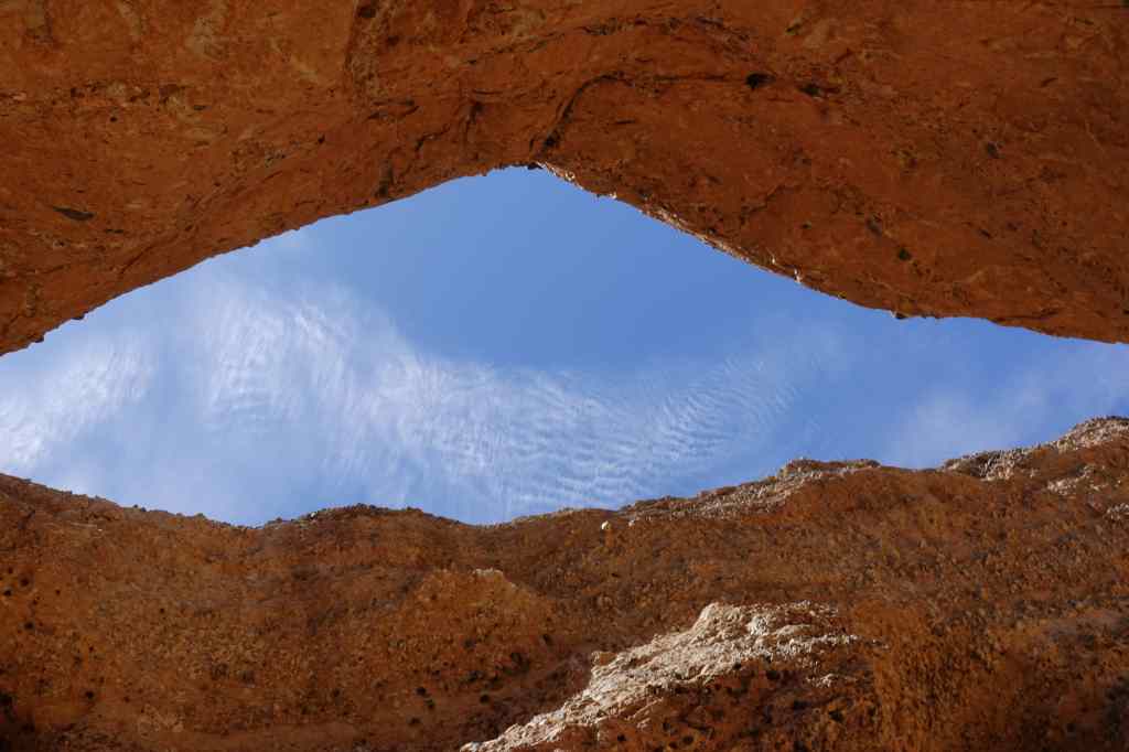
Next, I revisited Fish River Canyon briefly in the morning….
Early morning at Fish River Canyon
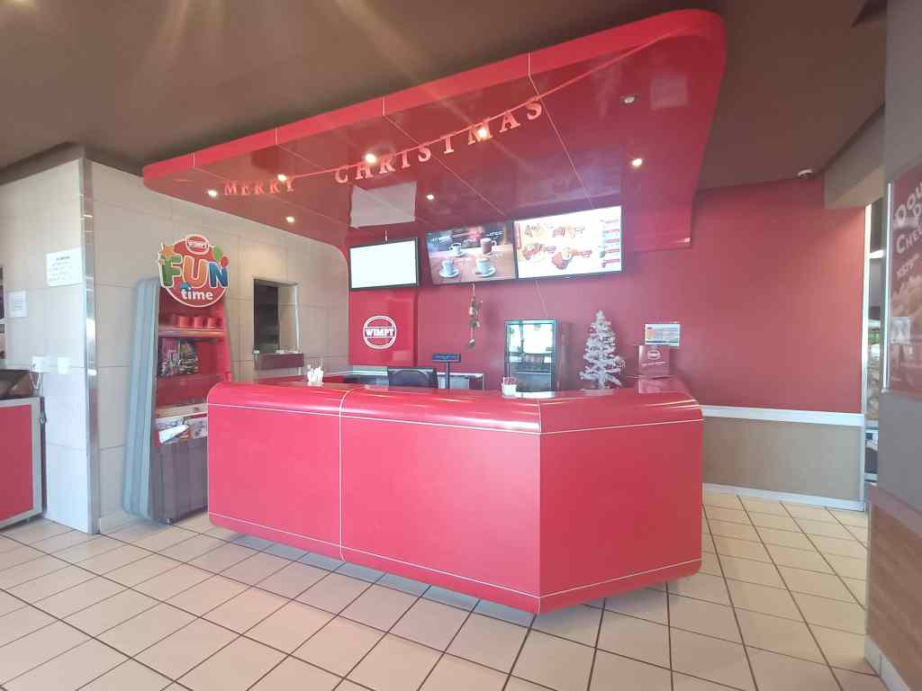
…before making a rather boring six hour drive north, to a lodge near a town called Mariental. This was not a destination in itself, but a convenient place to spend the night on the long, long way back to Windhoek. Now I know why Fish River Canyon is so little visited – it is so far away from anywhere else. Namibia’s B1 is surfaced, flat and fast, but must be one of the most boring roads on the planet. The “highlight” of these six hours was finding a Wimpy restaurant at a service station – I though they had died out, but apparently they still thrive in Africa. The décor was wonderfully sixties kitsch.
I thought it was extinct…..Wimpy lives on in Africa
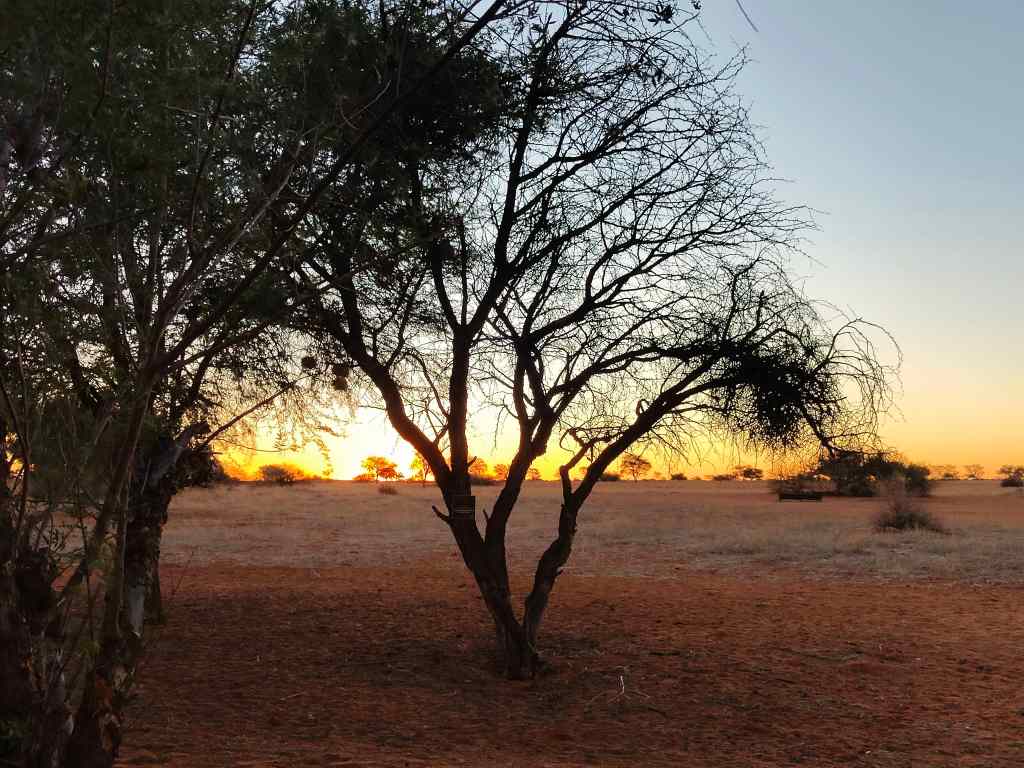
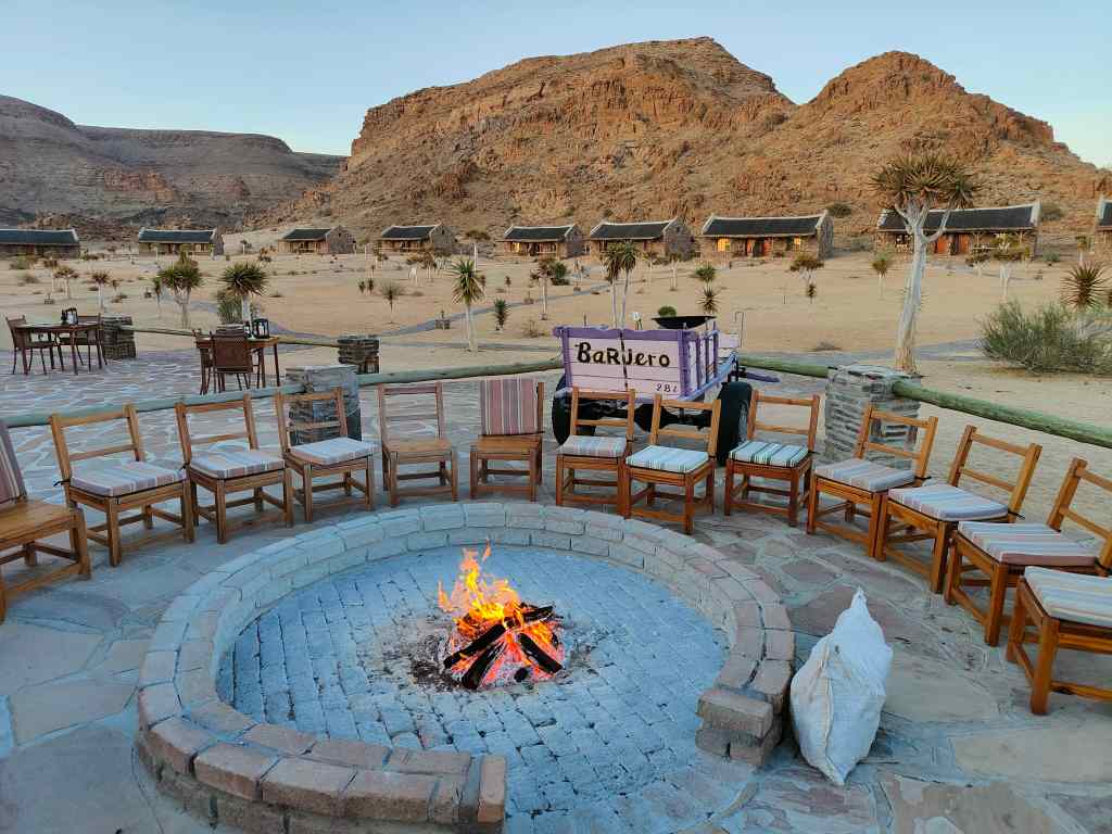
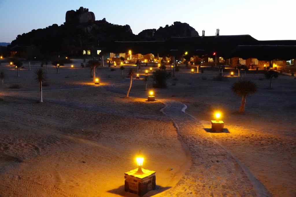
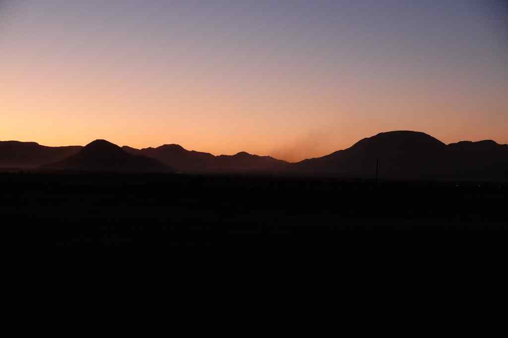
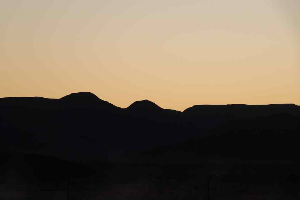
I finally arrived at around five, having driven all day (or so it seemed). I had originally intended to go on the lodge’s “sundowner” game drive, but since I was tired, I decided instead to spend my last night in Namibia sitting on the big swinging chair on my balcony, and watch the sunset with a good glass of wine.
Watching the sunset over the Kalahari desert
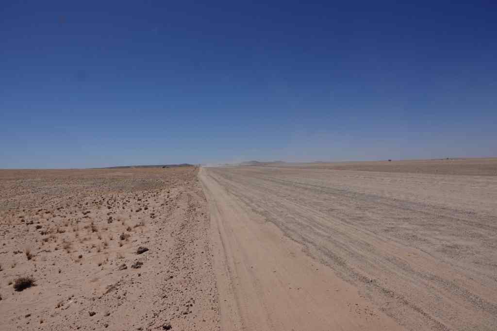
The next morning, I got up early and continued the road to the north – another 3 ½ hours – to Windhoek airport, to catch my early afternoon flight to Cape Town, where my adventure will continue. On returning my hire car, I found out that in 20 days I had driven over 5,000km – at an average speed often limited to 70km/h by Namibia’s gravel roads. Namibia has many world class attractions, but getting to them requires a big investment in time.
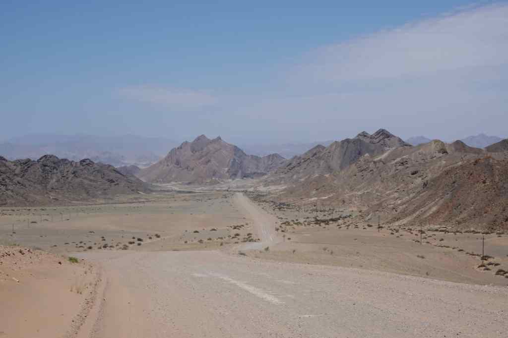
Be prepared for lots of this driving around Namibia…..
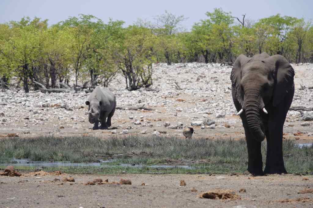
So that was the end of my Namibia trip – now I am off to South Africa for more adventures. It’s time to share a few photos of the highlights. First, there was the wonderful park of Etosha and its wildlife…..
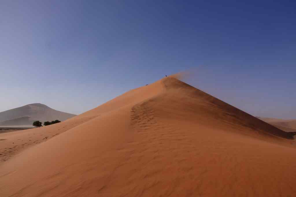
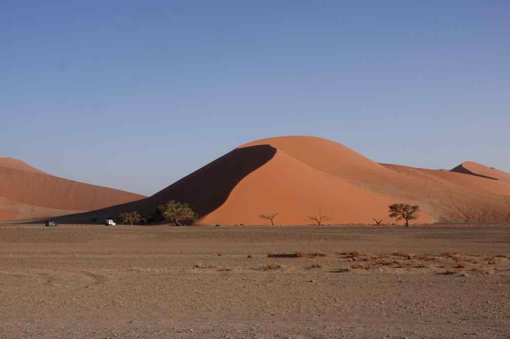
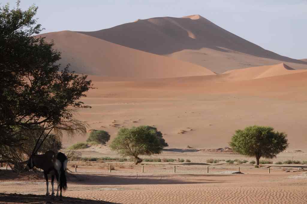
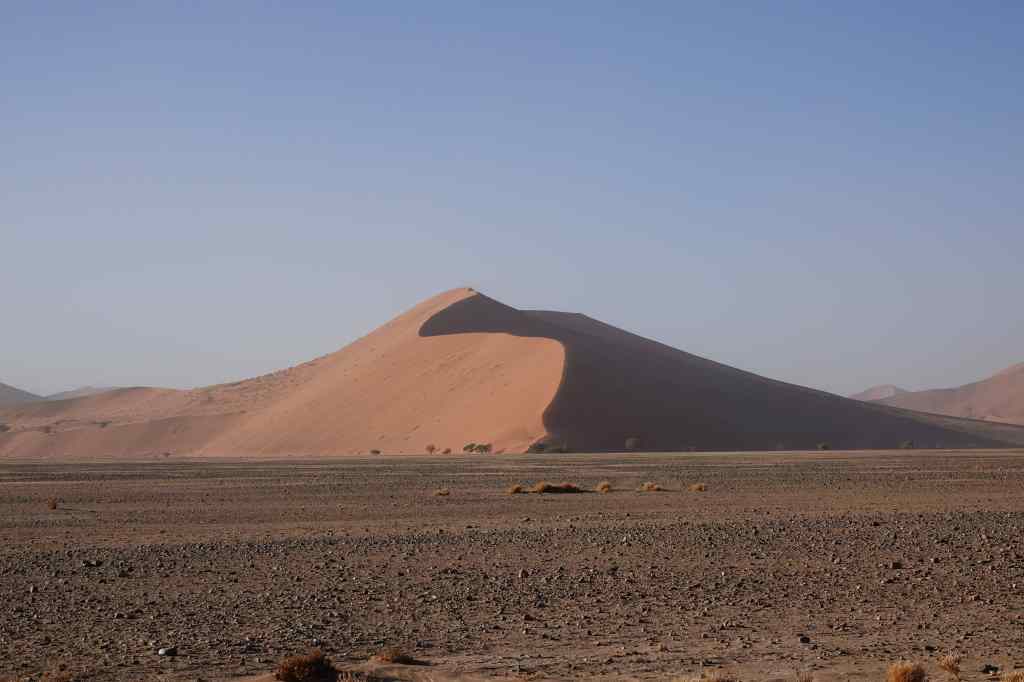
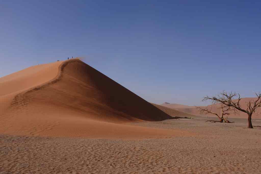
Namibia’s next world class attraction are the dunes of Sossusvlei
Sossusvlei!
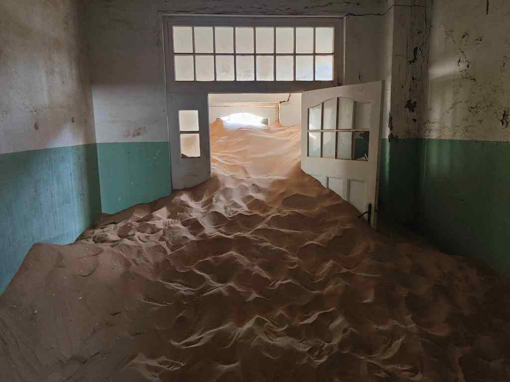
I will also always remember Kolmanskop, as a symbol of the power of nature over man……
The irresistible force of nature at Kolmanskop
….and my solo drive down to Eagle’s Rock in Fish River Canyon. It is not often you get a view this like all to yourself.
Eagle’s Rock, Fish River Canyon
I was keen to see if South Africa can match Namibia as a travel experience. Keep reading my blog to find out!
Today was day sixteen of my tour around Namibia and it saw me return to traditional sight-seeing. My destination was Fish River Canyon, the world’s second largest canyon (after the Grand Canyon in the US) and one of Africa’s most impressive – and least visited – natural wonders. It was located a short drive from my lodge. First, I drove to the main viewing point, where there was an information display and a few other tourists taking in the awesome view.
The main viewpoint at Fish River Canyon
Fish River Canyon is 160km long, up to 27km wide and 550 metres deep. It was formed initially by a rift between the earth’s plates and then was deepened by the action of glaciers during the Ice Age 300 million years ago. For the last 60 million years the canyon has been deepened further by the flow of the Fish River – although in the dry season, the river is reduced to series of ponds of stagnant water.
I enjoyed the main viewing area for a while and then set off to the “Hiker’s Viewpoint”, for an alternative perspective. This was the starting point for a tough, 5-day, 80km hike covering the deepest and most impressive parts of the canyon. A steep path led down, marking the start of the trek. Once in the canyon, walkers have only two further emergency exits up steep cliffs before the end of the hike 80km away. Prospective hikers must register months in advance, be prepared to be totally self sufficient for 5 days, and produce a medical certificate attesting to their fitness before setting off.
The “Hiker’s Viewpoint” and main path down into the Fish River Canyon
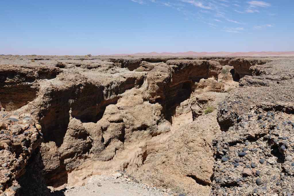
From the Hiker’s Viewpoint I retraced my steps and then found a track heading south along the canyon edge, which I had missed earlier. The track was totally unmarked, and very few other visitors seem to have found it; without my guidebook, I would never have known it was there. After a few km it stopped at another viewpoint, where I had the views completely to myself.
Sulfur Springs ViewpointMore Fish River Canyon views
From there, another very rough track, suitable only for 4×4 vehicles, led further south. After another thirty minutes it led to the final viewpoint – Eagle Rock – which was perhaps the most impressive of all. I sat there for around thirty minutes, making sure I was fully rewarded for the effort of getting there.
Eagle Rock Viewpoint
On the drive back I passed one other car struggling to reach Eagle Rock – maybe the place gets ten visitors per day, for one of the world’s best views.
Back on the main road I headed south to Ai-Ais, a name that means “burning water” in the local language, where there are some hot springs, a government-run resort, and the place where the 80km canyon hike finally ends. I walked a short distance down the hiking route to see what it was like. To me, it was a rather unexciting dry sandy riverbed, and must have been an anticlimactic way to end an epic hike through the world’s second biggest canyon.
Must be an uninspiring end to an 80km trek…
I ended my visit at a big swimming pool filled with warm water from the hot springs. A group of schoolchildren kept me amused with their games.
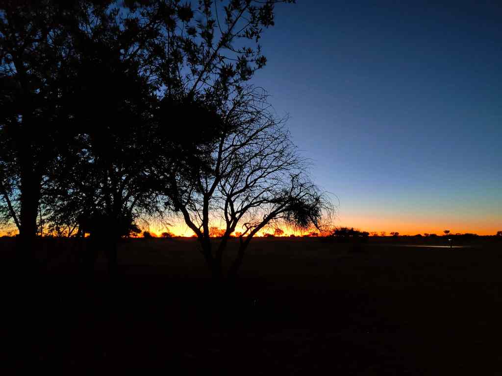
Suddenly, I realised that apart from the people serving me in restaurants and hotels, I had hardly met any local black people. The owners of hotels and businesses had all been white, and my fellow travellers were all white. The legacy of Namibia’s colonial times lives on, even if today’s government is trying to improve the lot of poor black majority. I reflected on this thought whilst enjoying yet another glorious African sunset back at my lodge.
Today I had one of these long drives that had become typical of my holiday in Namibia – from Luderitz in the southwest corner to Fish River Canyon, in the south. There was a direct – and rather dull looking – main road that could take me most of the way there. But since I had already travelled part of this, I decided on a detour around the southernmost part of the country, the border with South Africa.
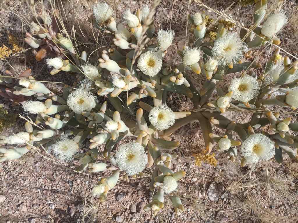
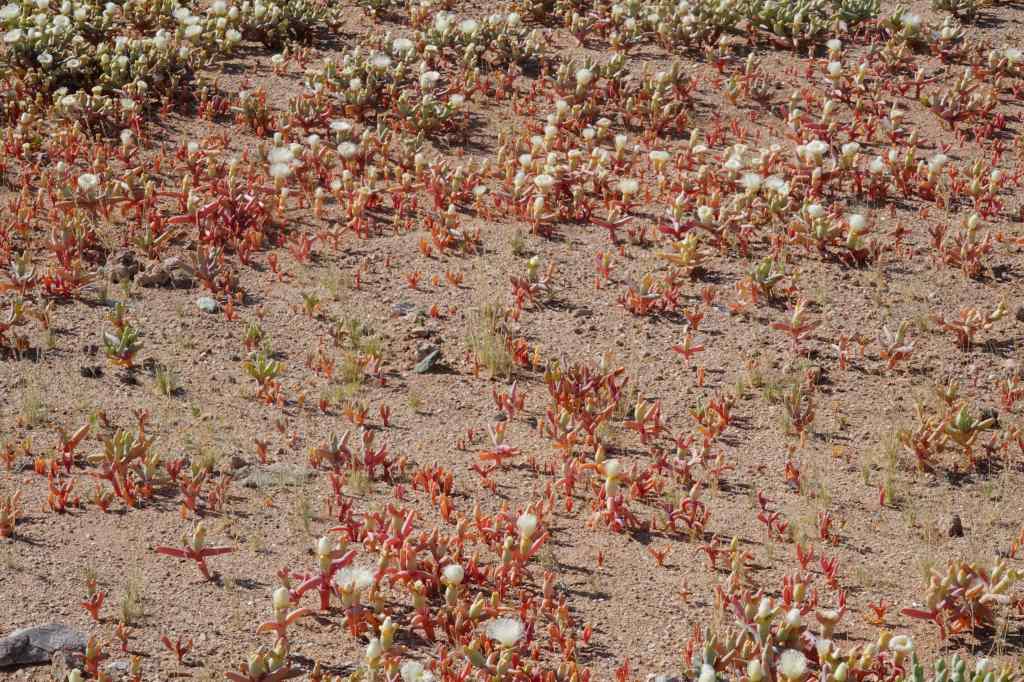
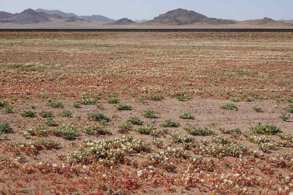
Shortly after Luderitz, I had a pleasant surprise – on either side of the road was a carpet of flowers. They are only visible in the morning, and close during the afternoon sun, so I had missed them on the way here. They stretched away in all directions as far as the eye could see.
White flowers….Red flowers….As far as you can see
I stopped for a very good coffee at a town called Aus and decided to fill up on fuel. It was a lucky decision, since the station at the next town, Rosh Pinah – some 170km away – had run out of diesel. Rosh Pinah is a major centre for Namibia’s mining industry, and well off the main tourists routes. It had a similar feel to Luderitz, with many unoccupied people lounging around on the streets and looking at me with curiosity.
Near Rosh Pinah – typically dry Namibian scenery
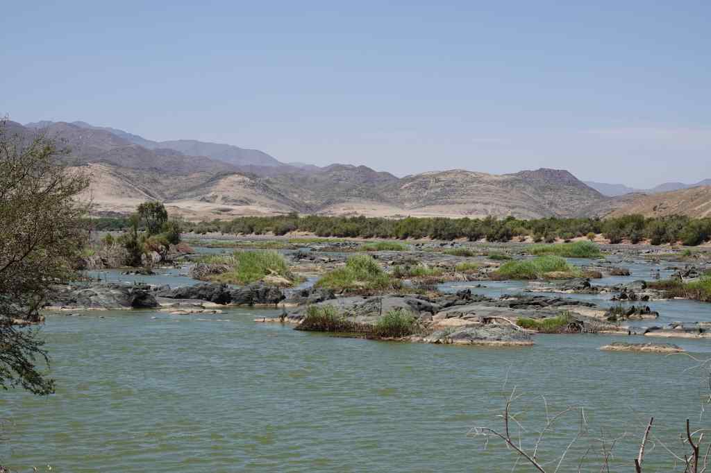
From Rosh Pinah the road headed east, following the Orange River, which marks the border with South Africa. It was dry season and the river was low, but it was still the first running water I had seen during all my time in Namibia. The road was empty, and passed some nice scenery (green for a change!) and a few shuttered camps offering kayaking excursions.
50km further on – the Orange River, the first running water I had seen for two weeks!
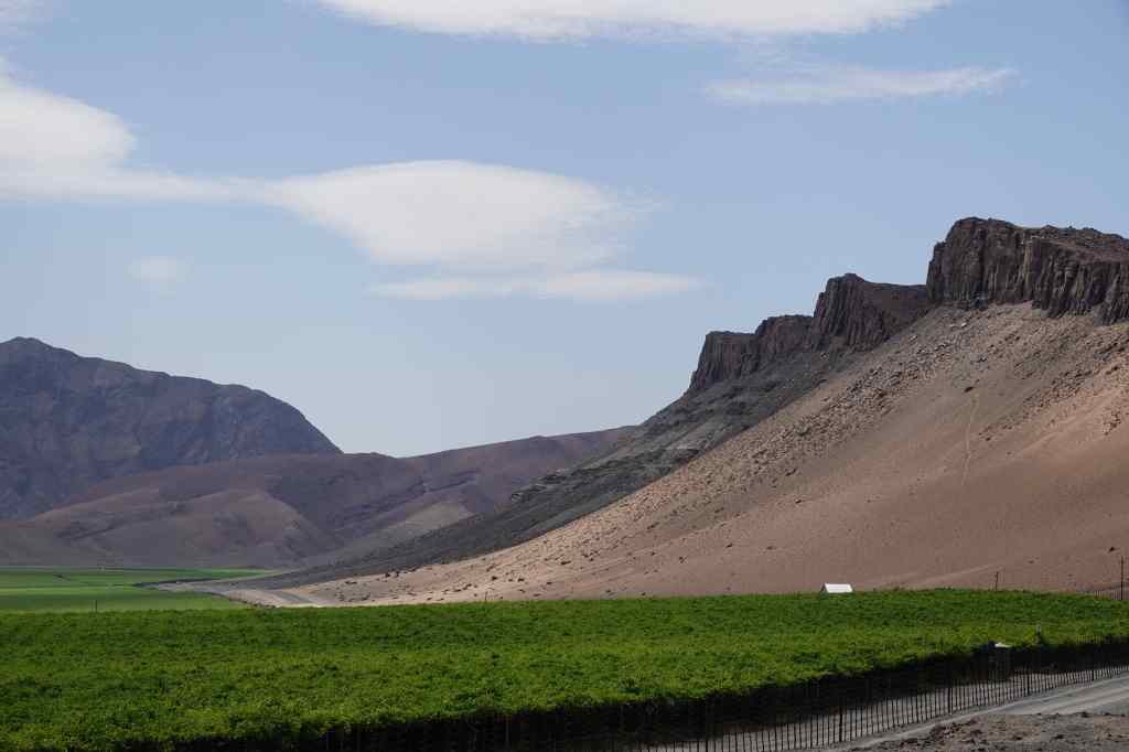
After enjoying the scenery along the river, I arrived at a huge vineyard just outside the town of Aussenkehr.
A huge vineyard on the Orange River
I had been on the road for six hours, and was tired. I ventured into the town in search of coffee but could only find a big branch of Spar where I bought a Red Bull. Most of Aussenkehr was a shanty town consisting of small shacks made of corrugated iron, and again groups of people hung around the shopping area and stared at me. At this place far from the tourist route, I had discovered the reality of Namibia for the majority of its people, and it’s a good time to talk a bit about the country and its history.
Aussenkehr’s shanty town
Before the Europeans arrived, Namibia was a typical African country settled by many different tribes – such as the Herero and the Nama – each with their own language and culture. They scraped an existence by farming or hunting in the country’s harsh, dry environment.
The country was largely ignored by colonial powers until the late 19th century – from the sea, the Namibian deserts looked inhospitable and unpromising territories. Then in 1883, the German trader Adolf Luderitz bought an area in the southwest of the country (around the city that bears his name today) from a Nama chief. He then persuaded chancellor von Bismark to declare Namibia a German territory. Colonial rule of Namibia was particularly brutal, even by the standards of the time, and culminated in what was possibly the world’s first attempted genocide (of the Nama and Herero peoples).
During the First World War, South Africa (allied to Britain) conquered the German colony of Namibia and proceeded to “administer” it – in practice, exploiting the country’s resources and its people. Eventually international pressure, UN resolutions and an armed struggle persuaded South Africa to grant Namibia independence – but only in 1990. Since then, the young country has done better than many other African countries, remaining a stable democracy and slowly addressing its many problems.
One of the most pressing issues facing Namibia is unemployment, which is around 20%. This is why there were so many people hanging around Namibian towns like Luderitz with nothing to do. Another problem is huge inequality and widespread poverty – many people are very poor, and live in shanty towns like the one at Aussenkehr. On the usual tourist circuit, visitors are insulated from the reality of life in Namibia for many of its people. You go from one nice lodge to the next, eat good food and drink good wine.
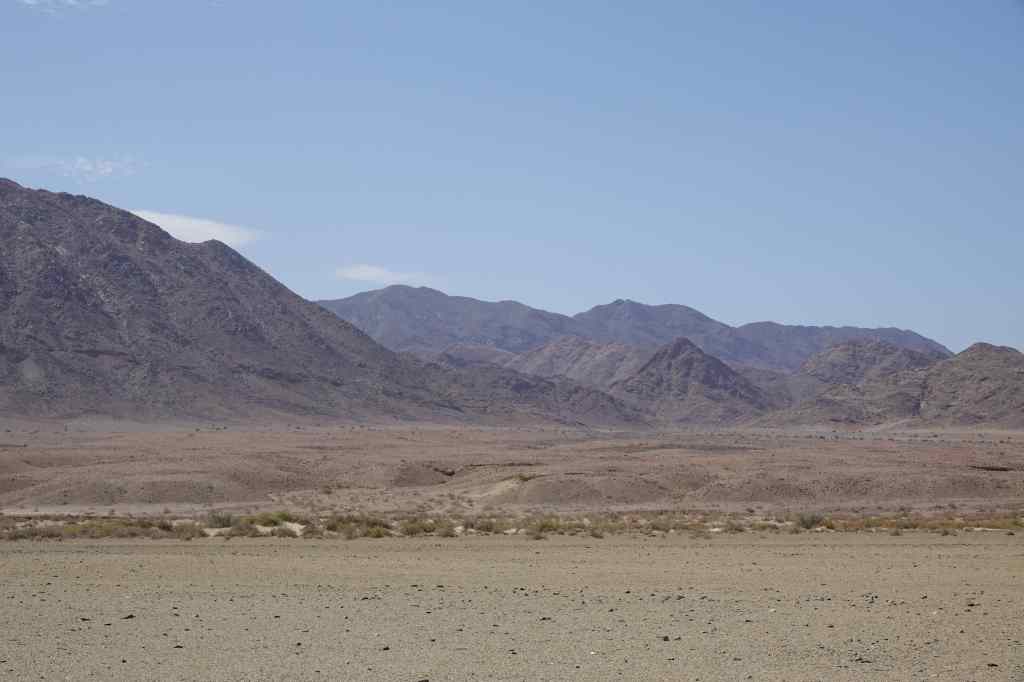
From Aussenkehr the road headed north across an especially featureless landscape, devoid even of plants.
The lunar landscape approaching Fish River Canyon
The landscape had a certain barren beauty, and further north, hinted at the spectacular Fish River Canyon that lay just out of sight behind the mountains – which I would see the next day. But I was tired, and after eight hours on the road, I was relieved to arrive at my destination – yet another stylish tourist lodge. I had found my excursion around the far south of Namibia and my brush with real life interesting, but was glad to be back on the comfortable tourist circuit.
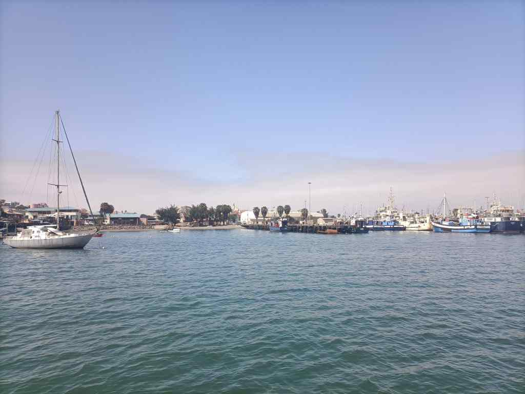
Today I had two very different experiences – one wet and one dry. I woke early to make the 8am departure of a catamaran cruise to Halifax Island, home to a colony of African penguins. The port of Luderitz was quite busy – in addition to a small fishing industry, several giant diamond-mining ships operate there. The latter scrape the sea floor, sieve the mud, and harvest large quantities of high quality diamonds.
Luderitz port
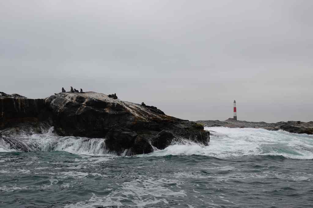
On the way to see the penguins we passed the port’s lighthouse and a few seals; dolphins also followed our boat but proved frustratingly hard to capture on film.
Luderitz lighthouse and seals
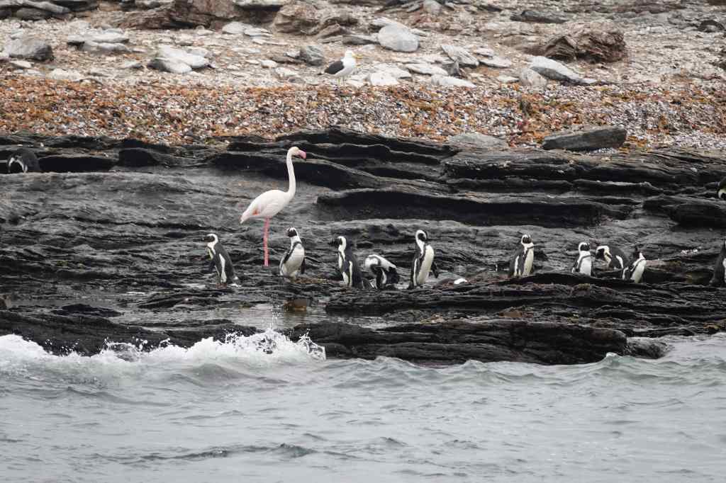
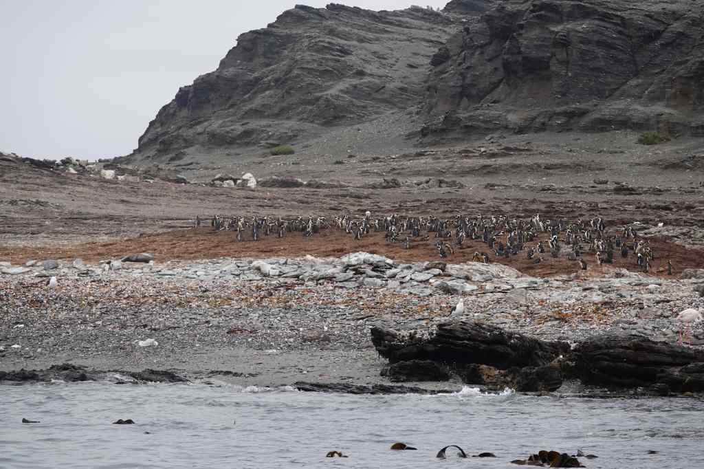
When we got to Halifax Island, we saw a large colony (about 1,000 pairs) of nesting penguins with the added bonus of a few flamingos. It was the first time I had seen penguins in the wild.
Penguins and a flamingo on Halifax Island
Most of the penguins nested in two large groups, standing on top of a large mound of guano from generations of birds. I thought this was not the most hygienic place to raise young.
Nesting in their own droppings…hmmmm
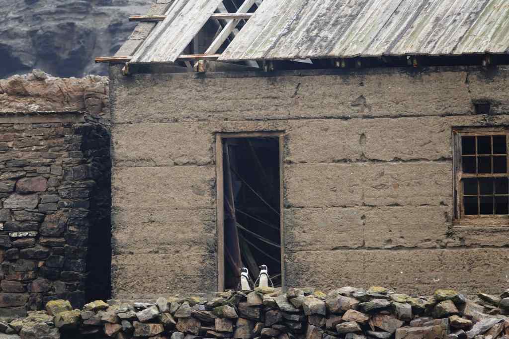
One couple had instead chosen to nest in an abandoned house, which seemed a much more sensible place to me.
Houseproud penguins on Halifax Island
After my cruise, I went shopping in the town of Luderitz to buy food to cook that evening. After many evenings of steak, I wanted to find some fresh fish….but bizarrely the city had none, despite being a fishing port. I had to buy meat yet again, and settled back in my room and looked at the sea for a midday break. A seal and a dolphin came looking for fish in the sea right in front of my room – I hope they had more success than I did!
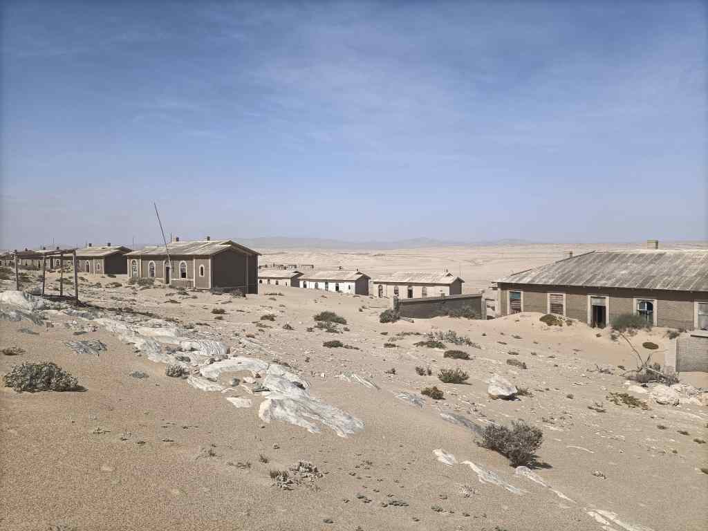
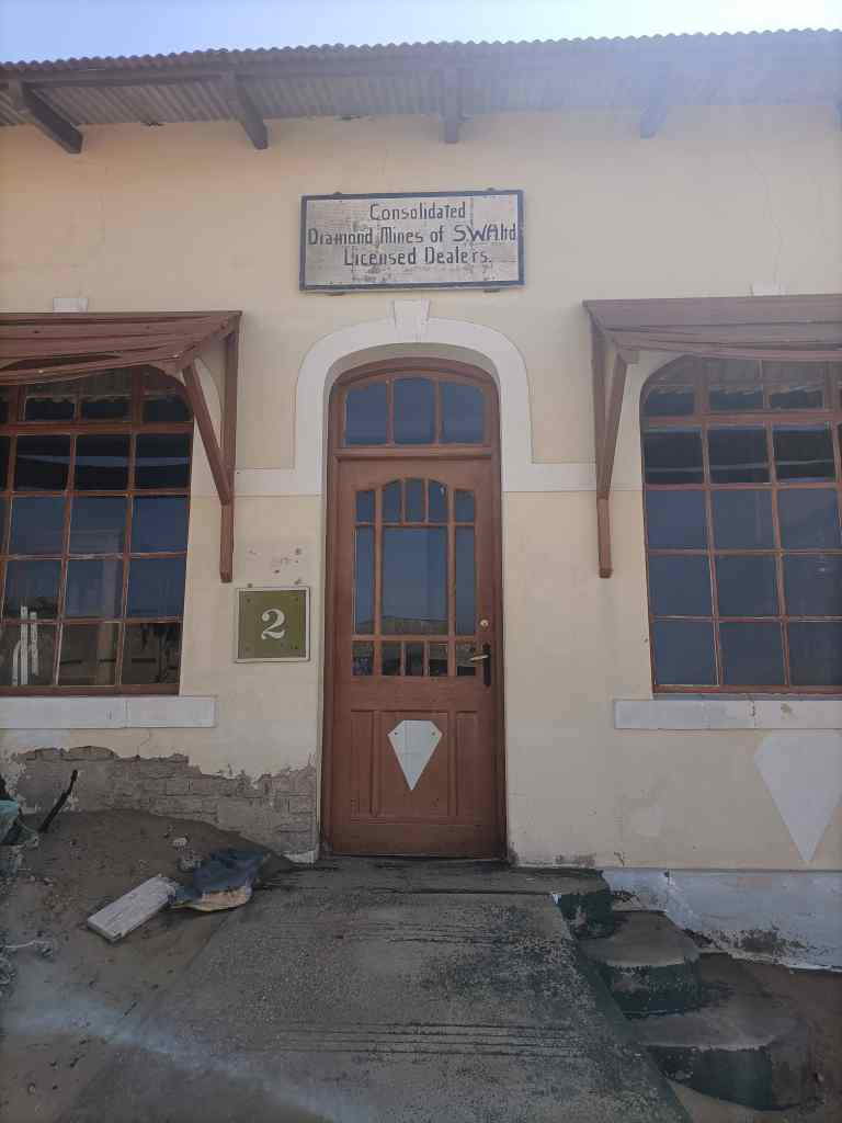
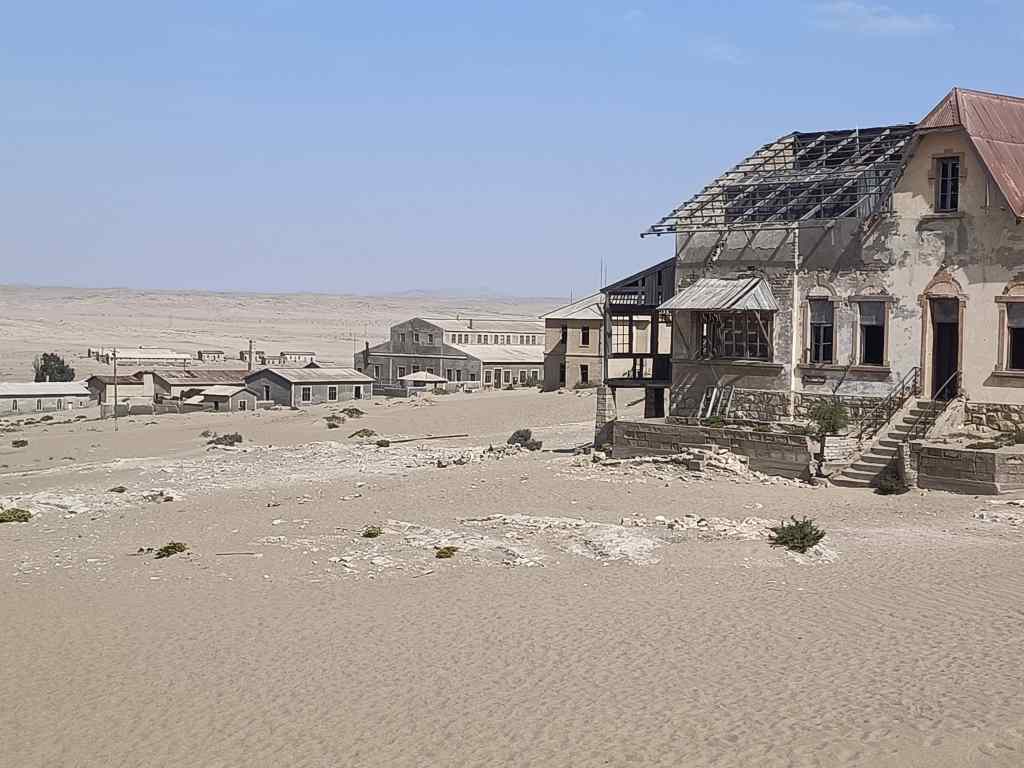
In the early afternoon, I set off for my second excursion of the day, to the abandoned diamond mining town of Kolmanskop. Diamonds were discovered by accident in the area in 1908, by a worker clearing sand from railway tracks. The find prompted a prospecting boom of which the town of Kolmanskop was initially the centre. The miners – mostly German colonists – systematically stripped and sieved the surface levels of sand, at their peak producing a million carats per year of diamonds (or about 12% of total global production). Many became rich in the process, though the native people who provided the manual labour got little or nothing for their efforts. The residents built a hospital, school, and even a casino.
Overview of KolmanskopThe diamond trading counter
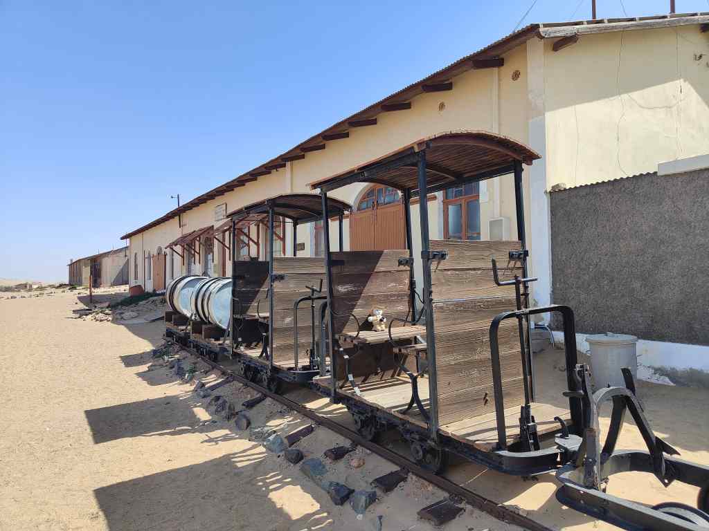
There was a butcher, baker and ice factory, and fresh water was brought in by rail and stored in a big tank on the hill above the town.
A dedicated train line kept Kolmanskop supplied
It couldn’t last. In the late 1920s, the ground around Kolmanskop was almost depleted, and in 1928 another big diamond field was found in a different place. The town’s residents abandoned it, and by the 1950s it was deserted. The sand dunes that constantly move around the area – and which even today need constant clearing from the roads and the railway line – swept in to reclaim the town.
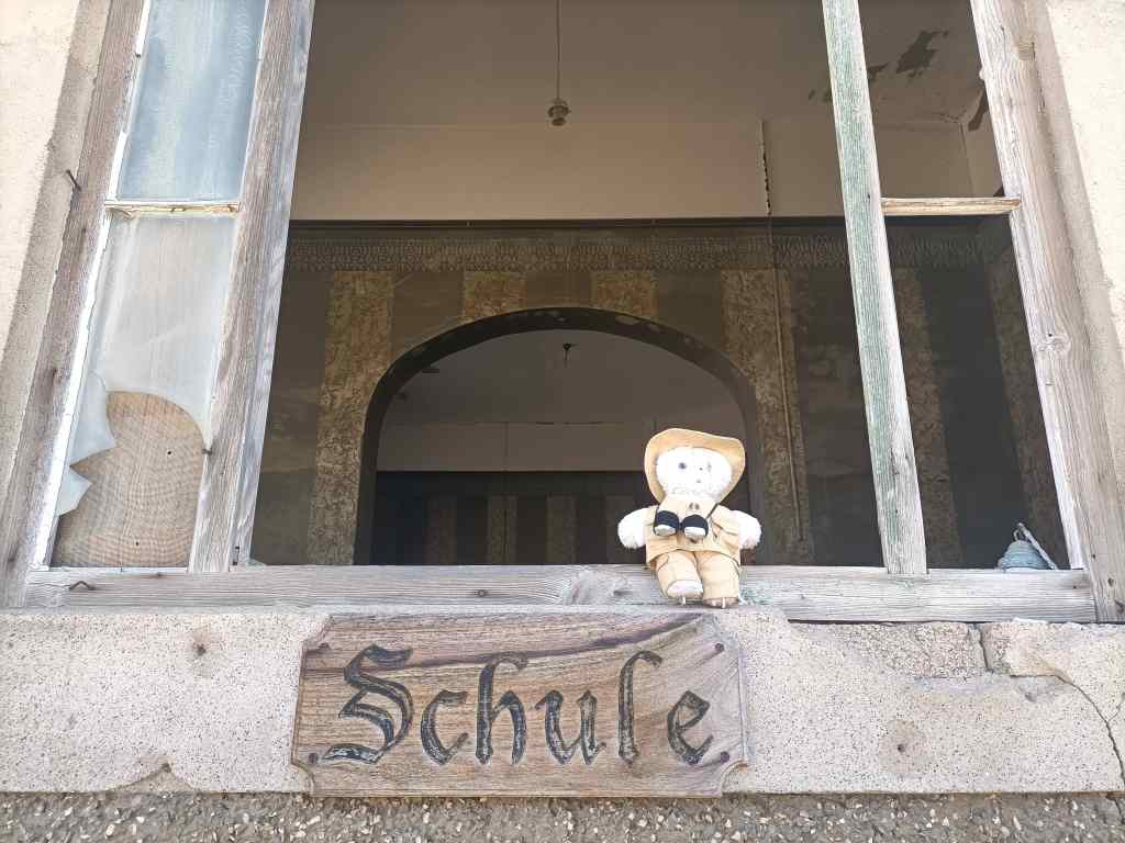
Entry to Kolmanskop’s school
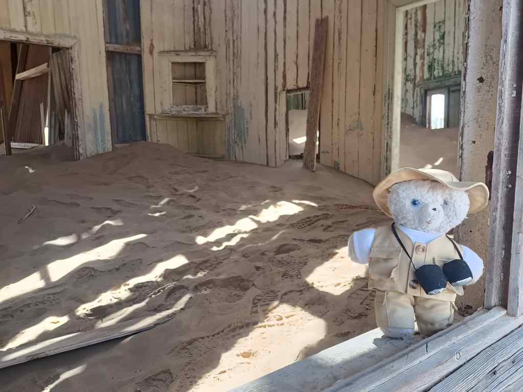
Today, Kolmanskop has become a tourist attraction. Most people visit on the guided tours in the morning, but I bought a special ticket allowing me to walk round in the afternoon, and I had the place completely to myself. A few buildings had been restored, but most had been allowed to slowly decay. The most atmospheric were those which were in the path of the shifting sand dunes. Sand would pile up on their outside walls and force an entry through doors or windows, piling up inside as a continuation of the marching dune.
The irresistible force of nature takes over Kolmanskop’s houses
I also liked some of the grandest houses, built for the town’s management – like the accountant’s, the architect’s or the quartermaster’s residences. These were built on slightly higher ground and had so far escaped the marching sand dunes.
The accountants house
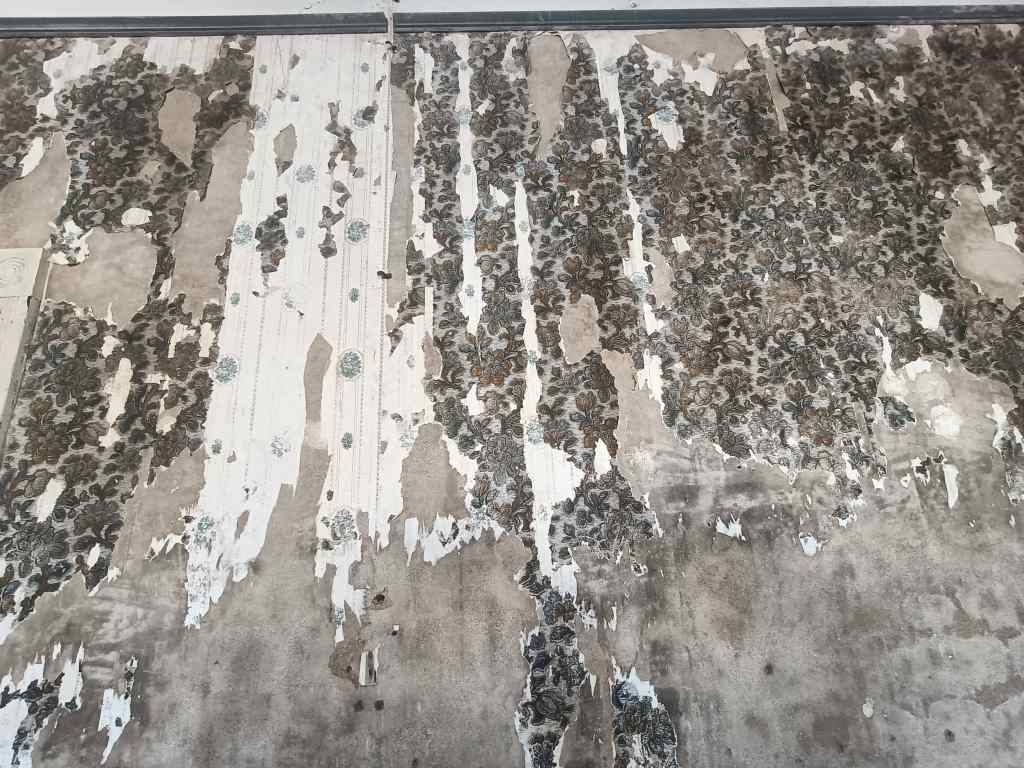
Inside, ornate wallpaper peeled from their walls, and a strange silence reigned. I sat on the veranda of the accountant’s house in the late afternoon sun, reflecting on the transience of life and the futility of humanity’s attempts to defy nature.
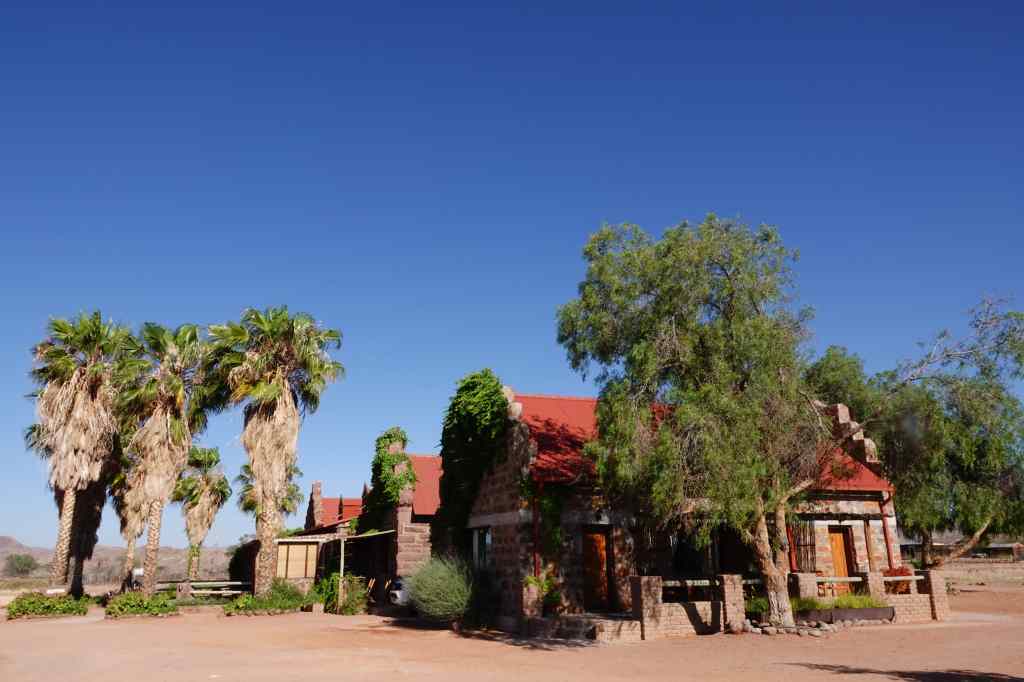
My accommodation in Duwisib was a working farm with a few guest bedrooms, which made a pleasant change to the more commercial lodges I had been staying in up until then. The splashes of green surrounding the farm – plants and fields fed by water from a well – made a welcome change to the constant brown, red and yellow of the Namib desert.
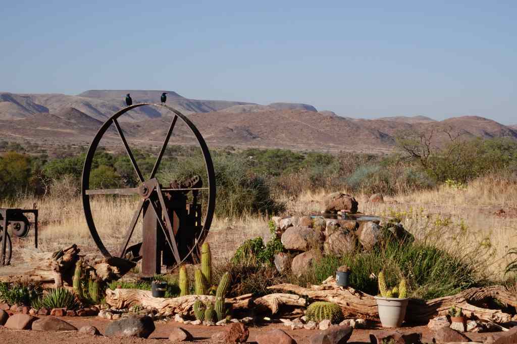
Duwisib Guest FarmSome green in the landscape for onceOld farm equipment
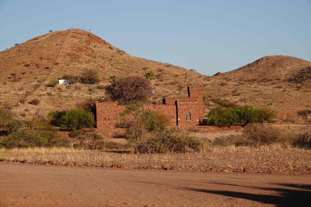
The farm’s owner showed me around and pointed out the small gothic castle improbably located a short way away.
Duwisib Castle
The latter had a strange and sad history. It was the project of a former officer in the German army, Hans Heinrich von Wolf. Poor himself, he married a rich American, Jayta Humphries, who paid for the considerable cost of the project (most of the materials were imported by ship from Germany, then hauled by oxen 300km inland). The newly wed couple camped for two years next to the building site until the work was finally finished in 1909. Von Wolf had intended to use the castle as base to live whilst establishing a farm and breeding horses – a strange project in a near-desert environment. However, the von Wolfs only enjoyed their property for five years; in 1914 war broke out whilst they were travelling to Europe and their ship was diverted to Rio de Janeiro, where Hans Heinrich was interned. He was finally released a couple of years later, and the couple continued their trip to Europe in 1916, where von Wolf rejoined the German army and was killed two weeks later. Jayta never returned to the castle, and eventually remarried and settled in Europe. After the von Wolfs, the castle’s ownership changed hands many times, and today it is owned by the government. It used to be possible to visit but never reopened after the Covid epidemic. The farm owner said we could probably see inside if we made an arrangement with the guardian, but for me it was enough to see the castle from the outside.
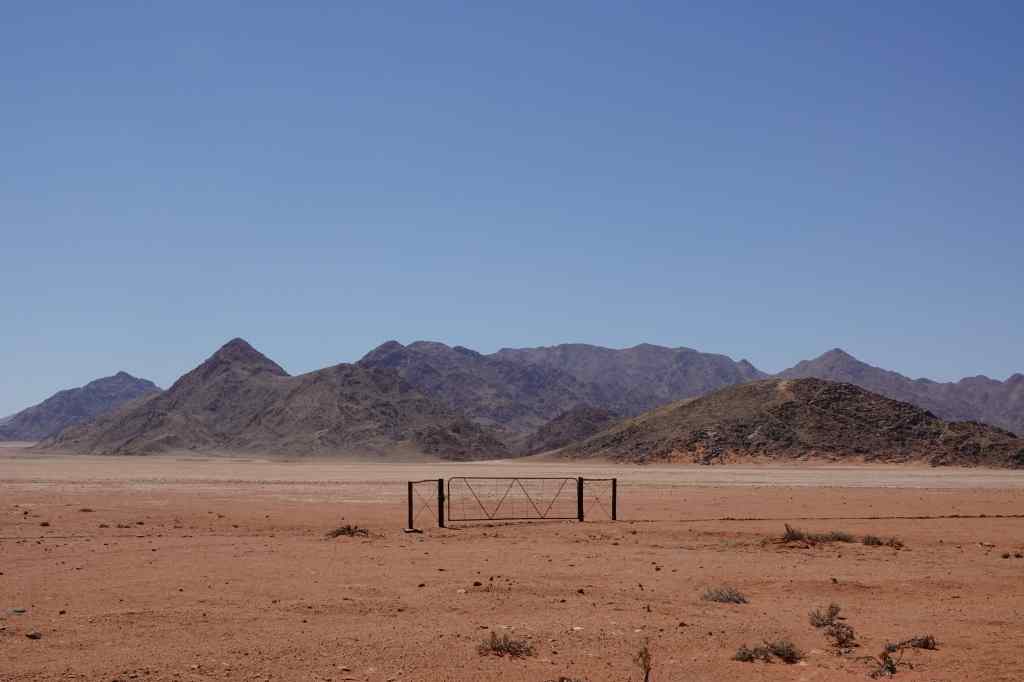
The guest farm also gave me the chance to meet some fellow travellers over dinner to swap stories and information. This was also a welcome change after dining on a table alone at desert lodges. I checked that the road I wanted to use the next day, the D707, was open and passable and that its reputedly great scenery was worth the extra time. One of my fellow diners had just come from that direction and assured me that all was good.
So next morning I set off on another fairly long drive, this time to Luderitz, on the coast in the southwest corner of Namibia. The D707 lived up to its scenic reputation and I made lots of stops to take pictures.
Back to red and brown scenery on the D707A gate to nowhere…Still on the D707
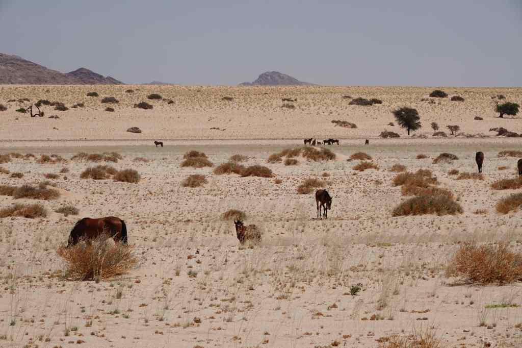
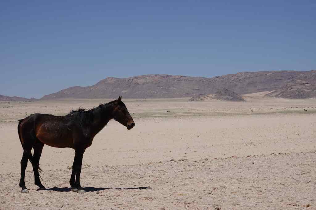
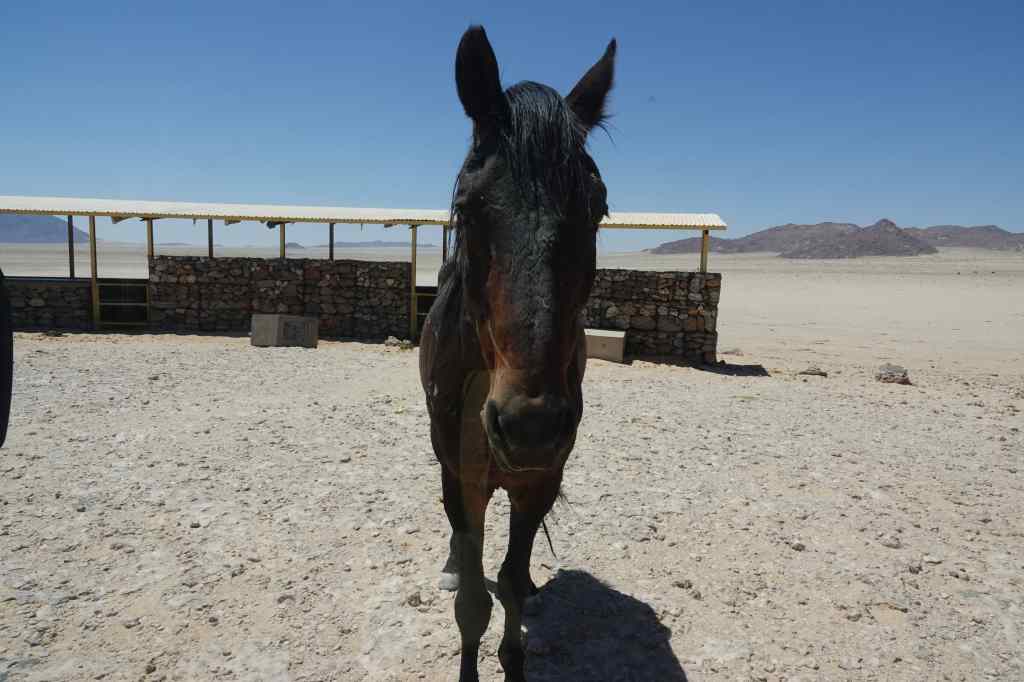
Next, I joined the straight flat and dull but fast B4 to the coast. I made one stop on route, to see a herd of wild horses – the only ones anywhere in the world to live in desert conditions. One theory is that the horses’ ancestors escaped from von Wolf’s farm over a hundred years ago.
Desert Horses! A horse poses for my shotThis horse was hungry and approached my car looking for food
After another hour I reached Luderitz, which is known for its colonial German architecture. Indeed, it had a couple of old churches and other buildings dating from its time as the centre of a mining boom just over a hundred years ago (more about this tomorrow). But today the town feels rather poor. The many unoccupied people on the streets stared at me as if they had never seen a bear before, and I felt slightly uncomfortable. Fortunately, my accommodation was in a smart area, right on the sea shore and I checked in and enjoyed the view whilst preparing two very different excursions for the next day.
A dune on the now familiar drive down to Sossusvlei
Today my luck finally changed. When the alarm woke me at 5.30am, all was quiet outside – there was no wind. I hurried to get breakfast and then set off on the now familiar drive to Sossusvlei National Park. I drove straight to the very end, to Sossusvlei itself and found that almost all the other visitors had stopped earlier, at Dune 45 or the Dead Vlei. I had the place almost to myself and set off to climb Big Mommy dune.
Looking back at Sossusvlei from the flanks of Big Mommy
It was hard going. The sand stretched up before me, perfectly bare and flat, and devoid of any sign of humans or other large animals having passed that way. The only marks it bore were faint traces left by snakes. For every three steps I made forward, I would slip back two. I finally made it to a pleasant sandy ridge, and lay down to catch my breath and peak over the top to see an endless sea of sand, stretching away into the distance.
Resting on a ridge on the side of Big Mommy
I looked at my watch. I had been walking an hour and was less than half way up. I was not sure the view from the top of “Big Mommy” would be any better, and if I tried to find out, I would use up the entire morning on the climb. Walking after noon would be impossibly hot.
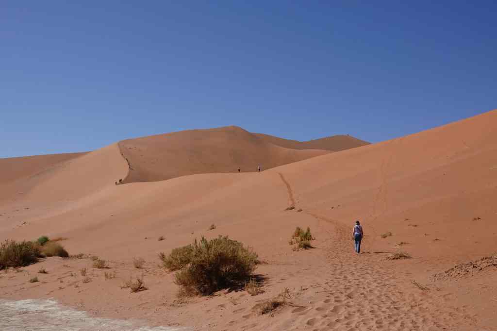
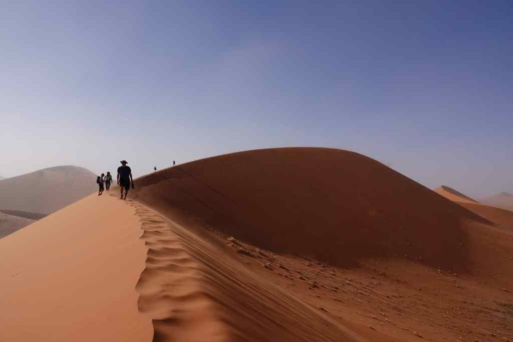
I decided to retrace my steps to the Dead Vlei car park, where a steady stream of visitors were setting off to climb “Big Daddy”.
The start of the popular climb of Big Daddy
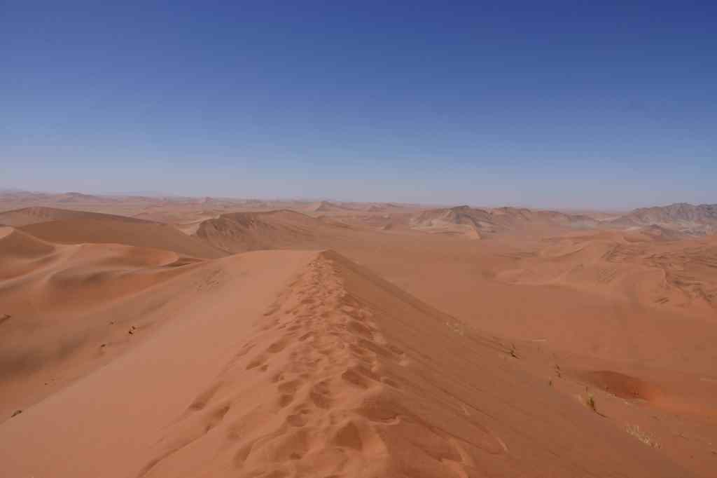
I followed in their tracks and found that this climb was much easier – the earlier guests had compacted the sand, and I could use their footprints as a sort of staircase.
A much easier pathA view from half way up Big Daddy
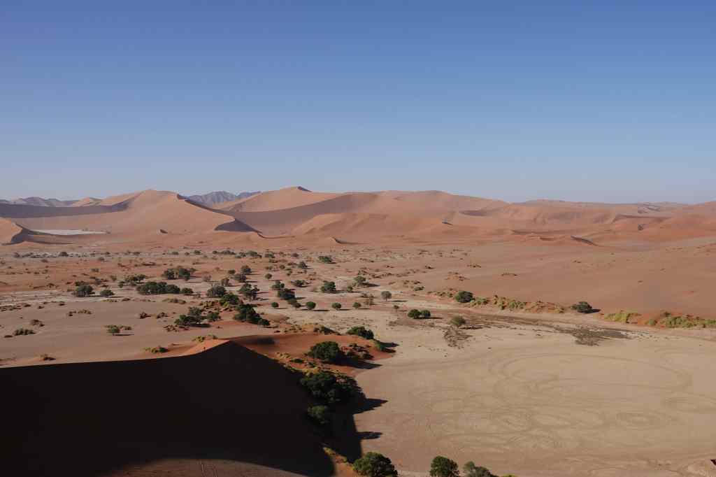
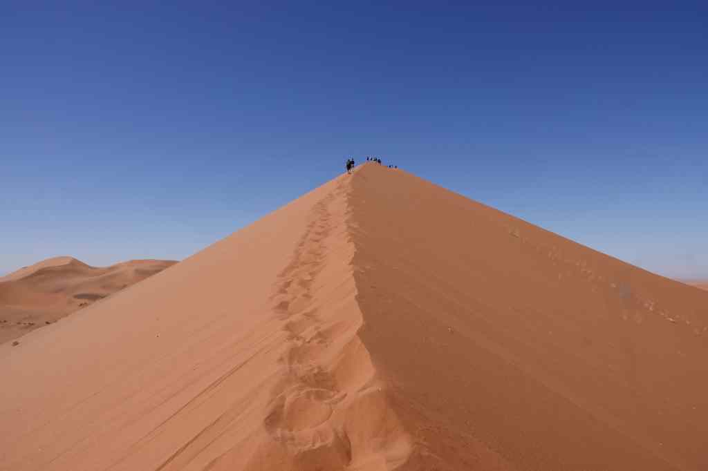
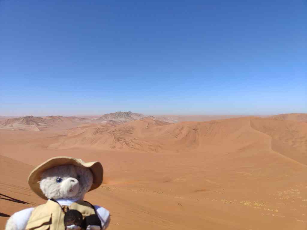
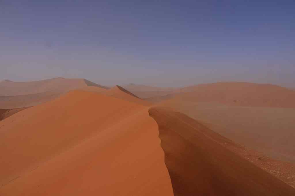
To reach the top took me just under an hour, and I was rewarded with an amazing 360 degree view – east along the river valley and the road, north to the Dead Vlei and “Big Mommy”, south to a range of mountains, and west across countless smaller dunes. In the far distance I fancied I could see the coast and the South Atlantic Ocean some 50km away – or maybe it was the combination of my imagination and a heat mirage.
On top – looking southwestLooking west from Big Daddy dune
I stayed a long time absorbing the view and recovering from my exertions. Then I made my descent, which was much quicker than the climb. I noticed some of the taller humans running straight down the steepest part of the dune, making great big strides with their legs. The soft sand swallowed each foot as it landed, and then slid downwards with the foot’s owner. The same shifting sand that had made going up so hard made going down fun…….and very quick. Even with my smaller teddy legs, I was at the bottom of the slop in five minutes, with my shoes full of sand and a big smile on my face.
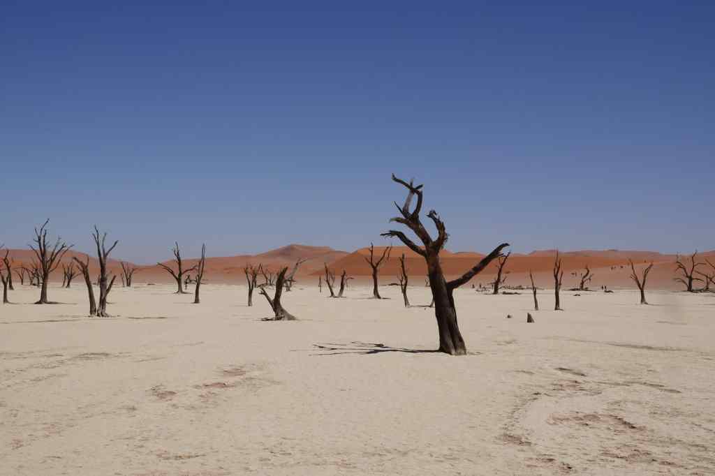
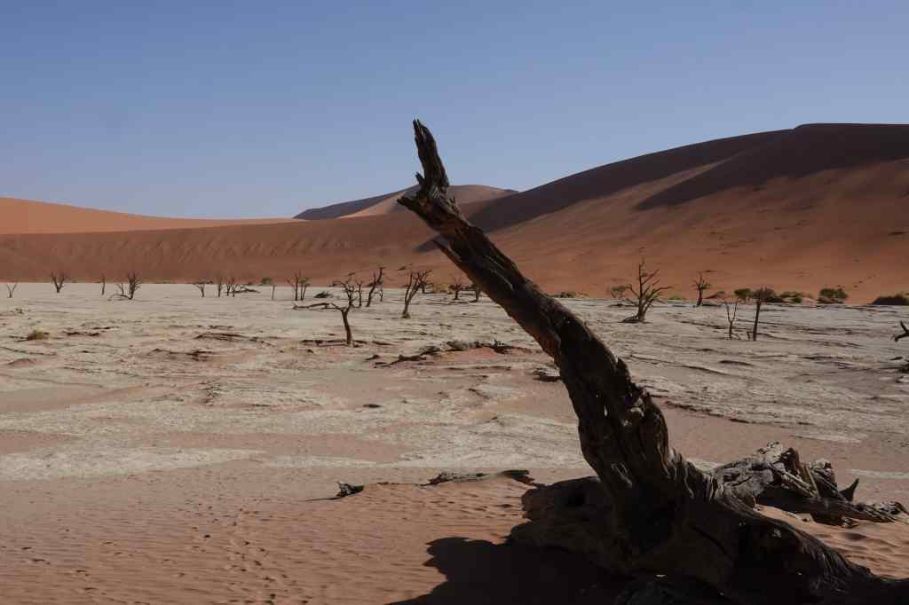
The base of the dune gave a new perspective to the shrivelled trees of the Dead Vlei.
The Dead Vlei again
I traversed the barren empty space in the heat of the late morning to regain my car – hot, tired but happy. I drove back to the park entrance for a well-earned coffee and a cold drink, before making the roughly two hour drive to my next destination – a place called Duwisib, about two hours driving to the south. The road was spectacular – more red and yellow sand dunes, but this time alternating with black and brown rocky mountains. But after my early start and exertions on Big Daddy and Big Mommy I was too tired to stop to take many photos. More about Duwisib in my next post.
The next day I woke up early again to check the wind. It was still strong, so I went back to sleep. When I got up, I could have a leisurely breakfast and enjoy the lodge’s pool and the view from my room – a desert plain with mountains in the distance, occasionally visited by groups of Oryx.
Oryx stroll past my veranda
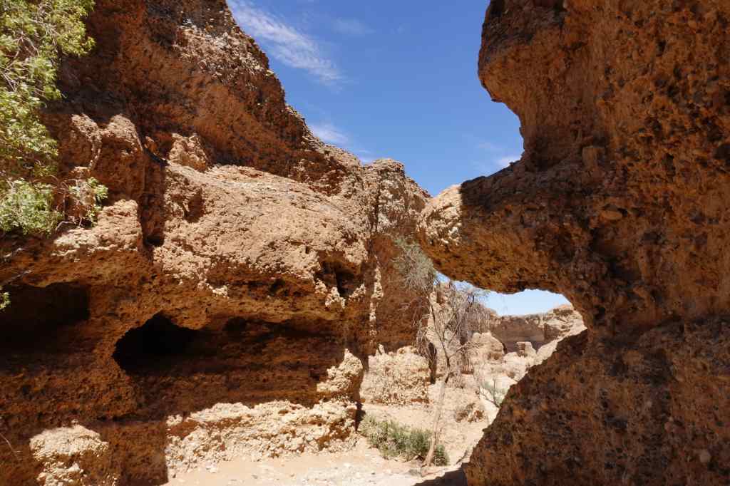
In the afternoon, I went to visit Sesriem Canyon – also in the national park. It was an interesting fissure in the ground, protected from wind and sun, so ideal to visit at that time.
Sesriem canyon – from aboveInside Sesriem CanyonA narrow path inside Sesriem CanyonLooking up
After visiting the canyon, I noticed that wind had dropped so I continued the road to the end, to visit the more famous giant dunes. I arrived first at the “Dead Vlei” – an atmospheric area of dead trees at the base of “Big Daddy” dune. All the other visitors were heading in the opposite direction, leaving the park. In Afrikaans, a “vlei” is a low-lying area of ground, sometimes filled with water, sometimes dry.
The Dead Vlei
From there I continued to the very end of the road, along a sandy track that was only suitable for 4×4 vehicles, to Sossusvlei itself. I arrived at around half past five to find that everyone else had left and I was the only visitor. Ahead of me rose Big Mommy dune, but since I had to be out of the park by sunset, I did not have enough time to climb it. Instead, I enjoyed the perfect calm and the company of a solitary Oryx who had wandered this far. I resolved to hike the dunes the following day, whatever the weather.
In front of Big Mommy duneSossusvlei with Big Mommy Dune and a solitary Oryx
Today I made the long drive from Swakopmund on the coast to the centre of Namibia, to a place called Sesriem, near Sossusvlei, where Namibia’s most famous sand dunes are located. At Swakopmund several people told the road was in bad condition and the drive very boring. At first, they seemed to be right, as I crossed an almost featureless desert while bouncing up and down as I drove over a badly corrugated section of track.
An unpromising start to the drive
But later the road improved, and the scenery became interesting.
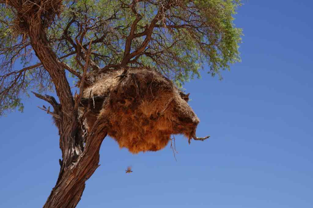
The famous red dunes begin to appear…A weaver bird nest
After a few hours I reached a tiny settlement, aptly named Solitaire. It sat at the main road junction in its region and had all the essentials for travellers in Namibia – a petrol station, car repair workshop and a very good café with bakery. I enjoyed an excellent cappuccino as a stream of other drivers came and went.
The essential stop of Solitaire, with its collection of rusting vintage cars
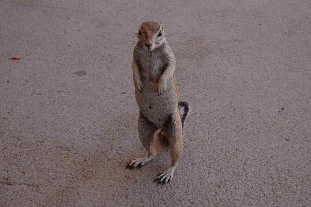
I also made friends with this little chap.
This ground squirrel had worked out that the cafe was a good place to get fed by visitors
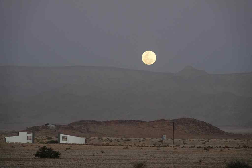
From Solitaire it was a short drive to my accommodation – yet another bush camp, located on a flat desert plain, about forty minutes drive from the entrance to the Sossusvlei national park. I enjoyed a glass of wine from their lounge as I watched the moon rise over the distant mountains.
Moonrise over the camp’s gates
Most visitors travel to the sand dunes either early in the morning or late in the afternoon, when it is cooler and when the light is better for photography. My early morning visit involved getting up at 5.30am in order to get to the dunes area for 7.30am. I awoke to sound of a strong wind, which worried me – wind and sand are not a good combination. I did not manage to shower, since the hot water was provided by solar power, and the sun had not yet risen. As I had breakfast, the sky changed colour, and it became quite light, even before the sun appeared.
The light changing in the desert before sunrise
I drove off to the park entrance, which was at the start of the long valley of a now-dry river lined on both sides with sand dunes. The river’s course was marked by dead and living trees – the latter surviving from water that continued to pass deep underground. There was a good asphalt road that followed the valley, with great views of the dunes on either side – at least, when the ferocious wind occasionally stopped, and the dust settled.
Some of the many dunes lining the road
One of the best known is called Dune 45 and had already many people trying to climb it.
The ever popular Dune 45
I continued right to the end of the road, where there was a parking area in a depression (or “vlei”) at the base of very largest dunes. I was greeted with an almost apocalyptic scene. Visitors struggled to open their car doors against the force of the wind, and then staggered around, holding onto their hats and bowing their heads to hide their faces from the stinging sand. I realised that visiting this part of the park was pointless and drove back to Dune 45, where conditions seemed to be better.
Back at Dune 45 “base camp”
I parked at the base of the dune and struggled up the bright red sandy slope. My worries about not showering were soon forgotten as the wind sandblasted my fur, no doubt removing any possible dirt and a few layers of skin. It was a hard climb – for every little step forward I would slip backwards half a step in the sand.
Part way up Dune 45
Half-way up, I dropped the lens cap of my camera and it rolled on its side all the way down – I could not have done such a perfect trajectory if I had tried. I had to hurry down the slope to collect it before it got buried by sand and lost forever. Then I recommenced the long struggle up….
The view from the top of Dune 45, Sossusvlei
When I finally managed to struggle to the top, my efforts were well worth it. There were fine views across the field of dunes and the opportunity to take some great selfies.
Made it!
Proud of my achievement I headed back to the park gate to the small village of Sesriem and enjoyed a much needed coffee. I headed back to my bush camp to catch up on some lost sleep and to enjoy the pool before dinner. I had been surprised that my tour agent had booked me three nights near Sossusvlei, but now I was very glad – I had several more chances to see the largest dunes, at the end of the valley, under more favourable conditions. And my brief morning visited supported my guidebook’s assertion that the area was one of Africa’s most spectacular attractions.
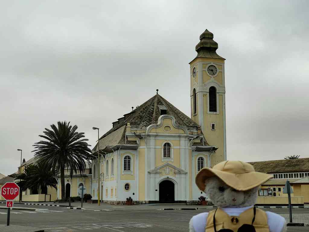
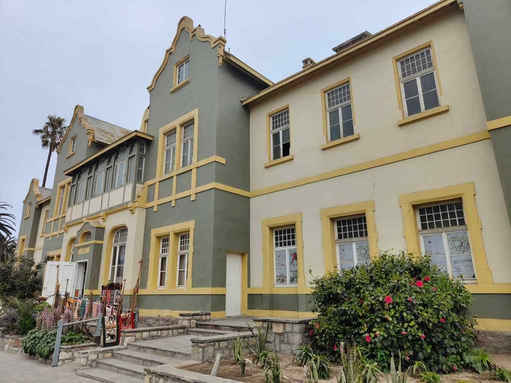
Today I explored the quaint town of Swakopmund in the morning. In December and January, it is a popular holiday getaway for people living in the capital, Windhoek, but in October it was a pleasant, sleepy town with some fine colonial German architecture, dating from the 1900s. Unlike all the other places I had visited in Namibia, the weather was overcast and even a bit chilly.
SwakopmundColonial architecture in Swakopmund
It may also be the last city in the world that still has a “Kaiser Wilhelm” Street.
The Alte Apotheke on Kaiser Wilhelm Street
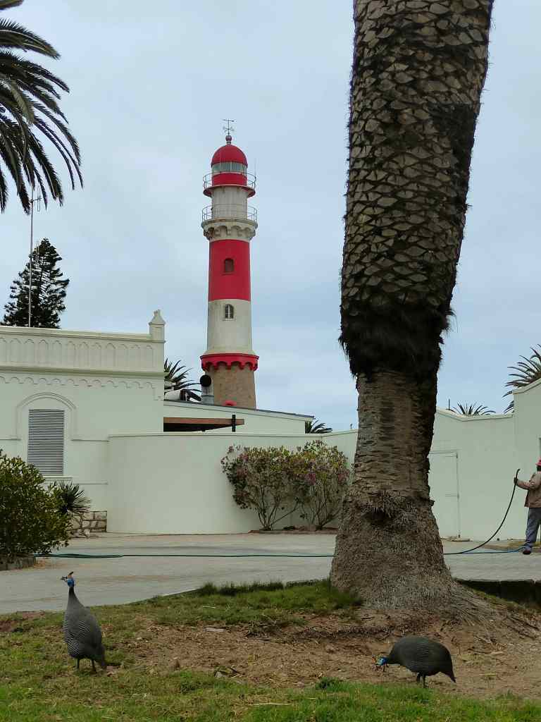
I strolled around, enjoying the sensation of walking after many days spent in the car, as well as the small-town laid-back atmosphere. Lots of guinea fowl wandered around the town’s parks, obviously feeling very safe. In most other places they would have ended up on a restaurant plate, but maybe Swakopmund’s excellent seafood keeps them safe from this fate.
Guinea fowl roaming free in the park and Swakopmund lighthouse
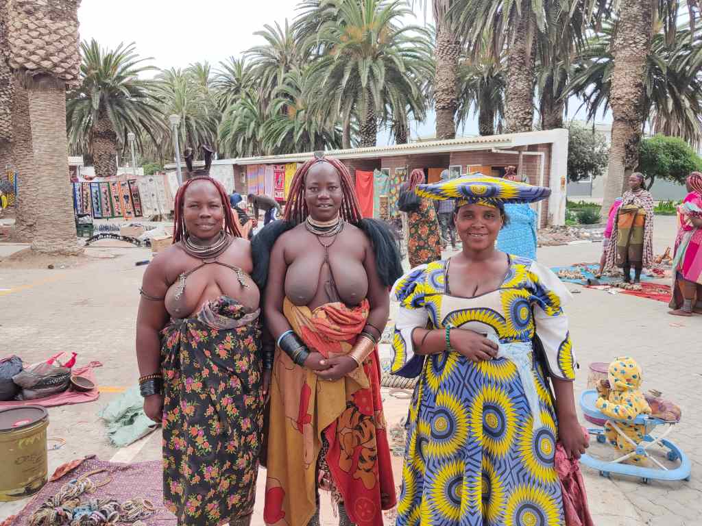
I also visited the local market where some tribeswomen posed for a photo for me.
Ladies from the local market in Swakopmund
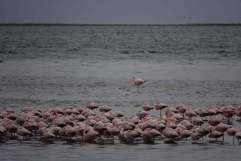
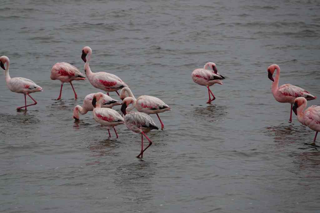
In the afternoon I had booked a tour of the area. The route went through Walvis Bay, another of Namibia’s small cities, which had a colony of flamingos wading just off its shoreline.
Flamingos at Walvis Bay
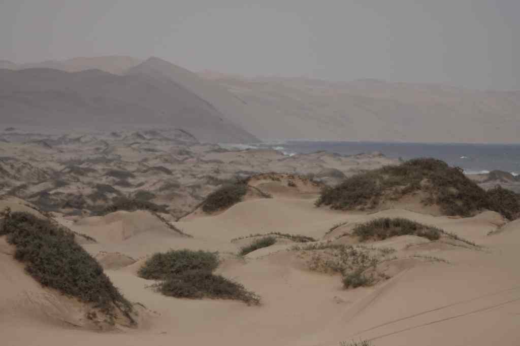
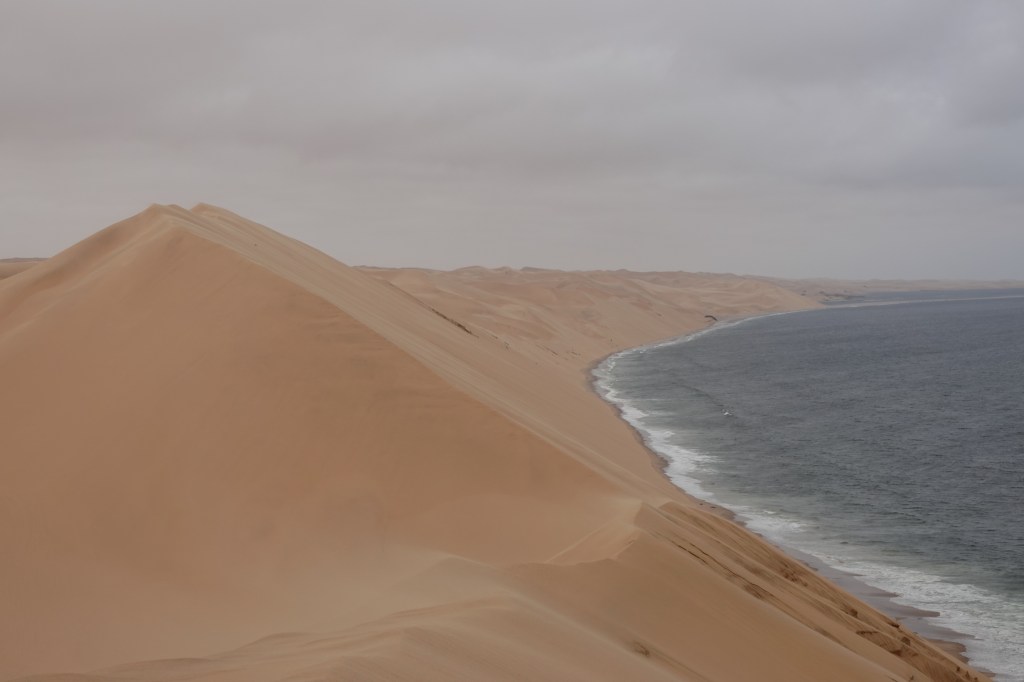
My tour continued towards Sandwich Harbour, a national park accessible only by 4×4. At first the scenery was pleasant but unremarkable, a little bit like the Skeleton Coast, but a bit sunnier; but in the distance I could see the giant dunes plunging into the sea. This was our destination.
Stuck in sand! Sandwich Harbour – the big dunes loom in the distance
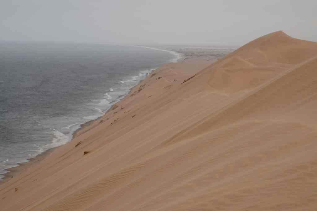
Our driver took us up onto the giant dunes and showed off his skills driving on sand, up and down steep slopes.
It was great fun, and the adrenaline rush made a good change from the more sedate pace of my holiday so far. We finally ended up on a dune nicknamed “Kodak” because of its endlessly photogenic views.
The views from “Kodak” dune
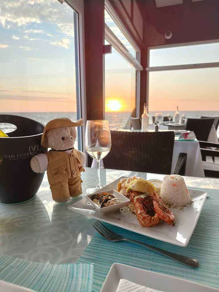
We then did some more dune driving before having a snack and then heading home. It had been a good day, and I returned to the seafood restaurant I had visited the night before to treat myself to kingclip (a local fish) and giant prawns.
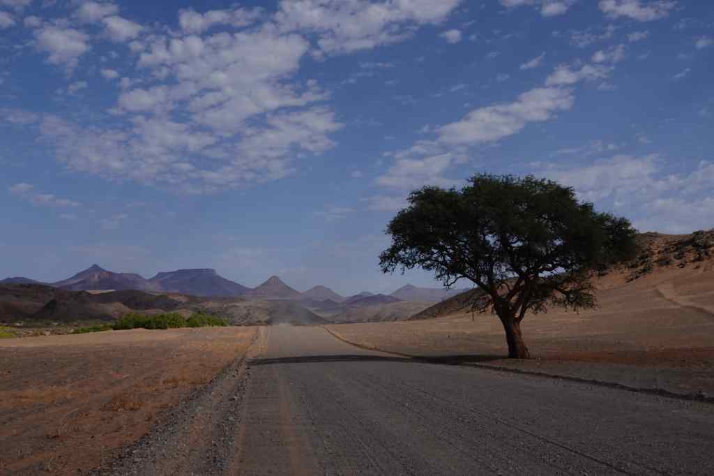
Today I set off on a long drive, from Twyfelfontein to Swakopmund, which is Namibia’s fifth biggest city (albeit with a population of only 25,000) and located on the coast, roughly half way down the country. To get there I was going to fulfill a childhood dream. When I was a young bear cub, my parents gave me a book about remote places in the world, and I was captivated by one of the them – the Skeleton Coast. The name was so evocative, and the book showed pictures of rolling dunes and wrecked ships, which were victims of the coast’s treacherous currents and dense fogs. Today, the Skeleton Coast is a national park and was rated highly by both my guidebooks. I set off with high expectations. At first, the road passed through some pretty Damaraland mountain scenery.
Damaraland scenery on way to Skeleton CoastMore Damaraland scenery
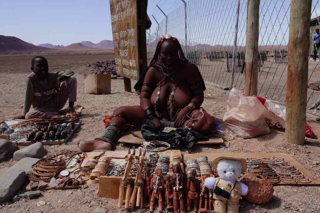
Then it became flat, and headed like an arrow to the coast. I reached the gates of the park at around 11am, and met this striking tribeswoman, who was selling jewellery for the few tourists that passed – in the register of visitors for the day, I was number 3.
An impressive sales lady
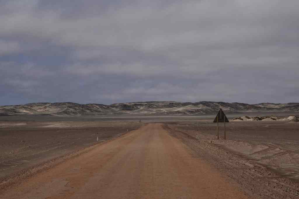
Then I headed into the park for a huge disappointment. The road was flat, and almost featureless. At first, the sea was at out sight, hidden behind some low sand dunes. It wild and desolate, but in a negative nihilistic way and not at all what I had expected.
The Skeleton Coast – two hours of this….
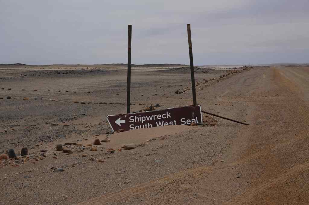
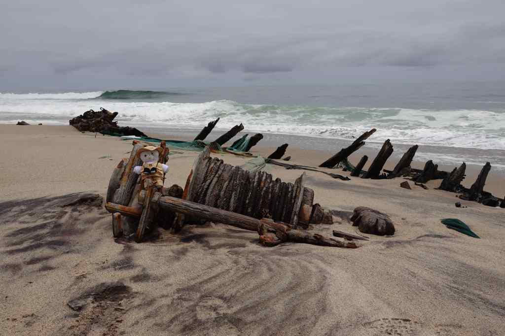
The insurance policy for my car limited my speed on gravel roads to a pedestrian 70 km/h, which made the miles pass very slowly. I tried to find music on my phone to match the utter emptiness of the place, and ended up playing Shostakovich string quartets. After an hour and a half, I saw a sign lying in the sand showing the location of a wreck, so I made a short detour and found the remains of a small fishing boat, which was being slowly buried by sand and dissolved by the salt water of the sea. Nearby was a huge bone from a dead whale, and three corpses of dead seals. It summed up the Skeleton Coast that this was recommended by the guidebook as a highlight and a nice place for a picnic.
Everything fees run-down on the Skeleton CoastOne of the Skeleton Coast’s highlights (really)
In another half an hour I reached the gates at the other end of the park. In the entire two hours I had spent there, I had seen only five living things other than plants – four vultures (who were yet to find the dead seals) and one seagull.
Finally – the exit from the Skeleton Coast!
With a sense of relief and disappointment I drove through to different national park, the Dorob. If anything this was even more featureless than the Skeleton Coast – a flat salt plane. But at least it had a salt road rather than a gravel road, meaning I could drive faster. It also had some wildlife – the colony of seals at Cape Cross, which I reached via a side road after a short stop to buy some impressively bulky salt crystals.
Buying salt
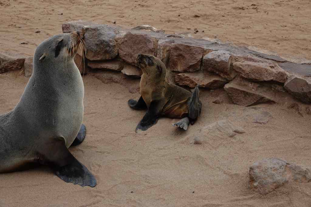
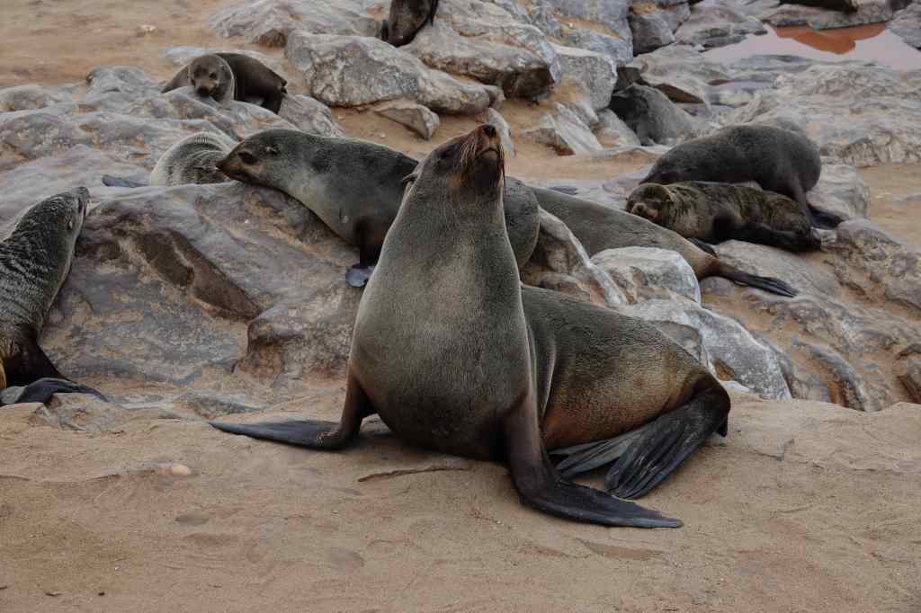
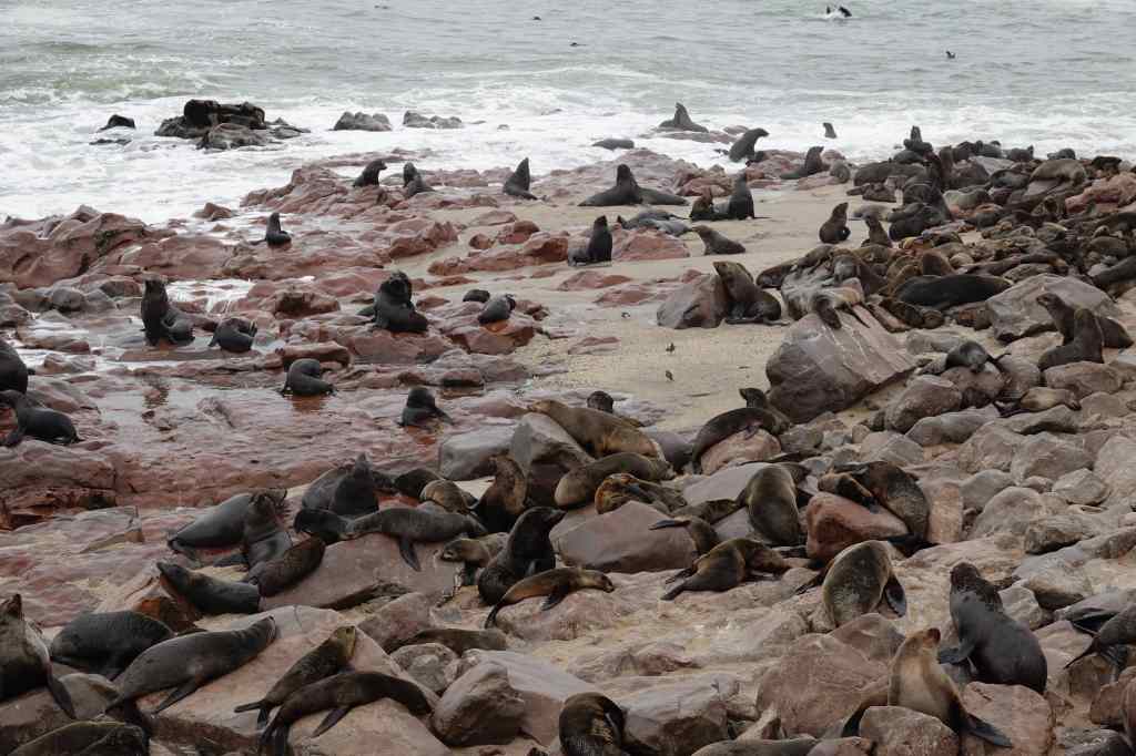
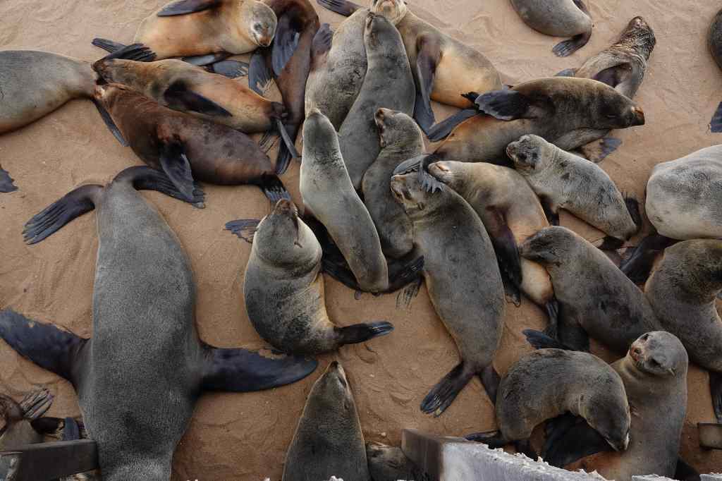
The Cape Cross seal colony was impressive – hundreds of seals lying on the sand or on rocks. There were also many dead animals, mostly pups, lying on the sand being pecked at by gulls. A wooden walkway took visitors around and over the colony; the narrow space under the walkway seemed to be a popular place for seals to rest. The noise – males fighting each other for females, or seals grunting in alarm as I was walked above them – was deafening. Even more overpowering was the stench, that covered the whole area. It resembled rotting fish, with maybe decaying flesh mixed in. I hurried to find the place on the walkway closest to the shore, reasoning that the air coming from the sea must be a bit more breathable. I stayed to take pictures until my nose and stomach insisted that it was time to leave to escape the putrid odour. On the photos, the seals look cute and pretty, but it is hard to convey how bad they smell.
A resident of Cape Cross Seal ColonySeals everywhere! Cape CrossCape Cross seals – cute….but oh, so smelly
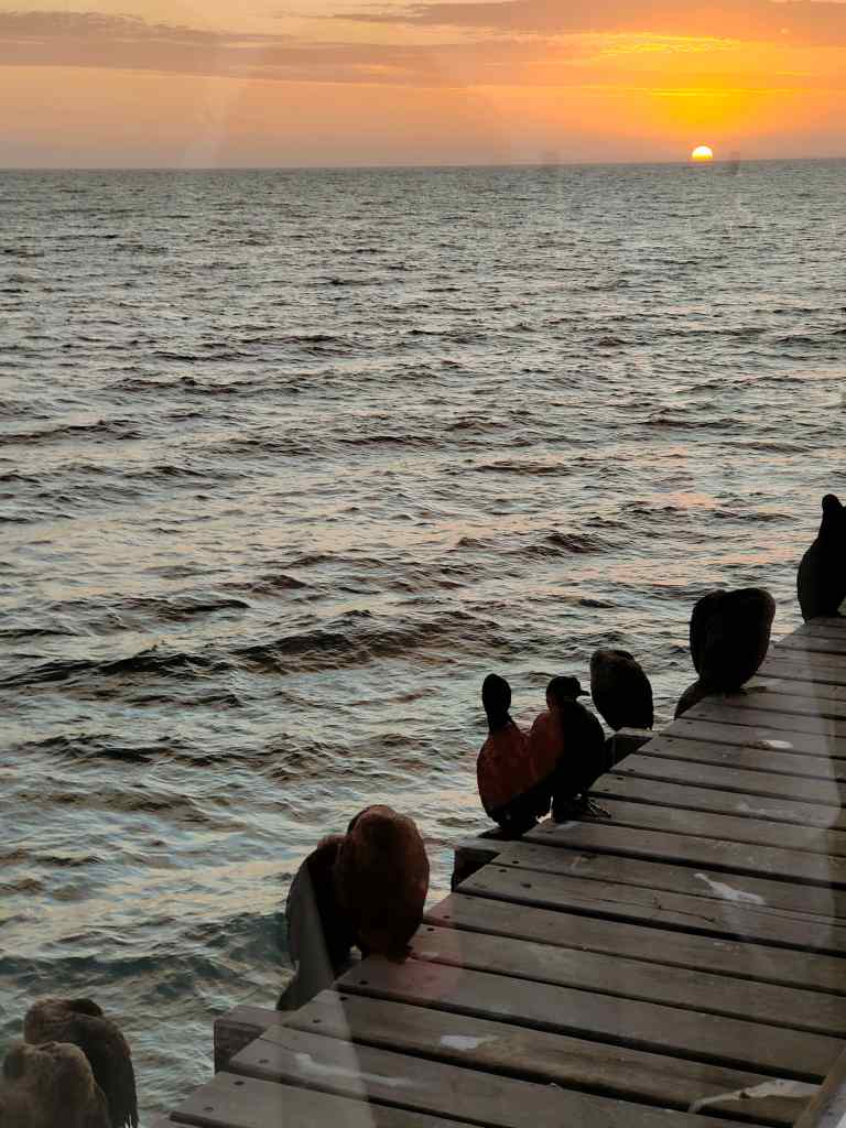
I regained my car and sped away, opening the windows wide to force the smell of the seals out of my clothes and fur. Soon I reached an asphalted road and could speed the remaining 100km/h to Swakopmund, where I just had time to check into my guest house before heading off for dinner. It had been a difficult day. The Skeleton Coast, which had so intrigued me in my childhood, had turned out to be a big disappointment. Going back to my guidebooks, I noticed that most of the photos shown were taken from the air – maybe the place is attractive from this perspective, but from ground level it was desolate and monotonous. I comforted myself with an excellent dinner in a fish restaurant located at the end of Swakopmund’s pier, in the company of a group of cormorants. It was nice to the have the company of living things that did not smell bad.
Sunset in a good restaurant in Swakopmund….the solution to a difficult day on the road