The Skeleton Coast and Cape Cross

A mum and her pup at Cape Cross seal colony

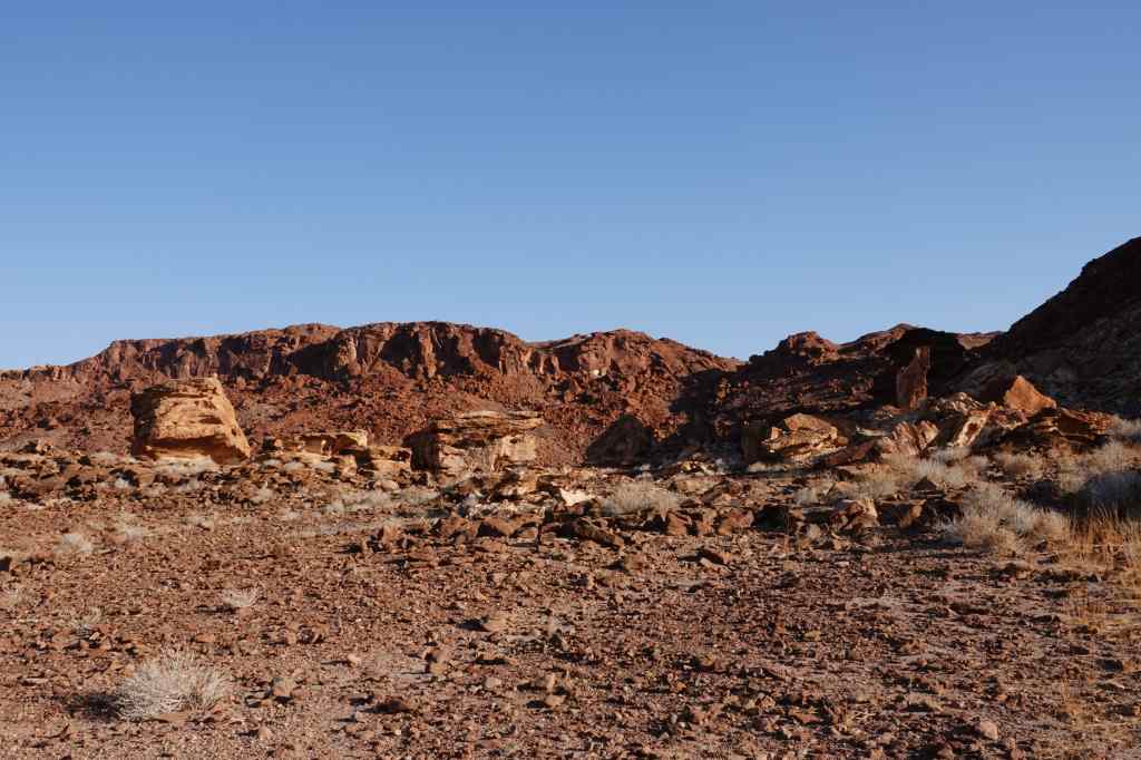
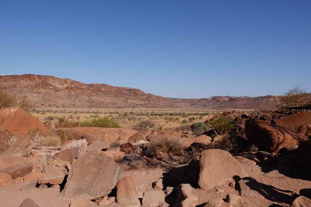
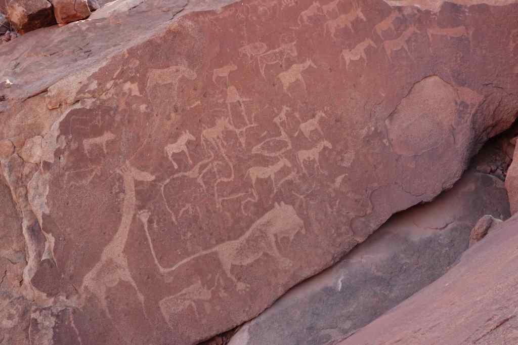
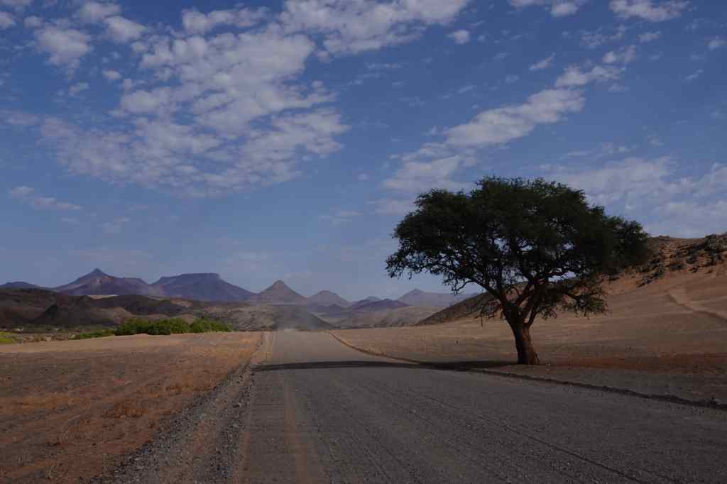
Today I set off on a long drive, from Twyfelfontein to Swakopmund, which is Namibia’s fifth biggest city (albeit with a population of only 25,000) and located on the coast, roughly half way down the country. To get there I was going to fulfill a childhood dream. When I was a young bear cub, my parents gave me a book about remote places in the world, and I was captivated by one of the them – the Skeleton Coast. The name was so evocative, and the book showed pictures of rolling dunes and wrecked ships, which were victims of the coast’s treacherous currents and dense fogs. Today, the Skeleton Coast is a national park and was rated highly by both my guidebooks. I set off with high expectations. At first, the road passed through some pretty Damaraland mountain scenery.

Damaraland scenery
Damaraland scenery on way to Skeleton Coast
More Damaraland scenery

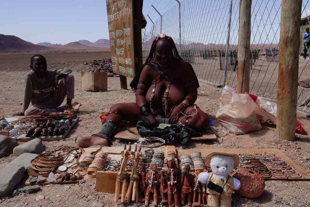
Then it became flat, and headed like an arrow to the coast. I reached the gates of the park at around 11am, and met this striking tribeswoman, who was selling jewellery for the few tourists that passed – in the register of visitors for the day, I was number 3.

An impressive sales lady

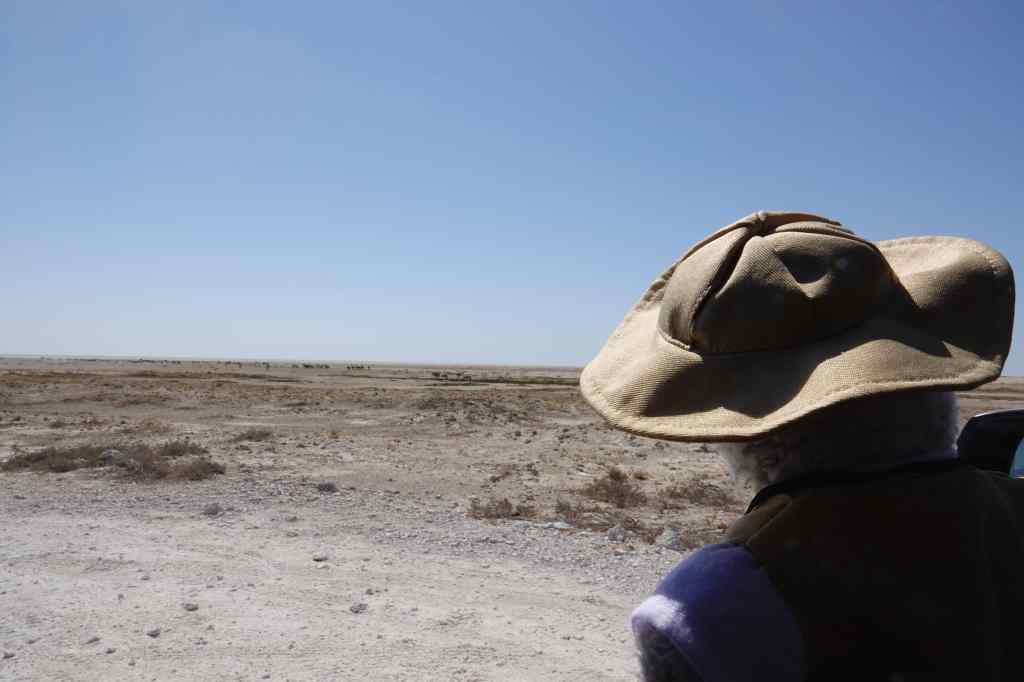
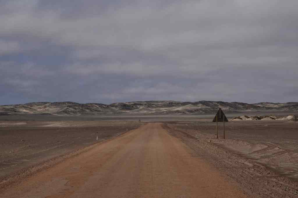
Then I headed into the park for a huge disappointment. The road was flat, and almost featureless. At first, the sea was at out sight, hidden behind some low sand dunes. It wild and desolate, but in a negative nihilistic way and not at all what I had expected.

a boring pic of a boring road - Skeleton coast
The Skeleton Coast – two hours of this….

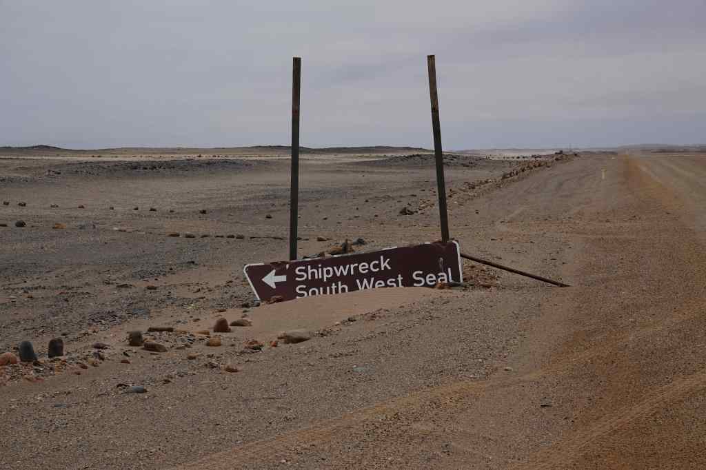
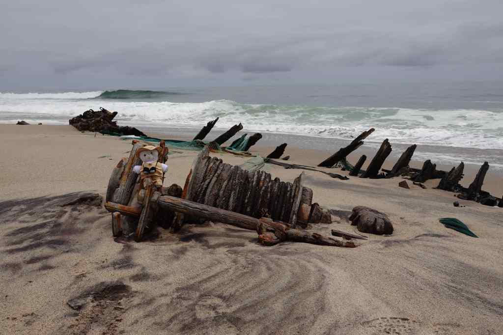
The insurance policy for my car limited my speed on gravel roads to a pedestrian 70 km/h, which made the miles pass very slowly. I tried to find music on my phone to match the utter emptiness of the place, and ended up playing Shostakovich string quartets. After an hour and a half, I saw a sign lying in the sand showing the location of a wreck, so I made a short detour and found the remains of a small fishing boat, which was being slowly buried by sand and dissolved by the salt water of the sea. Nearby was a huge bone from a dead whale, and three corpses of dead seals. It summed up the Skeleton Coast that this was recommended by the guidebook as a highlight and a nice place for a picnic.

Everything fees run-down on the Skeleton Coast
One of the Skeleton Coast’s highlights (really)

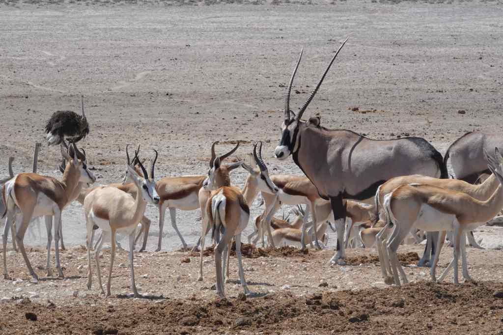
In another half an hour I reached the gates at the other end of the park. In the entire two hours I had spent there, I had seen only five living things other than plants – four vultures (who were yet to find the dead seals) and one seagull.

Finally – the exit from the Skeleton Coast!

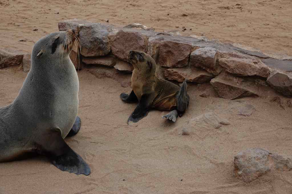
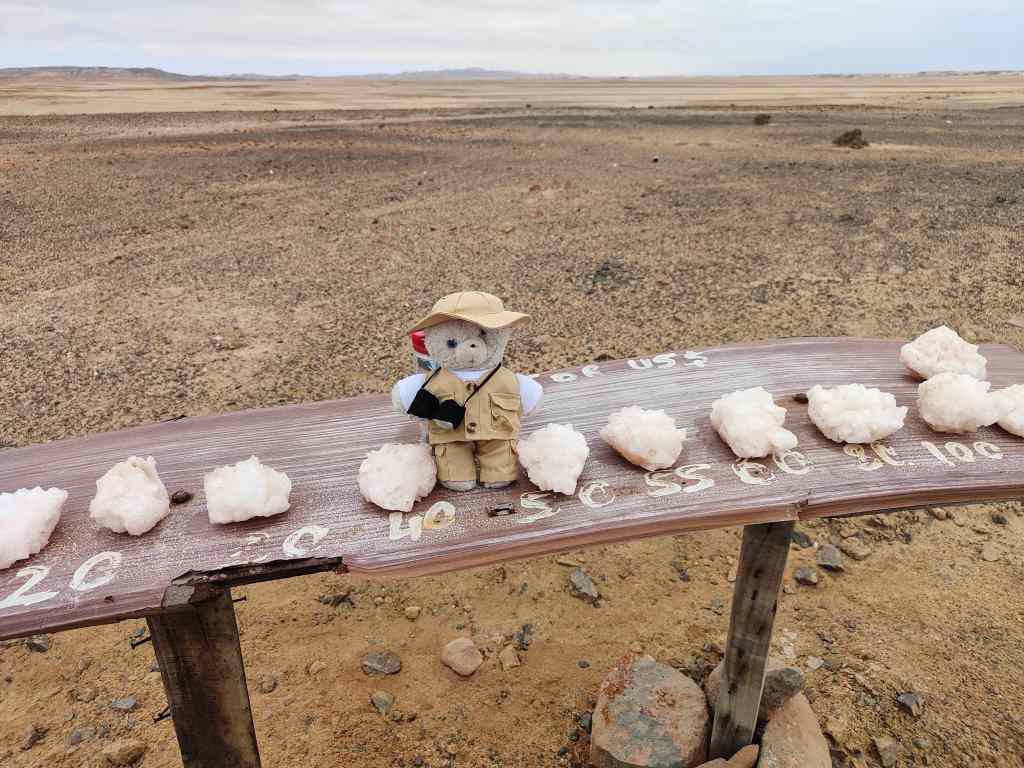
With a sense of relief and disappointment I drove through to different national park, the Dorob. If anything this was even more featureless than the Skeleton Coast – a flat salt plane. But at least it had a salt road rather than a gravel road, meaning I could drive faster. It also had some wildlife – the colony of seals at Cape Cross, which I reached via a side road after a short stop to buy some impressively bulky salt crystals.

Buying salt

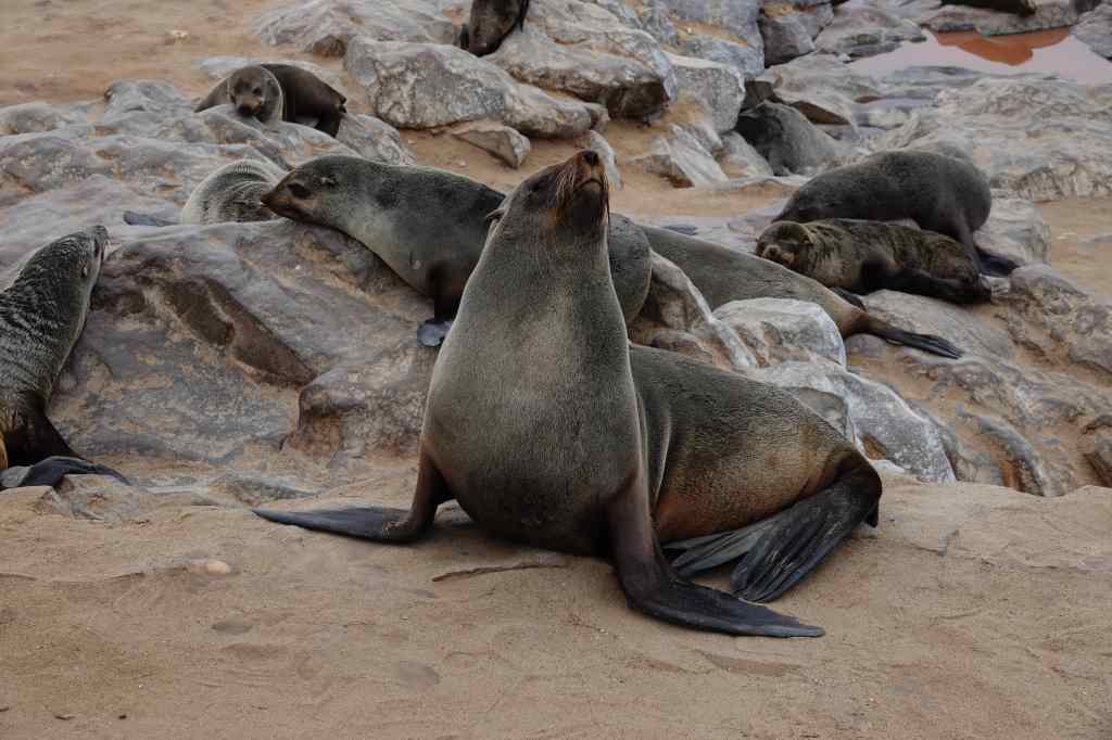
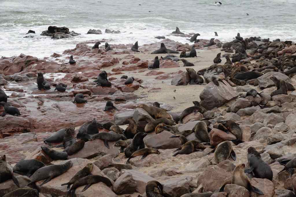
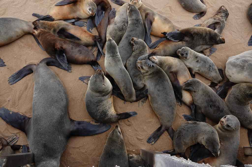
The Cape Cross seal colony was impressive – hundreds of seals lying on the sand or on rocks. There were also many dead animals, mostly pups, lying on the sand being pecked at by gulls. A wooden walkway took visitors around and over the colony; the narrow space under the walkway seemed to be a popular place for seals to rest. The noise – males fighting each other for females, or seals grunting in alarm as I was walked above them – was deafening. Even more overpowering was the stench, that covered the whole area. It resembled rotting fish, with maybe decaying flesh mixed in. I hurried to find the place on the walkway closest to the shore, reasoning that the air coming from the sea must be a bit more breathable. I stayed to take pictures until my nose and stomach insisted that it was time to leave to escape the putrid odour. On the photos, the seals look cute and pretty, but it is hard to convey how bad they smell.

A resident of Cape Cross Seal Colony
Seals everywhere! Cape Cross
Cape Cross seals – cute….but oh, so smelly

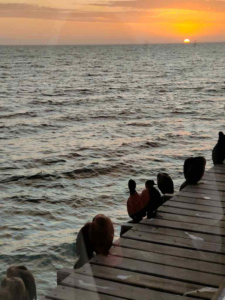
I regained my car and sped away, opening the windows wide to force the smell of the seals out of my clothes and fur. Soon I reached an asphalted road and could speed the remaining 100km/h to Swakopmund, where I just had time to check into my guest house before heading off for dinner. It had been a difficult day. The Skeleton Coast, which had so intrigued me in my childhood, had turned out to be a big disappointment. Going back to my guidebooks, I noticed that most of the photos shown were taken from the air – maybe the place is attractive from this perspective, but from ground level it was desolate and monotonous. I comforted myself with an excellent dinner in a fish restaurant located at the end of Swakopmund’s pier, in the company of a group of cormorants. It was nice to the have the company of living things that did not smell bad.

Swapkopmund restaurant
Sunset in a good restaurant in Swakopmund….the solution to a difficult day on the road

Next post: Swakopmund and Sandwich Harbour

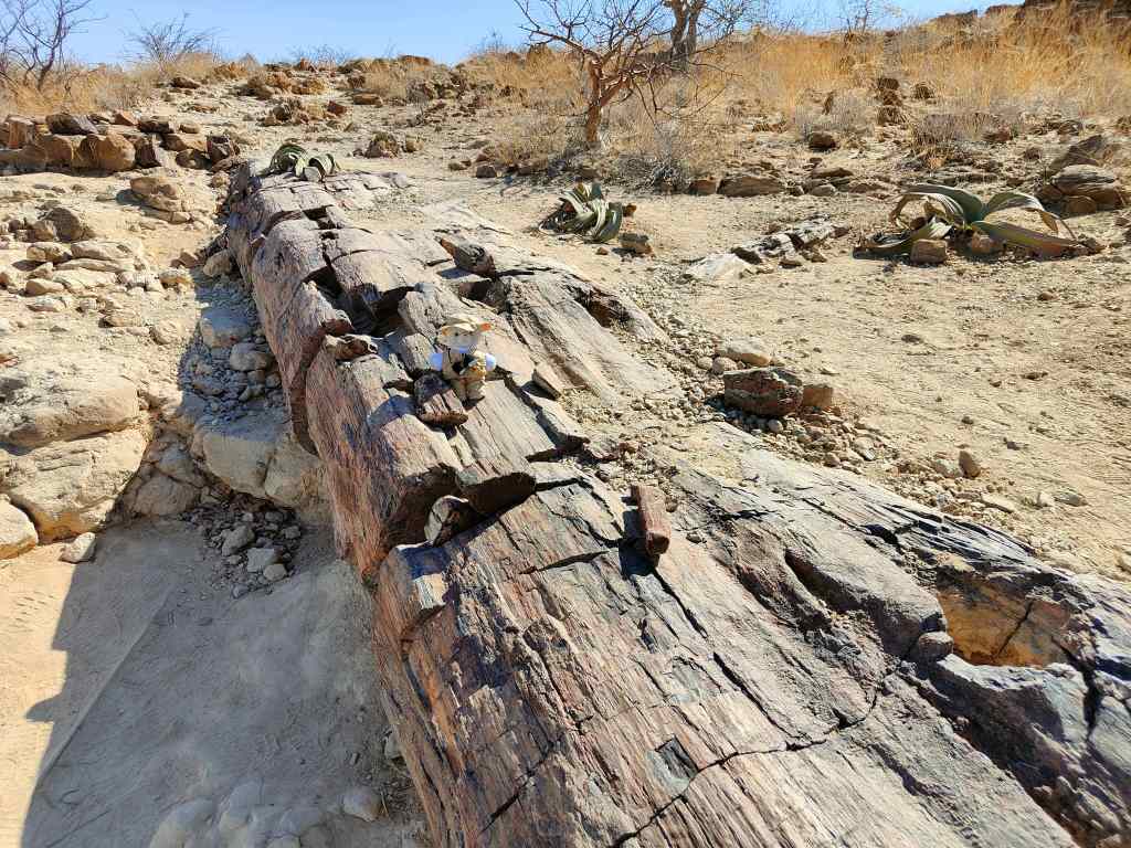
Previous Post: Twyfelfontein

Twyfelfontein – the “doubtful fountain” – and its rock art

Today I headed west from Etosha to Damaraland, a remote and dry part of Namibia that has famous collections of rock art (although most of Namibia is remote and dry). I spent the morning visiting a couple more waterholes, both of which were teaming with wildlife.

Early morning crowds at Etosha waterholes
Scanning Etosha’s horizon for more game from my car window

I then headed south to one of the park’s gates and said a sad goodbye to Etosha. It certainly deserves its reputation as one of the best places in the world to see game. I continued south to the town of Outjo, where I managed to find a usb cable for my camera (an essential first step in writing my blog). From there I headed west. At first, the road was asphalted, but then it turned into gravel. The scenery changed, as endless plains gave way to mountains and some interesting rock formations.

Damaraland
Damaraland scenery

I made a brief stop at the site of a petrified forest. Thousands of years ago, a great flood deposited some huge tree trunks, hundreds of kilometres away from where they had been growing. The trees were buried by sand and their organic matter slowly replaced by minerals – fossilising them.

A petrified tree, Damaraland

My next lodge was at a placed called Twyfelfontein, at the end of a particularly remote country road. It was built into the side of a mountain, around a bright red outcrop of rocks. I arrived in the late afternoon and settled down in the bar for an aperitif before an excellent buffet dinner.

My next lodge, Damaraland
The view from the bar

The next morning, I awoke to find baboons playing and drinking from the pond in front of my room.

Baboons playing, Damaraland

I had breakfast and to avoid the heat and the crowds, I set off early to the Unesco-listed Twyfelfontein rock art site, a short drive away. The area was inhabited by bushmen for thousands of years, and they left thousands of rock engravings (at Twyfelfontein) and some paintings (at a nearby site). I was assigned a guide who showed me around. She said the engravings were five to six thousand years old (on the web I have seen a range of estimates from one to ten thousand) and served various purposes.

Twyfelfontein rock art site
The rock art site at Twyfelfontein

The first set she showed us had representations of animals, and she said it was used to teach the bushmen children about the game in the area and how to hunt.

Educational engravings at Twyfelfontein

A second set was a map, showing the location of local waterholes – marked with exactly the same symbol that is used on maps today – a circle with a dot in the middle.

Possible map engravings at Twyfelfontein
Twyfelfontein rock art -The world’s oldest surviving map?

A third set showed more animals, including even seals and penguins – the coast is over a hundred km away, and the engravings prove that the bushmen led a nomadic existence and travelled widely. However there were no pictures of bears…..

More More -Twyfelfontein Rock Art

Other carvings had a religious significance. It is believed that the bushmen had a spiritual leader or shaman, who would go into a trance and have visions. The trance was believed to be a spirit world where the shaman would receive powers to heal the sick and bring rain. In this world, the shaman would change shape into powerful animals and saw strange geometric patterns – both of which are represented in the carvings. The giraffe was a common motif. It was believed to be a sacred animal to the bush, since it had its head in the clouds and could bring rain. The animal is often shown with stylised, wispy legs which may represent the feeling the shaman had during the trance of rising into the air.

Twyfelfontein -Trance animals

The most famous engraving represents another man/beast fusion from a shaman’s trances – a lion with human feet instead of paws and another human hand on the end of a very long tail.

The visit was very interesting, mostly for the guide’s explanation and the excellent information and displays in the visitor centre. These also explained the history of the site, first occupied by hunter/gatherer bushmen, who eventually settled to become farmers – a precarious life that depending upon the rains. In the 1940s an Afrikaans farmer and his family arrived from Cape Town. He gave the site its name, “Twyfelfontein” which means “doubtful spring” in English. The Afrikaans farmer family struggled to cope with the erratic rains and spring for fourteen years before leaving.

My visit lasted only about an hour and I headed back to my base, where I checked out yet more engravings on the rocks right in front of the hotel.

The rocks outside the hotel had yet more art

Then I settled down by the pool – after six days spent sitting in cars or airplanes, it was nice to swim and laze in the sun. In the early evening I went for a short walk around the along a marked trail – that eventually petered out. Still, it was pleasant to stretch my legs and absorb more of the austere, rocky scenery of the area.

Local scenery, Damaraland

I had dinner and went to bed early, so as to be ready for the long drive the next day along the famous Skeleton Coast. It was a part of the holiday I was looking forward to with anticipation.

Next Post – the Skeleton Coast

Previous Post – Day 2 at Etosha

Blog at WordPress.com.

Up ↑