A Day on the Nile and the Temple of Isis, Philae

Today was a very busy day. I had breakfast on my guest house’s roof terrace just as the sun was rising.

Aswan – The view at breakfast

Then I crossed over the mainland with the public ferry and made a short drive by taxi to the banks of Lake Nasser (formed by the Aswan Dam) to visit the Temple of Isis at Philae. It was the last day of Egyptian school holidays, and the temple was a popular destination for local tour groups and families with children. At the lake’s edge, many boats jostled to take visitors over to the island where the temple was located. I negotiated a rate for a private boat. The boatman seemed very happy to take an exotic passenger rather than yet another group of locals – not many bears visit Egypt.
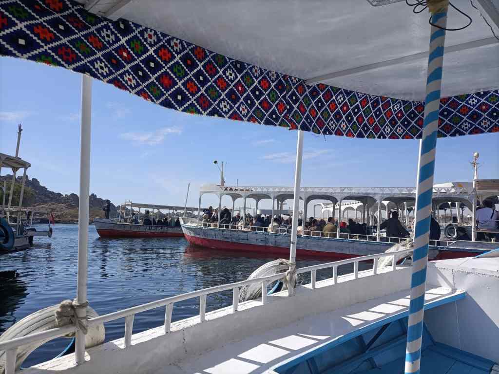
Boats jostling to get to Philae Island

The Temple of Isis is relatively modern by Egyptian standards. It was started around 690BC, though most of it was built around the third century BC by the Ptolemaic pharaohs (Egypt’s last dynasty of pharaohs before Roman rule). The Romans added some sections of their own – the Egyptian goddess Isis had become popular throughout their empire. After the Romans adopted Christianity, the temple was used as a Christian shrine, and most of the images of Egyptian gods were defaced. After the first Aswan dam was built in 1902, the temple was regularly flooded. The second Aswan dam in 1970 threatened to totally submerge the temple forever, but it was moved piece by piece to a new island with higher ground as part of the international effort to save the antiquities threatened by the new dam.
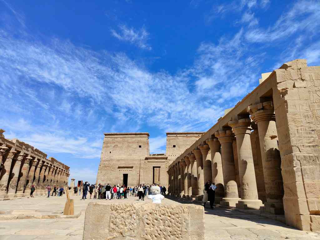
The Temple of Isis

I spent an hour and half admiring the different buildings making up the complex – including the courtyard of the main Temple of Isis….
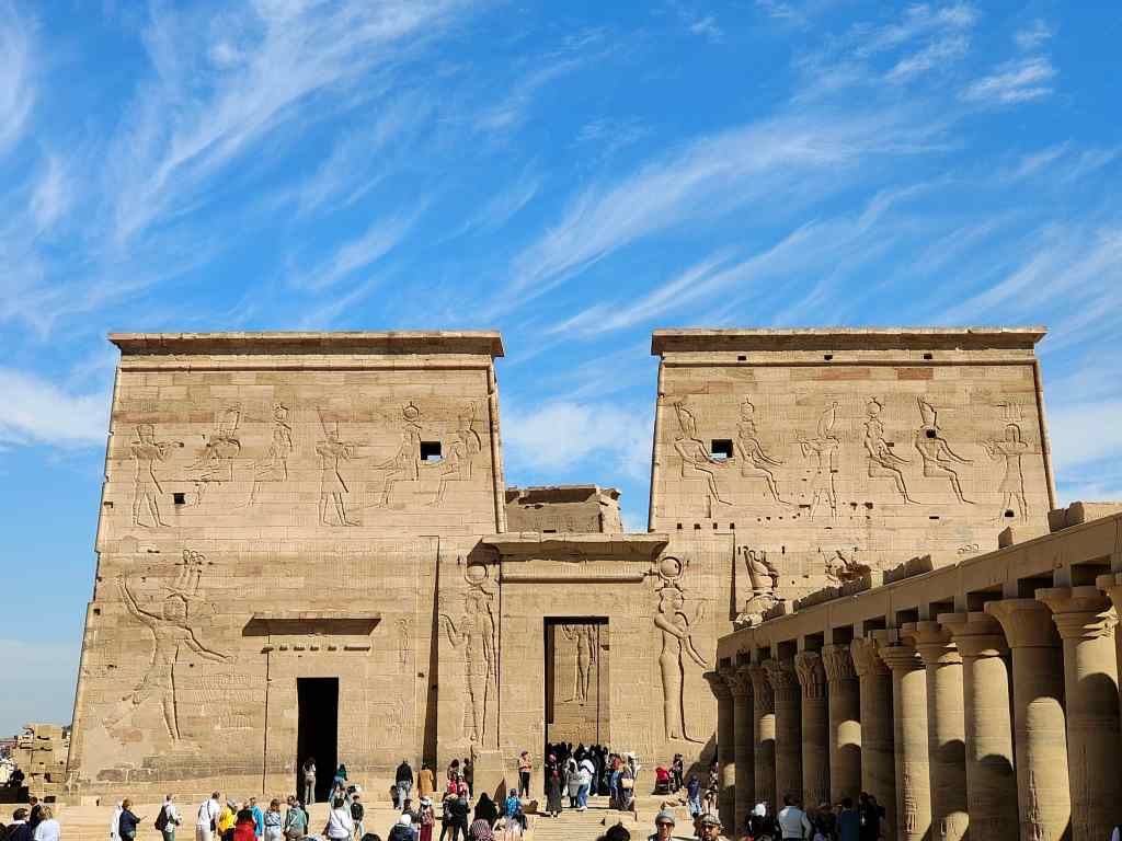
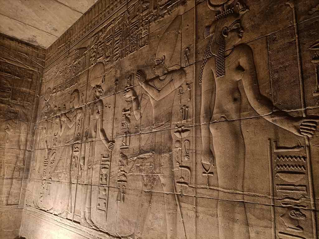
…….the interior of the Temple of Isis…….
……and the kiosk of Trajan, named after the Roman emperor.
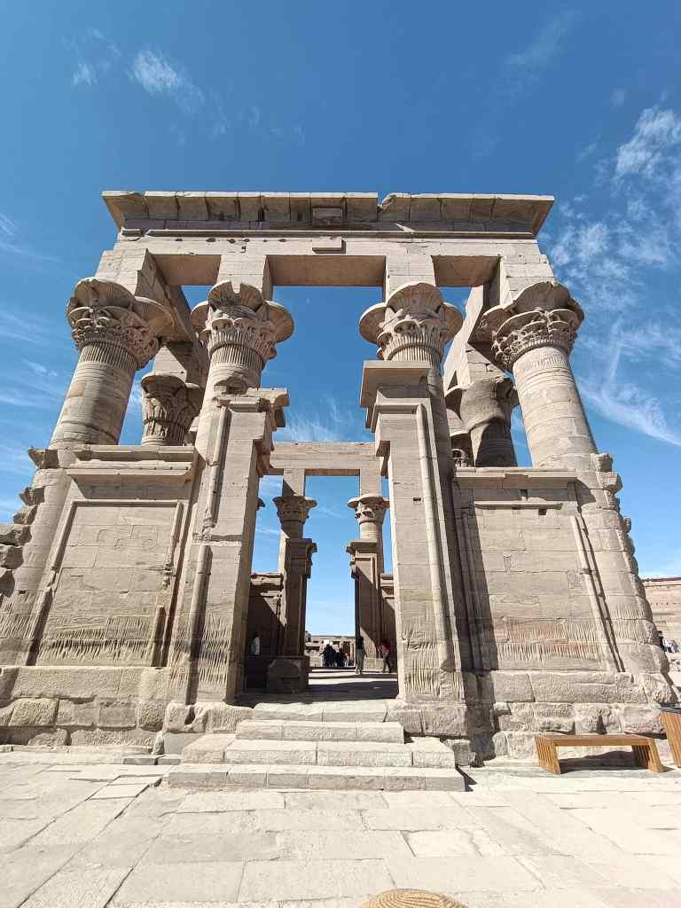
Kiosk of Trajan, Philae Island

The site was busy, and I found I could take some of the best pictures – without anyone getting in the way – from the boat on the way back.
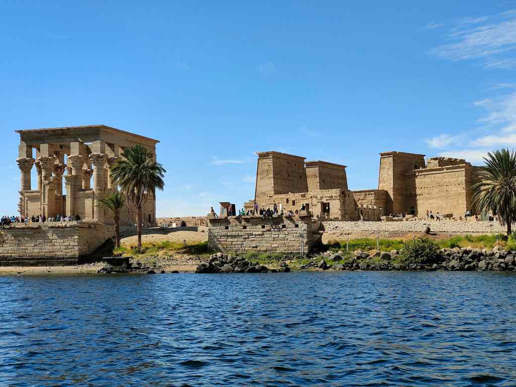
The Temple of Isis seen from Lake Nasser

Next my taxi dropped me off at the Nubian Museum in Aswan. This catalogues the history of the state of Nubia, that spent most of its existence being occupied by, or having to pay tribute to, its more powerful Egyptian neighbour to the south.  The history was interesting, but the items on display suffered from comparison with the Egyptian Museum in Cairo, which I had visited only two days earlier.
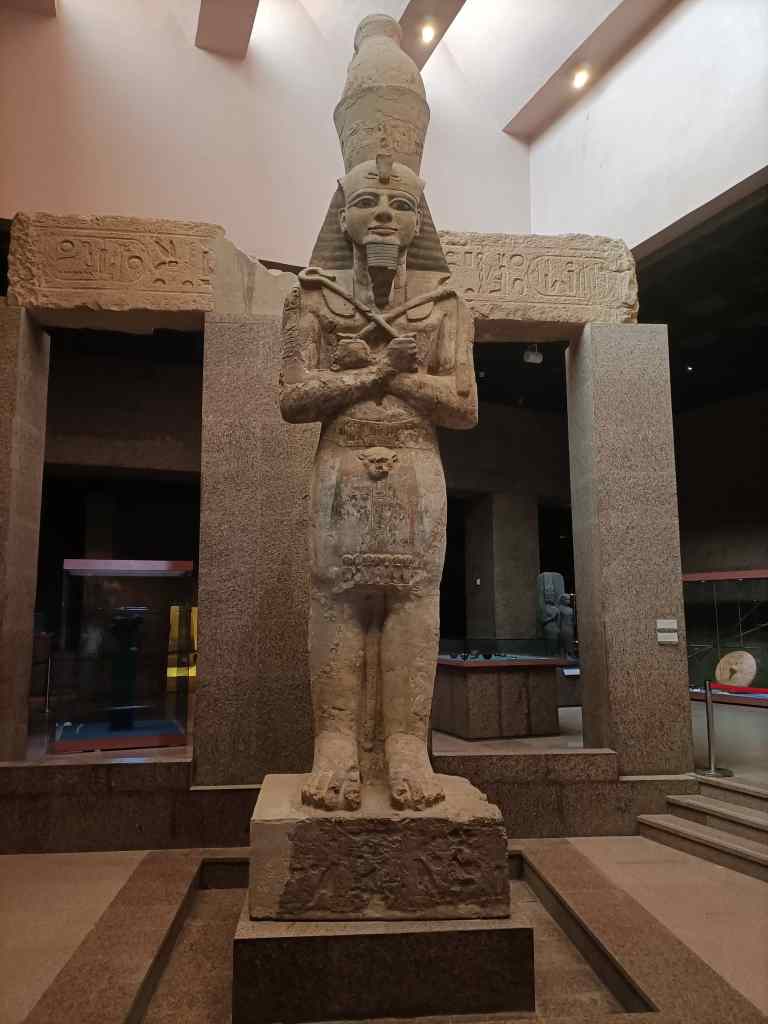
In the Nubian Museum, Aswan

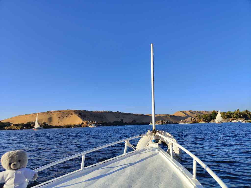
After visiting the museum, I had lunch and a coffee in a café overlooking the Nile and then I set off on a trip on a “felucca” – a traditional Egyptian sailing boat..
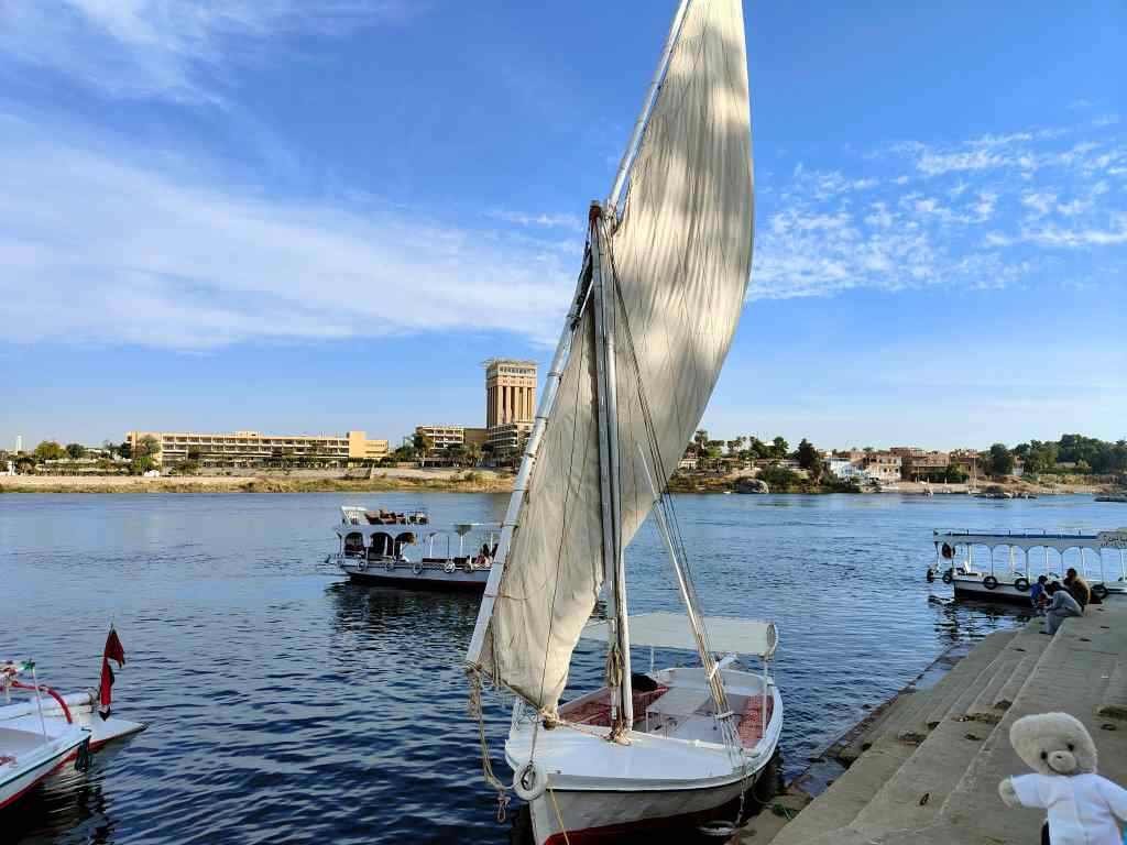
Starting my Felucca trip at Aswan

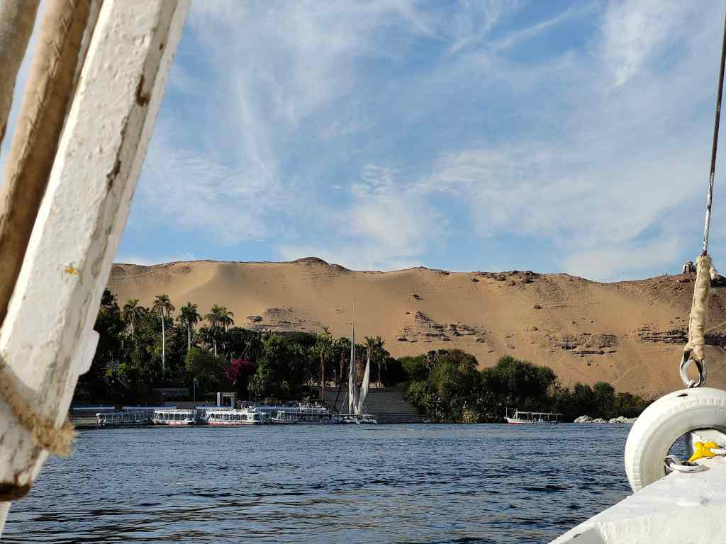
The weather was warm and sunny, and my trip offered great views of the mountains on the west bank of the Nile – every hill seemed to have some ancient ruin built on it.
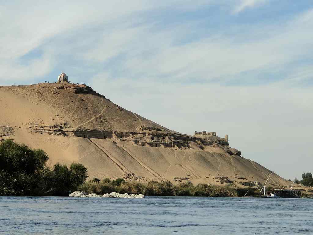
The West Bank of the Nile at Aswan

I asked the boatman to drop me briefly at Aswan’s botanical gardens, located on one of the many islands in this part of the river. In Victorian times, the island was given to the British general Lord Kitchener, who was passionate about exotic plants and turned the area into gardens. The story about their foundation was more interesting than the gardens themselves, and I was soon back on my boat enjoying the early evening sun.
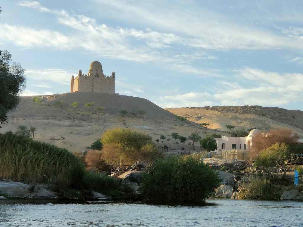
Kitchener’s Island, Aswan, home to the Botanic Gardens
The Mausoleum of the late Aga Khan – head of the Ismaili Muslims

The boat dropped me off back at my guest house on Elephantine Island and I set off immediately to the northern tip of the island to enjoy the sunset from the ruins of Abu. This area contained ruins of many different ages – some as old as 3000BC and some as recent as the 14th century AD – all jumbled together and most in an extreme state of dilapidation. One of the most interesting ruins was a “nilometer” – a set of steps going down to the river, flanked with stones with measuring markings that showed the height of the Nile. This was a very important instrument, because in ancient times, the pharaoh set taxes based on the maximum height of the river during its annual flood. A higher flood meant more water and more rich sediment washed down from central Africa, and so better crops for the kingdom’s farmers.Getting in was a typical Egyptian experience – the security guard said the site was closed for the evening but I could get in if I paid him the normal entrance fee. The ruins were just that – ruins – but the site was a great place from which to enjoy the setting sun.

Sunset at the northern tip of Elephantine Island, Aswan

The final part of the day was enjoying an early dinner and a fiery red sunset from a restaurant in Aswan city.
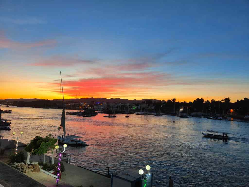
A Nile sunset at Aswan

It had been a very busy day, but I got home early enough to write a bit of my blog and make my first post before collapsing into bed. My guesthouse had basic furnishings, but its internet worked a lot better than that of the modern hotel I stayed at in Cairo.

Previous Post: Cairo to Aswan

Next Post: Abu Simbel and the Great Temple of Ramses II
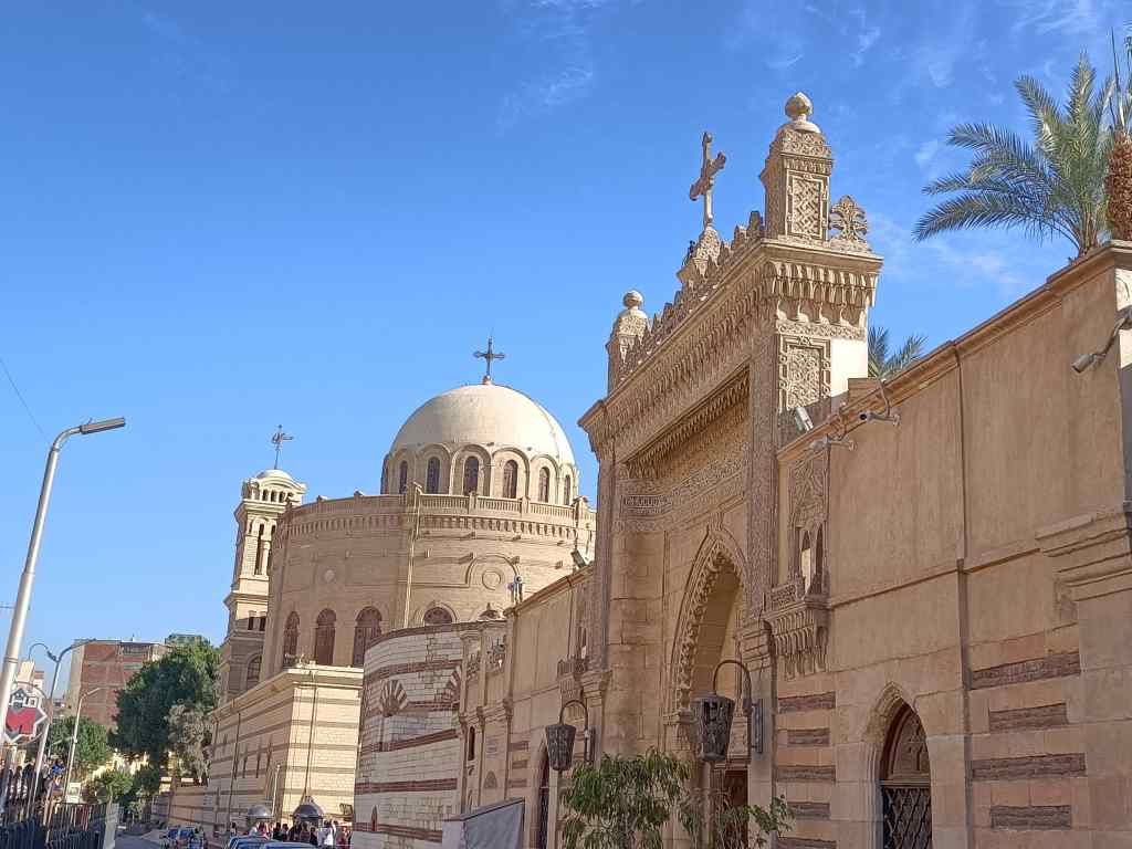
From Coptic Cairo to Aswan and the Nile

During the night I found out that the “Blue Nile” riverboat moored nearby (see previous post) was a nightclub which played very loud music into the early hours of the morning. The songs were clearly audible in my hotel; the volume inside the boat must have been deafening. The nightclub, combined with the honking of car horns, the screaming of police sirens and the early morning call to prayers from the nearby mosque all meant that I slept badly. Like New York, Cairo is a city that never sleeps.
In the afternoon I was due to fly to my next destination, Aswan. I would come back to Cairo for a few days at the end of my trip, but today I had to choose which of the city’s attractions to see in a sleep-deprived morning. I opted for Coptic Cairo. The Copts are a minority Christian group and their church – the Coptic Orthodox Church – is one of the oldest branches of Christianity, which legends say was brought to Egypt by St Mark in AD 42. Under the Romans, Christianity eventually became the official religion of the whole empire, and for a while was the main religion of Egypt. The Coptic Church split from the main Christian church in 322 following a disagreement about the exact divine nature of Christ. After the Arab conquest of Egypt in 642, Islam gradually displaced Christianity to leave the Copts as a small minority.

View of the main street of Coptic Cairo

Coptic Cairo is a small enclave of old Cairo which houses many churches, but also the Coptic Museum, a synagogue and a mosque. To get in, you need to pass through a bag check and every hundred metres in the main street, armed police were stationed. Egypt has had a long history of bloody terrorist attacks, and security for any area that draws crowds is always tight.

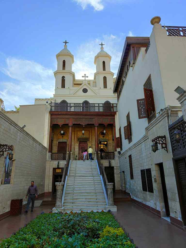
Once through the security check, it was like entering a different world. The anarchic traffic of Cairo was replaced by one empty central street (cars are not allowed in) and a wonderful calm. I started my visit at the Hanging Church, so called because it was built on top of the gate of an old fortress. The church was originally built around 690AD, though a new façade with two bell towers was added in the 19th Century. It is probably the most famous of Coptic Cairo’s churches.

The Hanging Church

Next, I found the Greek Orthodox Church of St George

Church of St. George

And then the Coptic Museum, which I strolled around for about an hour. It had collections of Coptic art, icons and fabrics; the old building it was housed in was as interesting as the collections themselves.

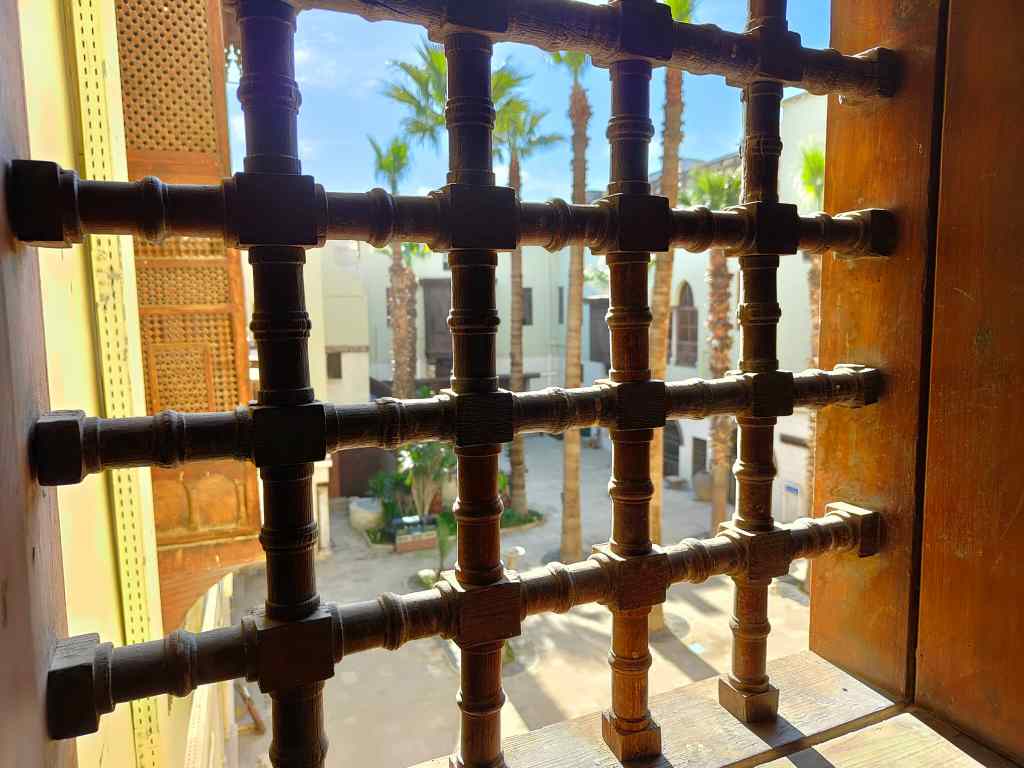
Looking out from the Coptic Museum
In the courtyard of the Coptic Museum

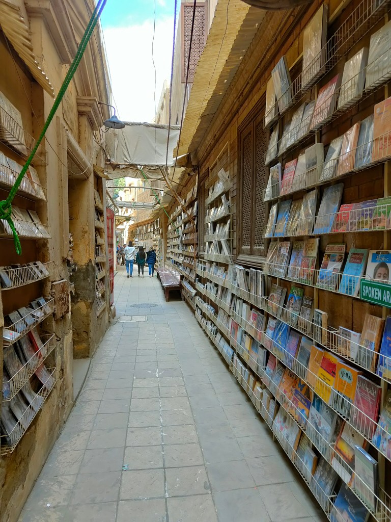
Finally, leading off from the only road, I found a little maze of side alleys, leading to yet more churches and a synagogue. When I arrived, Coptic Cairo had been quiet, but now there were many visitors – some Egyptians on a weekend outing, and some foreign tour groups, which mostly seemed to be Russians.

Bookseller in Coptic Cairo

It was time to move on, and I grabbed an Uber back to my hotel to pick up my bags and then another one to the airport. It was Friday, the first day of the Arab weekend, so everything went very smoothly with no traffic jams. At the airport I was treated to one of the toughest security checks I had ever had – shoes, belt and watch all had to be removed and scanned, and then I was thoroughly “frisked” for concealed weapons in my fur.

The flight flew over endless yellow desert sand, interspersed with a few mountains. Occasionally I caught a glimpse of the blue ribbon of the river Nile lined with bright green vegetation on both banks.  I arrived on time in Aswan, a town on the Nile that was the historic boundary between the ancient Egypt of the Pharaohs and the rival Nubian state. The latter enjoyed brief periods of independence but spent most of its history occupied by, or subjugated by, its more powerful southern neighbour. Today, Aswan is also known for the famous Aswan dam.

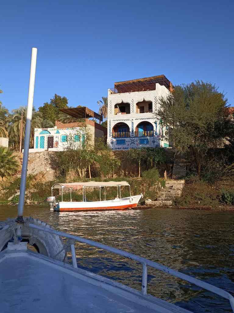
My guest house was on Elephantine Island, a place only accessible by boat. It has several ancient ruins, one ugly modern hotel, and many small townhouses. Some of these were painted with distinctive Nubian bright patterns of coloured geometric shapes. My guest house was on the other side of the island, and its owner picked me in his motor launch to take me there. It was the first of many times I got to experience the pleasure of sailing on the Nile.

On the way to my guest house at Aswan……
…..and arriving (my guest house is on the left)

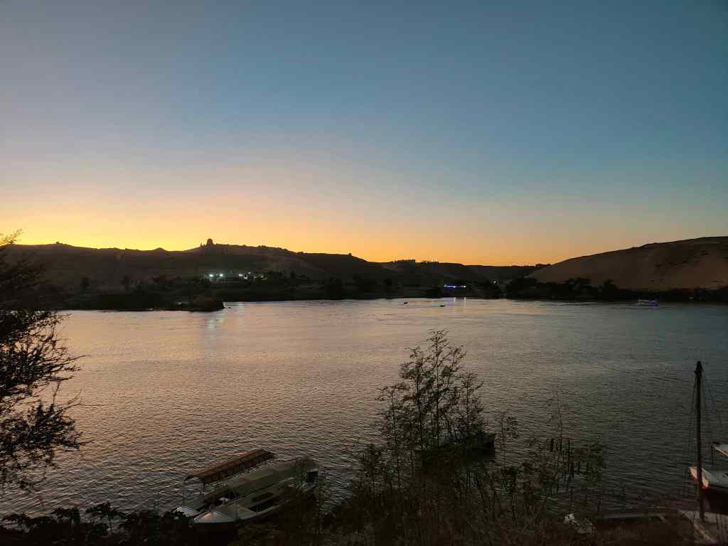
I arrived just in time to have a welcome drink on the roof terrace.  The view was beautiful, and the owner pointed out local landmarks like the Mausoleum of the last Aga Khan (head of the Ismaili Muslim sect) and the Monastery of St Simeon. After the chaos of Cairo, it was wonderfully peaceful……if rather chilly after sunset. I was glad of my fur!

The view from my balcony, Aswan
The sun sets over the Nile, Aswan

I decided to explore the island and see if I could reach the hotel, which had a panoramic terrace and bar in its ugly modern tower. I walked through a maze of twisting and turning small streets with no names…amazed to find that Google Maps could navigate through the area. When I had nearly reached the hotel, someone told me that it was surrounded by a wall and only accessible by special ferry from the main city. Instead I found a restaurant at the river’s edge, and enjoyed a beer watching the lights of Aswan city in the distance and listening to the boats chugging past.

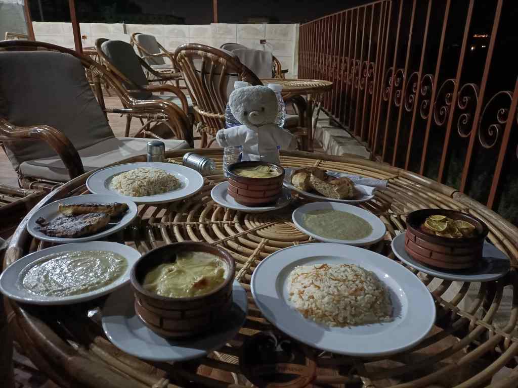
I had dinner back in my guest house, and enjoyed freshly caught Nile perch……..

A feast of fresh Nile Perch

…… before wrapping myself up in warm blankets in bed.

Next Post: A day on the Nile

Previous Post: A Bear in Cairo

ABC – A Bear in Cairo

The Bear is Back!

This trip is to Africa, to Egypt.  I want to get away from the cold in the UK and get a little bit of sun. My first stop, almost inevitably, is Cairo. My flight arrived on time and I breezed through the formalities of getting my visa on arrival and a sim card for my phone. I was soon sitting in a taxi, expecting to be stuck for hours in Cairo’s famous traffic jams – but instead I reached my hotel in only forty minutes.

The next morning, I set off for Cairo’s most famous attraction – the pyramids at Giza, a suburb of the city. Getting there was fun. First, I took Cairo’s metro. This was built recently, with the first line opening in 1987, but already looks rather tired and run down. However, it works well and soon I was at Giza metro station, where several polite Egyptians helped me find the minibus that went to the pyramids. On arrival I joined a queue of people jostling to buy entrance tickets, and then filed in together with many other visitors – mostly Egyptian.

The pyramids and Sphinx from near the entrance to the Giza site

From the entrance to the Giza pyramids was a walk of about 500m up a hill. Every few steps I was proposed a horse or camel ride, and having to dodge other visitors, avoid horse droppings or carts rushing past made the climb something of an ordeal.

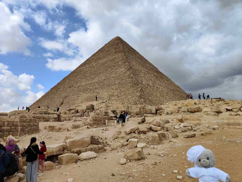
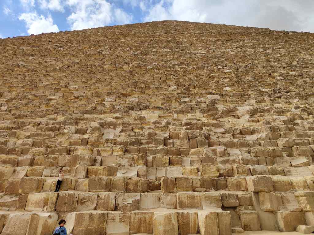
I finally got to the base of the Khufu Pyramid, the largest pyramid (although its neighbour, the Khafre Pyramid looks taller because it was built on higher ground). As expected, the “Great Pyramid” was an awesome sight.

The Great Pyramid of Khufu
Makes you feel small (especially small teddy bears)

It is hard to believe that over 4,500 years ago, human beings had the ability to build something so massive – 2.3 huge blocks of stone, weighing 6 million tonnes in total. It remained the tallest man-made structure in the world for 3,800 years.

I had invested in a ticket to visit the inside – a narrow, low path through the rock climbed steeply into the heart of the pyramid. It was a hot and humid inside and I had to squeeze past people coming the other way – not a place for people with claustrophobia.

Into the heart of the Great Pyramid

Finally, I reached an unremarkable chamber where the king’s equally unremarkable sarcophagus stood. I am sure that this will not be the highlight of my trip, but at least I can say I did it.

The rather disappointing burial chamber of Pharaoh Khufu

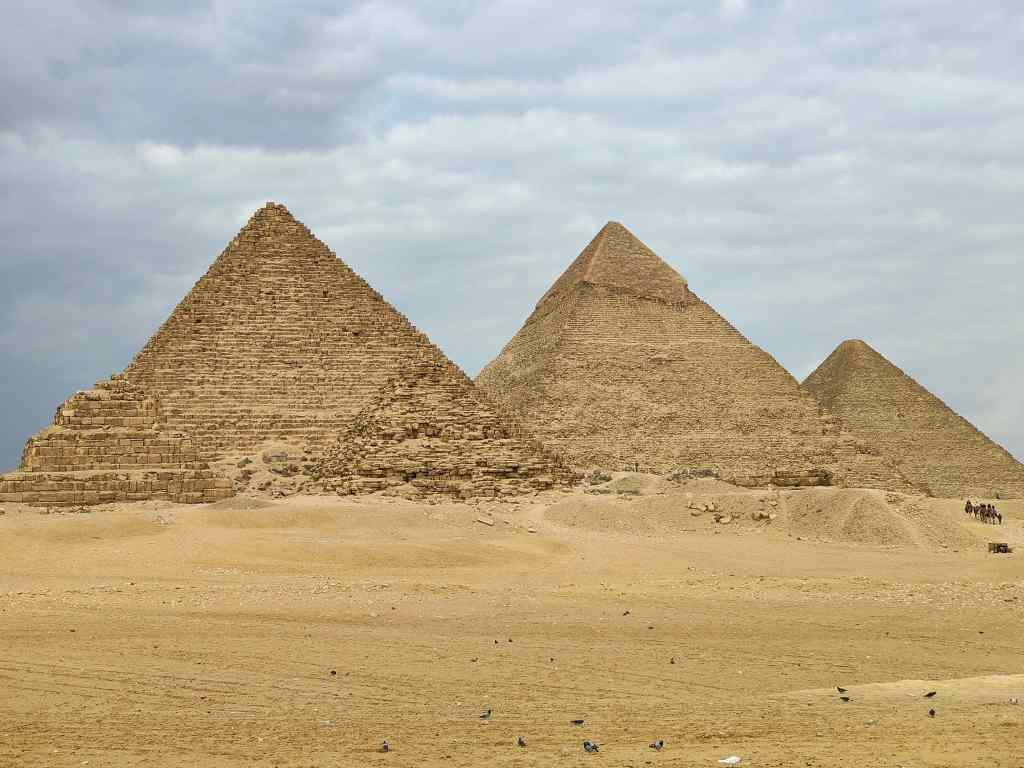
From the Great Pyramid I walked around to the Khafre Pyramid and then into the desert to a panoramic view point as camels and horse-drawn carriages sped past me on either side. Again, the walking was hard going – this time from walking through dirty sand littered with camel droppings and discarded plastic bottles.  I was rewarded with a wonderful view of the three pyramids, without the crowds this time.

The definitive photo of the pyramids at Giza
Finally a view without Giza’s usual crowds

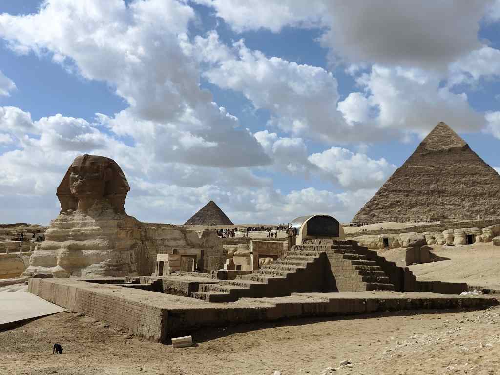
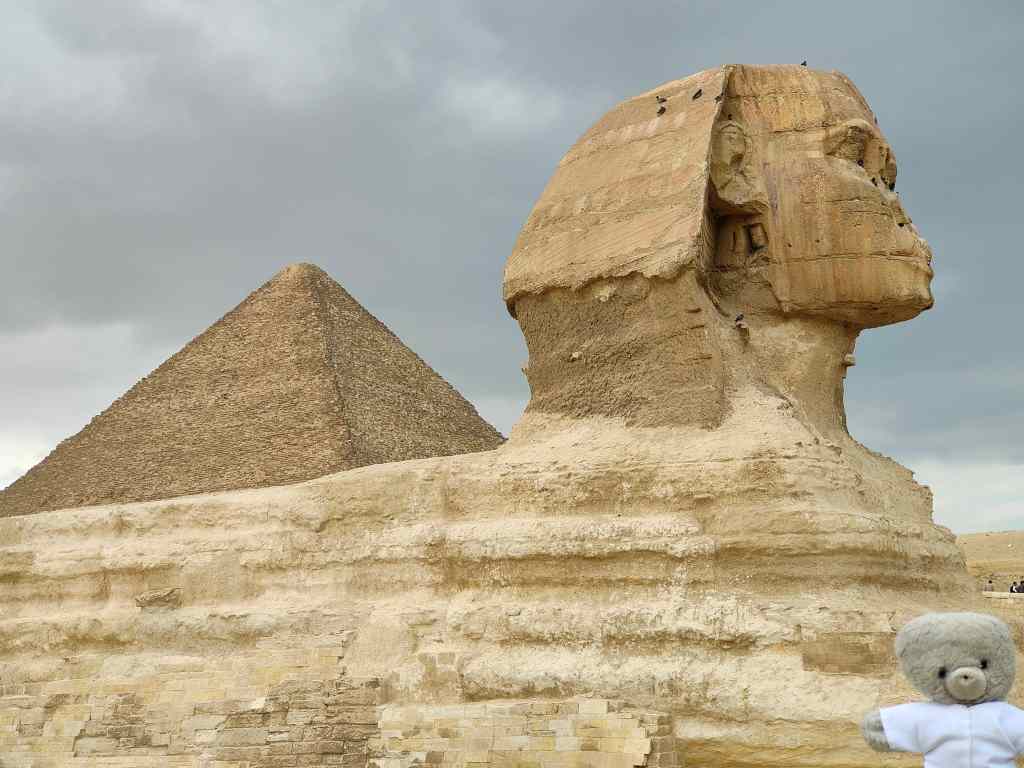
I headed back to main entrance, passing the famous “Sphinx” on the way – which in real life looks a lot smaller than in photos. 

My new friend the Sphinx, Giza

To get back to the centre of the city, I tried Uber and found that it is by far the best way to get around Cairo. Cars arrive quickly, the “comfort” category ones even have rear seatbelts (a rarity in Egypt), and even after a generous tip, the rides are so cheap that you feel very sorry for the drivers. Forty minutes and $5 later I was back in the centre of Cairo in front of the impressive exterior of the Egyptian Museum.  

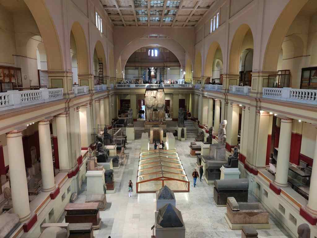
Inside, on a first impression the place had an abandoned feeling, like the home of an elder relative who hoarded their possessions throughout their life. Sometimes items were described in Arabic, English and French, sometimes in Arabic and English, sometimes in Arabic only, sometimes not at all…….and once in Braille only. A huge new museum to house Egypt’s archaeological treasures is scheduled to open sometime (its opening has already been postponed by several years), so this might explain the apparent neglect of the current museum.

The Entrance Hall of the Egyptian Museum, Cairo

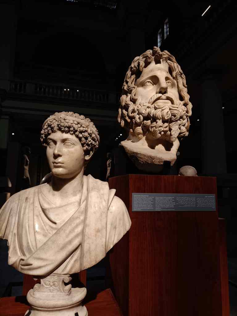
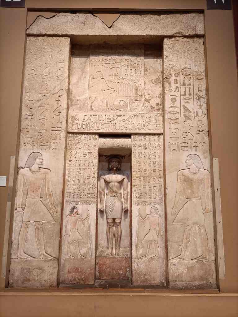
However, once I started exploring, I loved the place. I wandered around dimly lit corridors, stumbling upon treasure after treasure. Being able to hunt out exceptional items for myself, became part of the fun.

Some of the Egyptian Museum’s treasures

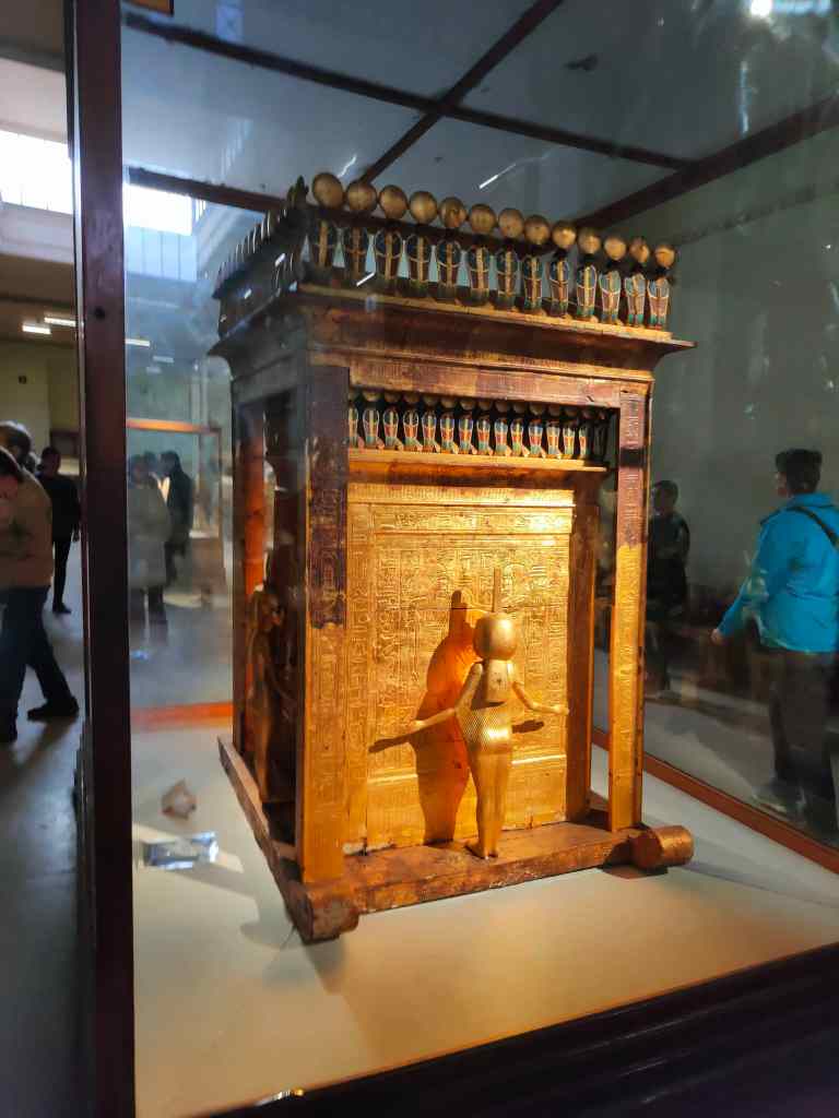
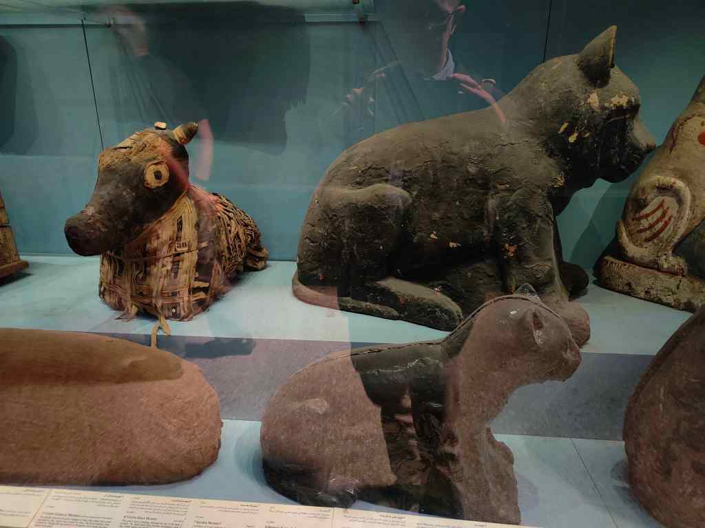
In most of the rooms there were few visitors, but the presence of a crowd announced the museum’s highlight – the contents of Tutankhamen’s grave (photos not allowed sadly!). Here the display and lighting were perfect, and despite the queue, the items on show dazzled me – not just the famous death mask, but also his jewellery and two coffins. After this memorable sight, I continued to wander around the museum, enjoying lesser-known exhibits like the mummies of the Pharoah’s pets and farm animals (cats, dogs, cows and even one mummified crocodile. At closing time, I sneaked back to the Tutankhamen display for a second look, and enjoyed having the room almost to myself.

Mummified pets in their coffins, Egyptian Museum Cairo

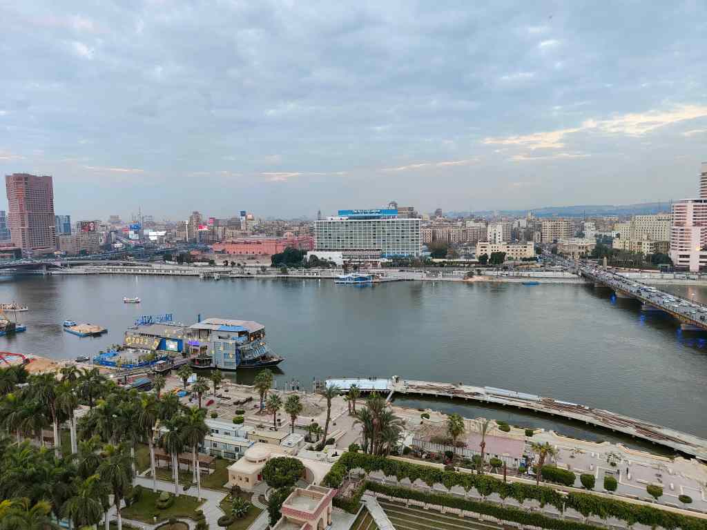
I headed back to my hotel and enjoyed the view of the Nile with a non-alcoholic cocktail from the roof terrace.

The view from my hotel, Cairo – note the “Blue Nile” boat which will feature in my next post

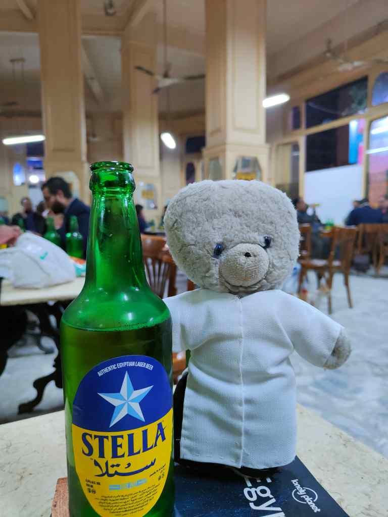
I then headed off to Cairo’s downtown in search of beer – which is not widely available. Outside of high-end hotels, alcohol is served mainly in rather seedy bars. I chose the most respectable looking one and was given a cold beer as soon as I had sat down – beer being the only thing on the menu. The local brew Stella turned out to be perfectly drinkable. 

The local beer Stella in one of the more respectable Cairo bars selling alcohol

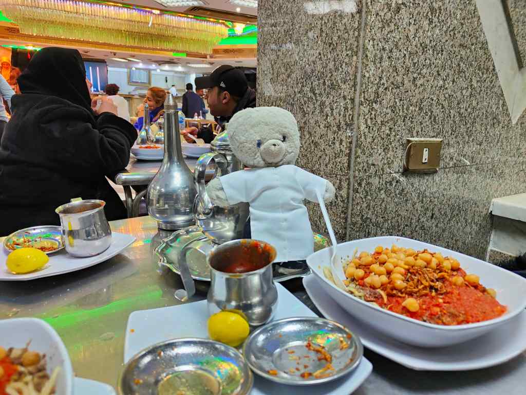
Dinner was “kushari” – a vegetarian dish made with chickpeas, lentils and pasta in a spicy tomato sauce, prepared by the waiter in front of me with a splash of showmanship. I asked for the bill and was just about to pay what I thought was a very reasonable 227 Egyptian Pounds (7€) when the waiter apologised and said he had made a mistake. I was astonished when the bill for my large meal for two (bears have big appetites!) came back as 127EGP or 4€.

Kushari in Cairo

Back at my hotel, I settled down for a quiet night. I had seen one of the wonders of the world – the pyramids and the Sphinx. But I had a nagging feeling that I had simply ticked off an item from Egypt’s (or the world’s) “must see” list rather than actually enjoying the experience. The Egyptian museum, on the other hand, was an unexpected gem of a place, and Cairo’s downtown was chaotic fun.

Next Post: From Coptic Cairo to Aswan

Trouspinet’s Top Tips and Highlights for Argentina

Wow, what a journey that was! Argentina jumps effortlessly into the list of my top 5 destinations of all time, and for scenery, it would be No. 1. However, this trip required lots of planning, and I also learnt a lot as I was travelling. In this post I list my personal highlights and give some tips for planning (valid as of November 2022).

TROUSPINET’S HIGHLIGHTS

To help you plan your trip, here is my ranking of the places I visited on this trip:

  1. Quebrada de Humahuaca (northwest Argentina)
  2. Perito Moreno Glacier, Patagonia
  3. Foz Iguazu
  4. Mount Fitzroy, Patagonia
  5. Torres del Paine, Chilean Patagonia
  6. The drive from Mendoza to Aconcagua
  7. The drive from Salta to Cachi
  8. Puerto Varas and the Chilean Lake District
  9. Buenos Aires
  10. Mendoza’s vineyards
  11. Bariloche and the Argentine Lake District
  12. Salta

I put Bariloche and Salta bottom because there are places in Europe a bit like them, whilst the other places are unique in the world. But I really enjoyed even my lower-ranked locations on this trip – I simply didn’t have a single bad travelling day.

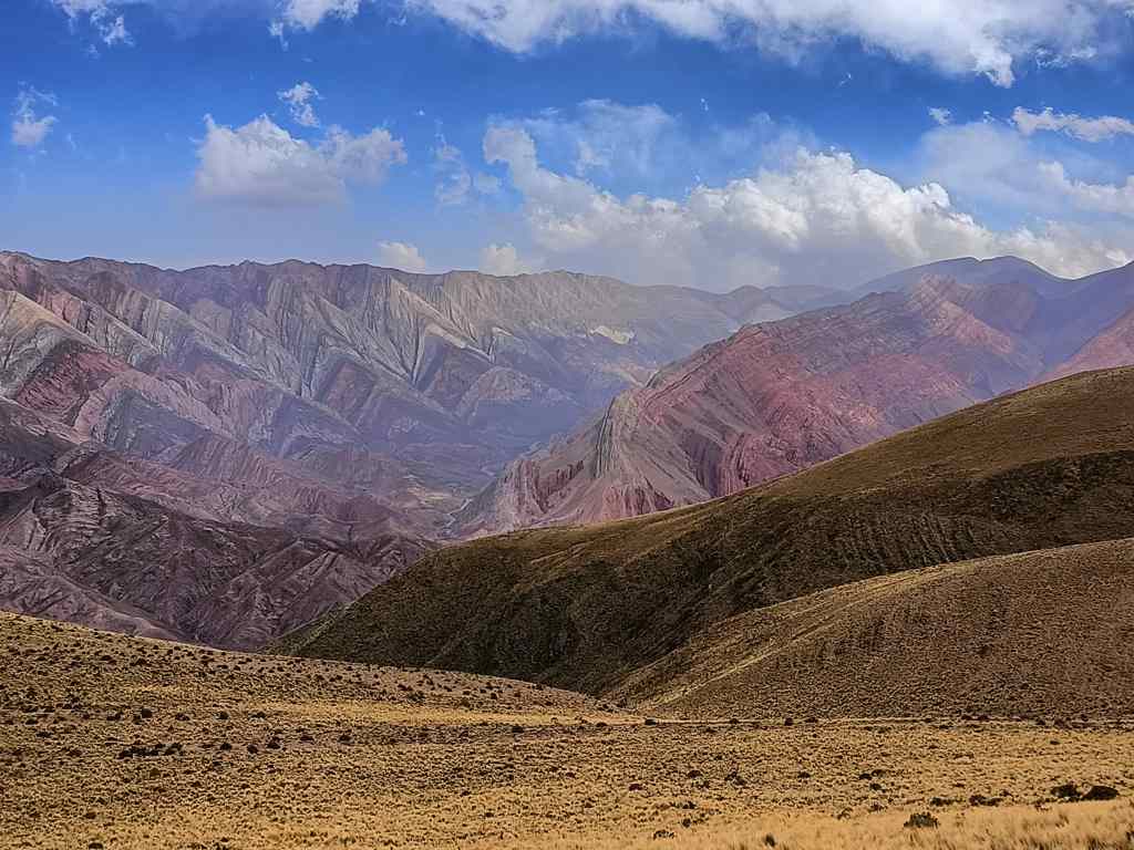
The Quebrada de Humahuaca

TROUSPINET’S TOP TIPS

Be Selective – Distances are huge, as is the choice of places to visit.

Unless you have the time (and endurance) for 12-36 hour bus rides, you will need to fly if you want to see many of the country’s highlights. I went for nearly one month, usually flew between destinations, but still did not have time to see everything I wanted to. After much thought, I regretfully excluded Ushuaia and some of the national parks from my list. You will also have to make some hard choices.  

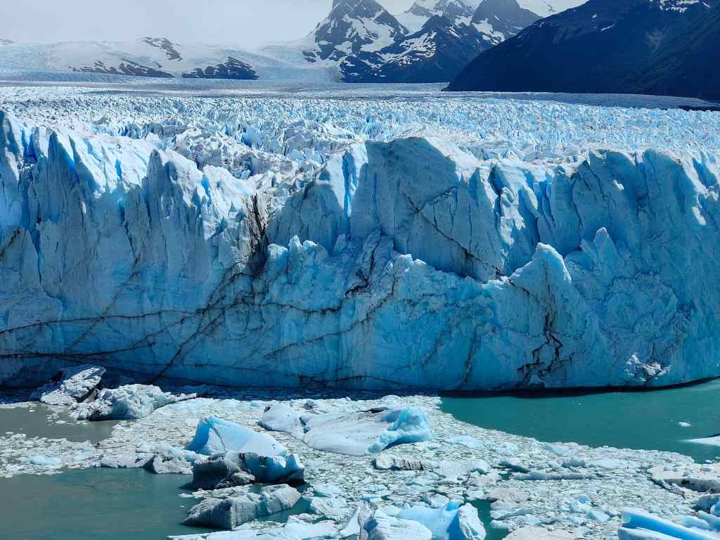
Perito Moreno Glacier

Check which Internal Flights operate

The main flight operators in Argentina are Aerolineas Argentinas, JetSmart and FlyBondi. Argentine airlines have a bad reputation for reliability and punctuality, but I had no major delays in any of my seven internal flights.

Check when flights go direct from one regional destination to another (eg Salta to Mendoza), without having to go back to Buenos Aires and out again. These flights will save you a lot of time and money, but they don’t operate every day. The popular and very convenient Bariloche-El Calafate flight only operates in the peak tourist season – late November to February.  If you do have to fly back to Buenos Aires, remember it has two airports – the very convenient Aeroparque Newberry (AEP) located in the city, and Ezeiza (EZE), which is a long way out of town. Book ahead for anything In, To or From Patagonia over November – February. The region is hugely and justifiably popular in the southern summer. I went in November – not the peak season – and even then, I heard that the buses from El Calafate to Bariloche were fully booked for several days.

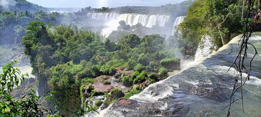
Foz Iguazu

Monte Fitz Roy

Accommodation – Check the Exchange Rate when you book

I used Booking.com to book hotels. You get quoted a price in US$. Once you have made a booking, contact the hotel to ask if they apply the official exchange rate if you choose to pay in pesos. Most of my hotels agreed to this; only one asked for the blue rate (so I cancelled and booked somewhere else). If you pay like this, you save 50%! More expensive hotels add 20% VAT to their bills, which can you avoid by paying with a foreign credit (but then you get the official exchange rate, so it is still better to pay with cash).

AirBnB is not recommended, because you pay in advance in your own currency. It may have been bad luck, but the one place I booked with them was of very poor quality and seemed more aimed at local tourists.

Torres del Paine

Don’t Rely too much on Guidebooks

Things change quickly in Argentina. Our guidebook claimed to have been reprinted in January 2022, but was hopelessly out of date.

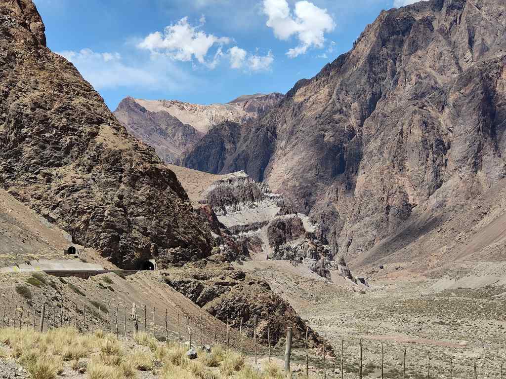
The Road from Mendoza to Aconcagua

Packing

Check average weather conditions and pack accordingly. Patagonia and Tierra Del Fuego are cold even in the southern summer and need very warm clothing and waterproofs. Aerolineas Argentinas (but not the other airlines) has a limit of 15kg for checked baggage, so you may also need to pack light and fully use the allowances of 8kg for carry-on baggage and 3kg for a personal item. The 15kg rule is not strictly enforced – we were usually a couple of kilos over, but the check-in staff ignored this.

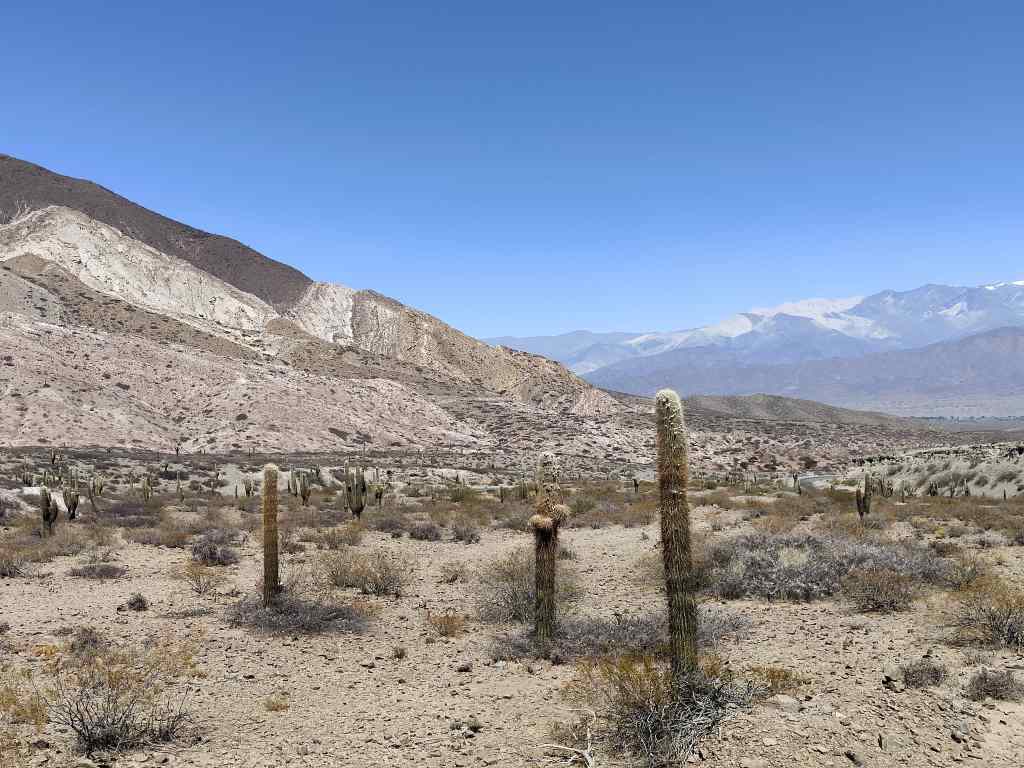
On the way to Cachi

Learn some (Argentine) Spanish

In touristy areas like Patagonia and parts of Buenos Aires, you can get by with English. But in most other places, few people other than hotel staff spoke a second language. If you already speak some Castilian Spanish, be aware that there are big differences in the pronunciation of “y” and “ll”, and that the second person singular “tu” is replaced by “vos” – with different verb endings. I didn’t find any good books on Argentine Spanish, but I found this website (for intermediate speakers) to be very good- https://argentalk.com

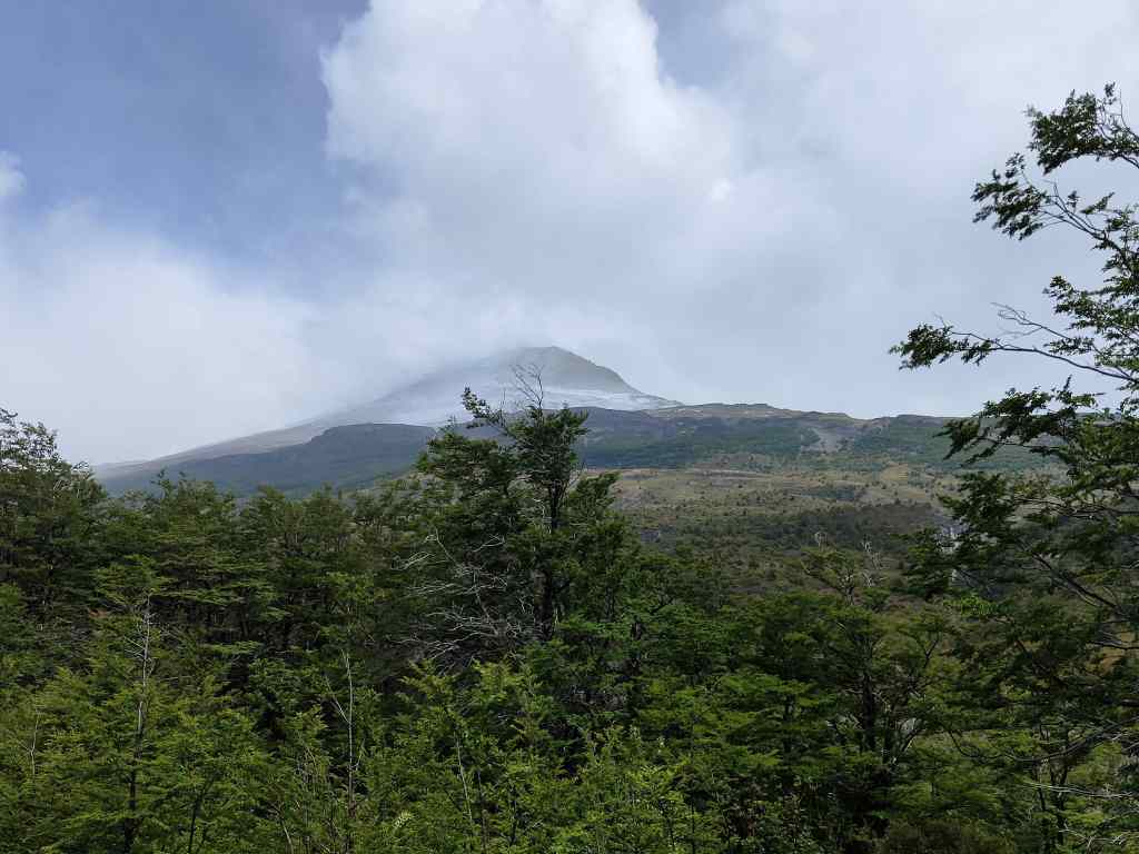
Mount Osorno, Chilean Lake District

That’s all for now. I could write a lot more, but I am worried I will bore my readers. If anyone has a question, please leave a reply at the bottom of this page. Happy Travelling!

Plaza de Mayo, Buenos Aires

Back in Buenos Aires Part 2 – Strolling Around

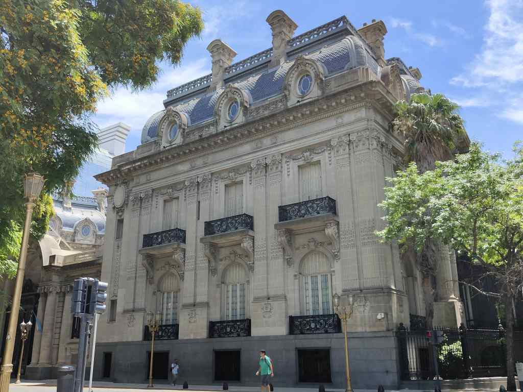
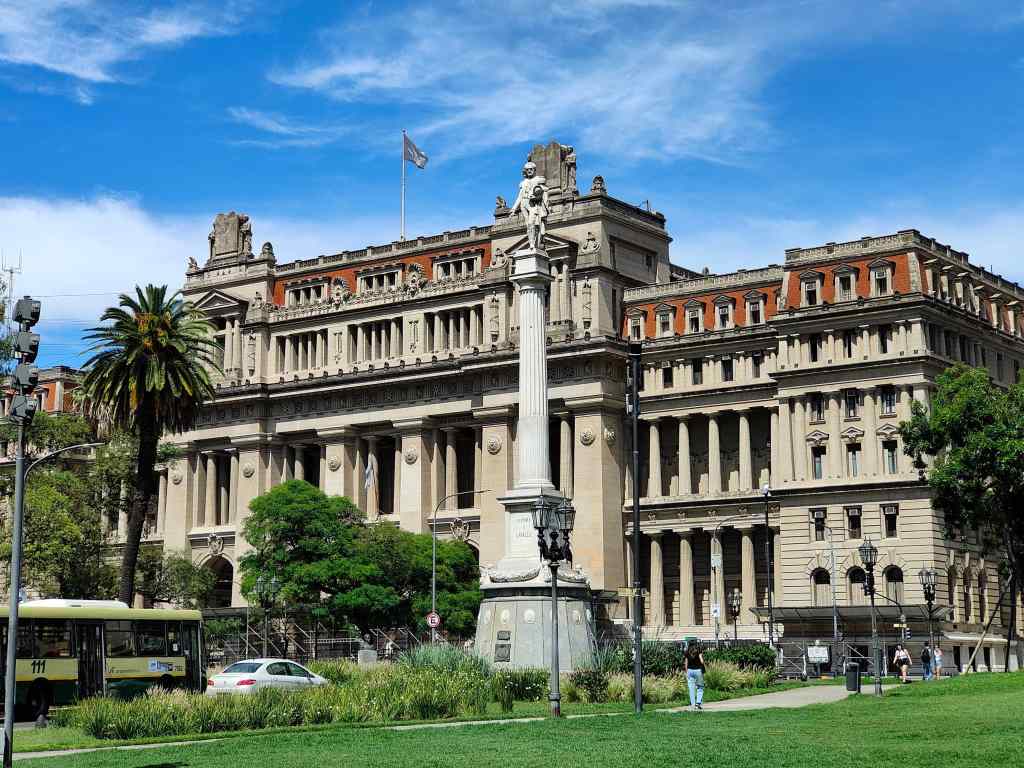
The visit to Tigre completed my sight-seeing in Buenos Aires. I spent the rest of my time simple enjoying the city. It is a very pleasant place, with many parks, and wide avenues. The richer central areas reminded me of Paris, with Hausmann-style mansions set amongst more modern buildings.

One of many elegant buildings I found by simple wandering around Buenos Aires – the Palacio San Martin
More Elegant Architecture in the centre of Buenos Aires
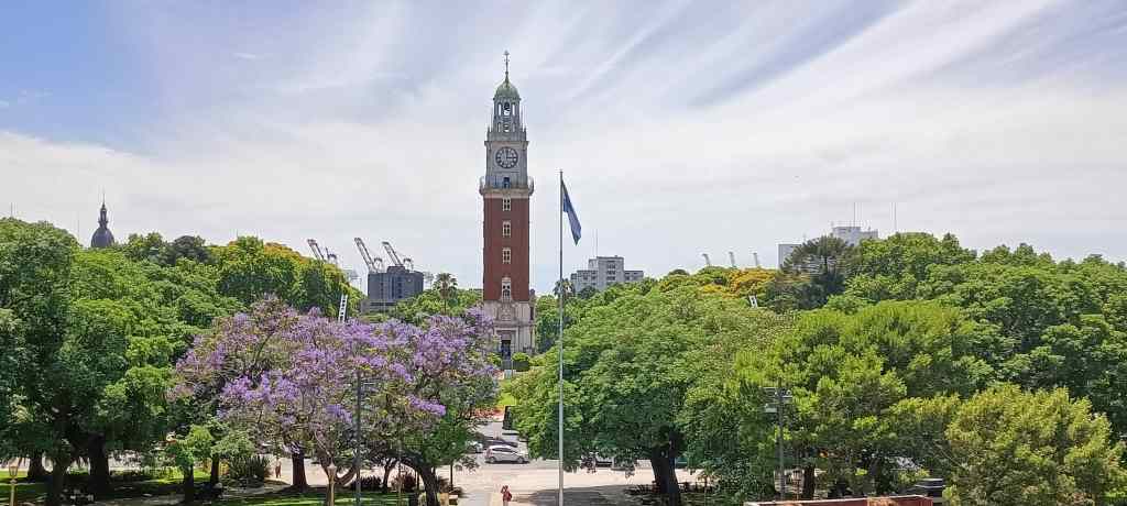
A monumental clock tower in Retiro barrio, built to celebrate independence

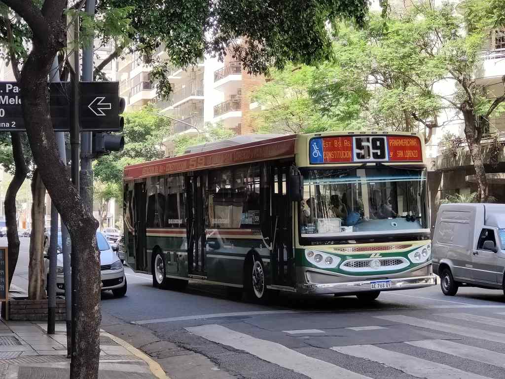
I explored on foot, by taxi and by bus. Getting around proved to be easy. Taxis are abundant and cheap and use their meter without having to be asked. I also bought a “Sube” card to be able to use the buses. This was a bit tricky at first, since you have to tell the driver the name of the stop you will get off at, and since the network is very extensive with hundreds of buses and no maps – but with the help of Google, I managed it. The bus drivers seem to be paid according to how quickly they complete their route and race through the traffic like Formula 1 drivers. You need to sit down as soon as you have paid, since the driver will immediately hit the accelerator and roar off. In the centre, there are places where there are two parallel bus lanes, which allows the drivers of different buses to race each other.  As a result, bus travel is surprisingly fast but might not be totally safe.

One of Buenos Aires’ thousands of buses, all driven by racing drivers.

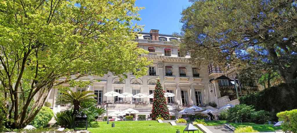
As I explored the city, I got to know local life better. There was a big inequality of incomes – some barrios are very opulent, and some very poor. The expensive areas have beautiful shady parks with wonderful tropical trees, but these are also places where the many homeless people sleep. Portenos enjoy life, and there are thousands of cafés, bars and restaurants that seem very busy at all hours of the day – I wondered if people ever worked. Sitting on a terrace and watching the world go by is a popular occupation – and a cheap one, since prices for food and drink are a fraction of what you would pay in Europe.

Elegant Terrace at Palacio Duhau, Buenos Aires
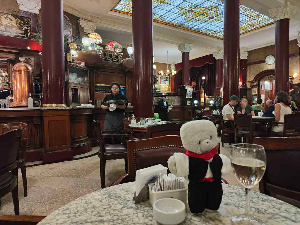
Café Tortoni, one of Buenos Aires’ most famous cafés.

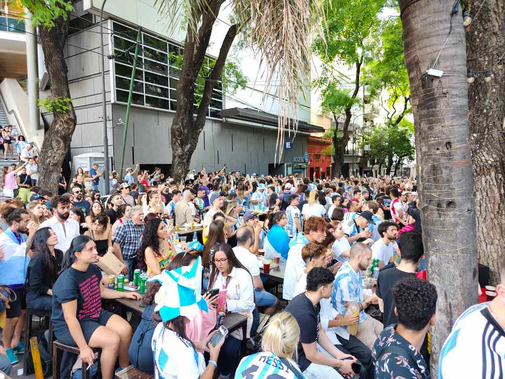
During my stay, this café culture was given a further boost by the football world cup. When Argentina played, those places showing the match would be besieged, whilst the rest of the city ground to a halt.

A bar in Buenos Aires that showed the football
The bar next door, which did not

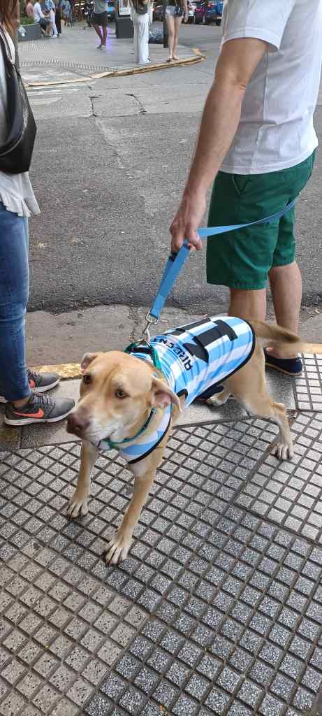
The games that did not involve Argentina were largely ignored. Lots of people wear the football shirt of the national team and everyone (almost literally, I only saw one exception amongst thousands) chooses Messi’s no. 10 shirt (I thought a football team had 11 players?). There were babies and even dogs wearing Messi’s shirt…

“Messi Dog”

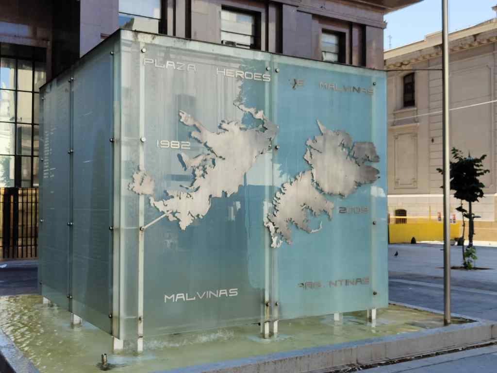
Another striking feature of the city – and Argentina as a whole – is their attachment to the Islas Malvinas, more commonly known as Britain’s Falkland Islands. Argentina lost several hundred soldiers, sailors and airmen in a failed attempt to invade the islands in 1982, and each city has its own square named after the “Heroes of the Malvinas”. Signs everywhere – on public buildings, on buses, in shops – proclaim that “Las Malvinas son Argentinas”.

Buenos Aires’ Plaza of the Heroes of the Malvinas

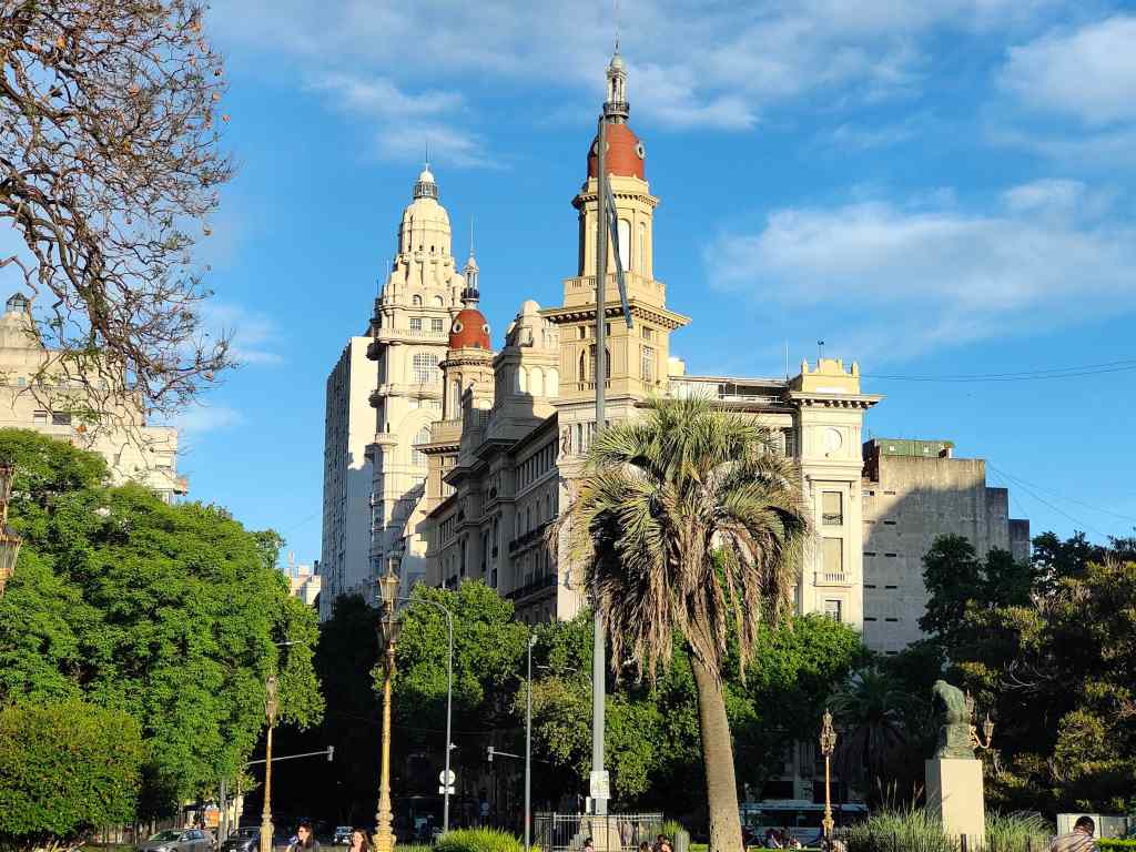
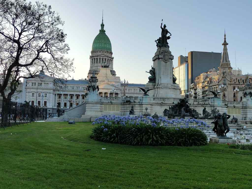
The one thing I failed to properly explore in Buenos Aires was tango. The many tango shows on offer looked very touristy – like the Moulin Rouge in Paris, which I would never consider visiting – so I tried to find a “milonga” or place where ordinary people dance. I found a website listing all the milongas in the city and chose an open air one in front of the Congress building. The dancing was far from the vision of the elegant movement of sexy, well-dressed people I had expected. The few dancers wore jeans and t-shirts and the dance itself reminded me of the exercises they make residents do in old peoples’ homes.  Searching out the “real” tango – if it exists – will need to wait for a future visit. My time wasn’t wasted, since in the evening light I had fine views of two of BA’s most beautiful buildings – the Congress, and the Palacio Barolo.

Palacio Barolo
The Congress Building, Buenos Aires

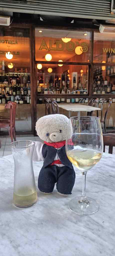
It is now nearly time to go. Here I am sitting at the terrace of Aldo’s wine bar on my last evening with a very good glass of Marsanne – I was sitting at the same terrace almost a month ago at the start of my trip.

Aldo’s Wine Bar, Buenos Aires

What a journey it has been – seven flights, two bus trips across the border with Chile and well over 10,000km travelled to see some of the world’s most spectacular sights. In Buenos Aires it is 30C, sunny and a pint of excellent craft beer costs 2€ (or even less in happy hour). Tomorrow the forecast for London is for a high of 2C and beer costs 6€ a pint. It is rather sad that all of the cold weather clothing I packed for Patagonia is going to be more useful at home. I am not looking forward to going back…I even calculated that I could continue living here in my cheap but excellent flat and save money as compared to living in expensive London. But all good things come to an end…..

That is all for now – next trip is Egypt in February, click the “follow” button at the bottom right of this page if you would like automatic notifications when I post again. My final post of this series will be a “how to” with tips for travelling in Argentina.

Next Post: Top Tips and Highlights for Argentina

Previous Post: Back in Buenos Aires part 1

Back in Buenos Aires – La Recoleta Cemetery, La Boca, San Telmo and Rio de la Plata delta

I ended my trip with four days to enjoy Argentina’s capital, Buenos Aires. Since I was staying a few days, I booked a flat in La Recoleta – a different area, more upmarket than where I stayed before.

Although the flat had a kitchen, I found a very good local restaurant with huge, juicy fillet steak. Eating out was not much more expensive than cooking my own food.

This fillet steak was almost as big as me!

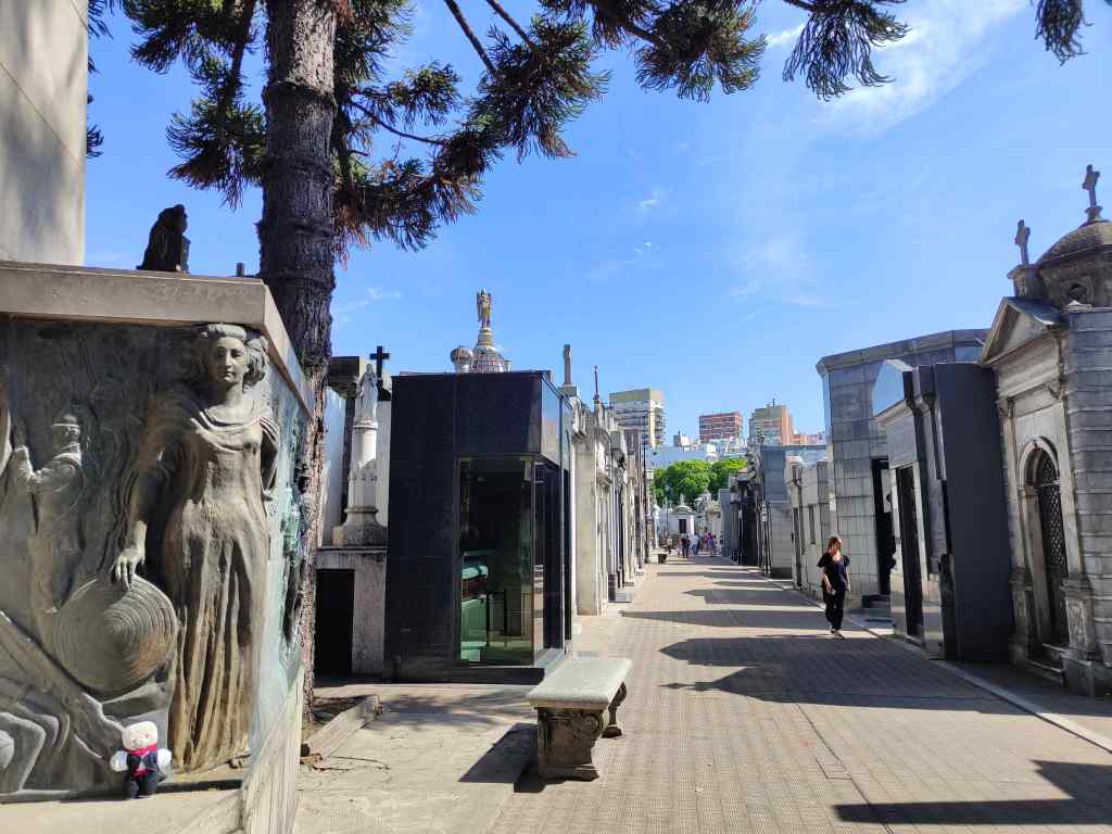
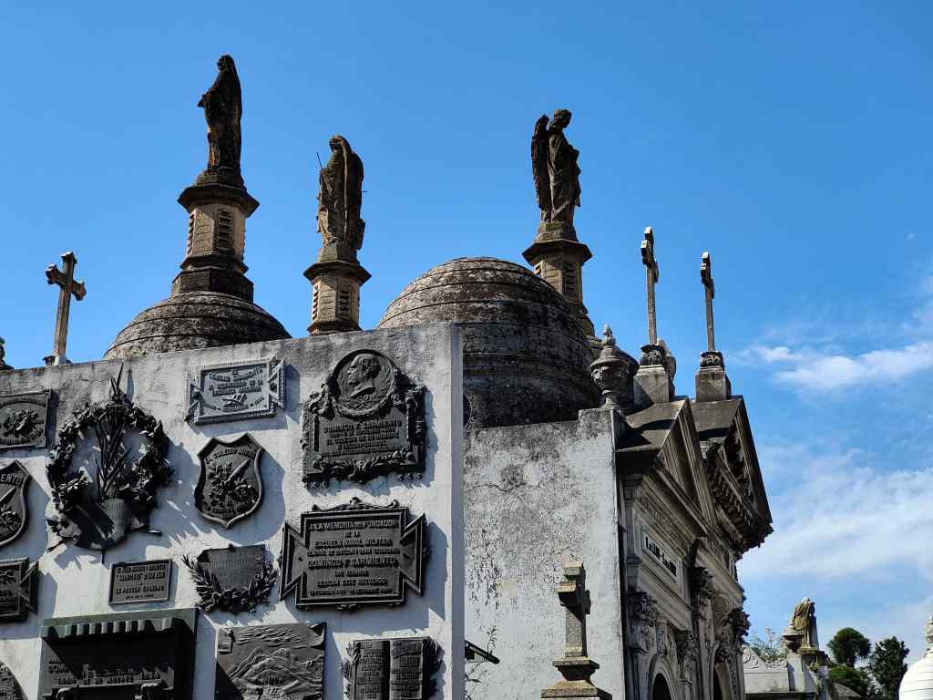
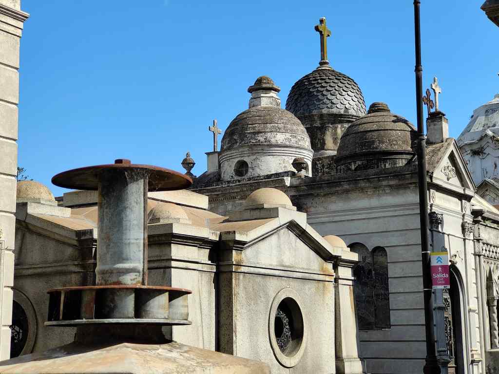
Buenos Aires does not have that many classic tourist sights – I covered the ones recommended in my guidebook in my first two days. My favourite was La Recoleta cemetery, where the great and good (or just rich) of the country are buried. It sits behind a tall wall in one of Buenos Aires’ richest areas, a strange city of death within a city. The many ornate graves make for endless photo opportunities and gave it an eery atmosphere.  They have recently introduced an entrance fee here, and as a result it was pleasantly quiet with few other visitors.

Recoleta Cemetery in Buenos Aires – spooky even during the day
Smart tombs in Recoleta Cemetery
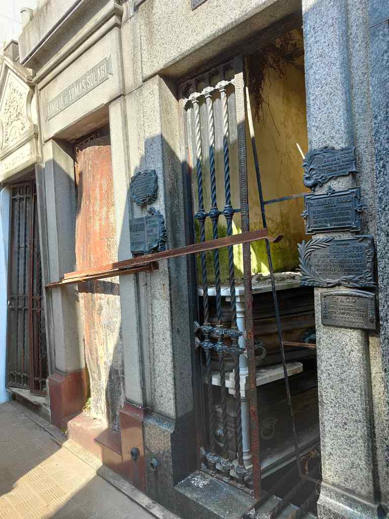
Most tombs are well-maintained, but some are falling into ruin. Eerily, you can see coffins through the glass doors.
The tomb bottom left had ventilation installed….maybe the occupants went to a hot place?

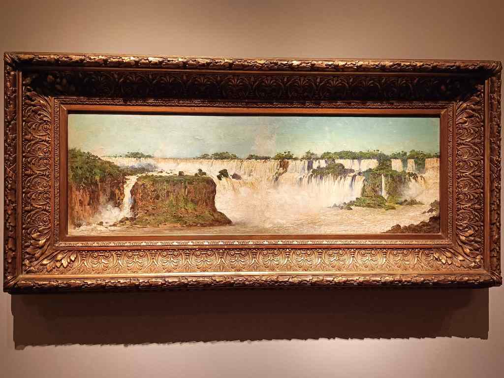
Buenos Aires also has some good museums, like the Museo de Bellas Artes, which has both Argentine and foreign paintings; some of the former reminded me of my epic journey around the country.

Painting of Foz Iguazu in the Museo de Bellas Artes, Buenos Aires
“Without Bread and Without Work”, Museo de Bellas Artes

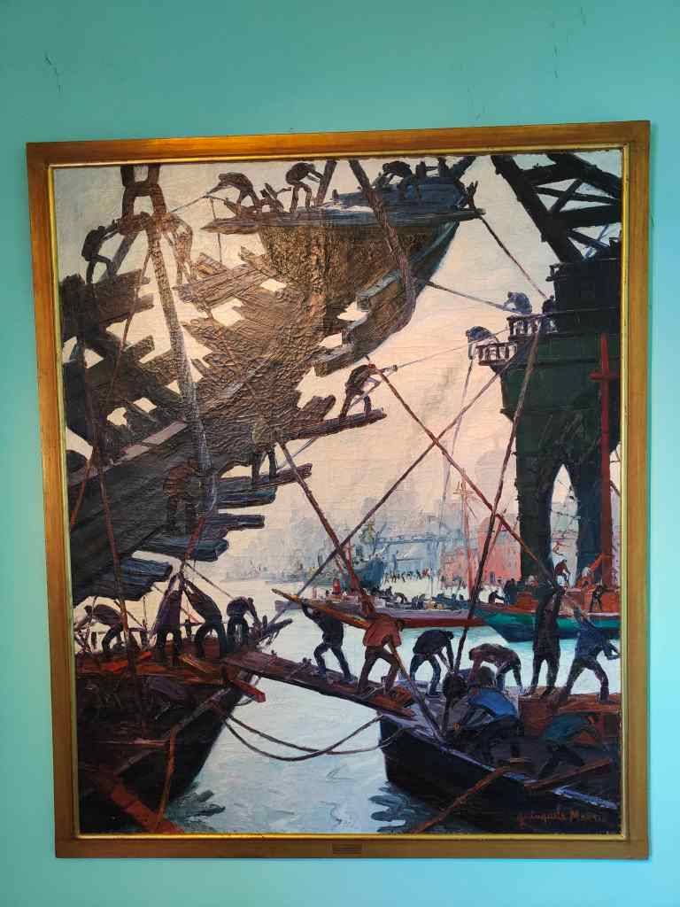
I also liked the Museo Benito Quinquela Martin in a neighbourhood (or “barrio” in Argentine) called La Boca.  Martin specialised in painting the lives of the poor people working in the docks of that area and remains a local hero to this day.

A painting by Benito Quinquela Martin

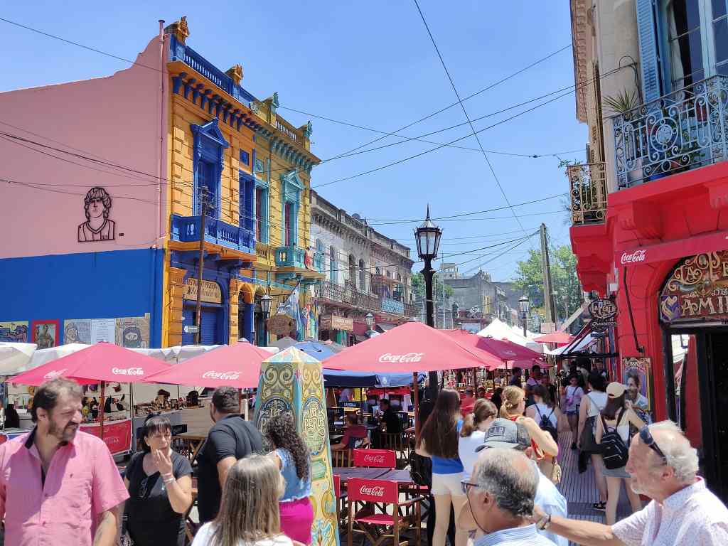
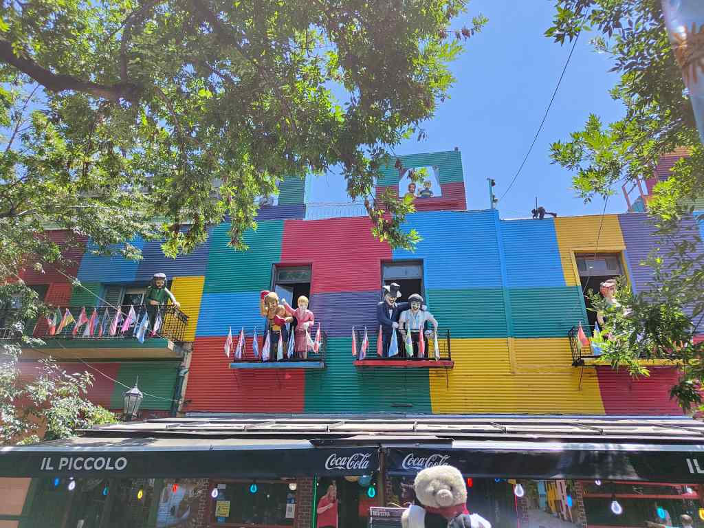
Nowadays, la Boca remains one of BA’s poorest suburbs, although the waterfront has a pretty street called la Caminito, which has brightly coloured houses.  It is very striking, but extremely touristy as well. La Boca is also famous for housing the stadium of the Boca Juniors football club, where Maradona played.

La Boca, Buenos Aires
In the touristy Caminito of La Boca

Another popular area for tourists is San Telmo, BA’s oldest barrio. I went there on Sunday for the famous market, whose stalls spread out for almost a mile to the centre of the city. The ones on the edge of the market sold cheap rubbish aimed at tourists, and I began to think it would be better to visit on a different day when it would be easier to see some of the beautiful older buildings. However, when I reached the heart of San Telmo – the Plaza Dorrego, my opinion changed. The stalls here sold some interesting antiques, and despite the tourist crowds, the square had a wonderful “old-world” atmosphere. I stopped for a while for coffee.

San Telmo Market, Buenos Aires
Plaza Dorrego, San Telmo, market day

Finally, I visited BA’s heart – the Plaza de Mayo, where you can find the Casa Rosada (the presidential palace), the main cathedral, and the “cabildo” or former town hall. This is where Argentines gather to celebrate football victories or demonstrate against the government (both of which they do very often and very energetically).

The heart of Buenos Aires – the Plaza de Mayo and the Casa Rosada

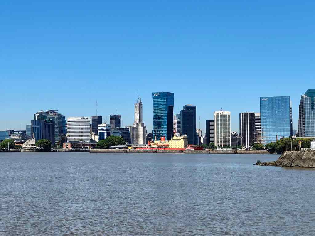
One more place recommended by my guidebook was a nature reserve on the banks of the Rio de la Plata. However, after the spectacular sights I had seen whilst touring the country, it was a disappointment – with more Portenos (residents of central Buenos Aires) noisily enjoying the weekend sun than animal or bird life.  A more successful trip was my visit to Tigre, a small town on the river about 40km northwest of BA. I travelled by boat, and for the first part of the trip got to understand just how big a city BA is.

Buenos Aires from the sea

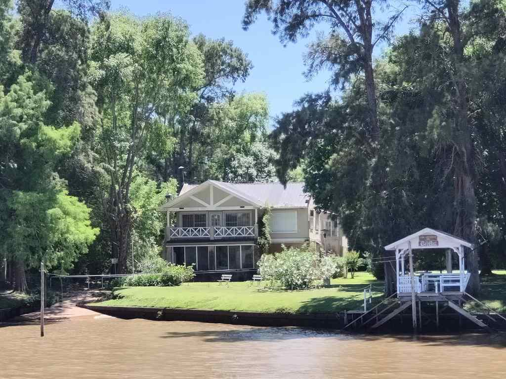
After an hour’s sailing the boat entered the Rio de la Plata delta and the high-rise buildings finally ended, giving way to jungle. The delta (the third largest in the world) is a tangle of smaller rivers making green islands where many BA residents have second homes.  It was a very interesting contrast to Buenos Aires.

One of the many fancy second homes in the Rio de la Plata delta

Most houses are built on stilts, since the area floods often, and there are no roads – people get around by boat.  On the remote islands, the houses are very basic, but in the popular areas they looked luxurious. 

Next Post: Back in Buenos Aires part 2

Previous Post: Foz Iguazu

Water, Water Everywhere – Foz Iguazu

My itinerary next took me to the exact opposite end of the country – Foz Iguazu, on the border with Brazil and Paraguay. It was a long day’s travel to get there, with a change of airport at Buenos Aires. My airline had warned that many people wanted to travel that day and urged me to check in early. When I arrived, I realised that the reason for the warning had nothing to do with the volume of passengers and everything to do with…….el fútbol. All the passengers and many of the staff were watching Argentina beat Poland on a huge screen. As a result, check in was slow but good humoured.

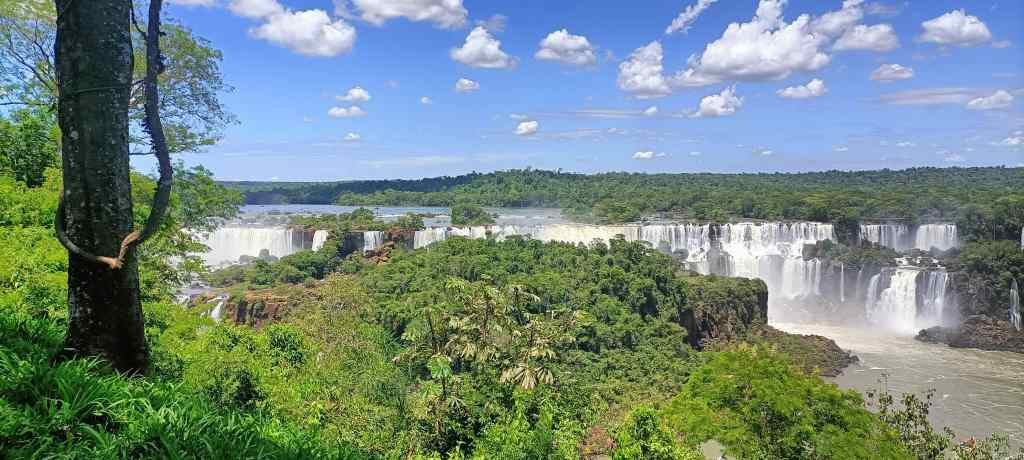
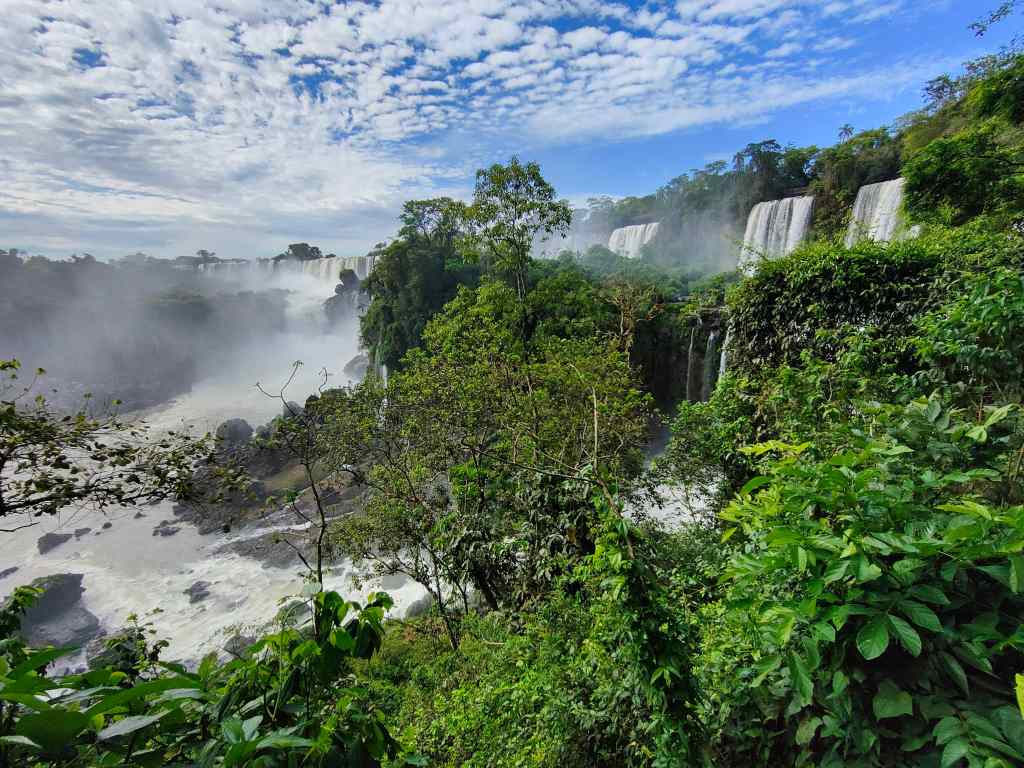
The far north of Argentina was completely different to Patagonia, with lush green jungle and hot, humid weather. I set off to view the famous waterfalls. First I headed to the Brazilian side of the river, where there are the best panoramic views. Crossing the border was quick and easy and soon I was admiring an amazing spectacle. Foz Igauzu is not just one waterfall, but dozens or even hundreds of falls spread out over a few kilometres.

My first view of Foz Iguazu – from the Brazilian side

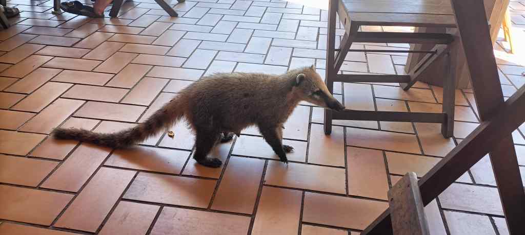
Visitors follow a path running along the river bank, giving a range of views.  After a short walk I stopped for drink, and was met by a small friend (a coati) looking for food.  I had none, which was just as well, since although coatis look cute, they can get aggressive in their search for something to eat.

A hungry Coati at Foz Iguazu

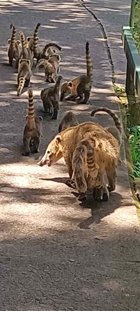
She was probably hungry because she had to feed this lot……..

The path reached the main set of falls on the Brazilian side. There, a walkway led out into the middle of the river to the Garganta del Diablo – the Devil’s throat, probably the most spectacular fall of the lot. The cool spray of water (I was soon soaked), constant roar of water and amazing view into the heart of the falls made for a unique experience.

The Devil’s Throat – Foz Iguazu, Brazilian side
The view from the middle of the river, Foz Iguazu Brazilian side

The next day, I visited the falls from the Argentine side. I set off early to avoid the mid-morning crowds and had the pathway along the “lower circuit” almost entirely to myself. This side of the river offered a very different experience – you could approach the falls more closely along walkways running through pretty jungle. 

Foz Iguazu Argentine Side

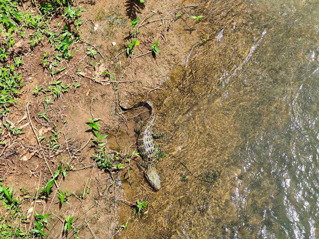
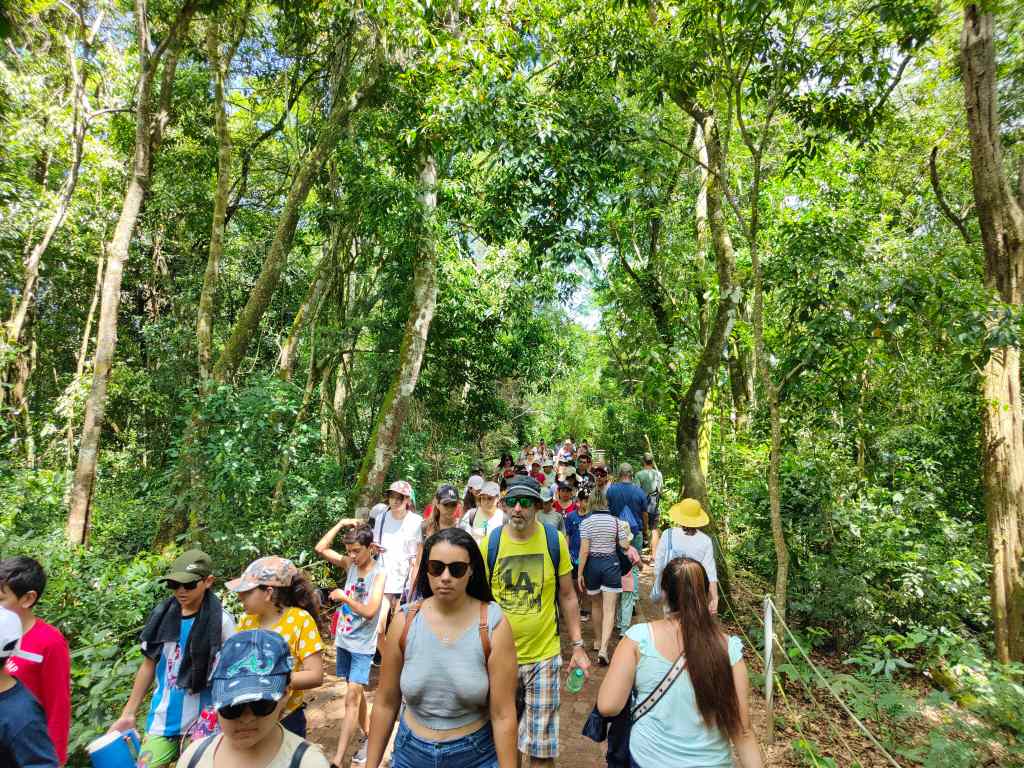
I finished the “lower circuit” just as the first tour groups began to arrive and started the “upper circuit”.  This had more amazing views, but at times was unpleasantly crowded. It was hard for someone small like me to get a view, and when I climbed up onto the railings to take photos, I worried about getting knocked off by tourists jostling to take selfies. The path back from the falls went through some interesting jungle, where I saw a baby crocodile…

Better stick to the paths!
Late morning – rush hour at the Argentine side

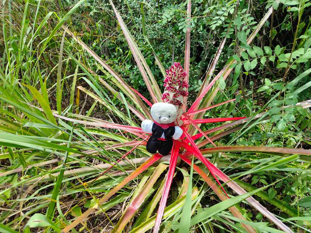
After the two classic circuits of the Argentine side, I tried a much less popular short trail through the jungle.  The signs at the start promised of the possibility of seeing monkeys and toucans, and gave advice about what to do if I encountered a puma or a jaguar. This raised my expectations, but sadly I saw only some birds, huge butterflies and giant ants.

Helpful advice for my readers
On one of the jungle trails at Foz Iguazu

The short hike took me about an hour, and it was now one o’clock. I had “done” everything and thought about going back to my hotel, but instead went back to try the upper circuit again. Maybe all those tour groups had a lunch break? I had guessed right – in the heat of the early afternoon, I had the upper circuit almost to myself and could now focus on taking pictures without being jostled.

Foz Iguazu Argentine Side

An added bonus was that the early afternoon sun made rainbows at many of the waterfalls

Foz Iguazu Argentine Side – rainbow

The second visit to the upper circuit was a great way to end my visit to Foz Iguazu, which is one of the wonders of the world – a destination truly at the end of the rainbow.

Next Post: Back in Buenos Aires part 1

Previous Post: El Calafate and Glacier Perito Moreno

El Calafate and Glacier Perito Moreno

Today, I had originally planned to do a short hike and then drive back to El Calafate. But the weather forecast was poor, and every trail had a minimum distance of 16km. Instead, I left early, reached El Calafate at noon, and after checking into my hotel drove to see one of Patagonia’s other highlights – the Perito Moreno Glacier. It was located 80km west of the town and I got there in the early afternoon. From the car park, there was the option of a shuttle bus to the main glacier or a path running along the side of a lake.

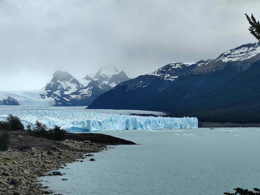
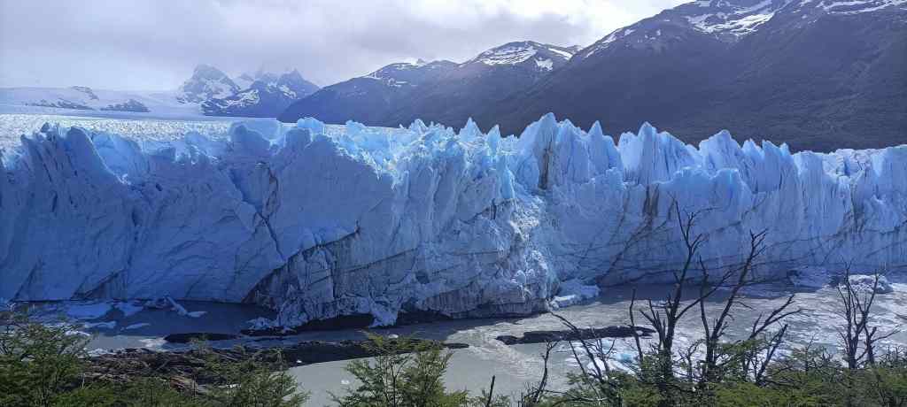
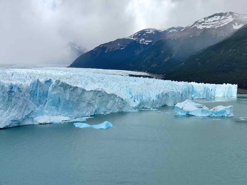
I chose the path and was very lucky – the weather had been cloudy and dull, but as soon as I set off, the sun came out. I turned a corner to be greeted with an amazing view of a blue wall of ice gleaming in the afternoon sun.

First glimpse of Perito Moreno Glacier – a wall of blue ice

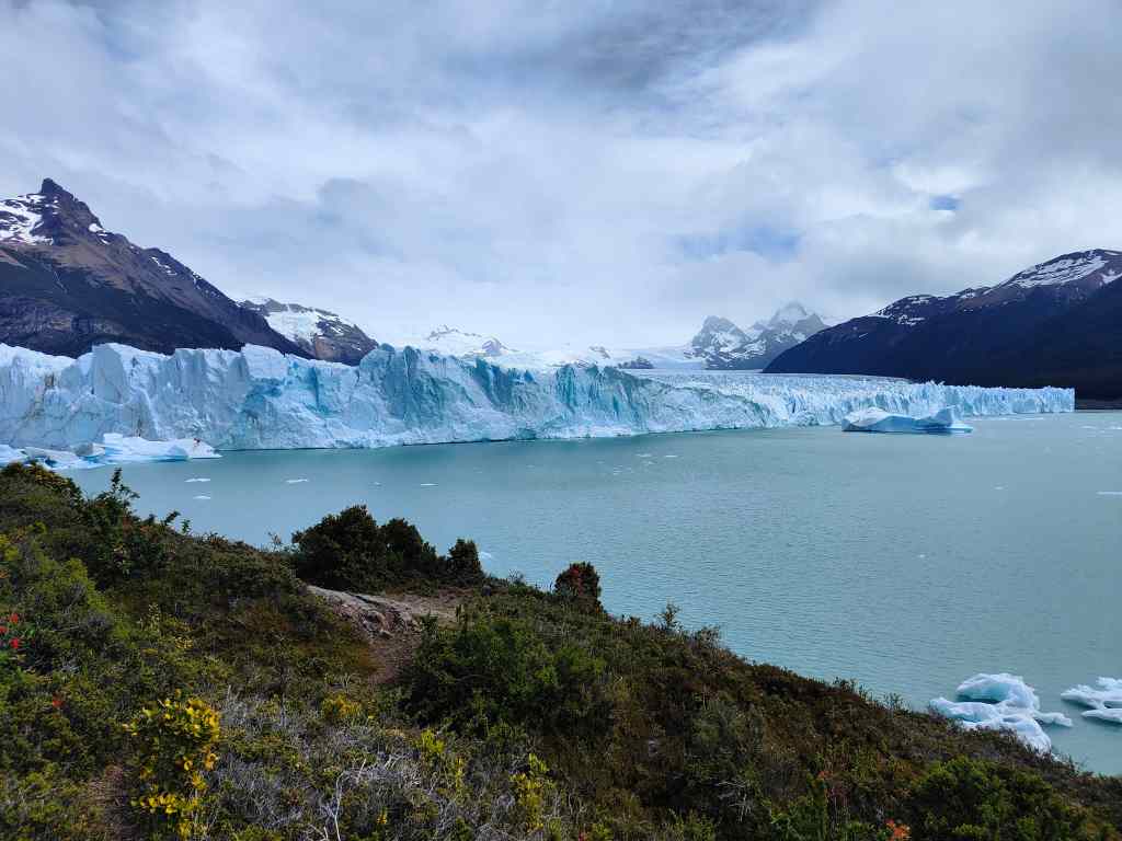
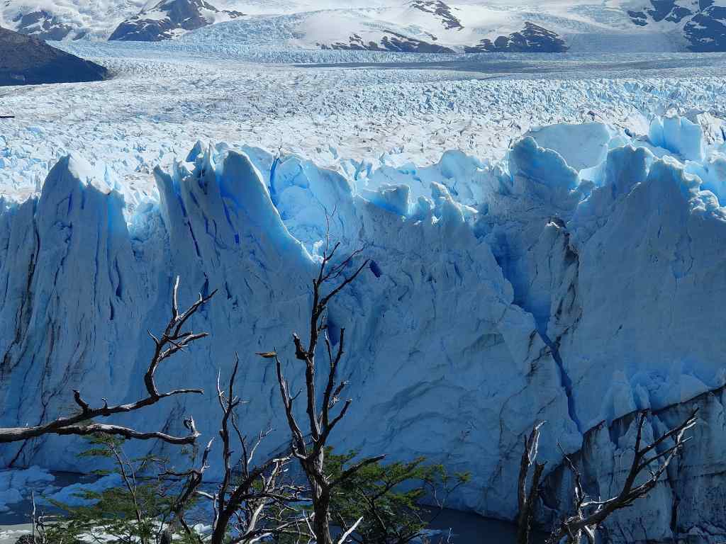
The path – on a raised walkway made of metal – brought me closer and closer to this incredible sight. There were frequent viewing platforms, each giving a slightly different perspective.

As you get closer, Perito Moreno is more and more impressive

The park has several trails, all on walkways. Most visitors seemed to stay on the “yellow” path, where the shuttle bus drops them off. This left the more remote blue and red paths nearly empty, and I spent several hours exploring and taking photographs. 

Up close to Perito Moreno
Wall of Ice – Perito Moreno

From time to time there was a cracking sound as the ice blocks in the glacier moved. The ice advances about 2 metres per day. Fresh ice from the mountains pushes the older ice further down the valley, until it reaches the lake where the warmth of the sun and the water causes it to fracture and break off (“calving”) as small icebergs. I saw – but was too slow to film – some smaller pieces of ice break off and crash into the lake below, with an impressively loud splash.

After a few hours, the clouds returned, and it started to rain lightly – although the Patagonian winds always mean that even light rain always turns into something much more unpleasant. The temperature dropped abruptly. It is hard to dress properly for the weather in Patagonia. When the sun is out, with no wind, it is hot.  When it is windy and sunny, it is cold. When it is cloudy and windy, it is very cold. And when it is windy and raining, it is unpleasantly freezing. 

It was time to leave for today, but I returned on the following day to see the glacier in the morning light.  The views were even better…….

Perito Moreno on Day 2
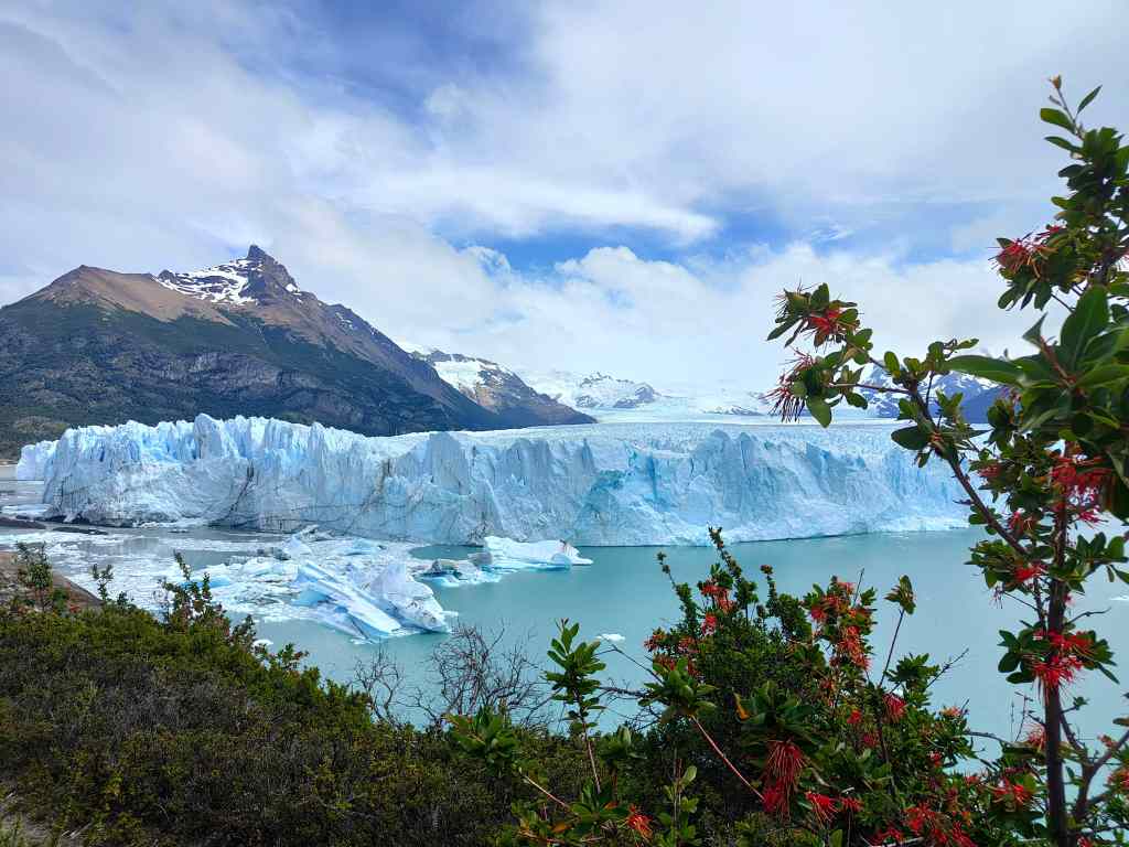
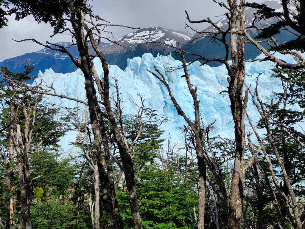
Perito Moreno seen through a forest
More stunning views of the glacier…the morning this time

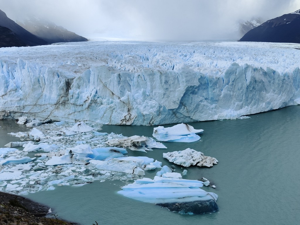
I noticed that all the ice formations I had noticed the day before had disappeared, to be replaced by new ones. A couple of large icebergs floated in the lake – calving events that must have happened after I had left the day before.

An iceberg that had formed overnight

I found a platform on the “red” trail in front of some rickety-looking ice structures and sat and waited, hoping for a big chunk of ice to fall for me. But my ice remained annoyingly solid, and my patience eventually ran out. I headed back to my car, having spent a total of six hours looking and filming the ice over two half-days. Back in my hotel I admired the hundreds of photos I had taken and started the difficult job of sorting them, before strolling around El Calafate. It was a very pleasant small town, fully dedicated to serving the many tourists that come to visit Patagonia. I had dinner in a craft beer brewery with more excellent Argentine beer and a burger.

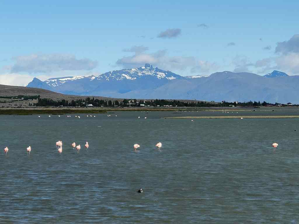
My stay in Patagonia had two last twists. On the way to the airport the next morning I was greeted by a very unexpected sight.

? Surely not….
Yes! Flamingos on Lake Argentina in Calafate

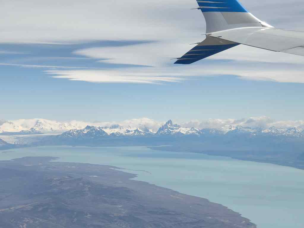
I reached the airport, boarded my plane, and was treated to one last view of Mount Fitz Roy as we took off….

View of Mount Fitzroy

I left Patagonia with a heavy heart. It was incredibly beautiful, with three world-class sights within close proximity of each other – Torres del Paine, Mount Fitz Roy and Perito Moreno. The town of Calafate is named after a blue berry found in the area. Legend has it that if you taste the calafate berry, you will return to Patagonia. I had tried a “Pisco Calafate” cocktail one night. I think the legend might be right.

Next Post: Foz Iguazu

Previous Post: Mount Fitzroy and El Chalten

El Chalten and Monte Fitz Roy – one of the world’s greatest hikes

Today I crossed the border by bus back into Argentina.

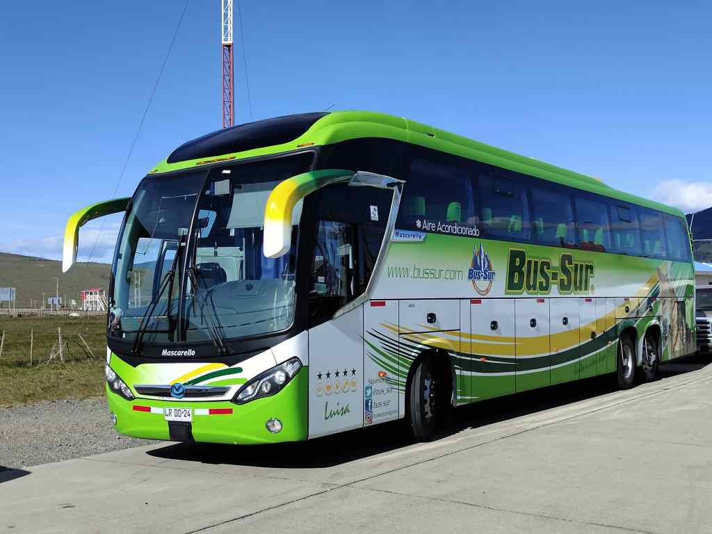
Bus travel in Latin America is comfortable and convenient – at least for a five-to-six-hour trip like this one.  I took some last photos of Chilean Patagonia from my window.

A last view of Chilean Patagonia

Across the border in Argentina, the landscape was quite different – dry and initially flat. We arrived at the small town of El Calafate (more about this in a future blog), where I collected my hire car and headed off to the village of El Chalten, 250km away.

On the RN40 heading north

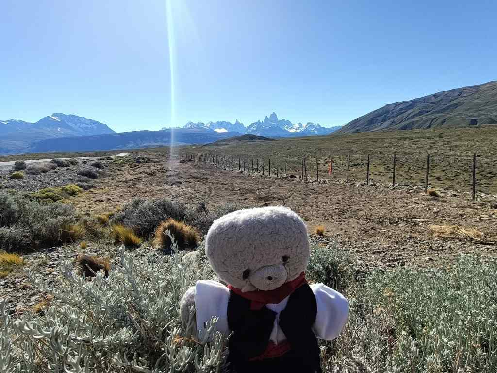
The road was perfect. Straight, surfaced, and scenic. It ran alongside pretty blue lakes with mountains far in the distance. At first my old friend RN40, took me north. Then after 150km I turned off to the west.  It was strangely quiet, and I crossed very few other vehicles. The road stretched away into the distance, straight like an arrow, and pointing at some magnificent mountains.

The Fitz Roy range appears ahead, small at first…

The Fitz Roy range in front of me would be the focus of my two days in El Chalten. I entered the Parque Nacional de los Glaciares, one of Argentina’s biggest natural parks.

…then larger…entry to Parque Nacional los Glaciares

As I sped along, the Fitz Roy range grew larger and larger.

….Fitz Roy larger again…this time with El Chalten in the background

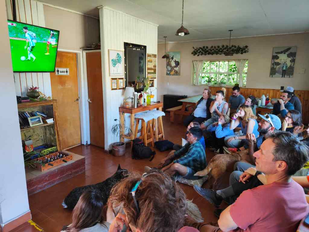
The village of El Chalten itself nestled in a pretty valley, at the foot of the mountains. I liked the place – there was fresh mountain air, amazing scenery and lots of small hostels, shops and restaurants – a typical hiker centre. But it was still very eerily quiet when I arrived at my hostel. I opened the car door and suddenly, from inside the building, there was an eruption of shouting. At first, I thought that there was a violent dispute, but then I realised the voices were happy. Someone emerged from the hostel and shouted “GOOOOOOOOL”.  Argentina had just scored their second goal in their world cup match against Mexico, and thereby avoid elimination at the group stages.

Argentina’s national passion

Inside the hostel everyone was glued to the television. The owner gestured to me that she would be free in five minutes, when the match ended. Nothing is more important in Argentina than football. The match ended, I checked in and set off to explore the town, which was now humming with people celebrating Argentina’s win. Pedestrians hugged each other whilst cars hooted their horns. Two pick-up trucks drove around, carrying groups of flag-waving children. It took an hour for the town to calm down again.

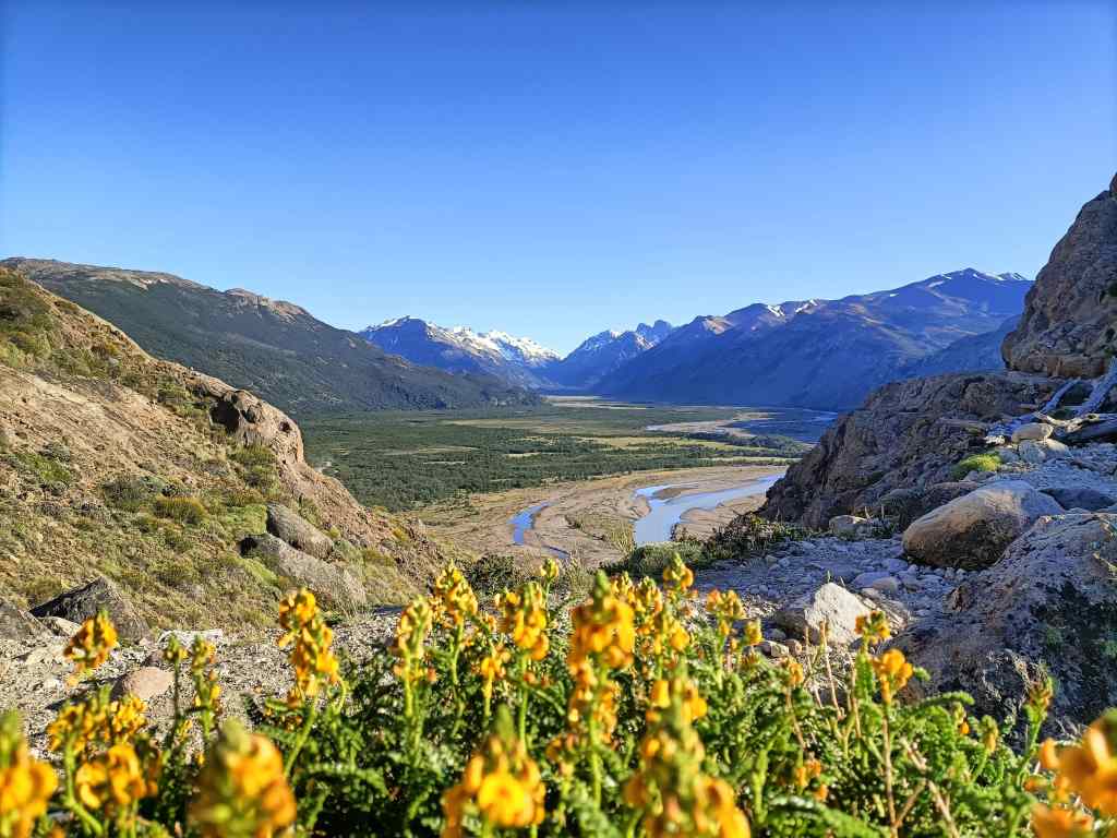
I had a very good dinner, before settling down for a sound night’s sleep ahead of hard day’s walking – the famous hike to Mount Fitz Roy. I set off at eight along an easy, gently sloping trail. The views of the mountain in front of me – a sight I had now seen for 90km since I turned off the RN40 – became more and more impressive.

Ftiz Roy gets bigger again….
…and again…

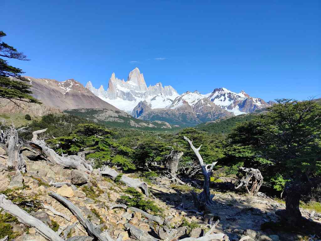
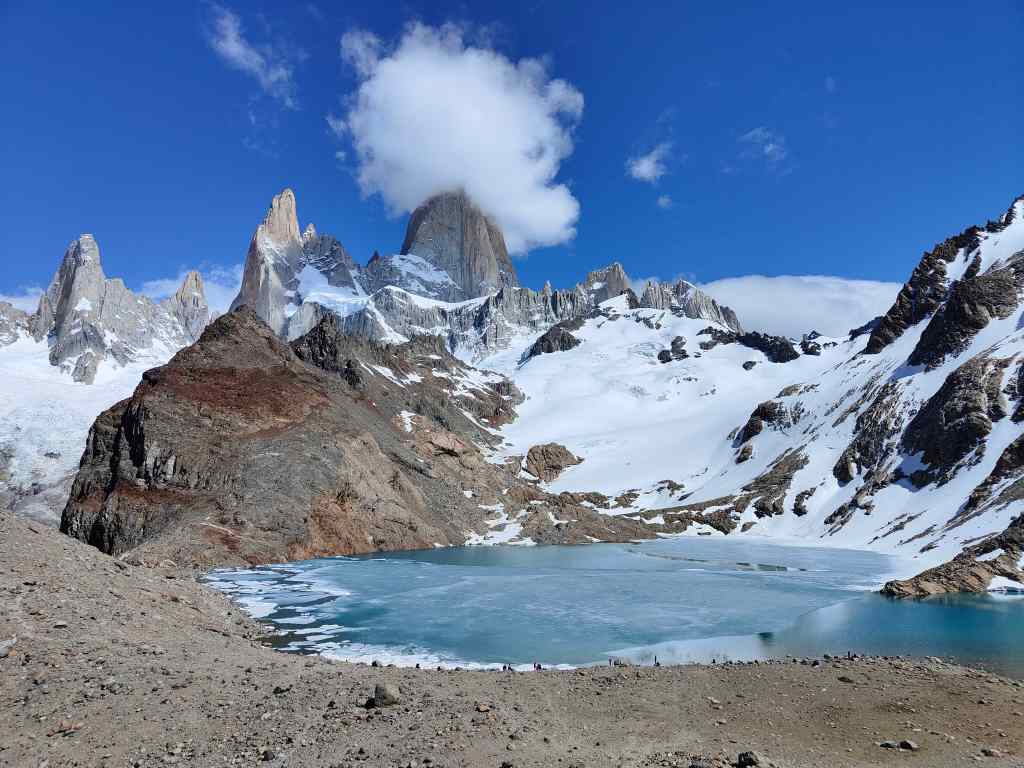
The path passed through woods and then a pretty river valley before reaching a steep slope. A sign said that the final km would involve a climb of 400m, take an hour, and should only be attempted by fit hikers. It was hard going, made harder by a discouraging sign reached after 40 minutes, which said that there was still one hour to go. The climb was worth it; when I reached the last ridge, a view opened of Mount Fitz Roy right in front of me, with a brilliant blue, partially ice-covered lake at its foot. It was one of the most stunning mountain sights I had ever seen, and I stayed there enjoying it for over an hour.

The glacial lake below the summit of Fitz Roy
The magnificent view at the end of the hike

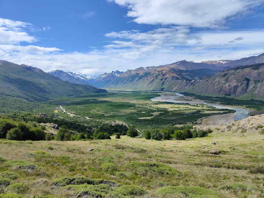
It was finally time to head back. If the way up was hard on the muscles, the way down was hard on the knees, but it offered a different set of views, this time of the valley spreading out from the mountain’s base.

On the way down…the valley
More Fitz Roy valley views
Tired legs but home is in sight – El Chalten

I made it back to hostel six hours after I had set off, and was tired after a 20km round trip. But it was one of the most memorable hikes I had ever done.

After a shower and a snooze, I rewarded myself with a steak and good bottle of red wine in a restaurant – a good way to end a memorable day.

Next Post: El Calafate and Perito Moreno

Previous Post: Torres del Paine, Chile

(Almost) the End of the World – Puerto Natales and Torres del Paine, Chile

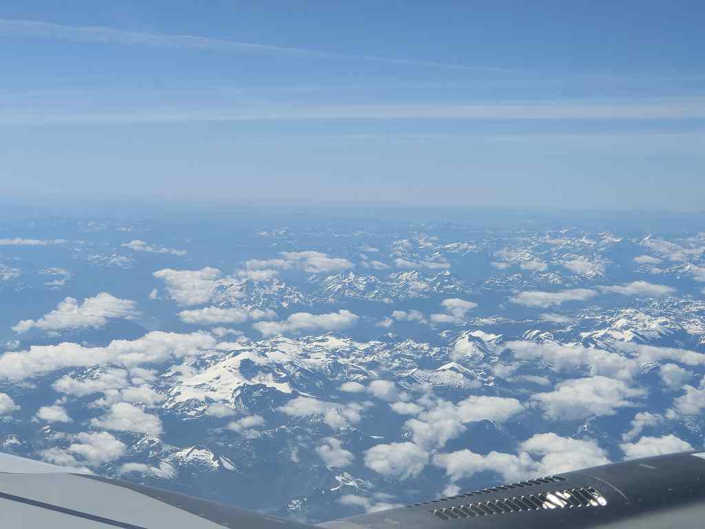
Today was a big day for me – I was due to fly nearly 2000km to Puerto Natales, the furthest south I had ever been. It was a critical part of my complicated South American itinerary; if the flight were cancelled, my only alternative would be a 36-hour bus ride. I was a little nervous, since the only airline serving the route was one I had never heard of, called “SKY”.  I was also worried about the weather forecast, which was for cold temperatures, strong winds and rain at my destination. But my flight passed without incident, and with my window seat on the left hand side of the plane, I had a great view of the Andes. Even better, I could see that the cloud cover was light, meaning that the forecast bad weather had not yet arrived.

Flying to Puerto Natales

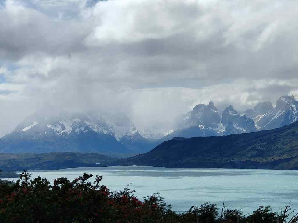
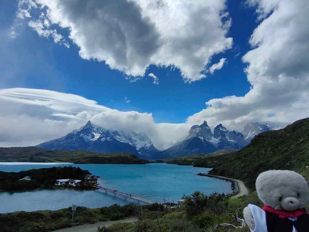
At the airport, my hire car was waiting for me. I dropped by bags at my hotel and headed straight off to my main destination – the Torres del Paine national park, praying the weather there would be as good as it was in Puerto Natales. After an hour’s drive through increasingly spectacular scenery, the distinctive granite towers of Torres del Paine came into view. At first, they were distant, and partially shrouded in cloud…..

First glimpse of Torres del Paine

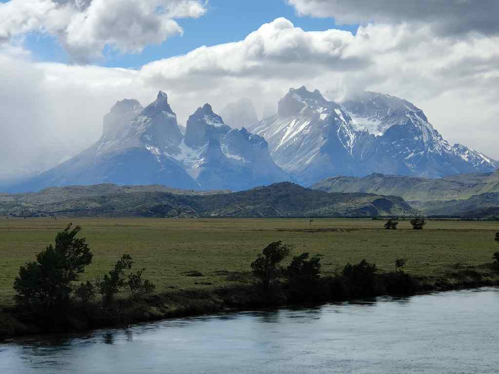
….but as I got closer the clouds began to lift.

The clouds lift

I reached the park entrance station, where the rangers explained that I had to get my entrance permit online. They offered me access to their Wifi. I entered the endless details required for the permit, and got all the way to the payment screen only to discover my credit card company needed confirmation by SMS……..and there was no phone reception. I explained my predicament to the head ranger, and also told him that I had checked their website that very morning and read that could you pay the entrance fee in cash. After some hesitation, the ranger let me through provided I promised to buy my ticket when I got back to my hotel. I breathed a sigh of relief – the first views of the mountains promised an exceptional day – not something I would want to miss. I drove into the park and the clouds lifted.

Good weather!!

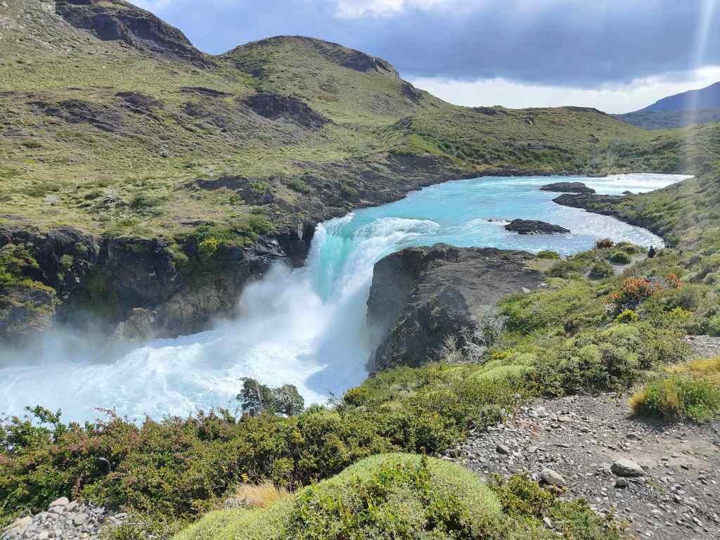
It was already early afternoon, and I didn’t have time for a long trek, so I drove to one of the car parks and hiked first to a waterfall……

Salto Grande Waterfall
Ferocious winds are a feature of the park

The wind is often very strong in Torres del Paine. Today it was “only” about 65km/h, but it can be even stronger and force the park rangers to close some of the paths.

After admiring the waterfall, I continued, against a ferocious wind, to a mirador at the base of the towers.

It was not raining, but the wind picked up sheets of spray from the lake and drove them over the water’s surface. Sometimes the spray spiralled upwards into a strange vortex.  

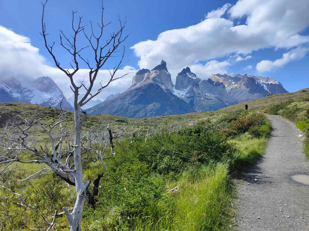
I finally reached the end of my short walk and was rewarded with a magical view of the giant granite pillars soaring vertically into the sky, in front of a brilliant blue lake.

the Torres del Paine seen from the end of my trail

Many visitors to the park do a 4-5 day circuit around the towers, which is called the “W”. It is extremely popular, so they have to book one of the limited campsite spaces many months in advance. I felt rather jealous since my schedule only allowed 1 ½ days in the park. I retraced my steps to my car. Although I had only walked 4km, the continual battle with the wind had left me quite tired.

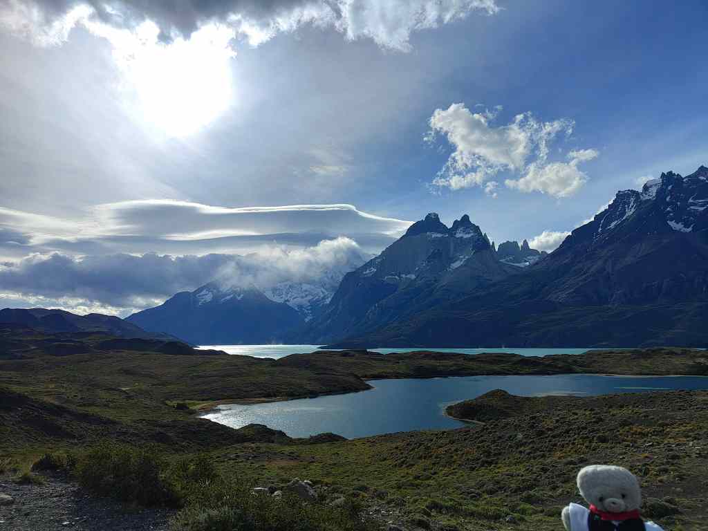
I continued my driving route through the park, stopping a few more miradors to take pictures, before making the long drive back to Puerto Natales.

More beautiful landscapes on the way back

I took a different road this time, which was called the “Road of the End of the World”.

“La Ruta del Fin del Mundo”

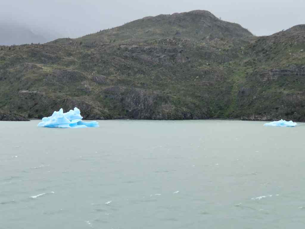
 It was late when I arrived, so I had a quiet dinner in my hotel and went to bed. The next day I was less lucky with the weather. Clouds hung over Puerto Natales, but unlike the previous day they got thicker as I approached Torres del Paine.  When I arrived, it started raining. Although the rain was light, the wind whipped it horizontally into my face as I walked, and it stung like hail. I abandoned my plans for an ambitious walk  and did a short circuit around Lago Grey, a lake containing floating mini-icebergs from a nearby glacier. The wind was even stronger than the day before – the park rangers said 80km/h – and a couple of times I felt it was gong to lift me right off my paws.

Mini Icebergs on Lago Grey

The bad weather showed no signs of changing, so I drove back to Puerto Natales to see what the town had to offer. I was no longer envious of the people doing the “W” trek – they would be stuck on the mountain and be forced to walk 10-20km to their next campsite in these appalling conditions. On the way back there were occasionally breaks in the clouds and some nice views.

When the clouds lift the scenery is majestic

Puerto Natales turned out to be a frontier town and centre for backpackers and outdoor sports enthusiasts. Most people wore heavy rainproof jackets, walking boots and a woolly hat. The town had a lot of restaurants and bars aimed at tourists. I tried one surprisingly elegant one for a cocktail before enjoying a pizza elsewhere.

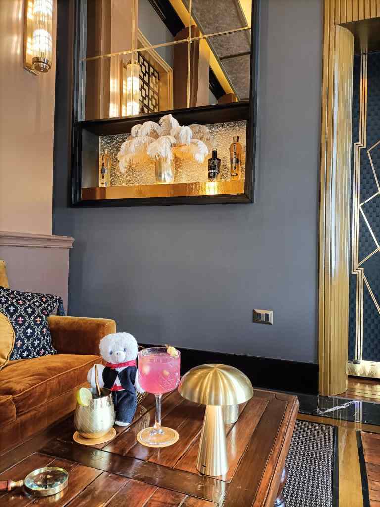
Trouspinet’s solution to a rainy day……Cocktails!

I was stoical. It was a shame not to see Torres del Paine’s towers in their glory a second time, but at least I had seen them once, and this was the first bad weather day in over 2 weeks of travelling.

Next Post: El Chalten and Monte Fitz Roy

Previous Post: Puerto Varas

Blog at WordPress.com.

Up ↑