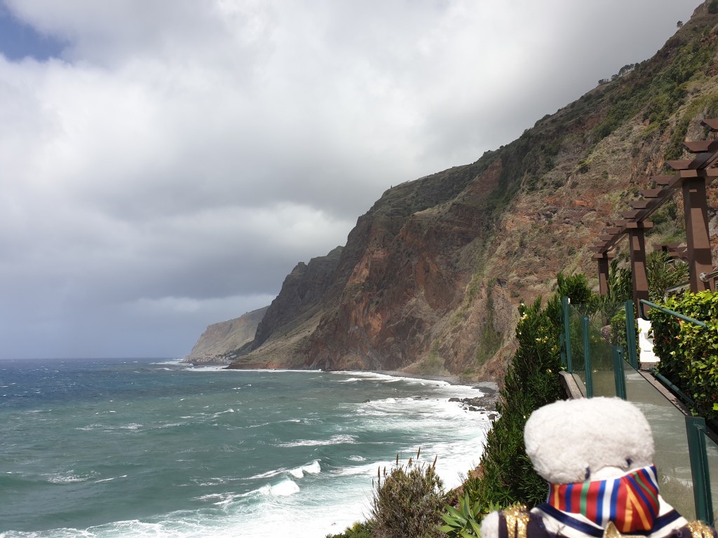
The next day I set off with the intention of doing a walk in the mountains in the north of Madeira, and then maybe visiting the lighthouse at Ponta del Pargo – the most south westerly point of Europe – on the way back.
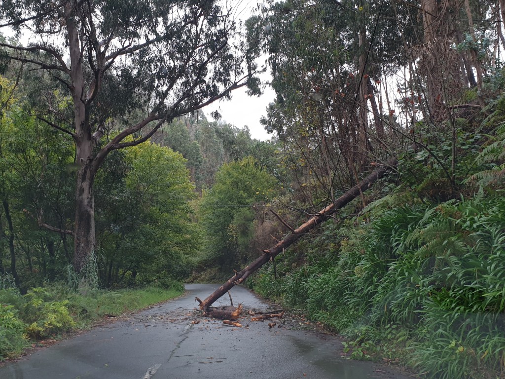
I took the main road around the far west of the island, which unlike the south, had yet to be “improved” with tunnels. Even though it was raining the road was pretty. It ran through woods of pine and eucalyptus and a pleasant smell of wet forest filled the air. The heavy rains and winds of the past few days had created a few hazards on the road, in the form of fallen rocks and one large fallen tree.
Unusual hazards on the roads of Madeira
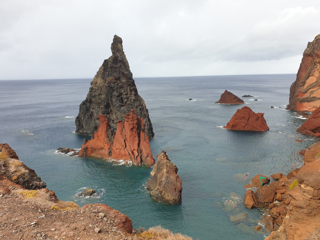
It was slow driving along the winding mountain roads, but I finally made it to Porto Moniz, at the extreme north western tip of the island. This town is famous for its natural pools of seal water, formed by volcanic rock formations stretching into the sea.
The spectaculaar coast and natural rock pools of Porto Moniz
There was a solitary bather in the pools. I dipped my toe in; the water was not too cold, but it wasn’t sunny enough to consider swimming. Instead I admired the beautiful seascape and the contrast of the blue sea, the white surf, the green mountains and the stark black volcanic rock.
I decided to change plans. The walk through the forest was going to be steep, and would be very slippery after the rain, so it would be better to do this another day. Today I was enjoying simply driving and exploring, making things up as I went along. It reminded me of my early carefree backpacking days where I would set off to a destination with no firm plan, no bookings, and sometimes not even a guidebook.
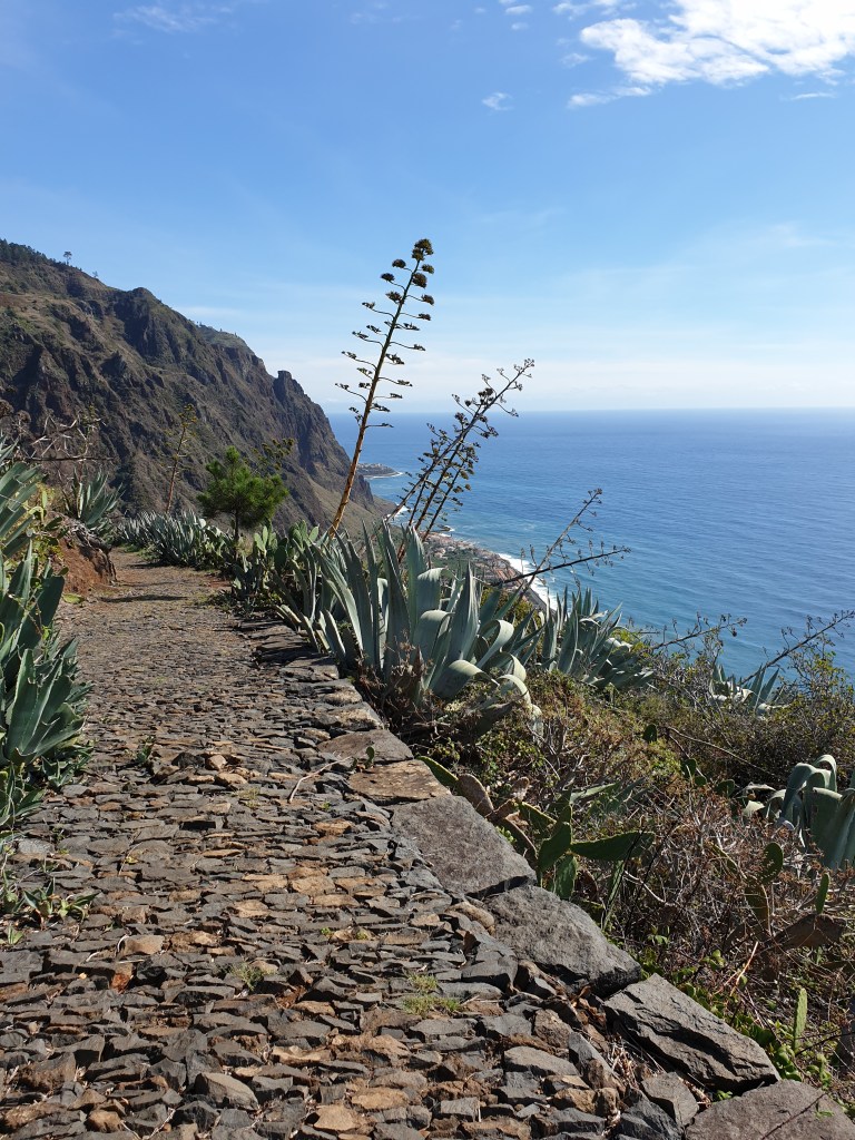
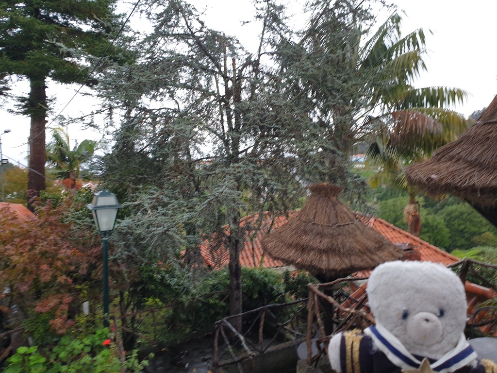
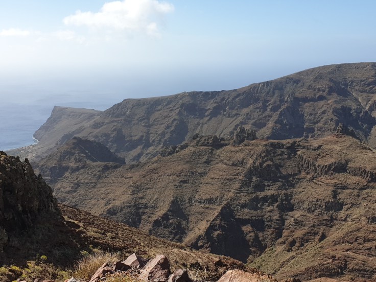
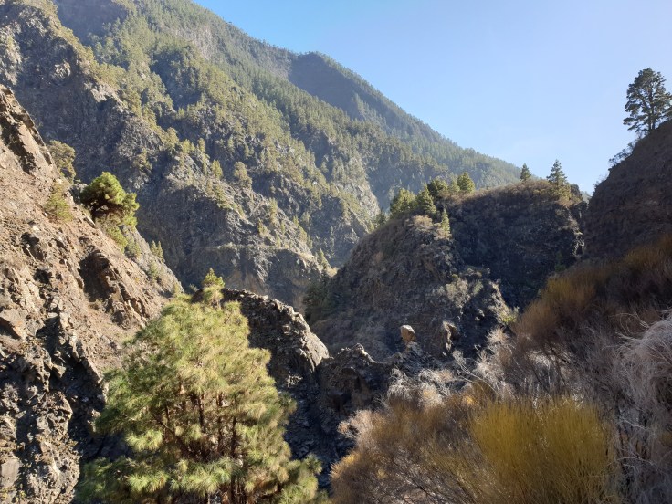
Typical north coast scenery
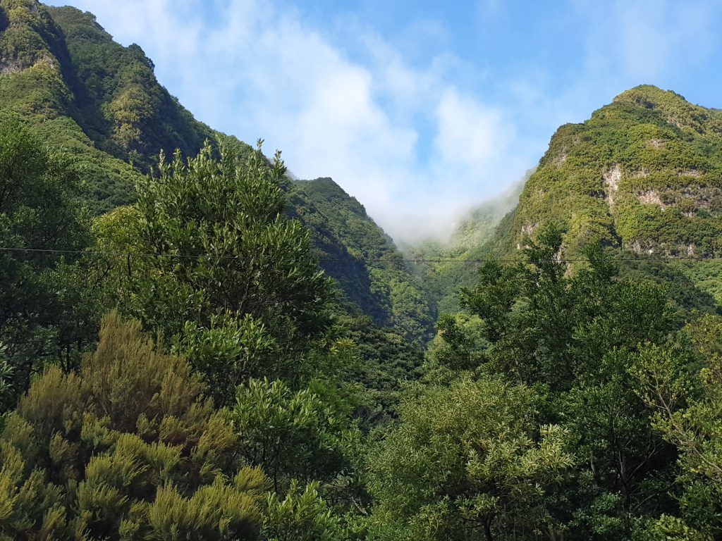
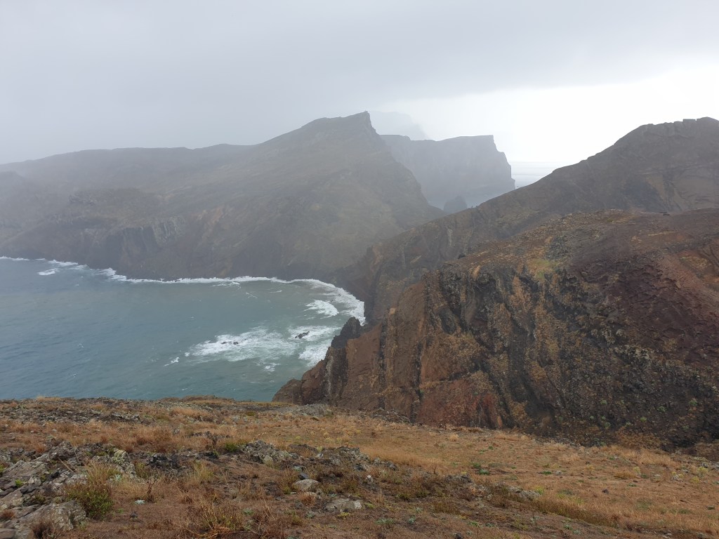
I drove along the north coast, admiring the views, and then took an interesting looking side road that that led steeply up into the mountains. After a few km the road petered out at the start of a walking trail; I stopped to take photographs and breathed in the fresh mountain air.
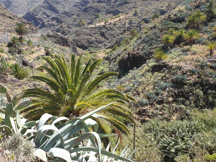
The mountains inland
Next I headed back to the coast. I reached the town of Seixal, which also has volcanic rock pools, took more photos and stopped for a coffee.
The natural rock pools at SeixalMore rock pools….
The weather continually changed – sometimes cold and showery, sometimes hot and sunny. The sea air made me feel relaxed and sleepy. I headed back home not having done any of the things that I had planned to do that day, but with a strange feeling of contentment.
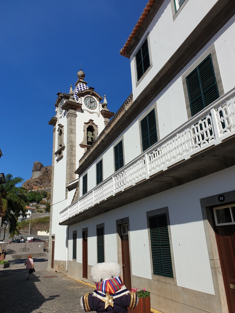
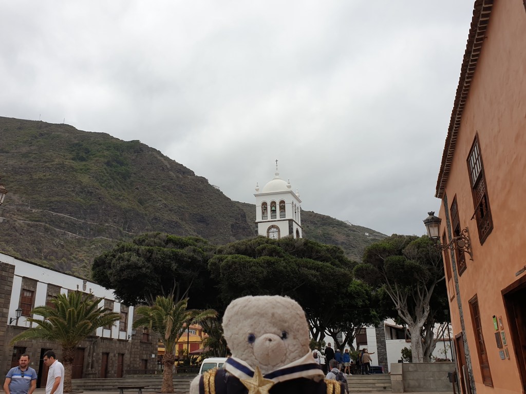
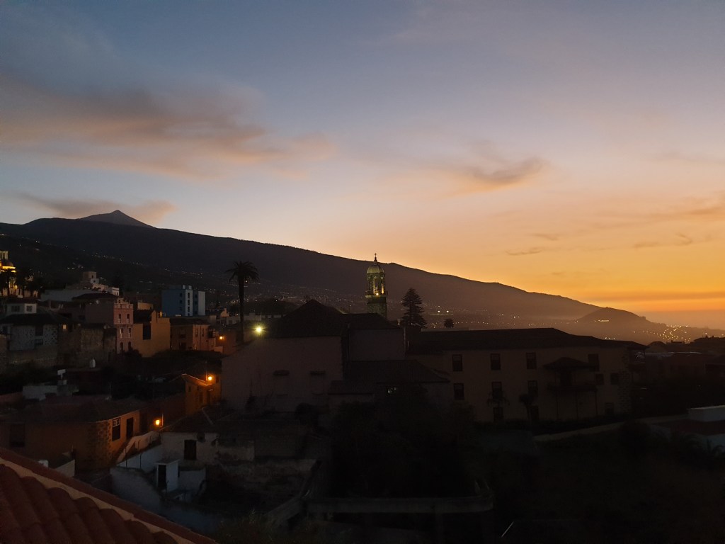
The next day I was due to move to my villa on the south west coast of Madeira. The weather in Santana was still very cloudy, but as soon as I had driven down to the south coast, the clouds were replaced by bright sunshine. The road seemed to consist almost entirely of tunnels. I couldn’t check in to my villa until 1 o’clock, so I made a short stop to visit Ribiera Brava, a pretty coastal town where I bought some food.
The Church at Riviera Brava
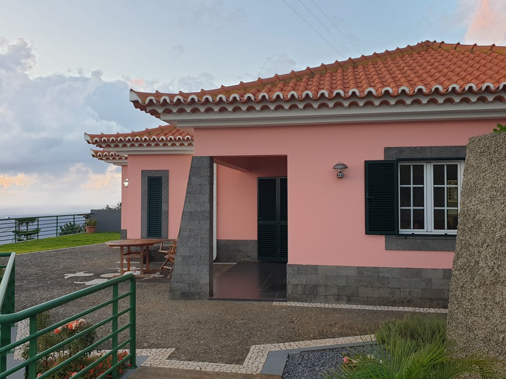
I then abandoned the highway and its endless tunnels for a slower winding mountain road, and I was rewarded by some spectacular views. My villa was in a small village called Faja da Ovelha, strung out over a steep hill which descended to the sea.
My villa
The village was tiny, with a church and a small bar but no shops. After checking in I enjoyed the view of the ocean from my terrace and then decided to take the steep path down to the village of Paul do Mar on the coast. The path gave a magnificent view of the mountains and the sea.
The start of the path downThe path continues
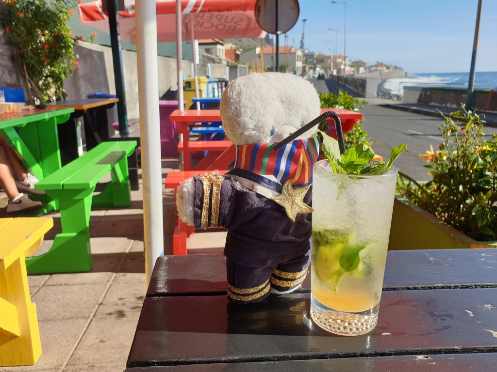
Paulo do Mar is a traditional fishing village but is also a surfing centre and had a few bars aimed at the surfer community. I stopped at the first bar I found and ordered a cold cocktail. The heat and the sound of the waves breaking against the sea wall made me feel very lazy, so instead of continuing my walk into the centre of the village, I ordered another cocktail.
Non-Alcolohic……honest!
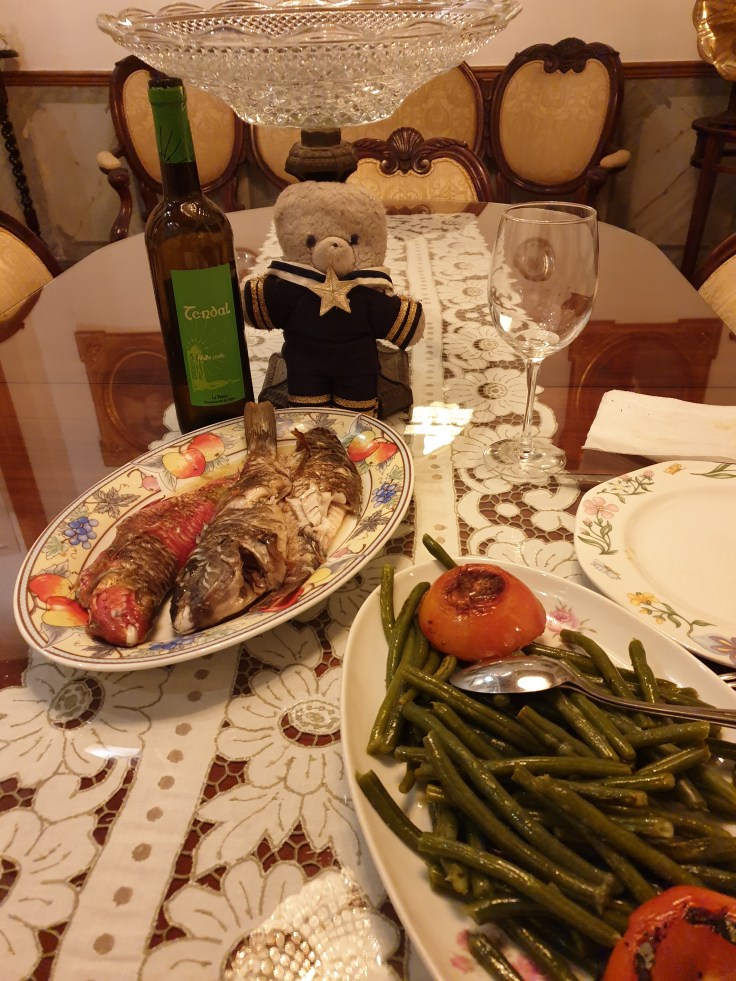
A van stopped to deliver bread to the bar; in this part of Madeira people get their daily bread from this van, so I followed the local tradition and bought a loaf for 50c. The trip back to the villa was much slower than the trip down. The sun was now lower down on the horizon, and its warmth seemed to beam horizontally across the ocean directly onto the path. When I got back to the villa I was sweating heavily. I relaxed in a sunlounger for a bit and then cooked myself a huge tasty tuna steak for dinner – Madeira is a fish lover’s paradise.
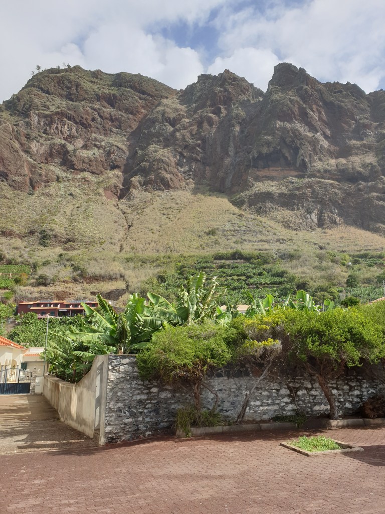
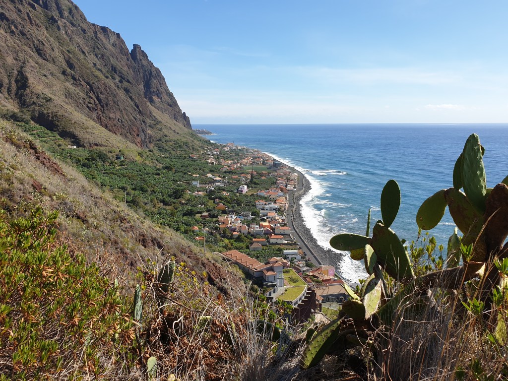
The next day the weather forecast was not great, but all the same the sun was shining when I woke up. The webcam site showed the weather in the north and centre was indeed bad, so I decided to visit the small seaside villages near my villa. The area is far off the usual tourist circuit and a long way (by Madeira standards) from the island’s main attractions. First, I drove to Paul do Mar, this time visiting the old centre, away from the surfers’ places. A maze of narrow streets led parallel to the sea and below towering cliffs to a small harbour.
Towering cliffs behind Paul do Mar
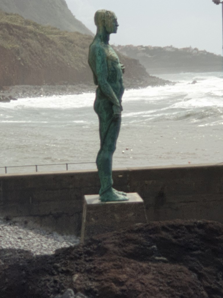
There I was met by a simple statue of a man staring out to sea, which had been commissioned by the local fishing captains and somehow seemed to perfectly capture the relationship between man, the land and the sea.
Simple but evocative
The next village along the coast was called Jardim do Mar and had long sea front path as well as a similar maze of small streets and colourful buildings. I stopped in a bar for a snack, enjoying the pleasant warmth and the gurgle of water running down the “Levada” running through the town. These small channels carry water from the mountainous centre of Madeira to the drier coast; many of them have walking paths running along their banks, which form an extensive long-distance hiking network around the island.
View of the sea at Jardim do Mar
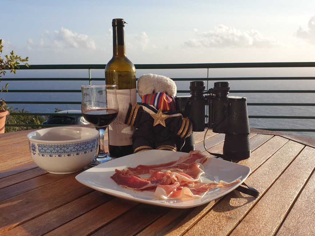
My final stop was Calheita, the next town along the coast. It was completely different, smart and modern, with a couple of large hotels and harbour filled with yachts. I enjoyed watchimg the ocean waves beating against, and occasionally over, the harbour wall before visiting the supermarket to do my shopping for the week. Although 30 minutes’ drive away, this was the closest large shop to my villa. There isn’t much to do in this part of Madeira but I was really enjoying taking things slowly and listening to the wind and the sea. Back at the villa I enjoyed a glass of red wine whilst looking out over the ocean. The welcome leaflet left by the owners said that sometimes you could see whales, and they had left some powerful binoculars for guests.
Tomorrow….
I couldn’t see any whales today, but it was fun looking. Maybe tomorrow. Here, it feels like “tomorrow” is the answer to everything.
Before starting my blog, a few words are in order to illustrate the difficulty of travelling during the global Covid epidemic and explain how I chose to visit Madeira, a little-known tourist destination. I had to go to Paris in October and was determined to avoid a repeat of two weeks’ quarantine on my return to the UK that I had had to do in the summer. I decided to spend time in a second, “approved” country instead of returning straight to the UK. Most of the countries on the approved list were in northern Europe and not somewhere worth going in October, but Italy was still on the list so I booked to spend two weeks on the Amalfi Coast. But then the president of the Campania Region said that all arriving travellers at Naples airport would have to do a Covid test and be quarantined until they got the result. My flight was scheduled to arrive very late, and who knows how long I would have to wait for a test at the airport or how long they might take to give me results. My Italian friends advised me to change my plans, so I cancelled everything and booked to go to Madeira instead.
Madeira!
Madeira is a group of volcanic islands located off the coast of Africa. Even the largest island is not very big – only 50km long by 20km wide. The islands were discovered and colonised by Portugal in 1420, but before that had been uninhabited. Today Madeira is known as a tourist destination, which has avoided the massive development of say Tenerife or Majorca, and as the source of Madeira wine. In the Covid era, the islands are now marketing themselves as “Madeira – clean and safe”. There is a complicated system where you do a Covid test before departure and fill in a long health form online. Someone checks everything and you get a QR code on your phone which lets you on to the island without having to do a test at the airport or quarantining. Having a holiday has never been so much work.
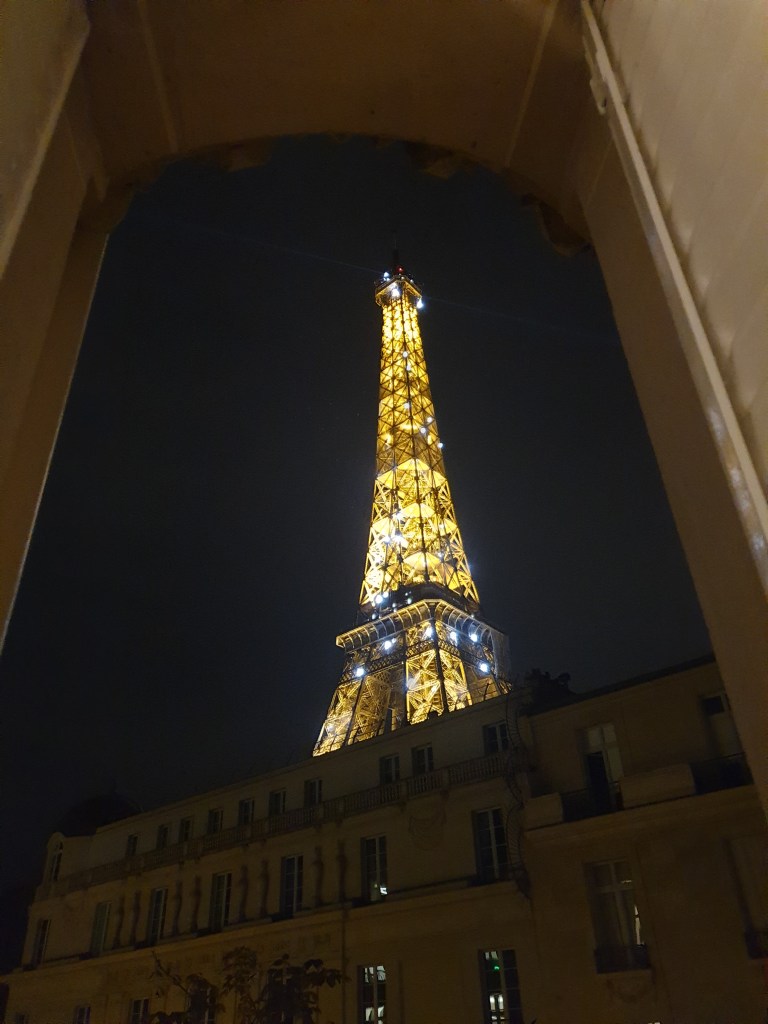
I spent a great few days in Paris in a flat with a view of the Eiffel Tower, enjoying the unique experience of visiting the Louvre and the Musee d’Orsay without the crowds.
View from my flat in Paris
I left Paris the day that a new 9pm curfew started and that the UK announced that Italy was no longer on its “exempt from quarantine list” (fist pump!!). With all the uncertainty and changing rules, I was greatly relieved that my flight left on time and I got thru the Madeira Covid controls with my QR code. I emerged from the airport into bright sunshine and a temperature of 20C, a welcome improvement on Paris and London.
I picked up my hire car and drove up to the small town of Santana in the east of Madeira. My accommodation was a small bungalow, which had a terrace with sun lounger, hammock…and lot lots of cats.
The terrace of my room
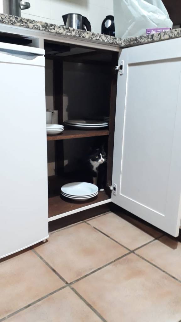
I bought some wine and pasta in a small local shop and enjoyed the cool evening air sipping my wine and playing with my new feline friends. They were used to visitors and had worked out a number of cute tricks to wheedle food out of them. These ranged from the traditional – being cute and asking to be stroked – to the adventurous – run inside as soon as a door is opened, take refuge in a kitchen cupboard and meow pitifully until fed.
“Feed me or I will stay here and cry all night!”
During the night I heard the sound of heavy rain and sure enough the next morning there were thick clouds in the sky. Over breakfast the hotel owner told me that the tropical storm Barbara was passing and we would have bad weather for four days. She recommended me a website which allows you to check the weather with webcams of towns all around Madeira. I thought it was strange to have such a website, but I soon found out why it was set up. Although the island is small, the weather in places only a few km apart can be completely different, and it changes constantly. However this morning all of the webcams showed the same fuzzy grey picture of thick cloud, so I decided to visit the vulcanology centre on the north coast, where you can visit lave tubes – caves formed when the outside of a flow of lava solidifies whilst the inside continues to flow. The guidebook described it as a good wet weather option. The road to get there was tricky – lots of steep climbs and sharp turns, with heavy rain most of the way. I arrived after about an hour, to find that the centre was shut due to bad weather – the caves flood during heavy rain. Disappointed I turned back and was rewarded with a small consolation – the sun appeared and revealed the spectacular mountain scenery of the island.
The sun begins to appear
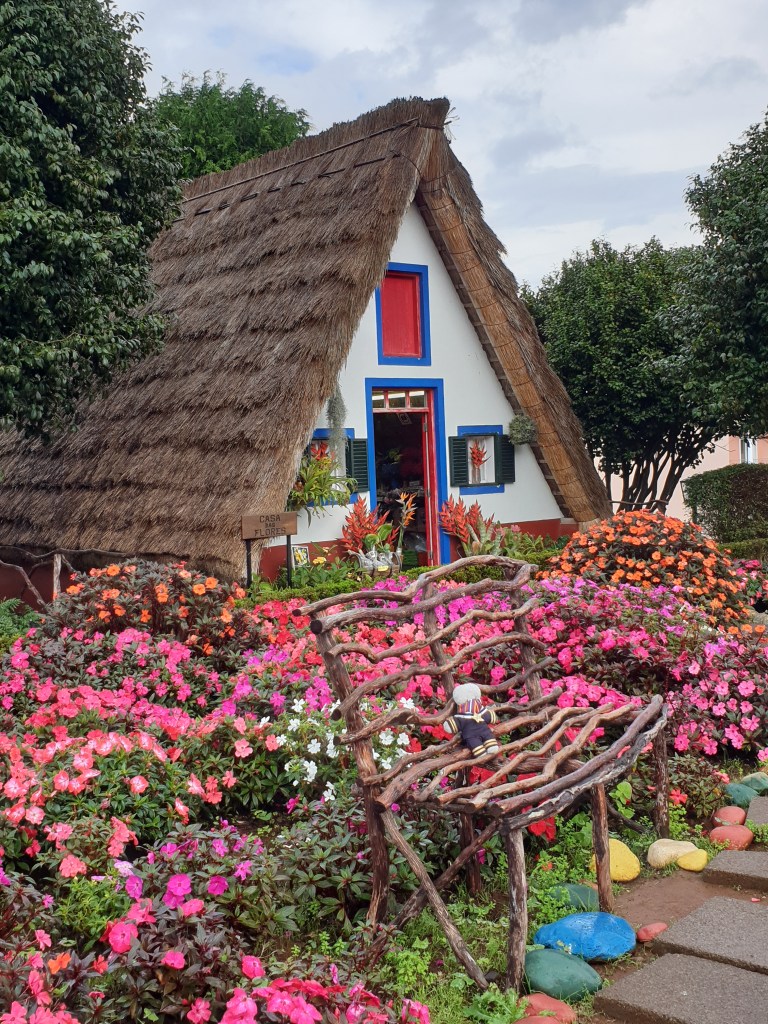
Back at Santana, I bought some fish for dinner in the local supermarket and visited some of the traditional houses for which the town is known. I am not sure how anyone – even a teddy bear – could ever live in something so small, but they are very pretty.
Traditional House in Santana
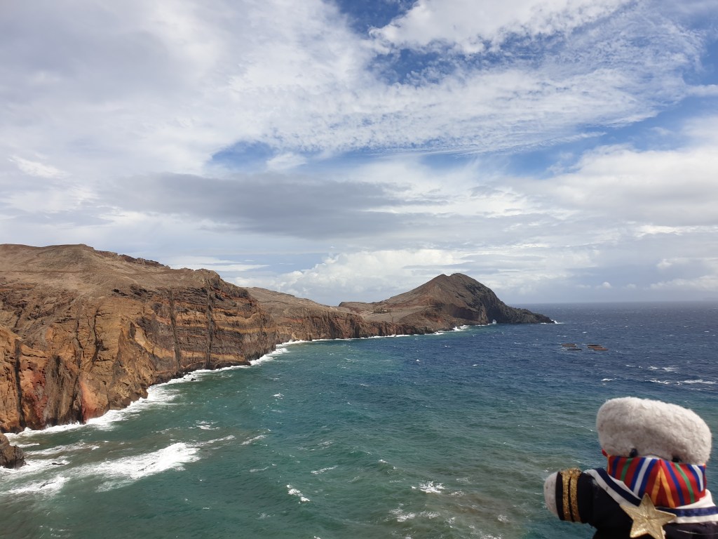
I noticed that the weather seemed to be improving. I checked out the website with the webcams, which showed bright sunshine at the Ponta de Sao Lorenco, a thin strip of land projecting into the Atlantic Ocean on the east side of the island, and one of Madeira’s national parks. The road leading there was good, with many tunnels instead of the twisting turns I had negotiated in the morning. Every time I went through a tunnel, the weather at the other end was different, and usually better. When I arrived at my destination there was bright sunshine, a clear blue sky and a very strong wind, which drove big waves against the colourful red and brown cliffs. The site was busy and I joined a stream of other walkers on the path to the far eastern point of the island. The scenery was spectacular, the red and brown cliffs contrasting with a bright blue sky and dark blue sea.
Ponta de Sao Lorenco in the sun….Still sunny……The weather begins to change……
After 3km and lots of stops for photographs, I reached the information centre for the park, which, like everything else I had visited today, was closed. As might have been expected, the weather then suddenly changed. First grey clouds covered the sun. Then came heavy rain, driven in horizontally from the sea by the wind. Just by opening your mouth and facing the wind you could have a drink of fresh rain water. What had been a muddy path turned into a river, fed by small waterfalls falling from the hills. It might have been pretty if it hadn’t been so………..wet. It is at times like these that you discover how waterproof your walking gear is – my top was good, but my legs were soon soaked through. Back at the car I peeled off the wet layers of clothing, removed my shoes and scraped the mud off them.
I drove back to my hotel barefoot and in my underpants, hoping that I wouldn’t be stopped by the police (even though my furry bear body is rather cute…). Back in my room, I hung up my wet clothes in a futile attempt to dry them. I reflected that the reason that there are very few Covid cases on Madeira is that if anyone coughs of sneezes, any infected droplets are immediately blown to Africa by the ferocious winds. At least dinner was delicious – fresh swordfish with tomatoes and pasta.
The next day I enjoyed a late breakfast. It was the penultimate day of my holiday and today I was going to drive around the north and west coasts of the island to a different hotel, located near Tenerife South airport. My first port of call was the town of Icod de los Vinos, a pleasant old town mostly famous for its huge and ancient dragon tree. Legends say it is 1000 years old, but botanists put its age as close to 500 years – still not bad for a tree, and much better than any human or bear. The dragon tree is the symbol of the Canary Island and a good example of the exotic flora that grows here.
Icod’s famous dragon tree
Icod is firmly on the route of tourist groups touring around the island, although away from the main square and the view of the dragon tree, and into the quite little side roads, the tourist crowds disappear and the town is pleasantly relaxed. From Icod, the road led along the coast to Garachico, another pleasant old town. As usual it had a central square with cafes and an old church.
Garachico with its square and church
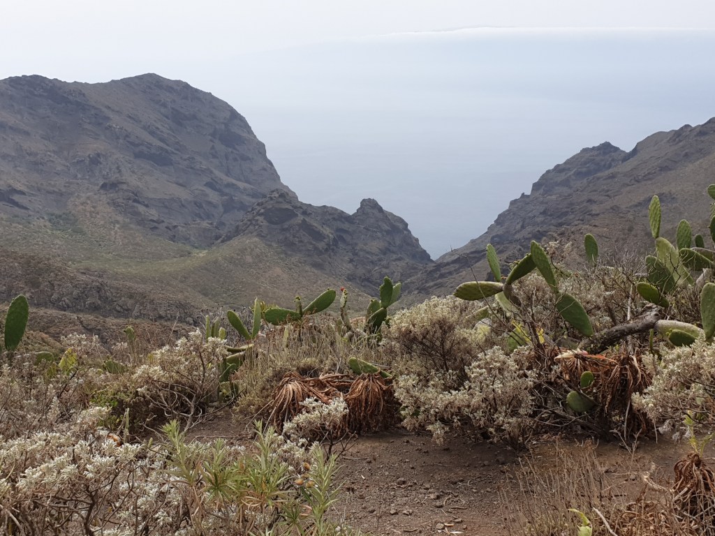
I carried on around the North-West coast; every town seemed to have its own “centro historico” with a church and a square. Even the ones that weren’t mentioned in my guidebook were very pleasant – maybe better than the popular towns even, since there were no tourists. Eventually the road led inland and up steep hills. This was the very north-west tip of Tenerife and the beautiful but wild countryside combined with the mist rolling in from the sea gave me a sad feeling, like reaching the end of the world. I had been following the news back home over the past days and thought of the thousands of people affected by the coronavirus outbreak, many of whom were confined to their homes. I wondered what lay in store for me on my return to London.
the end of the world?
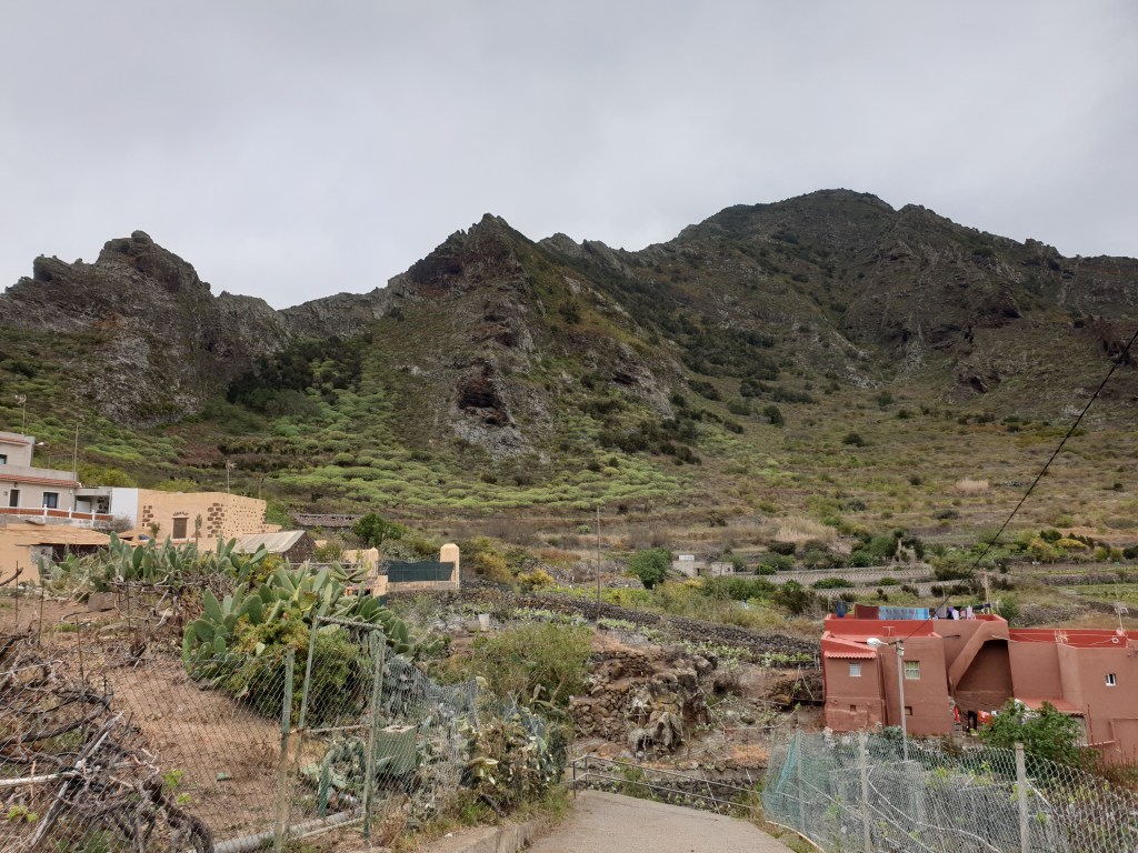
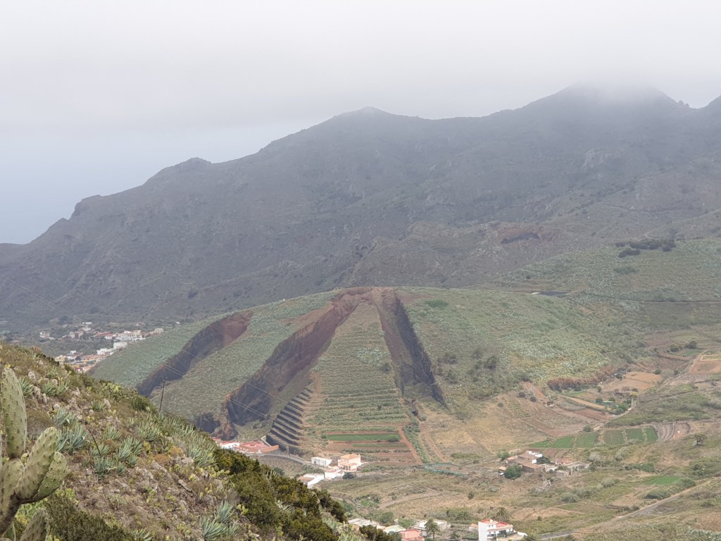
The road carried on up, twisting and turning along the hill side through strange and colourful plantations and past small houses, occasionally offering a spectacular view of the steep slope down to the sea.
strange hill…wonder what caused the cuts in the hillside?
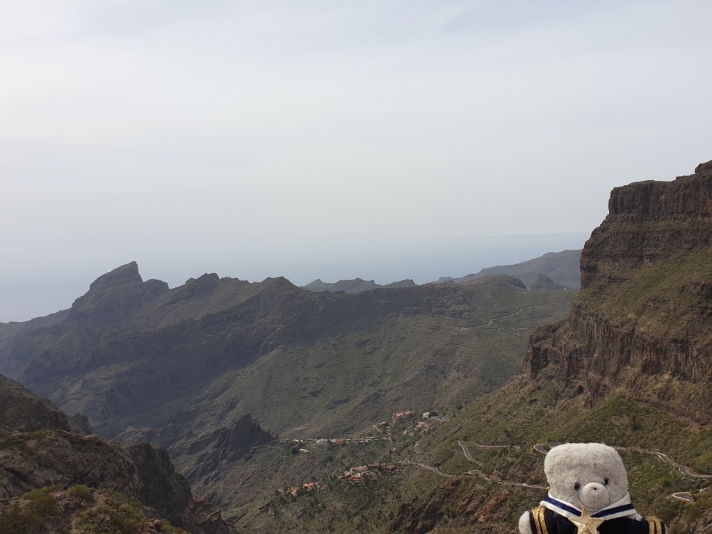
At the very top of the ascent was a mirador with a café looking out over the town of Masca, far down in the valley below. It was a great place to sit and recover from the rather difficult driving on the mountain roads, especially since now the sun had appeared from behind the mist and low clouds.
looking at Masca from the north
After my break, the road led down into Masca and then relentlessly up. Every 100 metres there was a hairpin bend on a steep slope, and I often had to stop to let other cars past on the narrow track. Once I met a bus, but fortunately the driver was patient and very used to the road; as soon as I had given him enough space, he nimbly squeezed around me, avoiding the side of my car by less than an inch. When I reached the top, I was sweating from anxiety, as is if I had walked all that way up.
the view of Masca from the south and the tortuous road I had just driven
The next part of my route was an uninteresting main road that turned into a motorway. After an hour I turned off to drive back into the hills, to my last hotel, Casa Alberto, which was outside a small village far from anywhere. My holiday home turned out to be enormous – with big living room, wood fire and two balconies. The common areas of the hotel were laid out in a garden of orange trees, with a heady sweet scent of orange blossom. I picked a couple of deliciously tasty oranges and flopped down onto a bed to enjoy them. One of the great things about the Canary Islands is the pleasant temperature all year round – 20 to 25C in daytime – ideal for lazing around or sitting on the terrace of a café. I attracted the interest of the hotel’s cat, who, it seemed, had never met a teddy bear before.
The next day I enjoyed the garden and orange blossom in the morning, before heading off to the airport. There, chaos reigned; Spain had just announced the closure of all schools, bars and restaurants in two days’ time, so a lot of people wanted to get back, but some of the flights in- and out- bound were cancelled and most of the rest (including mine) were delayed by several hours. During the wait I wrote my blog and thought about what might await me in London, where the coronavirus outbreak, although less bad than in Spain and Italy, seemed to be taking off. Adding the three-hour delay to a four-hour flight, I eventually arrived home at around 1am, with very happy memories of the Canary Islands and a feeling of foreboding about what was to come.
That’s all – each day’s blog was published a few days after the events it describes. This will be probably be my last blog for a while – I had great plans in spring and summer, but it looks like I will be stuck at home in London. Still, I was lucky – I could have my holiday exactly as planned and got back just in time before everything closed in Spain. Not everyone has been this lucky, and my thoughts are with those who are sick, or have sick loved ones, or who are simply stuck at home under curfew. I hope you all stay safe and healthy, wherever you are, and that my blog can cheer up these difficult times and help you look forward to all the great things life has to offer once things return to normal.
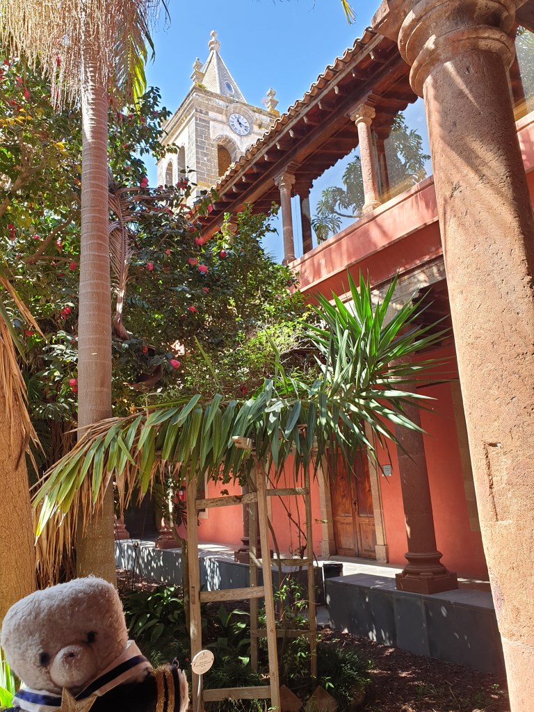
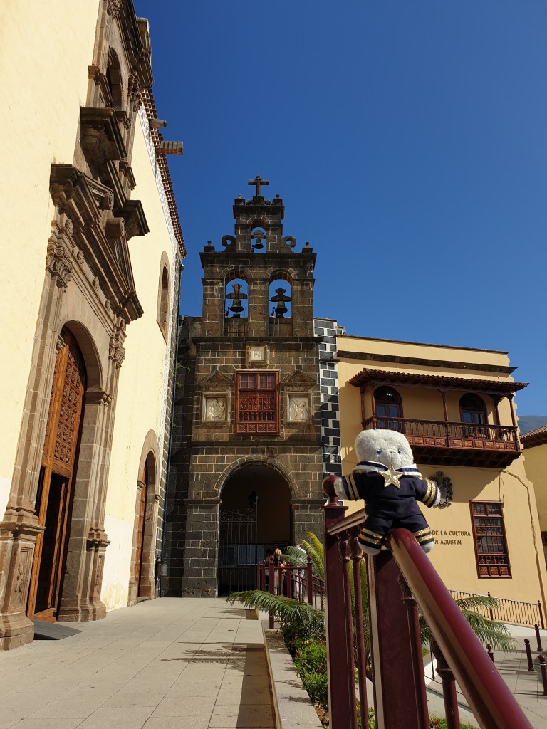
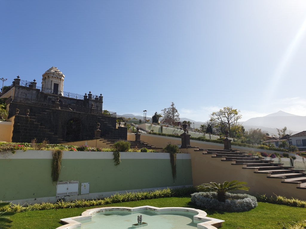
Today I visited the ancient city of La Laguna. This town was founded in 1496, shortly after the Spanish conquest, and for a while was the capital of the whole Canary Islands. The city is full of old churches, pedestrian streets, and old town houses with magnificent flowery courtyards inside.
First, I visited the Church of Nuestra Señora de La Concepción, the oldest church in the Canary Islands. I was dismayed that in La Laguna the churches charge for entry and post very assertive doormen to bar entry to anyone without a ticket – in my country entry to a church is free on principle. But I still stumped up 2€ to visit the bell tower, with nice views over the old town, and the church interior, which was a bit plain and not worth my euros!
The bell tower of the Church of the Conception
After that I simply roamed around the town to see what I could find, occasionally checking with my guidebook where I was. My next stop was a former monastery, which now housed an art gallery and a separate school.
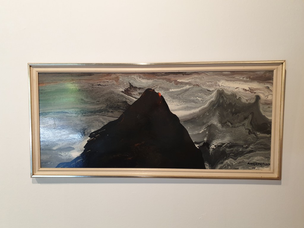
The entrance to the art gallery was through a beautiful cloister, in the centre of which was a garden with beautiful tropical plants. There was an exhibition of paintings by a local artist, Pino Ojeda, and I really liked here work.
A painting by Pino Ojeda
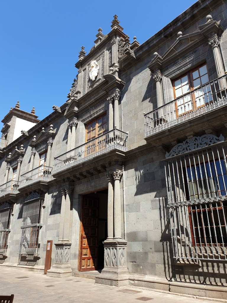
After that I continued my stroll, checking out the other churches (from the outside – they didn’t get my entrance fee, nor the money I’d normally invest in lighting candles for my loved ones) and other historical buildings.
One of the historic buildings – the town hall
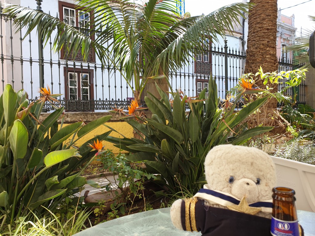
I stopped frequently – first for coffee, then for a cold drink in the grounds of the former casino.
The garden of the casino – the beer is non-alcoholic, honest!
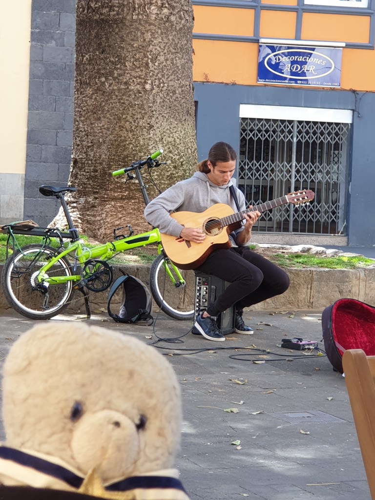
Finally I stopped for a late lunch in a café on the main square where a talented guitarist was playing.
La Laguna is really made for chilling out, drinking coffee and watching the world go by, something I think I’d earned the right to do after trekking on La Palma, La Gomera and Mount Teide. However, there is only so much coffee and low alcohol beer a little bear can drink, and in the mid-afternoon I set off back to my hotel.
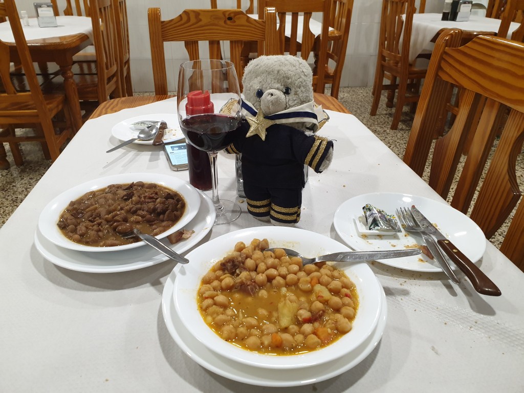
In the evening I tried some typical local food in a “Tasca” – a cheap local restaurant. The décor was very simple, and most of the food was good.
Beans and chick peas for my starter
I couldn’t resist trying another of the local fish specialities, “Cherne” which apparently translates as “wreckfish” in English, although it isn’t served anywhere other than here. It had a very strange salty and oily taste – no surprise it doesn’t get exported. Like parrotfish, it is not something I’d order again, but my motto has always been that if you never try new things, you never know what you are missing. To take the taste of the fish away I had a very nice local desert and headed back to the hotel for bed.
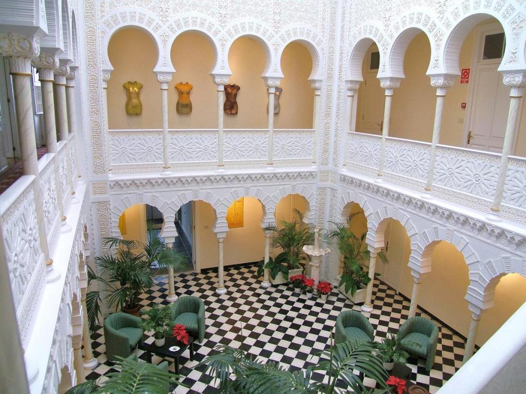
The next day I had to fly to Tenerife for the final leg of my holiday. For some reason I couldn’t sleep in my La Gomera holiday home, so in the morning I was very tired as I drove to the airport and didn’t really enjoy the short flight. In Tenerife, baggage return and car hire were again very efficient, and I was quickly on my way to my hotel. I soon realised that Tenerife was completely different to La Palma or La Gomera – the area around the airport was heavily developed, and although they even had a motorway, it was jammed solid. My navigator took me around busy back roads to my next destination, the town of La Orotava. I was very relieved when I could park my car directly in front of the hotel. I was even more happy with the hotel itself – called the Alhambra, it was a rich merchant’s house that had been designed by a well-known architect in the 1920s in Arabic style.
The owner of the hotel was very nice, and very enthusiastic about his property. He asked if we had a minute. I just wanted to go to my room and sleep, but it seemed rude to say no, so I listened to his passionate explanation of a large modern mural on one of the walls. I have to admit I didn’t like the painting at all and could only understand half of his explanation in Spanish. I nodded politely occasionally. When our host finally stopped talking, I turned to head upstairs, but he stopped me and asked if I had just one more “momento”. I made a sign that I wanted to sleep, which seemed to disappoint him. The room was really nice with a great view of the town and Mount Teide.
I slept for an hour and then headed out to explore La Orotava – it was a lovely colonial town dating from the 1700s, with many interesting old buildings and churches.
In the centre was a pretty park with a view of Mount Teide
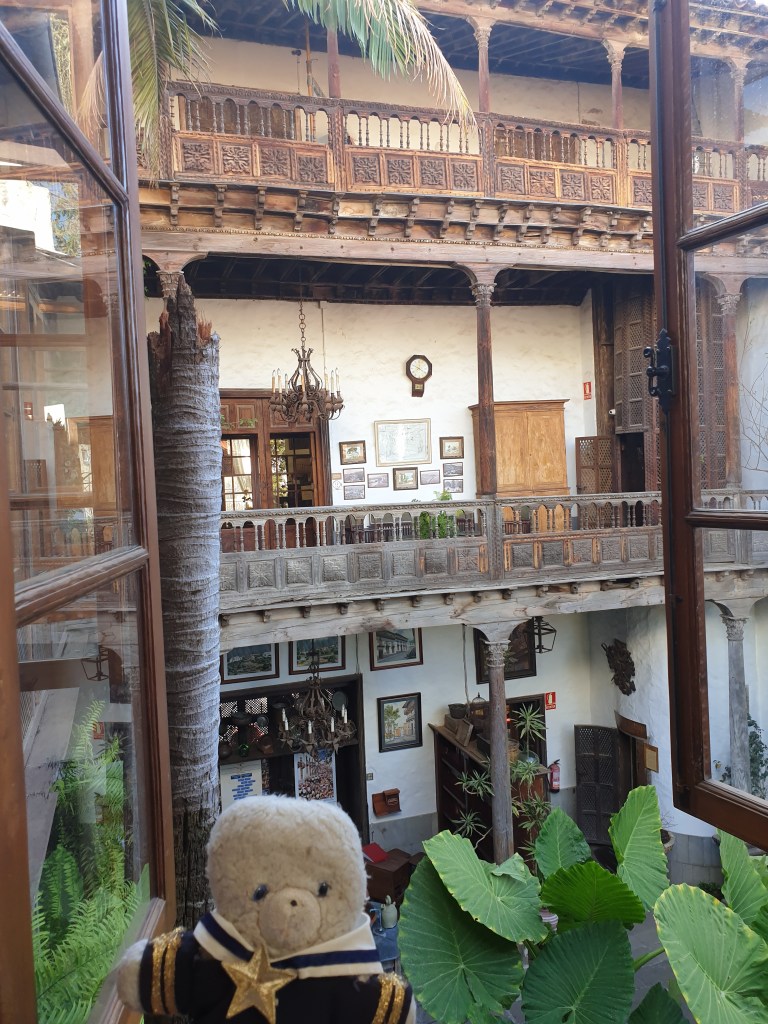
I also found the Casa de los Balcones, an iconic building for the city. On the street side, there were pretty wooden balconies, and inside was a small museum.
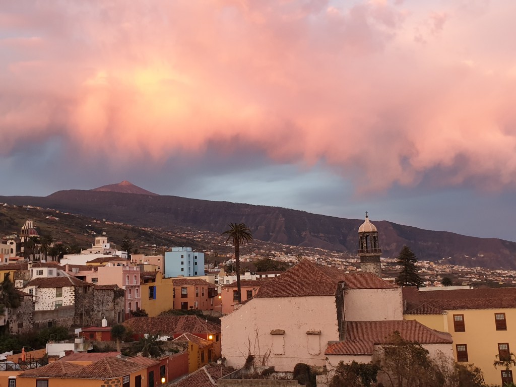
I bought ham, cheese and wine from the local supermarket and enjoyed dinner in my room, with a nice sunset view of the town with the volcano overlooking it.
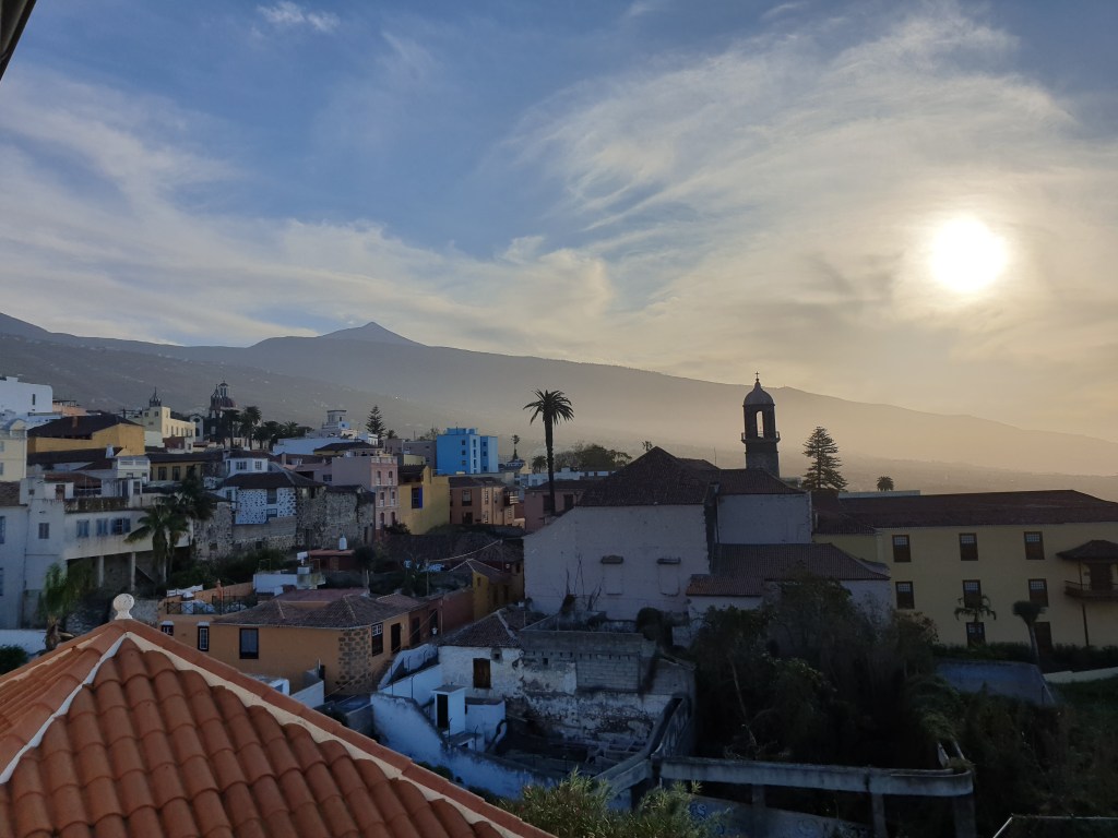
The next day I got up early because I had booked the first cable car up Mount Teide at 9am, meaning I had to leave the hotel at eight. Fresh coffee and a lovely sunrise over the town helped me wake up.
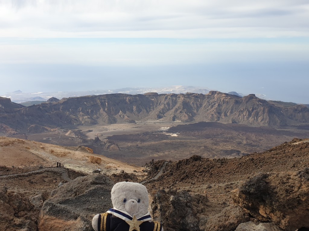
The drive to the cable car station was initially up very steep hills, and then along the plain inside the huge volcano caldera. In the centre of the caldera is the tall cone of the volcano. The cable car takes you nearly to the top, but you have to walk the last 400m. From the upper cable car station I found the path leading up, but was stopped by a park warden who asked to see my permit and ID. I duly handed over a print-out of my emailed permit and my driving licence. He looked at both suspiciously – I don’t suppose many teddy bears visit, and it was probably the first driving licence issued from the darkest Peruvian jungle that he’d ever seen. But eventually the man uttered a grunt of acceptance and allowed me through. I was first onto the path and hurried up to get to the top first and have the views to myself. Mount Teide is 3700m high and people used to think it was the highest mountain in Europe. Mont Blanc and other peaks in the Alps of course are much higher, but since Teide rises up steeply straight from the sea, it looks enormous and it is understandable that people made this mistake. The air was thin and I was soon panting for breath, but I am used to high altitude from the jungles of Peru and made it to the top a few minutes ahead of the two young human climbers who passed the checkpoint after me. At the summit the views were amazing, whichever way you looked:
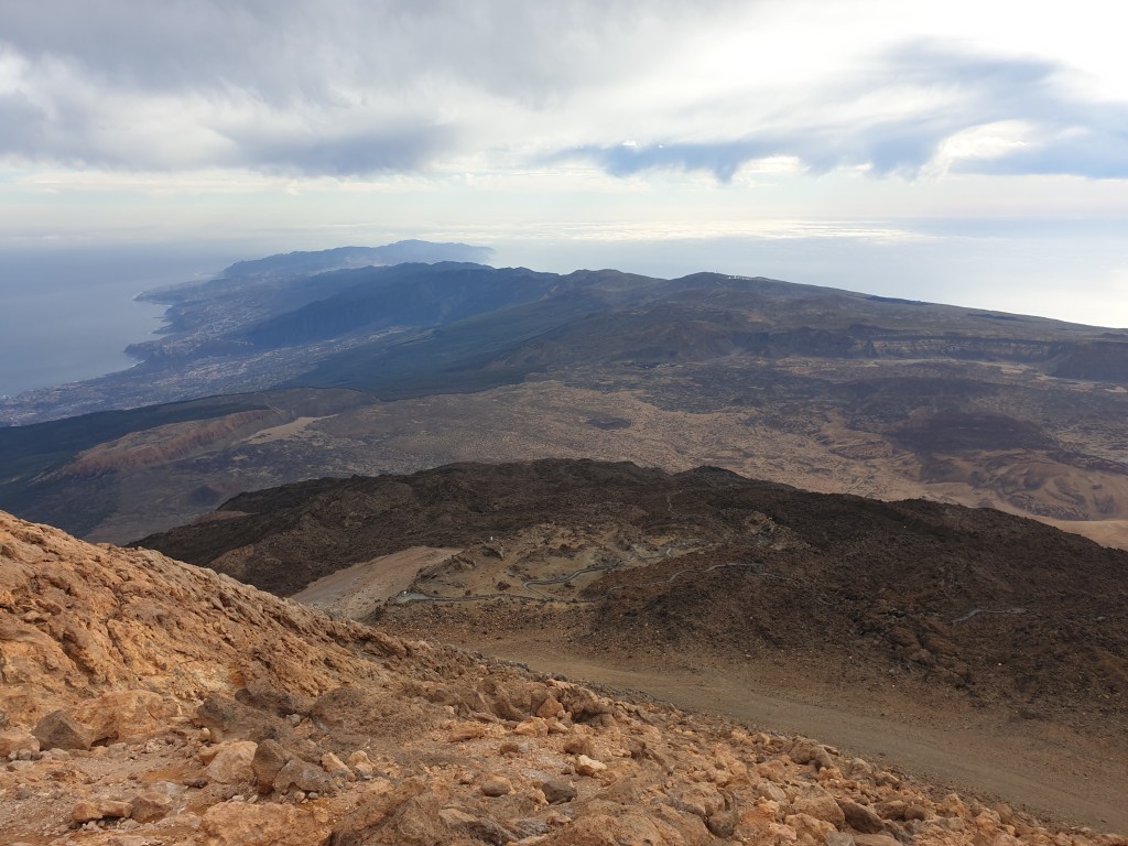
The view to the SouthThe view to the East
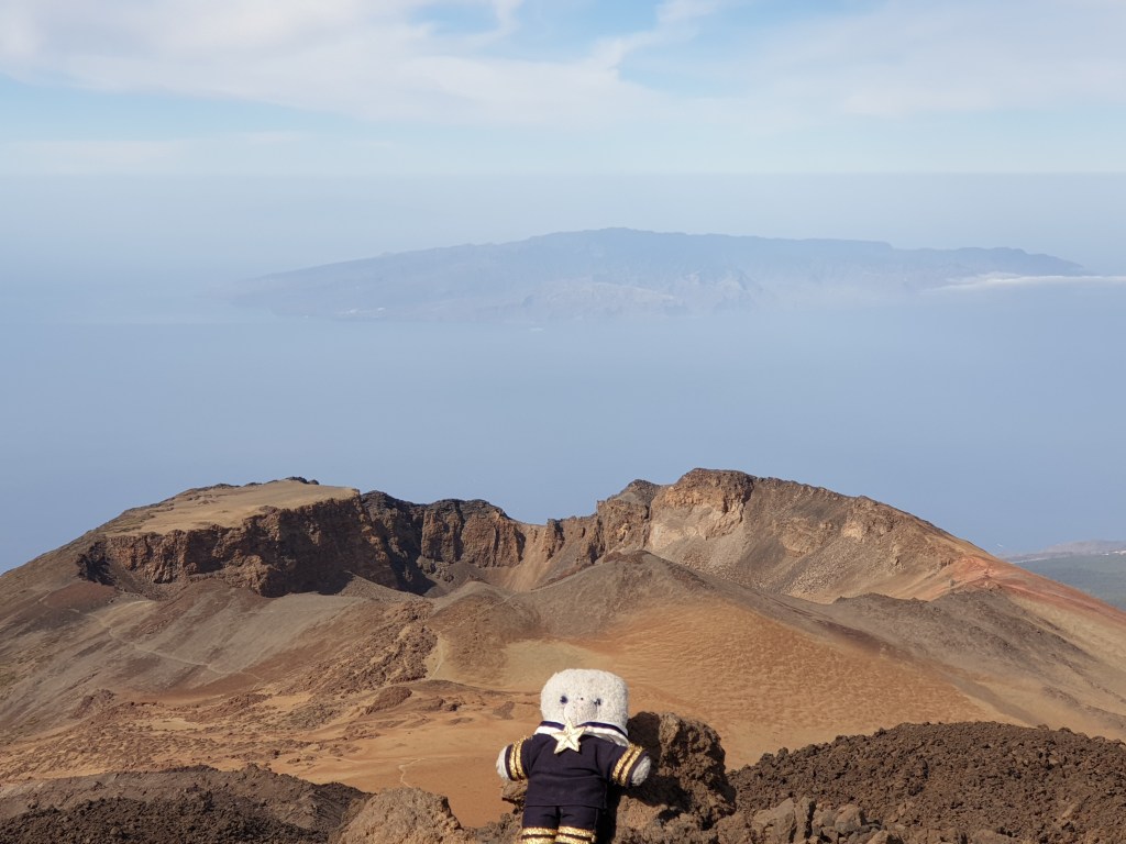
From the very summit I climbed back down to the cable car station. I passed a few other tourists, some serious hikers with proper boots and warm clothing………and some horribly unfit looking people in t-shirts, who were gasping for breath and shivering in the cold (my phone said it was +3C). From the station I then walked part of a different route that led to the old crater, for a different perspective.
The view to the West and the old crater, La Gomera in the background
The path was initially easy but soon became very rocky. Although it was possible to walk all the way down the volcano and then back along the road to the car, I was cold and the rest of the path looked like a scramble over volcanic boulders – hard for human, never mind a small teddy. So instead I enjoyed the view and then took the cable car back down. Back at the base station, the car park, which had been deserted at 9am, was now packed, and there was a big queue to take the cable car up.
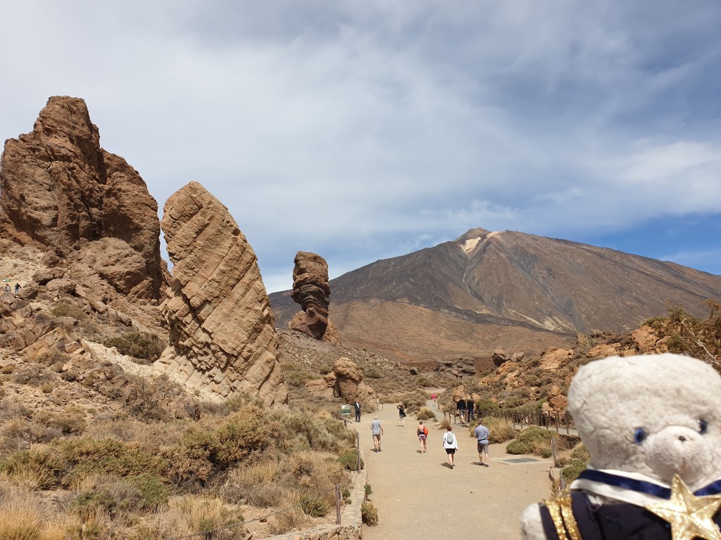
I drove a bit further into the Teide caldera to visit a formation of strangely shaped volcanic rocks near the visitors’ centre.
The area was swarming with tourists, and parking was difficult. After a short hike around the rocks I headed back home, admiring the lunar landscapes. I got back to my hotel in the early afternoon. I was feeling a bit lazy – the walks were not very long but were steep and at high altitude. So I enjoyed sitting in the hotel’s garden and listening to the happy noise of children playing in the school next door as a I dozed on a sunchair. That night I had more cheese, ham and wine and was treated to another spectacular sunset.
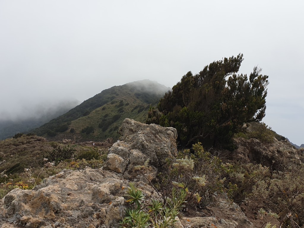
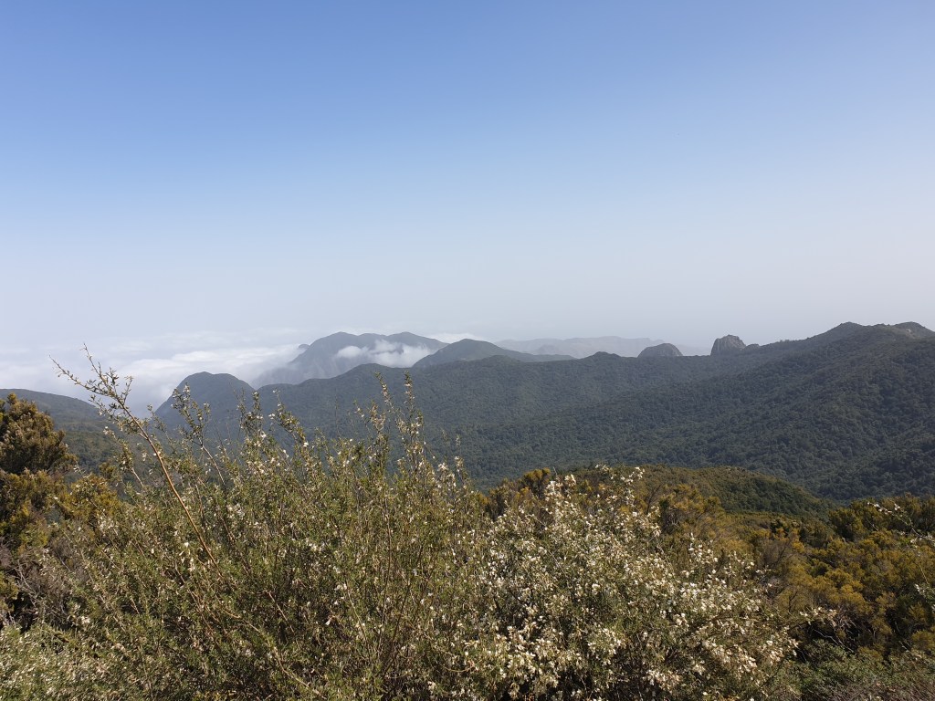
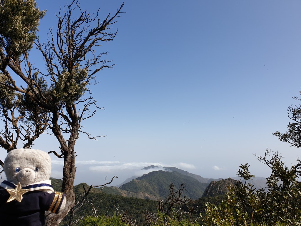
Today was hiking day. I chose Ruta 18, the big circular walk around the Garajonay Park, which started from one of the miradors I had visited the day before. On my map I judged it was about 6km, so even with some up and down walking I should be done quickly and have time to drive around the island a bit more.
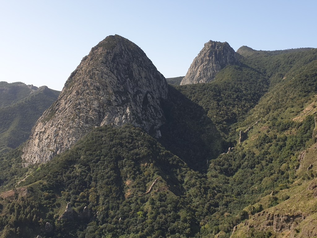
I drove up the valley road again and through the long tunnel into the park. At the mirador, I found signposts for route 18, but was a bit surprised that they said it was 14km long and should take 7 hours…. The hike started easily enough, along the top of a mountain ridge with fine views of Los Roques in the bright sunlight…..
Then the path headed up a steep hill to yet more miradors with views, before diving down into a dense forest. The cool of the forest was a pleasant change after the heat of the exposed mountain side.
After a while there was a clearing with a tables and picnic area, where I met a little feathered friend. I offered him some biscuit crumbs.
Me with my backpack feeding my friend
Twenty minutes later, I got to a junction with three different options. The signs showing the path had disappeared, and I wasn’t sure which way to go. I picked the path that seemed to be heading in the right direction, towards the main road crossing the island, and walked for about 20 minutes. It was a paved track for cars, and I was encouraged that one or two cars did indeed drive past – surely this was the way to the main road? My phone initially showed I was going the right way, but then the little blob showing my location veered away back into the heart of the national park and away from where I wanted to go. I carried on anyway, hoping the path might change direction, and was very happy when I saw a parking area up ahead. Surely a sign that I was on a main route? My happiness was short-lived though, when I realised I was back at the picnic area where I’d fed the bird some 40 minutes ago.
I looked at my “tedimeter” – 10km already, and I was only just over half-way through the walk. I was hot and tired. I carefully studied the maps provided on the signposts in the picnic area, realised my mistake and set off again. At the confusing junction I took another paved track that led steeply up, and this eventually took me to the main road and finally a sign saying that I was indeed back on route 18.
The path crossed the road and led back into the forest. It went steeply up, but the knowledge that I was back on the right path and only a couple of km from the end gave me a renewed bust of energy.
Suddenly the path opened up to the most spectacular view yet of Los Roques, so I sat down for a short break and to finish the last of my water.
It was a fitting reward for my efforts. Back at the car my “tedimeter” said I had walked 16km – so the signs were right, 14km plus my detour. The twists and turns and ups and downs had doubled the length compared to what my map seemed to show. It was lot more than I had expected, and I headed home for dinner a rather tired teddy bear.
I had two full days to enjoy La Gomera. Today I decided to explore the island by car and to look for good places to hike on the next day. The car hire company has said the car was fully insured except for damage to tyres caused by driving over rocks on the road. I soon understood why – the whole island is one steep extinct volcano that has been eroding away into the sea for the past few million years. The most visible sign of this erosion are great sweeping valleys, where rain dropping on the top of the mountains washes down to the sea. But another sign is the frequent little piles of rock in the road from small landslides.
At first I drove up the mountain on the south side of the island – the landscapes were stark and dry.
Then I crossed through a tunnel to the east side of the island, which receives clouds blown in by the trade winds, which blow from east to west at this latitude – which is why Columbus sailed south to the Canary Islands before setting off for America. As the clouds rise up the mountain they drop a steady supply of rain, meaning this side of the island is usually wet and supports luxuriant vegetation.
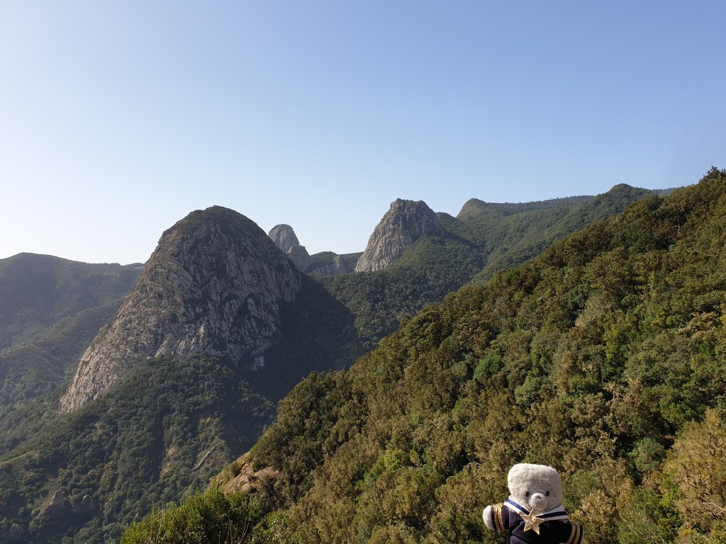
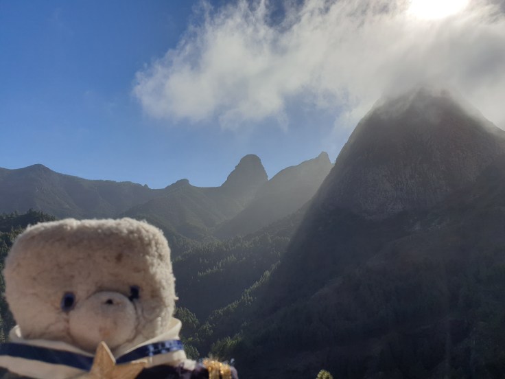
The road took me to the Bailadero “mirador” (viewing point) which I had been targeting on my walk yesterday. I was lucky that today there was less wind, meaning the clouds didn’t reach very far up the mountain, and the views of Los Roques were really spectacular.
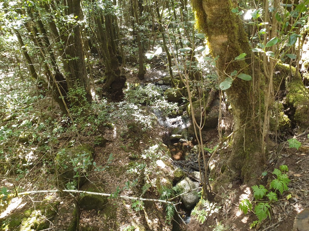
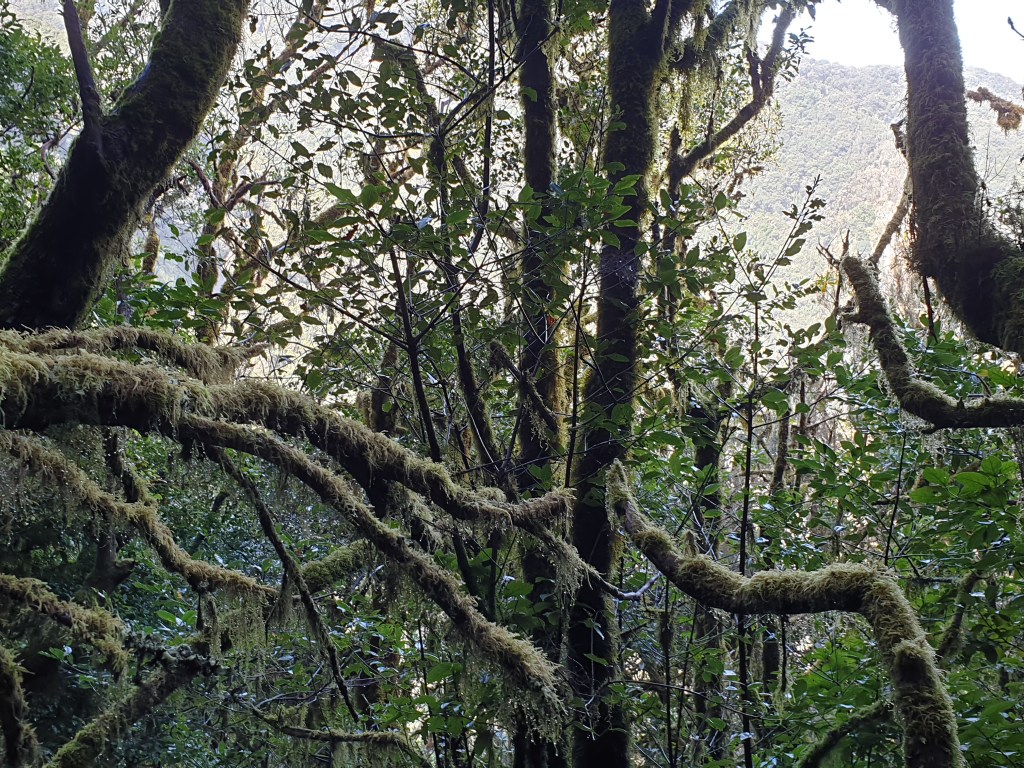
I realised that it was a good decision to turn back on yesterday’s walk, since I was still a long way away from my destination. From the mirador there was a pretty short walk through an atmospheric forest, whose trees were covered with thick moss and whose leaves and branches were wet with moisture from the clouds.
After that walk, the road continued up the central ridge right on top of the island. There I found yet more “miradors” with beautiful views north, south and east.
From the mountain ridge I drove to the south west corner of La Gomera, back into a bone-dry, lunar landscape of great eroding valleys.
I drove all the way down to the sea to have lunch at La Gomera’s main resort, Valle Gran Rey. This was supposed to the richest part of the island, but still looked slightly run down. Still, I had a nice octopus salad in a café on the seafront and after lunch ventured onto the beach for a paddle. The black sand had absorbed the heat of the sun and was very hot for little paws, so I ran to the sea…….which was very cold. Maybe my short paddle wasn’t worth getting black sand all over my paws and in my fur, but at least I can say that if have been in the sea!
Next I drove back up to the centre of La Gomera and around the west and north of the island; the road sometimes followed the coast, and sometimes wound deep inland to worm its way around the deep valleys. La Gomera is very beautiful, and its scenery very varied. Every few kilometres there was another mirador to admire a different island landscape.
Although the island is small – it’s roughly a circle with radius 5-6km – with the winding roads and frequent stops to admire the views, driving around it took a whole day and it was late afternoon by the time I got back home. I settled down on my terrace with a glass of local wine to write my blog, and then had a very good steak from the local market for dinner.
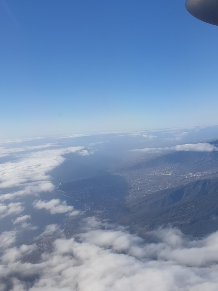
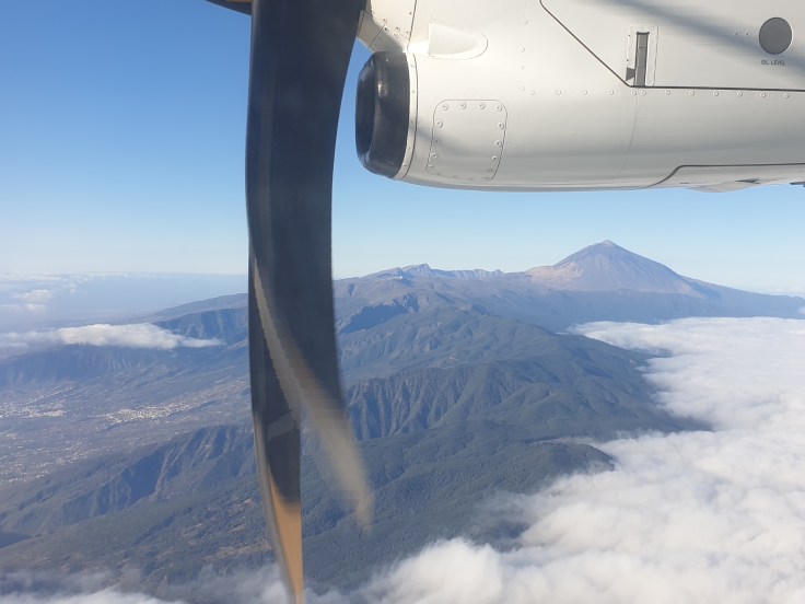
I arrived way too early at the airport – most people seemed to show up 30-40 minutes before their flights and breeze straight through check in and security. I boarded a small plane with propellers that went to Tenerife, where I was met on the runway by some nice people that whisked me away in a small car to another small plane for the flight to La Gomera (La Gomera is so small that you can only fly there from Tenerife). The flights gave great views of the islands, and in particular the volcano Mount Teide towering over Tenerife.
As we approached La Gomera I admired its rugged landscape and wondering where a plane could possibly land, but eventually behind yet another cliff there was a small patch of flat land that served as the airport. Within 5 mins of touching down I had picked up my bags, collected my hire car and was on my way to my holiday home. The road wound its way steeply up one mountain and then down another one -all roads in La Gomera are windy and steep. I stopped occasionally to admire the views and take pictures.
Then I made a bigger stop in the main town, San Sebastian, to buy food for three days – my accommodation was out in the country and far from any restaurants or shops. Unlike charming Santa Cruz on La Palma, San Sebastian was mostly modern and felt rather poor – so far there is very little tourism on La Gomera. I found the market where I stocked up on meat, wine and vegetables at very reasonable prices.
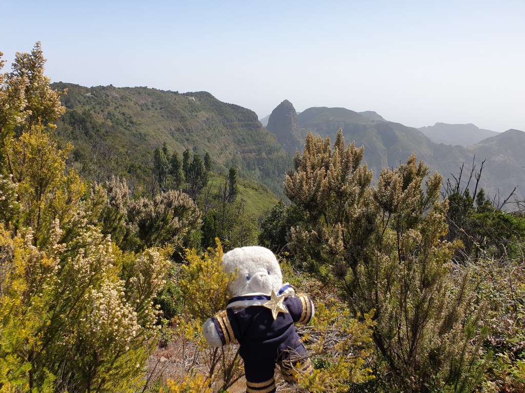
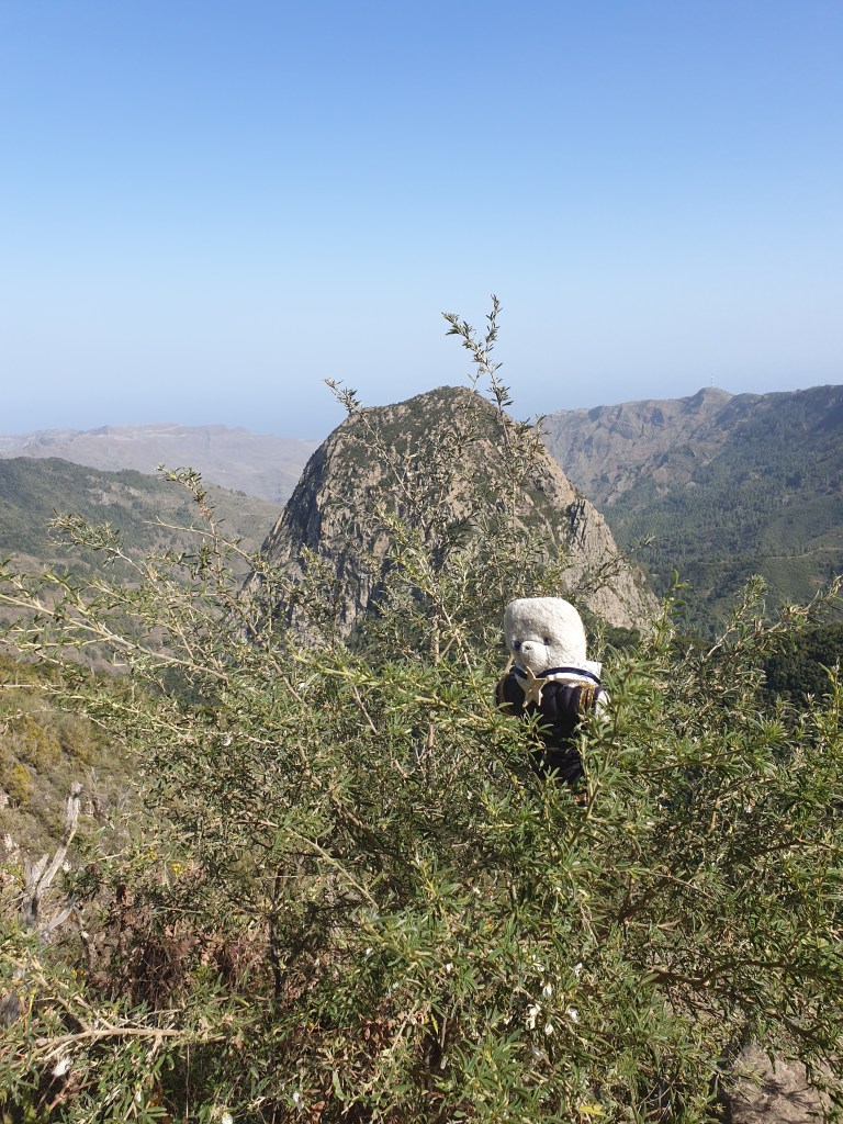
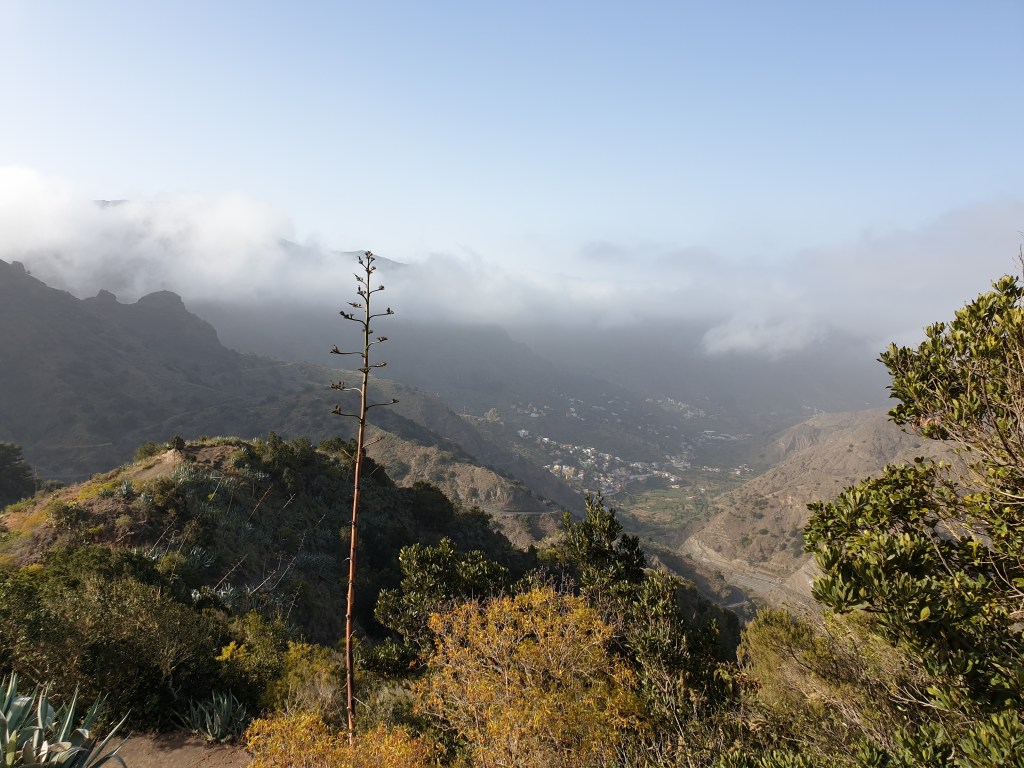
My holiday home was about 15km north of San Sebastian along – yes, that’s right – another windy road. Initially I missed my destination and drove all the way to the end of the track, where the valley ended and gave way to steep mountains. I wasn’t annoyed – it was only a small detour, and it allowed me to admire the beautiful scenery – the plant life was even more luxuriant than on La Palma, and you could see Los Roques, a group of three volcanic rock formations rising vertically from the surrounding mountains.
Los Roques are the most famous things on La Gomera and feature in every guidebook and website about the island. I also noticed some interesting paths leading from the end of the road into the Parque Nacional de Garajonay, a large park in the centre of the island famous for its ancient forests and spectacular scenery.
I retraced my steps and found my home for the next three nights. After the wonderful huge town house in Santa Cruz, I was a bit disappointed by my choice this time. The setting was very pretty, with a little terrace overlooking the valley, but there was just one room that served as both bedroom and kitchenette. It felt a bit cramped, even for a little teddy bear. So, after unpacking, I returned immediately to the end of the valley to go for a short hike. There were two paths, one signposted to Parque Nacional and the other to Bailadero, which the sign said was 3.4km away. I chose the second path. It wasn’t shown on any maps, but Bailadero was, and from there it looked possible to circle round and return to the car via some of the island’s main walking trails. It was 4pm and I might just have time to do the complete circuit.
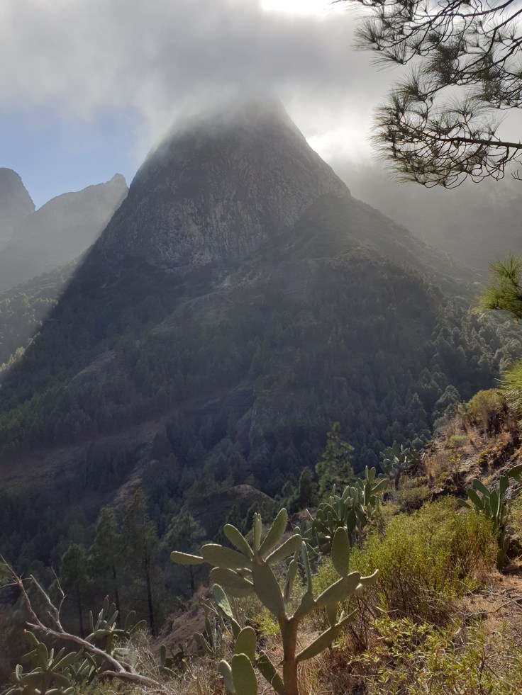
The path led up a very steep slope. The ascent was unrelenting and apart from the very first signpost, there were no other markings to confirm whether I was going the right way. Occasionally I came across small piles of rocks left by other walkers, which reassured me. The path led around to the right of los Roques; clouds were blowing over the top of the mountain ridge in front of me and spilling over the top of Roque de Agando, and then evaporating in the drier air of the west of the island.
I reached a sign saying “Parque Nacional” that marked the boundary of the park. I had been walking an hour and thought I would easily have covered the 3.4 km to Bailadero, but the map showed that there was still quite a long way to go between the entry to the park and my destination. The clouds were getting thicker and spilling every deeper into the valley, now completely hiding the Roque de Agando. I realised that if I carried on, I would be walking for a long time in thick mist, and I only had light clothes over my fur. I decided to go back and try again another day. The trip back was much faster – only 30 minutes – and soon I was back on the terrace of my holiday home enjoying a glass of wine whilst I wrote the day’s blog.
I woke up feeling lazy. It had been raining during the night, and heavy clouds were rolling in from the sea, so I sat at home enjoying my town house in the morning. I wrote my blog, and also found time to go to the market, where I bought some parrot fish (something you never see in London) for my dinner.
In the afternoon I was feeling a bit more energetic, so I headed out to the Parque Nacional de la Taburiente, which is located inside the caldera of the huge Cumbre Vieja volcano. The road there went through a long tunnel. On the Santa Cruz side, the weather was still cloudy – on the other side of the mountain, there was bright sunshine, and you could see the waves of cloud spilling over the mountain top and then evaporating in the drier air of the centre of the island.
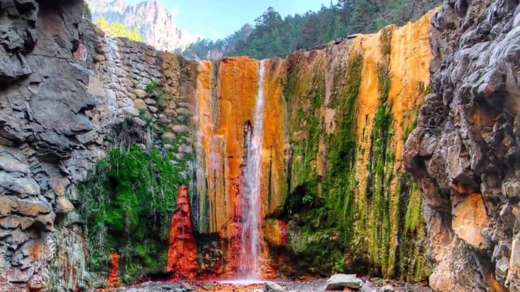
I intended to do a short walk somewhere near the main entrance to the park, but on arrival I was told that I needed a permit to enter by car, and had to go back to the visitors’ centre a few km down the road. At the visitors’ centre they said they had sold out of permits for the day (surely they could have said that at the park entrance…..?). I looked at my map and decided to try another entrance at the west of the park. I drove through a couple of sleepy small towns and then along a narrow mountain road that initially led steeply up before descending into a dry river valley, where I found a car park. I noticed a sign indicating a path to the Cascada de los Colores, 5.4km away, and remembered that I’d seen this waterfall mentioned on websites, which said it was one of the highlights of La Palma, and showing pretty pictures of an imposing waterfall falling over bright red and orange rocks.
La cascada de los colores as shown on the internet
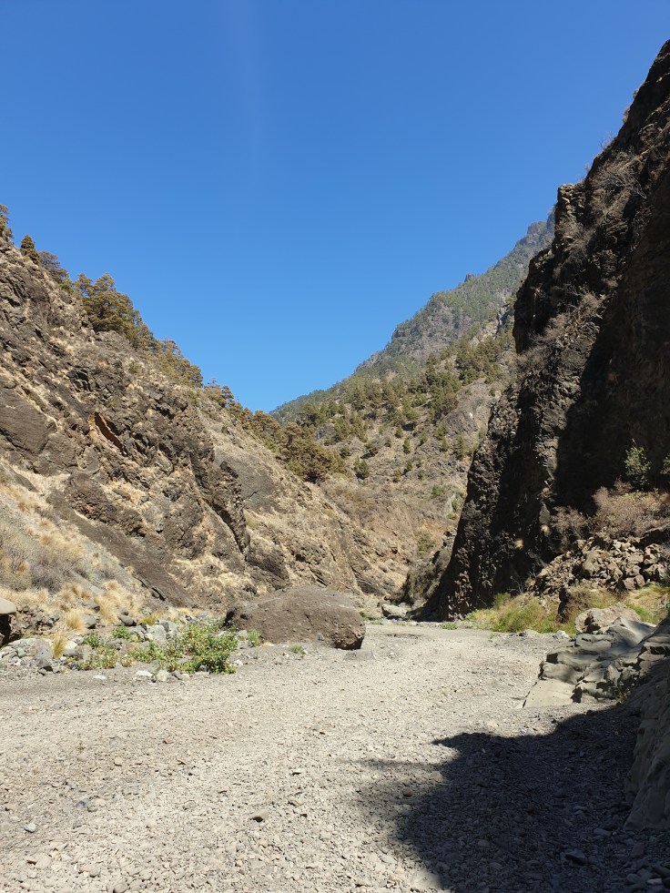
I also remembered people posting that you shouldn’t follow the path but should scramble up the riverbed instead. So off I set, thinking that 5km should take about an hour’s walking. Initially the riverbed was totally dry, but after a short while there was a small stream that I needed to jump across occasionally. The gorge was quite deep, so the stream must have been much bigger in the rainy season.
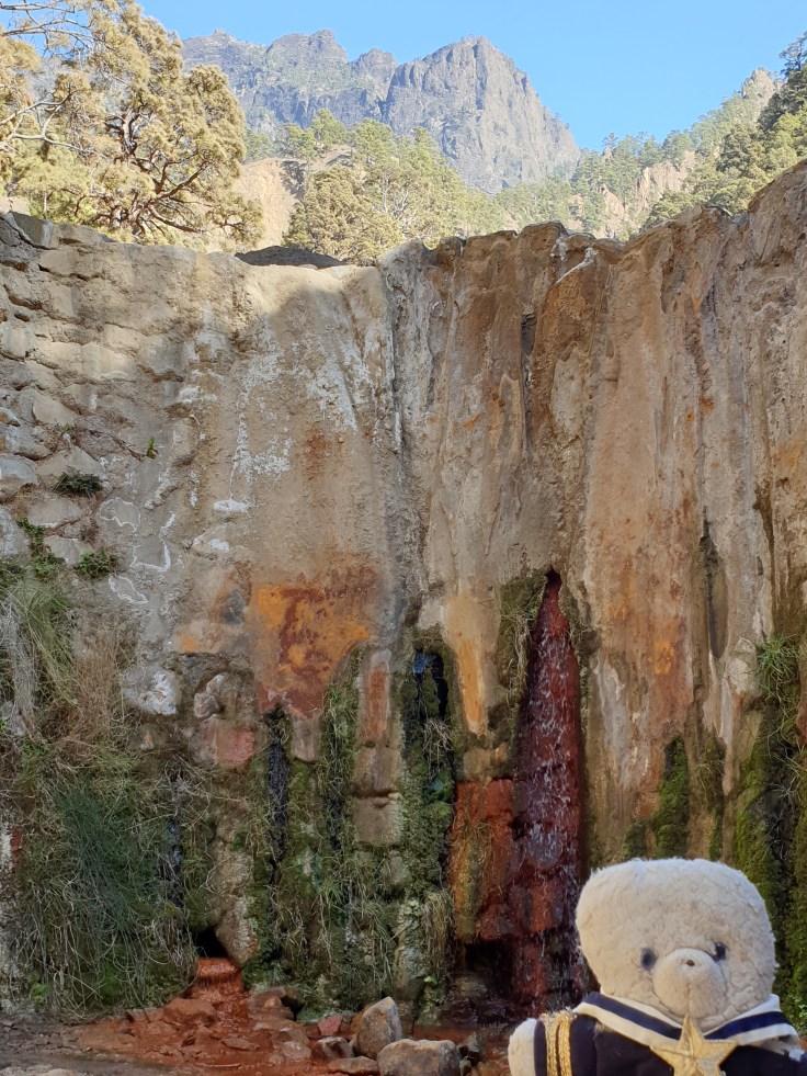
There were quite a few other walkers, all coming back (it was already 3pm). I checked with one group that I was on the right path and continued onwards. After an hour’s walking I checked again – “Yes, just carry on along the river” “How much further?” “About an hour”. An hour! But this was only supposed to be 5-6km! I was a little discouraged and thought about turning back because it was already quite late, but instead pressed on and after another 40 minutes, found a sign saying “Cascada de los Colores – 500m”. In anticipation I hurried around the next bend in the river…….to be very disappointed.
Cascada de los colores in real life
The waterfall was indeed pretty, and coloured red and orange, but it was only about 3m high. The pictures on the internet made it look big, but in real life it was dwarfed by the impressive scenery all around it. Feeling rather short-changed, I headed back. It was already 5pm and I was in a hurry to get home. I decided to follow the path along the side of the gorge this time, which was a good decision. It was much easier walking on the hard rock of the path than the soft shingle of the riverbed, and the views were much better. I enjoyed the walk back much more and admired the shadows of the mountains falling across the gorge in the late afternoon sun.
I got back to my car in only an hour and drove home. At dinner, my parrot fish had an interesting and rather strong meaty taste – good to try once, but not something to buy again. I also tried another bottle of very good local wine.
I reflected that today had not been the highlight of the holiday so far, but a nice walk all the same, giving a different perspective of la Palma. Then it was time to pack up my bags (not so easy since my stuff had spread out through all the many rooms of my huge town house) in preparation for the flight to my next destination, the small island of La Gomera. In anticipation of an early start the next day, I set my alarm and settled down in bed.